Do you ever see a landmark on Google Maps and wonder what it looks like in person? I do! I actually…read morespend hours when I'm bored traveling the world via Google Earth. It's how I find interesting things to do when I plan to be in a specific area either hiking or on vacation.
~~~
What makes this Old Iron Bridge special is its location over the mighty Chattooga River very early in the rivers journey. My guess is it's about 8 miles from where its headwaters begin @ Cashiers Lake. The Chattooga eventually becomes a much larger, wider and wild river as well as the defining squiggly boundary line between northeast Georgia and western South Carolina.
This same river eventually bleeds into Lake Hartwell and soon after becomes the Savannah River, dumping all this fresh water into the Atlantic ocean. So, almost its entire journey defines South Carolina from Georgia, and it all begins very near this Old Iron Bridge.
Call me a nerd if you want, but it simply fascinates me that I could possibly drop a note in a bottle from this bridge, and it has the potential of reaching Savannah, Georgia on a long journey 300+ miles away. Of course the bottle would have to survive the Class V crushing rapids + overcome multiple dams on the way to Savannah, but a fun thought nonetheless.
Or what if you could drop a gallon of dye into the water that doesn't dissolve and track how long it takes to make it to the Atlantic? As a kid, I always has a fascination of how things work... like how far up does a helium filled party balloon travel and how many miles away will it be found?
Coordinates: 35°00'57.5"N 83°07'34.8"W
~~~
[ WATERFALLS ]
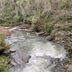
The most interesting highlight of this bridge is the waterfall below it! It's not a huge one (more of a large rapid in high water), but a thunderous spot in the river nonetheless as the southbound river takes a sharp turn east just past the bridge! I didn't know it until after I got home, but there was a spot on the other side of the river where I could have gotten a great pic of the falls, like this pic I found on pinterest: https://i.pinimg.com/originals/31/f6/fa/31f6fa1c47cfb5c0b57bc8417bea56aa.jpg
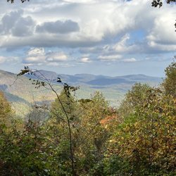
My photos are from the opposite side of the bridge, which by the way, has a trail and a small parking area good for two cars. The trail leads down to the river and in a rainy period, you may also spot a LARGE 100'+ waterfall in the distance coming off the Chattooga Cliff on Bullpen Mountain. I only took the trail a short way to get a better pic of the distant waterfall, but it seems to follow the river north.
~~~
[ HISTORY ]
Style: Pony truss bridge
Status: Open to traffic
Built: 1934
Length of largest span: 79.7 ft.
Total length: 81.7 ft.
Deck width: 11.8 ft.
Also called
Chattooga River Bridge
Bull Pen Bridge
Ammons Branch Bridge
~~~
[ FINAL THOUGHTS ]
If you are a fan of bridges, this is a great one to add to your photo collection. Bull Pen Road is a nice wooded drive from Burrell's Ford Campground to Highlands, North Carolina. IF you are a fan of waterfalls, Kings Creek Fall and Spoonauger Falls are near the campground, and Secret Falls, Dry Falls as well as a high concentration of other named waterfalls are all near the Highlands! Enjoy
2020 / 8