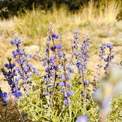
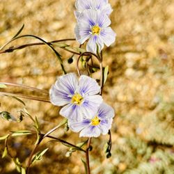
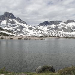
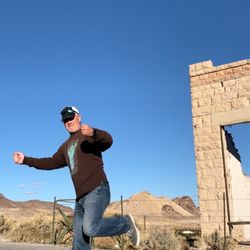
Goldfield Park Photos


More like Goldfield Park
Recommended Reviews - Goldfield Park
Start your review...

5 years ago
The owner was so very nice and accommodating. We showed up a day early and they switched our reservation so easily. Great spot to stop for the night ... been here twice and both times had a nice quite stay and even had two Burros show up read more


8 years ago
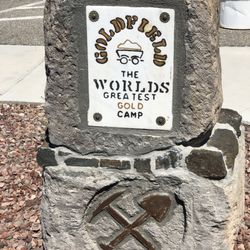
So, you should probably check out what a park in the desert looks like. I'm sure this is the largest public grassy area for miles! read more
More info about Goldfield Park
89013 Broadway St & Grand Ave
Goldfield, NV 89013
Directions
Hours
Outdoor Amenities


Goldfield Park - parks - Updated May 2026
Best of Goldfield
People found Goldfield Park by searching for…
Things to Do in Goldfield, Nevada
Things to See in Goldfield, Nevada
Attraction in Goldfield, Nevada
Nature Parks in Goldfield, Nevada
Night View in Goldfield, Nevada
What to Do in Goldfield, Nevada
State Parks in Goldfield, Nevada
Tourist Attractions in Goldfield, Nevada
Browse Articles
Browse Nearby
BEST of Goldfield, Nevada Things to Do near Goldfield Park
BEST of Goldfield, Nevada Hiking near Goldfield Park
BEST of Goldfield, Nevada Restaurants near Goldfield Park
BEST of Goldfield, Nevada Coffee near Goldfield Park
BEST of Goldfield, Nevada Museums near Goldfield Park
BEST of Goldfield, Nevada Breakfast near Goldfield Park
Browse Brands
Related Searches in Goldfield, NV
Best Nature Trails for Hiking in Goldfield, Nevada
Best Places for Stunning Views in Goldfield, Nevada
Best Spots for Star Gazing in Goldfield, Nevada
Check Out Off Road Trails in Goldfield, Nevada
Discover Lakes & Ponds to Explore in Goldfield, Nevada
Discover Popular Bike Trails in Goldfield, Nevada
Discover Top Nature Parks to Visit in Goldfield, Nevada
Discover the Best Fishing Lake in Goldfield, Nevada
Dog-Friendly Hikes With Dogs in Goldfield, Nevada
Enjoy Tent Camping Spots Around Goldfield, Nevada
Enjoy the Best Picnic Spots and Ideas in Goldfield, Nevada
Experience Stunning Sunset Views in Goldfield, Nevada
Explore Easy Hikes Perfect for All in Goldfield, Nevada
Explore Free Things to Do Around Goldfield, Nevada
Explore Landmarks & Historical Buildings in Goldfield, Nevada
Explore Nature Spots Around Goldfield, Nevada
Explore Popular Campgrounds Near Goldfield, Nevada
Explore Popular Scenic Overlook Points in Goldfield, Nevada
Explore Popular Scenic Views Near Goldfield, Nevada
Explore the Best Trail Options in Goldfield, Nevada
Family Friendly Hiking With Kids in Goldfield, Nevada
Find Beautiful Views in Goldfield, Nevada
Find Fun Kids Activities Outdoor in Goldfield, Nevada
Find Top-Rated Waterfalls in Goldfield, Nevada Now
Find the Best Parks for Picnics in Goldfield, Nevada
Locate a Public Shower Facility in Goldfield, Nevada
Must-See Tourist Attractions Around Goldfield, Nevada
Plan a Scenic Drive Route Near Goldfield, Nevada
Popular Fishing Spots to Explore in Goldfield, Nevada
Popular Things to Do in Goldfield, Nevada
Popular Things to See in Goldfield, Nevada
Relax at Natural Hot Springs Near Goldfield, Nevada
Top Places to Visit in Goldfield, Nevada for Sightseeing
Top Things to Do With Teenagers in Goldfield, Nevada