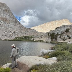
Black Rock Lava Flow Hiking Photos


More like Black Rock Lava Flow
Recommended Reviews - Black Rock Lava Flow
Start your review...

3 years ago


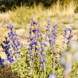
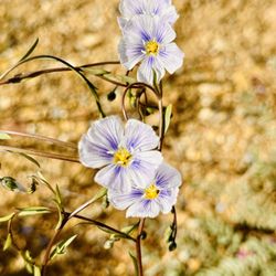
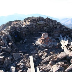
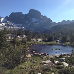
The Youngest Volcanic Flow in the Lunar Volcanic Field I recently had the unique opportunity to visit Black Rock Lava Flow during my nearby visit to Lunar Crater. Not very much is known about the Lunar Crater Volcanic Field except that the last volcanic activity in the area was 15,000 years ago at the black rock flow, this is do to the need for further studies of the rock to be completed by geologists. However some historians believe the cinder cones to be fairly young and forming around the Holocene Era, which is 11,700 before AD 2000 to the Present-day with reference to looking at the types of rocks. But according to several of the ancient faults in the area pre-dating from the Pleistocene Era from 2.5million years ago to 11,700 would have the formation and eruptions during the end of the Pleistocene Era, hence the reason last activity is estimated to be around 15,000 years ago. Believe it or not there is an immense amount of prehistorical volcanism in the state of Nevada. So much so that its bound to keep any rockhound or enthusiast busy with hours of intense research. The Black Rock Lava Flow is located on the Northern side of Highway 6 and it is mainly composed of a mostly basalt type of flow that at the time the magma pushed up but since the cinder cone could not support the weight and pressures. Resulting in the lava pushing out of the side of the cinder cone and thus not creating a violent eruption like most would think. **Overall, Granted its in the middle of the boonies in Nevada, just the shear amazement and wonder of this flow has sparked a newfound interest volcanism as a whole. I found it extremely interesting that there is several other locations also in Nevada, perhaps some extinct volcano could be just under your nose, waiting for you to find it, to learn and explore the mysteries of the great outdoors. Cheers. read more


More info about Black Rock Lava Flow
Tonopah, NV 89049
Directions
(775) 482-7800
Call Now
Hours
Outdoor Amenities


Black Rock Lava Flow - hiking - Updated May 2026
Best of Tonopah
People found Black Rock Lava Flow by searching for…
Browse Articles
Browse Nearby
BEST of Tonopah, Nevada Things to Do near Black Rock Lava Flow
BEST of Tonopah, Nevada Restaurants near Black Rock Lava Flow
BEST of Tonopah, Nevada Coffee near Black Rock Lava Flow
BEST of Tonopah, Nevada Parks near Black Rock Lava Flow
BEST of Tonopah, Nevada Breakfast near Black Rock Lava Flow
BEST of Tonopah, Nevada Campgrounds near Black Rock Lava Flow
BEST of Tonopah, Nevada Museums near Black Rock Lava Flow
Browse Brands
Related Searches in Tonopah, NV
Best Nature Trails for Hiking in Tonopah, Nevada
Best Places for Stunning Views in Tonopah, Nevada
Best Spots for Star Gazing in Tonopah, Nevada
Best Waterfalls and Swimming Holes in Tonopah, Nevada
Check Out Off Road Trails in Tonopah, Nevada
Discover Lakes & Ponds to Explore in Tonopah, Nevada
Discover Popular Photo Spots in Tonopah, Nevada
Discover Top Nature Parks to Visit in Tonopah, Nevada
Discover a Hiking Trail in Tonopah, Nevada
Discover the Best Fishing Lake in Tonopah, Nevada
Discover the Best Night Hike Trails in Tonopah, Nevada
Enjoy Camping Adventures Around Tonopah, Nevada
Enjoy Exciting Mountain Biking Adventures in Tonopah, Nevada
Explore Easy Hikes Perfect for All in Tonopah, Nevada
Explore Free Things to Do Around Tonopah, Nevada
Explore Nature Spots Around Tonopah, Nevada
Explore Popular Campgrounds Near Tonopah, Nevada
Explore Popular RV Parks Around Tonopah, Nevada
Explore Scenic Lakes to Visit in Tonopah, Nevada
Explore Secret Spots Worth Visiting in Tonopah, Nevada
Family Friendly Hiking With Kids in Tonopah, Nevada
Find Beautiful Views in Tonopah, Nevada
Find Cozy Camping Cabins in Tonopah, Nevada
Plan Nature Center Visits in Tonopah, Nevada
Plan a Scenic Drive Route Near Tonopah, Nevada
Popular Picnic Spots to Visit in Tonopah, Nevada
Popular Things to Do in Tonopah, Nevada
Popular Things to See in Tonopah, Nevada
Relax at Natural Hot Springs Near Tonopah, Nevada
Safe and Fun Parks for Kids in Tonopah, Nevada