Boundary Peak Photos


More like Boundary Peak
Recommended Reviews - Boundary Peak
Start your review...

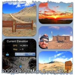
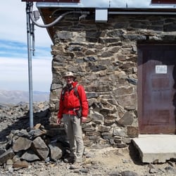
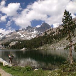
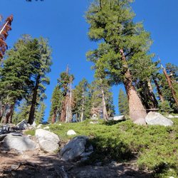
The most challenging part of Boundary Peak was the 4x4 road leading to the trailhead. You will definitely need a high-clearance vehicle if you plan on reaching it without a lot of scraping! (I did it in a Jeep Patriot) The GPS coordinates for the Queen Mine, where most folks start, are: 37.889317, -118.317599 You can drive about another 0.5-1 mile past these coordinates and save yourself some hiking but I wouldn't do it unless you have a vehicle that is both High Clearance AND 4WD, the more clearance the better. (stuff like: Wrangler, Tacoma, 4runner, etc) I was too scared to do it with a Jeep Patriot. Anyway, Boundary Peak is the tallest mountain in Nevada and it's right next to the California border, but you probably already knew that. It's a fun and scenic hike. It's not really technical and the trail is surprisingly well-graded. I wish I had more time to traverse the ridge over to Montgomery Peak in California (which is slightly taller). I had to rush back to the airport though, and had to turn around. Views from the summit were great, dry desert all around and bluebird skies in all directions. Great little off-the-beaten-path activity Mid-Eastern California/Mid-Western Nevada. Just make sure you've got a gnarly set of wheels! read more


More info about Boundary Peak


Boundary Peak - hiking - Updated May 2026
Best of Dyer
Browse Brands
Related Searches in Dyer, NV
Best Waterfalls and Swimming Holes in Dyer, Nevada
Check Out Off Road Trails in Dyer, Nevada
Enjoy Tent Camping Spots Around Dyer, Nevada
Explore Popular Campgrounds Near Dyer, Nevada
Explore Popular RV Parks Around Dyer, Nevada
Explore Scenic Lakes to Visit in Dyer, Nevada
Explore the Best Swimming Holes Around Dyer, Nevada
Find Cozy Camping Cabins in Dyer, Nevada
Hiking Trails With Waterfalls in Dyer, Nevada
Locate a Public Shower Facility in Dyer, Nevada