Cancel

    Open app

    Search

    George Crosby Manitou State Park

    5.0 (2 reviews)

    George Crosby Manitou State Park Photos
    More like George Crosby Manitou State Park

    Recommended Reviews - George Crosby Manitou State Park

    Your trust is our priority, so businesses can't pay to alter or remove their reviews. Learn more about reviews.
    Yelp app icon
    Browse more easily on the app
    Review Feed Illustration

    4 years ago

    Helpful 0
    Thanks 0
    Love this 0
    Oh no 0

    6 years ago

    Helpful 1
    Thanks 0
    Love this 0
    Oh no 0

    Verify this business for free

    Get access to customer & competitor insights.

    Verify this business

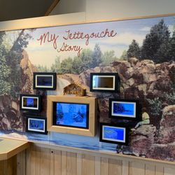
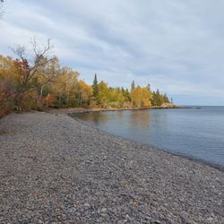
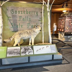
    Tettegouche State Park

    Tettegouche State Park

    4.9(34 reviews)
    0.0 mi

    Cart-in campsites are normally great and well taken care of, especially campsite H…read more We scooped up a campsite(H) and reserved it early on. We get to the site after pushing a full cart(with a messed up wheel) to find a dozen fallen trees that haven't been clean up, and a bunch of dry old rotting brush on the site, and the fire pit is needing to be cleaned out(its full) Site needs maintenance, bad, was really looking forward to our stay, and now just kinda disappointed.

    Tettegouche State Park yes what a worthwhile place to come for a visit! Tettegouche is located…read morealong North Shore Scenic Drive running up and down the Minnesota coast. For me...the star attraction is the hike to HIGH FALLS!!! You can never have enough waterfalls and these High Falls were fantastic! I highly recommend everyone make the trek to High Falls and take some time to appreciate the beautiful backdrop. First off, Tettegouche SP is sort of a hidden little park. When I arrived here, the parking lot was small and it appeared that I fortunately got the last available spot. I visited back in June around 9am and the park and trailhead had filled up. I read at the entrance sign that the trail to High Falls was 1.5 miles each way taking roughly 2 hours. I was able to arrive at High Falls in a little over 1 hour each way with a quick pace. I found the hike to be relatively difficult especially starting out and towards the end. Leaving the trailhead I did have to climb up and over some rocks and cliff areas that I wasn't expecting to be so rugged. I'd say the elevation along the way was pretty elevated at times. When you do arrive near High Falls, there's a sign that states you have to step down 83 stairs to the base. But not to fret...it's all worth it. Upon making it to High Falls, I found the setting to be spectacular! It was a sunny, brisk and pleasant morning for the start of summer. Also, there was zero wind. I was able to climb on the rocks for some great looking photos of this 63 foot tall waterfall along the banks of the Baptism River. High Falls splashed down the cliffside and is sort of divided, making the appearance you're gazing out upon two unique looking waterfalls. Really, in total, it was a beautiful scene. If you don't mind taking your shoes off you can certainly step onto the waters for closer views up to High Falls. You can cross the river for different perspectives. I was really impressed with the surroundings at High Falls. There wasn't a cloud in the sky and as I always point out...I got fortunate with the sun being at my back and allowing for picturesque photo opportunities. On the side next to the trail you can climb safely up to the falls. For me, I was content getting a panoramic view from the riverside area. I simply took a seat on the rocks and had High Falls in plain clear sight for one grand magical moment. I hung out for 45 minutes. Eventually it filled up with hikers. For the time I was there though, I was appreciative for looking at such a pretty waterfall. Also at these High Falls, there was a sign for the Two Step Falls Access. I tried to decipher where this access lead towards but unfortunately I never discovered anything worthwhile. For those wanting more out of their time here you can connect to the Superior Hiking Trail. There were signs for it. Another worthwhile spot was Shovel Point. According to the entrance sign, if you follow the cliff line trail to Shovel Point, you're afforded views of the world's largest freshwater lake. Finally, you can also hike to Tettegouche Camp where you can reserve a cabin in advance and stay overnight in nature. Or it's mentioned that you can simply picnic in the lodge or canoe Mic Mac Lake. My experience here at Tettegouche State Park was fulfilling. Getting the chance to hike to High Falls for fantastic photo chances was memorable. I left feeling satisfied and grateful for taking a few hours out of my summer morning to visit. I highly recommend stopping here during your travels along North Shore Scenic Drive. I've become a waterfall enthusiast and believe if you make the 1.5 mile trek each way, you will not be disappointed with the sights and surroundings of this 5 star attraction.

    Photos
    Tettegouche State Park
    Tettegouche State Park
    Tettegouche State Park - North shore 2019

    See all

    North shore 2019

    Apostle Islands National Lakeshore - Sand Island - North Beach

    Apostle Islands National Lakeshore

    4.5(35 reviews)
    38.7 mi

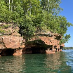
    Visit for the Sea Caves! We spent 4 days in the Apostle Islands National Lakeshore - 3 days of…read morecamping on Sand Island and a full day touring the surrounding area. Skip Madeline Island if your schedule is tight. Highlights: Sea Caves - my favorites were the northeastern edge of Sand Island (next to Justice Bay). They are so breathtakingly beautiful, especially in sunrise or sunset lighting. Since we took our boat, we were able to get up close to see all the spectacular details. If you don't have a boat, rent kayaks and a tour guide to get up close views. Grand Tour - we drove to Bayfield to ride a large catamaran boat for a 3 hour tour of the Apostle Islands. Visitor Centers - they were full of interesting info and has some fun merch for souvenirs. Many people rave about their experience visiting Madeline Island (the largest island) which isn't actually a part of the National Lakeshore, but we found it rather outdated and boring and left on the very next ferry.

    Great area with some beautiful scenery. We stopped at 2 mainland visitor centers for about 30…read moreminutes each and learned a bit about the islands. The Little Sand Lake visitor center we could have actually spent more time if we'd had the luxury but we had an appointment to keep. I could see spending about an hour there. I recommend visiting both centers and taking a ferry/tour of the islands. If you want to do it all give yourself 3+ days. Otherwise you could probably hit the highlights in 1.5 days.

    Photos
    Apostle Islands National Lakeshore - Sand Caves

    Sand Caves

    Apostle Islands National Lakeshore - Sand Island - North Beach

    Sand Island - North Beach

    Apostle Islands National Lakeshore - Bayfield Marina

    See all

    Bayfield Marina

    Black Beach - Views

    Black Beach

    4.8(22 reviews)
    3.9 mi

    This is such a fun beach and about an hour-ish north from Duluth!…read more There is a small parking lot(free) and if you get lucky, you may be able to park there! Otherwise there is street parking and overflow!(both free) There is a golf cart that takes people back and forth from overflow to the beach for free! He does work off of tips, so be sure to throw some money his way! He is super nice, places music and has a cool bubble machine! You will walk down a short path and then... BEACH TIME!!! The beach has some areas with coarse rocks and then fine black sand! The beach is kept pretty clean and there are garbage cans as you are coming onto the beach and leaving. There are fire pits and picnic tables on a first come first serve basis. There are rocks for kids to climb on and stay entertained! The water is always cold, but on those hot days, it feels so good!!! It is a smaller beach and is gorgeous. We like to stop at the Rustic Inn, grabs some slices of pie, and eat the on the beach! Respects the area and make sure you leave with your trash! Together we can keep this beach as outstanding as it already is! **I dropped a star because there is no toilet, only a Biffy)

    We didn't get to spend as much time here as we'd have liked to, as we were traveling with the…read moreparents & they prefer "from the car" experiences. We will be making a return trip for a more in-depth venture. The "black sand" is more like ground rock - don't expect a powder feel. Still, it's rather cool & a great place to stop, especially off-season!

    Photos
    Black Beach
    Black Beach
    Black Beach

    See all

    Meyers Beach- Bayfield Sea Caves

    Meyers Beach- Bayfield Sea Caves

    4.8(4 reviews)
    33.8 mi

    We hiked the Lakeshore Trail from the Meyers Beach parking lot. (National Park Service. $5 parking…read morefee; $2.50 if you have a Senior Pass or Access Pass. May, 2023). As noted by others, this is a launch point for kayaks to launch for views of the sea caves and cliffs. We were at this location twice in late May, 2023, and national park Rangers were there on both days (Wednesday, Friday) ensuring that kayakers were prepared for the rough and cold waters, and to provide guidance to hikers. There are clean vault toilets at the location. Regarding the Lakeshore Hike, we did about 2.2 miles of the hike, returning on the same trail to make it about 4.4 miles roundtrip. The trail continues to a campground site (I believe NPS reservations are required) but we didn't go that far. The first 1.8 miles are largely inland, without views of Lake Superior. Of this segment, the first 0.7 miles are almost completely on a double plank boardwalk that goes over swampy land in parts. It requires some stepping up and down on planks, following terrain changes. After you cross a service road at 0.7 miles, the trail alternates between plank boards and regular trails. As you approach the crevasse at 1.8 miles, there are quite a few ascents and descents wherein you go down to a stream-bed and then back up. Some of these are steep but have logs to help with footing. The stream crossings all had sturdy boards or bridges to cross. At 1.8 miles, you reach the crevasse area with views of Lake Superior. Take a look on both sides to see sea caves and the deep crevasse. There are benches here too so it made a great lunch spot. Be careful not to get too close to the edges. It's a long way down! Beyond the crevasse, walk another 0.4 miles to the "basin". This stretch is relatively easy (flat) walking with spectacular views. My husband, who has been hiking in the Himalayas recently, found the entire trail to be easy. For me, I'd characterize it as moderately challenging. On the positive side, there is very little elevation change, so I wasn't huffing and puffing. However, I have balance issues, so I didn't particularly like the footing for the ascents/descents to the stream beds nor all of the roots on the trail. Some of the steps up and down, even on the boardwalk, were also a bit too high for my short legs! Having walked with hiking poles and an occasional hand from my husband helped. Finally, remember bug spray. The mosquitoes are active. 4-star rating overall instead of 5 due to distance required to walk to get views of the sea caves and mosquitoes. 5 stars for the Park Service.

    You have to come check out the sea caves on the shoreline of Lake Superior. Meyers beach is the…read morelaunching point for kayaks. It's also the location for the hiking trail. The views from the water are beautiful! I highly recommend the water instead of the walking trail. There are multiple vendors you can rent kayaks and wet suits from. You can even take a guided tour. We personally, have our own kayaks and decided to do our own trip. The DNR do sit at the beach and give you the whole spiel on safety and risks. It is recommended to use sea kayaks due to the rough waters of Lake Superior. We have used normal lake kayaks and used good judgement on the water/ weather conditions. Both times were just fine on the normal kayaks. Just be careful. The waters are freezing all year-round and if you do go overboard near the caves there's no good spot to pull off. Check out my pics of the stunning caves!

    Photos
    Meyers Beach- Bayfield Sea Caves
    Meyers Beach- Bayfield Sea Caves
    Meyers Beach- Bayfield Sea Caves

    See all

    Big Bay State Park

    Big Bay State Park

    4.3(17 reviews)
    45.3 mi

    We came here on the ferry from Bayfield (super easy, but recommend having your car on the ferry if…read moreyou plan to head out here) and had a great time hiking. I was a little confused on where I was supposed to park for the trails, but there's essentially one road so you just kinda figure it out as you go (I went the wrong way the first time, maybe a 2 minute detour). We parked near the beach access area, and started off on the trails. We took the Woods Trail to the Point Trail to the Bayview Trail -- and it brings you right back to the same place. I recommend doing it in this order (which I think is counter-clockwise?) versus the reverse. While the Woods Trail is in a lovely, lush green woods, after seeing the rocks and lake sites along the other trails, the Woods Trail would be a very boring way to end. Starting with the Woods Trail, it's only better as you go along. I hiked with my senior large dog, and he did just fine on the paths. Pretty clear markings and nothing super treacherous if you don't venture out on to the rock formations. Dogs are not allowed on the beach or boardwalk (big sad face), so we went back to town after the hike. Along our way, we saw a small black bear crossing the road! Quite an adventure. Depending on date and time, might be limited food options on the island, so have a plan and check out your options ahead of time.

    Wonderful Wisconsin State Park with unbelievable views of Lake Superior! Lots of hiking (just…read moreremember to wear insect repellent), swimming or just walking along the shoreline. We biked to the park after taking the ferry-bicyclists are free at the state park! Primitive pit toilets was the ONLY drawback at this magnificent state park!

    Photos
    Big Bay State Park
    Big Bay State Park - Perfect spot for a picnic!

    Perfect spot for a picnic!

    Big Bay State Park

    See all

    George Crosby Manitou State Park - parks - Updated May 2026

    Loading...
    Loading...
    Loading...