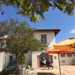
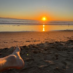
Franklin Trail Photos


You might also consider
More like Franklin Trail
Recommended Reviews - Franklin Trail
Start your review...


4 years ago


5 years ago
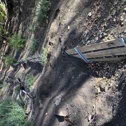
This is a hidden gem of a hiking trail! Starting behind the high school, the trail has plenty of switch backs in between breaks of flat ground to provide a solid hike. Not to mention there's a gorgeous view of the ocean all the way to the top. The beginning of the trail is a bit tricky to find, but just make your way to the back of the baseball fields and you should be on your way. Not crowded compared to other trails in the area. read more

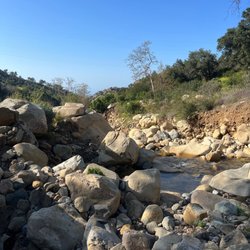
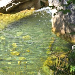
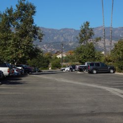
A newer, or more accurately stated, recently reopened trail in Carpinteria. Construction is still underway, currently Phase 1 of 3 is the only open section, word is that phase 2 will open in 2016. Eventually the trail will enter the Los Padres National Forest. Phase 1- Distance is 2.25 miles each way, making the loop 4.5 miles. It is an easy hike with some areas of incline. There visibility of the city and ocean during 90% of the hike which make for pretty scenery however limited shade. Bring water, wear sunscreen, etc... Directions- Easiest is to enter the address for Carpinteria High School as the trailhead starts to the left of the school (when facing it from the from entrance). Parking is at Meadowview Lane as it is prohibited on school property. A short walk on a walking/biking path leads you from parking to school. read more

4 years ago
5 years ago
Carpinteria has a new hike and it is great! It starts with a jaunt around the high school, and then you hike up, up, and into some incredible views of this lovely beach community. The fenced in beginning parts make you feel like a convict, but I promise it gets better. read more

6 years ago
10 years ago
unbelievable views! Definately worth the drive. come at see for yourself. you will not believe the views. read more
9 years ago
8 years ago
11 years ago
More info about Franklin Trail
Ask the Community - Franklin Trail
Review Highlights - Franklin Trail
You might also consider


Franklin Trail - hiking - Updated June 2026
Best of Carpinteria
People found Franklin Trail by searching for…
Scenic View in Carpinteria, California
Beaches in Carpinteria, California
Things to Do in Carpinteria, California
Parks in Carpinteria, California
Hiking Trails in Carpinteria, California
Free Parking in Carpinteria, California
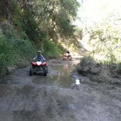
Off Road Trails in Carpinteria, California
Secret Spots in Carpinteria, California
Easy Hikes in Carpinteria, California
Things to Do at Night in Carpinteria, California
Flower Field in Carpinteria, California
Running Trails in Carpinteria, California
Scenic Drive in Carpinteria, California
Walking Trails in Carpinteria, California
Mountain Biking in Carpinteria, California
Beaches for Kids in Carpinteria, California
Photo Spots in Carpinteria, California
Scenic Overlook in Carpinteria, California
Natural Hot Springs in Carpinteria, California
View Points in Carpinteria, California
Places to Take Pictures in Carpinteria, California
Parks for Kids in Carpinteria, California
Trending Searches in Carpinteria, CA
Bait And Tackle Shop near Franklin Trail
Black Owned Nail Salons near Franklin Trail
Boat Rental near Franklin Trail
Cliff Jumping near Franklin Trail
Dog Friendly Trails near Franklin Trail
Fishing Spots near Franklin Trail
Jet Ski Rental near Franklin Trail
Kayak Rental near Franklin Trail
Lakes & Ponds near Franklin Trail
Outdoor Activities near Franklin Trail
Pick Your Own Farms near Franklin Trail
Places To Walk Around near Franklin Trail
Public Shower near Franklin Trail
River Swimming near Franklin Trail
Rock Quarry near Franklin Trail
Scenic Night View near Franklin Trail
Scenic Overlook near Franklin Trail
Secluded Spots near Franklin Trail
Soccer Store near Franklin Trail
Splash Pad near Franklin Trail
Strawberry Picking near Franklin Trail
Sunrise View near Franklin Trail
Swimming Holes near Franklin Trail
Swimming Lakes near Franklin Trail
Swimming Pools near Franklin Trail
Watch Sunset near Franklin Trail
Browse Articles
Browse Nearby
BEST of Carpinteria, California Coffee near Franklin Trail
BEST of Carpinteria, California Restaurants near Franklin Trail
BEST of Carpinteria, California Things to Do near Franklin Trail
BEST of Carpinteria, California Breakfast near Franklin Trail
BEST of Carpinteria, California Fishing near Franklin Trail
BEST of Carpinteria, California Shopping near Franklin Trail
Browse Brands
Related Searches in Carpinteria, CA
Affordable Kayak Rental Services in Carpinteria, California
Best Fishing Locations and Guides in Carpinteria, California
Best Places for Horseback Riding in Carpinteria, California
Best Waterfalls and Swimming Holes in Carpinteria, California
Check Out Off Road Trails in Carpinteria, California
Discover Dog Friendly Trails to Explore in Carpinteria, California
Discover Kid Friendly Hiking Trails in Carpinteria, California
Discover Scenic Waterfall Spots in Carpinteria, California
Discover a Hiking Trail in Carpinteria, California
Discover the Best Night Hike Trails in Carpinteria, California
Discover the Best Running Track in Carpinteria, California
Dog-Friendly Hikes With Dogs in Carpinteria, California
Enjoy Camping Adventures Around Carpinteria, California
Enjoy Exciting Mountain Biking Adventures in Carpinteria, California
Enjoy Kayaking Adventures in Carpinteria, California
Enjoy Tent Camping Spots Around Carpinteria, California
Enjoy a Beautiful Waterfall Hike in Carpinteria, California
Enjoy a Peaceful Nature Walk in Carpinteria, California
Enjoy the Best Picnic Spots and Ideas in Carpinteria, California
Enjoy the Best Walking Path in Carpinteria, California
Enjoy the Best Walking Trails in Carpinteria, California
Exciting Cliff Jumping Spots in Carpinteria, California
Explore Beautiful Parks and Green Spaces in Carpinteria, California
Explore Easy Hikes Perfect for All in Carpinteria, California
Explore Fun Activities to Do in Carpinteria, California
Explore Popular Campgrounds Near Carpinteria, California
Explore the Best Beach Spots in Carpinteria, California
Explore the Best Swimming Holes Around Carpinteria, California
Explore the Best Trail Options in Carpinteria, California
Family Friendly Hiking With Kids in Carpinteria, California
Find Beautiful Views in Carpinteria, California
Find Popular Ziplining Spots Around Carpinteria, California
Find the Best Scenic View Locations in Carpinteria, California
Great Places to Walk in Carpinteria, California
Hiking Trails With Waterfalls in Carpinteria, California
Off Leash Dog Hiking Trails in Carpinteria, California
Plan a Scenic Drive Route Near Carpinteria, California
Play at a Splash Pad Park in Carpinteria, California
Popular Outdoor Activities to Try in Carpinteria, California
Popular Picnic Spots to Visit in Carpinteria, California
Safe River Swimming Areas in Carpinteria, California
Safe and Fun Parks for Kids in Carpinteria, California
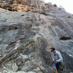
Top Climbing Spots and Gyms in Carpinteria, California
Top Paddleboarding Activities in Carpinteria, California
Top Places for Snorkeling in Carpinteria, California
Top Running Trails to Explore in Carpinteria, California
Top Swimming Lakes to Enjoy in Carpinteria, California
Top Swimming Spots and Pools in Carpinteria, California