1. Franklin Town Common

0

Franklin, MA

Cancel

Open app

Search

Franklin Town Common

4.0 (1 review)

Franklin Town Common Photos

You might also consider

Recommended Reviews - Franklin Town Common

Your trust is our priority, so businesses can't pay to alter or remove their reviews. Learn more about reviews.
Yelp app icon
Browse more easily on the app
Review Feed Illustration

9 years ago

Helpful 0
Thanks 0
Love this 0
Oh no 0

You might also consider

Verify this business for free

People searched for Parks 989 times last month within 15 miles of this business.

Verify this business

Choate Park

Choate Park

5.0(5 reviews)
4.3 mi

We were on our way to a picnic dinner at Sweat Beach in Wrentham, MA but they decided to close two…read morehours early and shuffled everyone off. So we googled picnic areas nearby and put our GPS to Medway, MA. The rood trip was winding picturesque road through towns with beautiful houses and finally came to Choate Park. Free and plenty of parking. It's a trash free park, what you bring in, take out. There is an event pavilion and beautiful lake for catch & release fishing ....or turtles ( see pics) lol. There is a fantastic playground for the little & big ones. The trail around the lake has exercise spots and open fields with a huge wall mural. This will definitely be a go to spot for picnics, walking and being in nature.

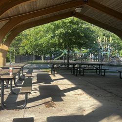
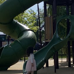
I took my 5yo and 7yo to the playground and splash area. Very nice park. The splash area is simple…read more(just some fountains that shoot up from the ground) but is great to cool off on a hot day. The water stops at 5pm. I don't think the water area is particularly slippery but i would suggest water shoes. My son and a couple of other children who were barefoot did slip. The playground structures are really unique and fun. They have a smaller one for young kids and larger structure for older kids. There was also a trail and lake but we didn't follow. Highlights: -fenced in with only two doors -bathrooms (clean and open until 5pm) -clean - picnic area with tables and benches. Covered and large with plenty of seating. -electric car charging station (not free) -plenty of parking Cons -no trash cans. Small inconvenience. Overall would def recommend as a summertime activity.

Photos
Choate Park
Choate Park
Choate Park

See all

Upper Charles River Trail

Upper Charles River Trail

3.8(5 reviews)
6.8 mi

Great place to walk, run or ride your bike…read more It's not lit up at night, so avoid the trail when it gets dark. The people are usually very friendly that you come across, many walking their dogs and surprisingly picking up after their pets. I wish the geese weren't doing their mess on parts of the trail because sometimes if you're running and not looking down- you can step in it. They have tables to eat lunch. People fish there as well. There's also markers so you know how much you've walked or ran. Great trail to see some nature too. We've seen little bunnies, chipmunks, and at one point at dusk I was being chased by a bat. lol So yeah, don't walk there at night. Also the police will check it out from time to time so at least you know they're looking out for you as well.

I first found out about this path when my boss took me here after work one day. He likes to go on…read morewalks to delay returning home when his psychotic girlfriend (according to him) or her psychotic 10yr old daughter (also, according to him) are too much to handle. Sometimes his goal is to wait for them to fall asleep, then go home. I duck out before it gets to that point. The Upper Charles River Trail will eventually be 24 miles long and through Milford, Ashland, Sherborn, Holliston, and Hopkinton. It's on an old CSX right of way. I believe the Milford section is the only section complete so far, roughly ~5 miles. I don't jog that long anyway, especially with the sunset getting earlier. I usually park at Fino Field and go the trail until it intersects Route 85 by the Sports Authority, then turn back. Round trip is ~4.5 miles GPSed. The trail is paved and has mile markers in 1/4 mile increments. Traffic is pretty light when I'm there; dusk, weekdays. I see more walkers and less bikers. There are unimproved trails through the woods that you can stumble into and I'm still exploring where they all go. Also, I believe what they call "Vietnam" has an entrance on the north end of the trail across US495. NEMBA actually owns it. (http://www.nemba.org/Articles/VietnamFAQs.html) I'd like to try Vietnam out, but reading reviews saying that there are "6 foot drops out of nowhere" kind of scares me.

Photos
Upper Charles River Trail
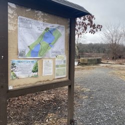
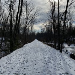
Upper Charles River Trail - Upper Charles trail in the winter

See all

Upper Charles trail in the winter

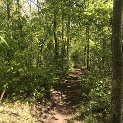
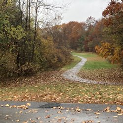
Birchwold Farm Conservation Area - The way a trail should be marked

Birchwold Farm Conservation Area

3.0(3 reviews)
4.4 mi

WATCH YOUR SURROUNDINGS HERE!…read more I used to come here a lot a few years back and absolutely loved walking here. However today, I cannot say the same. The weirdest thing happened to me this morning on my walk. I was walking here with my dog and as soon as we got out of the car and only a few steps in, this women came out of no where and asked if she could walk with us. I will say, she did open with "I know this is a really weird thing to ask." In my head, I was like yeah it is, but what's the harm, we're in a nice area. I made sure to keep my distance, as I was still nervous/creeped out by the situation. The conversation started out fine, "oh your dogs cute, what's her name, what breed is she." However as we walked a little further, she started asking more personal questions, "where are you from, how old are you, etc" This is when I knew, something was just off. So when my dog stopped and she kept walking a little further, I turned around and ran to my car. The vibes were just not right and in my gut I knew there was something off about the whole situation. I could be completely wrong and maybe she was just looking for a friendly walk with someone. However, the personal questions or saying "I don't know this area very well can you show me the path to walk." That line alone was very off putting because there is a clear open path to follow here. I even told her this but she continued to walk with us even when I knew she could tell I was feeling uncomfortable. So PLEASE be aware of your surroundings and make sure you are safe. It's a nice area, however you just never know. She was probably in her early thirties, tall, African American - I don't recall her name. You just never know what could happen, things might seem perfectly fine, but always have your guard up like I did! Sorry for the long message, but I just want to make people aware of what happened so it doesn't happen to you!!

I hiked this for the first time this year and found trail markings missing and ended up on a road…read moretaking me far away from the trail. BE VERY COGNAZANT OF THE TRAIL I found myself on another trail with excellent marking, but leading me further away. The trailhead at Birchwald refers to only 2 markings - red and green. Within a mile those are gone.

Photos
Birchwold Farm Conservation Area - The state line in the woods. If you see this, get back on the trail!!

The state line in the woods. If you see this, get back on the trail!!

Birchwold Farm Conservation Area

See all

Franklin Town Common - parks - Updated October 2026

Loading...
Loading...
Loading...