Cancel

    Open app

    Search

    Birchwold Farm Conservation Area

    3.0 (3 reviews)

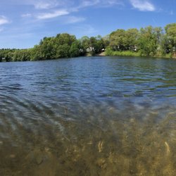
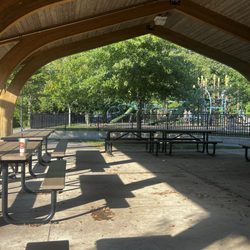
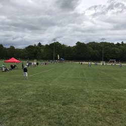
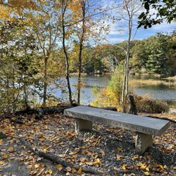
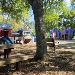
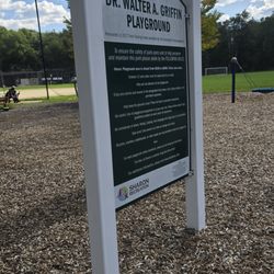
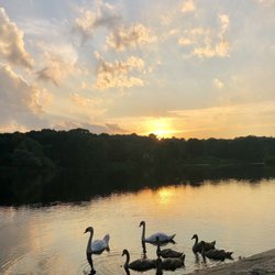
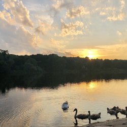
    Birchwold Farm Conservation Area Photos

    You might also consider

    More like Birchwold Farm Conservation Area

    Recommended Reviews - Birchwold Farm Conservation Area

    Your trust is our priority, so businesses can't pay to alter or remove their reviews. Learn more about reviews.
    Yelp app icon
    Browse more easily on the app
    Review Feed Illustration

    2 years ago

    Helpful 3
    Thanks 2
    Love this 0
    Oh no 0

    7 years ago

    Helpful 0
    Thanks 0
    Love this 0
    Oh no 0

    10 years ago

    Helpful 2
    Thanks 0
    Love this 0
    Oh no 0

    You might also consider

    Verify this business for free

    People searched for Hiking 2,202 times last month within 15 miles of this business.

    Verify this business

    Upper Charles River Trail

    Upper Charles River Trail

    4.0
    (6 reviews)
    10.0 mi

    I first found out about this path when my boss took me here after work one day. He likes to go on…read morewalks to delay returning home when his psychotic girlfriend (according to him) or her psychotic 10yr old daughter (also, according to him) are too much to handle. Sometimes his goal is to wait for them to fall asleep, then go home. I duck out before it gets to that point. The Upper Charles River Trail will eventually be 24 miles long and through Milford, Ashland, Sherborn, Holliston, and Hopkinton. It's on an old CSX right of way. I believe the Milford section is the only section complete so far, roughly ~5 miles. I don't jog that long anyway, especially with the sunset getting earlier. I usually park at Fino Field and go the trail until it intersects Route 85 by the Sports Authority, then turn back. Round trip is ~4.5 miles GPSed. The trail is paved and has mile markers in 1/4 mile increments. Traffic is pretty light when I'm there; dusk, weekdays. I see more walkers and less bikers. There are unimproved trails through the woods that you can stumble into and I'm still exploring where they all go. Also, I believe what they call "Vietnam" has an entrance on the north end of the trail across US495. NEMBA actually owns it. (http://www.nemba.org/Articles/VietnamFAQs.html) I'd like to try Vietnam out, but reading reviews saying that there are "6 foot drops out of nowhere" kind of scares me.

    Update: I frequent this trail weekly and try to go a few times a week and go in the mornings when I…read moredo. Since August there's been this young couple I want to say in their early twenties with a dog and they have extremely loud music that plays vulgar songs. I don't mean to be a stick in the mud but there are young children and elderly on this trail and they don't need to hear songs about "suck a f****** d***" and other terrible expletives that shouldn't be played at an OBNOXIOUS LEVEL. Not only this but I guess it's you can smoke on this trail even though people are there to exercise so it's pretty rude!! BUT THEY'RE SMOKING WEED! Again I understand weed is recreational now so it's fine and I don't care if people smoke but they were smoking a huge blunt as a mother and a kid and her infant in a stroller passed them and I felt awful as she gave me an odd look and I was behind them. Why do that? There are plenty of areas to go off and hide and smoke do you really have to do it and pass it to each other in front of everyone's children when they're trying to get exercise? It's so rude! Also pick up your dogs shit! I think there should be more police on foot on this trail since were right by the police station or something because I am avoiding this trail until next year they are ALWAYS there. I sat by the lake for almost 2 hours in hopes they would be gone but nope. There they were passing the trail again. Do they live in the woods?? What the hell. The guy always has a backpack and they wear sunglasses. A cute little trail that's pretty clean. Usually pleasant people on this trail for the most part consisting of moms with their kids and the like.

    Photos
    Upper Charles River Trail
    Upper Charles River Trail
    Upper Charles trail in the winter

    See all

    Upper Charles trail in the winter
    F Gilbert Hills State Forest

    F Gilbert Hills State Forest

    4.4
    (18 reviews)
    7.4 mi

    Over a thousand acres in Foxboro and Wrentham, 23 miles of trails, nice and hilly, great place for…read moretaking a long hike, dog walking and mountain biking. Good Mountain Biking/multi-use trails, many challenging areas, some areas are muddy year-round. Few picnic tables. Nice fall colors here as well. Convenient to I95, I495, Rt. 1, close to Gillette Stadium.

    I visit Gilbert and Borderland State Forests frequently as I live in Norton. Both have pros and…read morecons, but I overall Foxboro is better imo. The wide variety of trails and the mileage of trails is why visit here more. Dog friendly and very relaxed leash policy. Trails are pretty well maintained. Very rocky and hilly. Lots of watering holes, but most are dried up toward the middle of season. Trails are marked via painted trail markers on trees or rocks. Maps are scarce so make sure to snap a pic of one before venturing. The yellow trail from start to finish is ~9 miles alone and most trails interlink with each other. Very easy to get lost if you don't know the park. Parking is free. I usually park on Mill st where the State Forest Fire department is located, but there's probably 10+ parking areas surrounding the park including one off route 1 near Gillette. Con: terrain is tough, especially if you want to run. Also easy to get lost. I can't stress this enough. Take a pic of the map before going in the park. 4/5 stars

    Photos
    F Gilbert Hills State Forest
    F Gilbert Hills State Forest
    Lost with no direction hah

    See all

    Lost with no direction hah
    Ponkapoag Trails

    Ponkapoag Trails

    3.8
    (18 reviews)
    17.8 mi

    How did I not know this existed?! Probably because you have to walk through the golf course to get…read moreto it. Way worth the visit on the other side of great blue hill from the highway you walk through the golf course to the pond and a wide trail circles the whole pond. It is a 4 mile loop. The trail was really muddy when we went (November) and we didn't make it all the way around but I look forward to going again, next time we will wear hiking boots instead of sneakers. The walk through the golf course is pretty nice too the paved road for golf carts is lined in gorgeous big old maples.

    Been wanting to check out these trails for a while now and today was the day. There was no clear…read moreaddress on yelp directions but it got me there correctly. There's a tiny little spot you can park right before the head of the trail but only enough for a few cars. I guess if you came and it was full you could park down the street. There is a pretty big lot there that usually has quite a few spots open. You'd have to walk a bit to the trail though. Great trail around Ponkapoag pond. My Fit bit says it was a little over 11,000 steps. Most trails are marked good. There are maps posted every so often and most have an arrow that point "you are here". I would suggest to bring a map although at the place where I started from the box holding the Maps was empty so I just took a picture of the one posted. Definitely bring bug spray! This place is loaded with bugs. I was pretty bitten up at the end of my walk. I stayed on the main trail but there were lots of small trails to go off on. I was pretty disappointed to see signage that said no bikes allowed on a lot of them though. That's a real bummer for me and my beloved mountain bike. Saw lots of beautiful birds and butterflies. Luckily I didn't run into any coyotes but just be aware that they are around. 3.5 stars.

    Photos
    Boardwalk
    Boardwalk
    Boardwalk
    Boardwalk
    Side trail. Sign in upper right corner. No bikes allowed. :-(

    See all

    Side trail. Sign in upper right corner. No bikes allowed. :-(
    Blackstone River Bikeway

    Blackstone River Bikeway

    4.5
    (55 reviews)
    5.3 mi

    One of the prettiest, smoothest, easiest and most accessible bike paths if you live in northeast RI…read moreor nearby MA border towns. The bikeway (approx. 20 miles) runs from Woonsocket, through Cumberland into Lincoln along the Blackstone River through lots of greenery and passing by bridges, dams, old mill buildings and historic sites. Of course, there are plenty of ways to do shorter rides/runs/walks. My riding buddies and I especially enjoy getting on at Albion Street in Cumberland (limited parking though!) and riding towards Ashton Mill (Cumberland) and into Lincoln for either a 10- or 12-mile spin, depending on where we decide to turn back. We also like the stretch from Woonsocket to Albion (about 9 miles back and forth) that starts out by taking us by sunny soccer fields in The River's Edge Recreation area. No matter where you get on, the terrain is mainly flat and it's easy to keep a steady pace.Be on the lookout for turtles sunning themselves on fallen trees in the river as well as occasional deer. And expect plenty of friendly waves and nods from walkers, runners and bikers on your journey. The Lincoln and Woonsocket ends offer ample parking.

    The Blackstone River Park put on a historic tour with an NPS guide, so my review is more for that…read morethan for the bike path. There is a parking lot at the Wilber House (open seasonally) and the guide described and showed the site of the original mill off of the river canal and then walked us over the multistate bridge to the Ashton Mill and pointed out the smokestacks of the factory-turned-lofts and the old residence of the factory workers. If possible, you should check park events because it gave some great local history of the site. It sounds like they have some tours on weekdays and weekends. If not on a tour, there are some informational signs but not much to look at and wouldn't take more than 10 minutes to read the signs. The interaction was definitely a great additional to learning about the site.

    Photos
    Blackstone River Bikeway
    Blue heron at Blackstone River Canal in Lonsdale, RI
    Blue heron at Blackstone River Canal in Lonsdale, RI
    Blackstone River Bikeway

    See all

    Birchwold Farm Conservation Area - hiking - Updated August 2026

    Loading...
    Loading...
    Loading...