Fishbits' Trail Photos


You might also consider


More like Fishbits' Trail
Recommended Reviews - Fishbits' Trail
Start your review...



3 years ago
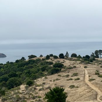
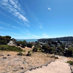
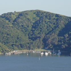
We started our hike to Fishbits at the Old St Hillary's church. There is limited parking there. Maybe two spots. There is a trail head just in front of the parking spots or you can catch it at the back of the church. This trail cuts across the bottom of the Old Hillary Preserve - imagine the preserve is a wedge and the trail cuts across the point of the wedge. It ends on a residential street - Vistazo West, where we then hiked up the hill - linking to Lyford Dr. It's pretty steep, but eventually you get to another trailhead from Lyford. You may want to turn left up Sugar Loaf and then Right on Heathcliff Dr, but it was pretty steep and we decided to stay on Lyford, which also leads to a trialhead for Fishbits. Once on the trail head you climb to the top with the trail's clear hills and valleys ,and have amazing views of the bay, Angel Island and the Golden Gate and Richmond Bridges. If you take this to the end - you will be greeted by a "No Trespassing -Private Property," sign just outside a wire fence that has been cut open - clearly some time ago. We proceeded and there is another sign posted right at the lookout point for Angel Island. Taking this trail around - there are now houses on the left which are enclosed by chainlink fencing. At this point, you may want to go back on the main trail or if you proceed, the trail gets a bit more narrow and challenging - uneven, less groomed, some rocks, etc. but clearly more than a deer trail. It cuts across the mountain and then switches back towards the trail behind Old Hillary's Church. All Trails lists this a down and back trail and not a loop. We kept going and it did eventually loop back to the church. It was just short of 4 miles, steep, and took us 2.5 hours and I'm not in great shape. So there you have it! read more

5 years ago
More info about Fishbits' Trail
1496 Vistazo St
Belvedere Tiburon, CA 94920
Directions
Visit Website
http://www.bahiker.com/northbayhikes/osh.html
Hours
Outdoor Amenities
Other Amenities
You might also consider

















Why does Yelp recommend reviews?
1 review that is not currently recommended
The reviews below are not factored into the business's overall star rating.

14 years ago


