Eagle's Beak Park Photos


You might also consider
More like Eagle's Beak Park
Recommended Reviews - Eagle's Beak Park
Start your review...

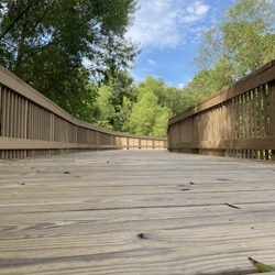
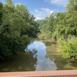
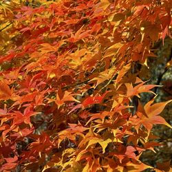
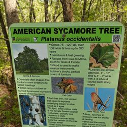
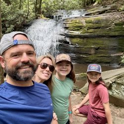
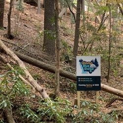
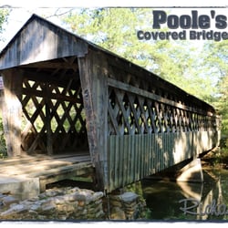
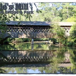
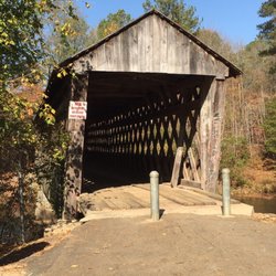
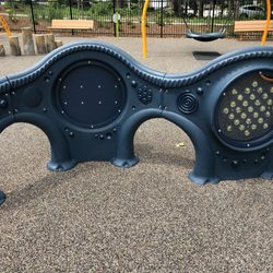
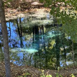
This park in N. Forsyth County is one that's perfect for moms with strollers or anyone that wants a flat course to walk or run! A newer park that is well maintained has a large playground, restrooms, paved walking/jogging path, 2 decks that overlook the river, and an entry point into the river that includes a hookup to lower your kayak or canoe for easy navigation into the water. There is a hydration station with 4 different uses. One for refilling water bottles, a second fountain for children, a third for pets, and a forth one, you could wash your boots off or your dog if they got dirty in the Etowah River! The county really thought of everything when they built this park. Covered pavilions that are free to use anytime but if you want to secure a pavilion for a party, there is a small fee. It's easy to a reserve a pavilion online through the Forsyth park website. Mature trees, benches to stop and rest and best of all history. There are information boards that give history of the local Indian population and how the area developed over the years. Forsyth County truly has some of the best parks in GA! read more


More info about Eagle's Beak Park
You might also consider


Eagle's Beak Park - parks - Updated July 2026
Best of Ball Ground
People found Eagle's Beak Park by searching for…
Fireworks in Ball Ground, Georgia
Playgrounds in Ball Ground, Georgia
River Swimming in Ball Ground, Georgia
Watch Sunset in Ball Ground, Georgia
Hiking Trails With Waterfalls in Ball Ground, Georgia
Free Things to Do in Ball Ground, Georgia
Walking Trails in Ball Ground, Georgia
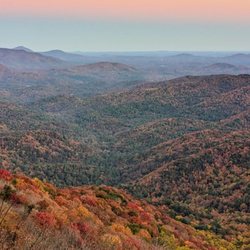
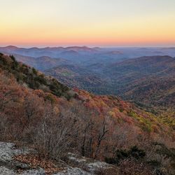
Scenic Overlook in Ball Ground, Georgia
Fun Things to Do in Ball Ground, Georgia
Things to Do on a Rainy Day in Ball Ground, Georgia
Places to Take Pictures in Ball Ground, Georgia
4th of July Fireworks in Ball Ground, Georgia
Kayak Rental in Ball Ground, Georgia
Star Gazing in Ball Ground, Georgia
Sunset View in Ball Ground, Georgia
White Water Rafting in Ball Ground, Georgia
Secret Spots in Ball Ground, Georgia
Dirt Bike Riding in Ball Ground, Georgia
Scenic Drive in Ball Ground, Georgia
Public Running Track in Ball Ground, Georgia
Lookout Points in Ball Ground, Georgia
Trending Searches in Ball Ground, GA
Black Owned Nail Salons near Eagle's Beak Park
Boardwalk near Eagle's Beak Park
Boat Rental near Eagle's Beak Park
Cliff Jumping near Eagle's Beak Park
Day Trips near Eagle's Beak Park
Dog Friendly Beaches near Eagle's Beak Park
Dog Friendly Trails near Eagle's Beak Park
Dog Swimming near Eagle's Beak Park
Fishing Spots near Eagle's Beak Park
Jet Ski Rental near Eagle's Beak Park
Kayak Rental near Eagle's Beak Park
Kids Activities Outdoor near Eagle's Beak Park
Lakes & Ponds near Eagle's Beak Park
Lookout Points near Eagle's Beak Park
Off Road Trails near Eagle's Beak Park
Outdoor Activities near Eagle's Beak Park
Outdoor Basketball Courts near Eagle's Beak Park
Picnic Areas near Eagle's Beak Park
Places To Walk Around near Eagle's Beak Park
Pool Day Pass near Eagle's Beak Park
Public Beaches near Eagle's Beak Park
Public Pools near Eagle's Beak Park
Public Shower near Eagle's Beak Park
River Swimming near Eagle's Beak Park
Rock Quarry near Eagle's Beak Park
Scenic Night View near Eagle's Beak Park
Scenic Overlook near Eagle's Beak Park
Secluded Spots near Eagle's Beak Park
Soccer Store near Eagle's Beak Park
Splash Pad near Eagle's Beak Park
Strawberry Picking near Eagle's Beak Park
Sunrise View near Eagle's Beak Park
Swimming Holes near Eagle's Beak Park
Swimming Lakes near Eagle's Beak Park
Watch Sunset near Eagle's Beak Park
Water Parks near Eagle's Beak Park
Browse Nearby
Browse Brands
Related Searches in Ball Ground, GA
Affordable Canoe Rental Options in Ball Ground, Georgia
Affordable Jet Ski Rental Options in Ball Ground, Georgia
Affordable Kayak Rental Services in Ball Ground, Georgia
Affordable Paddle Board Rental in Ball Ground, Georgia
Best Dog Hiking Trails Around Ball Ground, Georgia
Best Fishing Locations and Guides in Ball Ground, Georgia
Best Nature Trails for Hiking in Ball Ground, Georgia
Best Off Leash Dog Parks in Ball Ground, Georgia
Best Parks for Parties and Events in Ball Ground, Georgia
Best Places for Horseback Riding in Ball Ground, Georgia
Best Pontoon Boat Rentals Near Ball Ground, Georgia
Best Trout Fishing Spots Around Ball Ground, Georgia
Best Water Parks for Kids in Ball Ground, Georgia
Best Waterfalls and Swimming Holes in Ball Ground, Georgia
Book Exciting Whitewater Rafting Adventures in Ball Ground, Georgia
Book Kayak Lessons for All Levels in Ball Ground, Georgia
Check Out Great Playgrounds in Ball Ground, Georgia
Check Out Off Road Trails in Ball Ground, Georgia
Discover Baseball Fields Around Ball Ground, Georgia
Discover Dog Friendly Trails to Explore in Ball Ground, Georgia
Discover Fun Toddler Parks in Ball Ground, Georgia for Your Little One
Discover Kid Friendly Hiking Trails in Ball Ground, Georgia
Discover Lakes & Ponds to Explore in Ball Ground, Georgia
Discover Popular Bike Trails in Ball Ground, Georgia
Discover Scenic Mountain Bike Trails Near Ball Ground, Georgia
Discover Soccer Fields in Ball Ground, Georgia Near You
Discover Top Boat Tours in Ball Ground, Georgia for All Ages
Discover Top Nature Parks to Visit in Ball Ground, Georgia
Discover Top State Parks to Visit in Ball Ground, Georgia
Discover a Hiking Trail in Ball Ground, Georgia
Discover the Best Beaches in Ball Ground, Georgia
Discover the Best Night Hike Trails in Ball Ground, Georgia
Dog-Friendly Hikes With Dogs in Ball Ground, Georgia
Enjoy Camping Adventures Around Ball Ground, Georgia
Enjoy Exciting Mountain Biking Adventures in Ball Ground, Georgia
Enjoy Fishing Pier Spots in Ball Ground, Georgia With Scenic Views
Enjoy Hiking Adventures in Ball Ground, Georgia
Enjoy Kayaking Adventures in Ball Ground, Georgia
Enjoy Lazy River Tubing in Ball Ground, Georgia
Enjoy Off Leash Dog Hikes in Ball Ground, Georgia
Enjoy River Tubing Adventures in Ball Ground, Georgia
Enjoy Tent Camping Spots Around Ball Ground, Georgia
Enjoy Thrilling Atv Riding Experiences in Ball Ground, Georgia
Enjoy Water Activities and Fun in Ball Ground, Georgia
Enjoy a Beautiful Waterfall Hike in Ball Ground, Georgia
Enjoy a Relaxing Paddle Boat Ride in Ball Ground, Georgia
Enjoy the Best Tubing Experiences in Ball Ground, Georgia
Enjoy the Best Walking Trails in Ball Ground, Georgia
Exciting Water Sports Activities to Try in Ball Ground, Georgia