Buzzard Hill Photos


You might also consider
More like Buzzard Hill
Recommended Reviews - Buzzard Hill
Start your review...

14 years ago
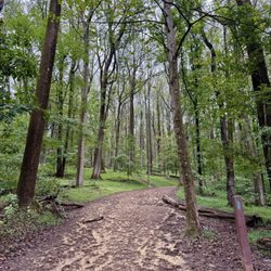
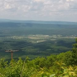
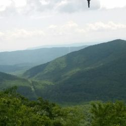
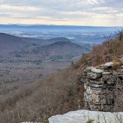
Started out from the Bears Den Trail Center. This 9+ mile out and back hike is a great calorie burner with all the elevation change (translation: LOTS of hills). Near the parking lot, before you hop on the AT there are some nice overlooks from Bears Den Rocks. As for the trail to Buzzard Hill, it's very rocky and there are some shallow slippery stream crossings so bringing trekking poles or a walking stick are helpful. On your hike you will probably pass a few thru hikers, the majority of which are friendly and willing to chat. No views along the trail. Buzzard Hill itself is not too difficult to find provided you follow the directions on HU (Hiking Upward). Also helps if you use GPS to track your distance so you know you're getting close. I used EveryTrail on my iPhone. Make sure to pace yourself appropriately. Remember all those downhills you are facing on the way to Buzzard Hill will all be uphills on the way back. The last mile in fact is all uphill. And that is after 8 + miles of hiking. read more


More info about Buzzard Hill
1948 Morgans Ml Rd
Bluemont, VA 20135
Directions
Hours
Outdoor Amenities


Buzzard Hill - hiking - Updated June 2026
Best of Bluemont
People found Buzzard Hill by searching for…
Walking Trails in Bluemont, VA
Places to Take Pictures in Bluemont, VA
Scenic Overlook in Bluemont, VA
Running Trails in Bluemont, VA
Bungee Workout in Bluemont, VA
Off Road Trails in Bluemont, VA
Off Leash Dog Hikes in Bluemont, VA
River Swimming in Bluemont, VA
Dog Friendly Trails in Bluemont, VA
Lookout Points in Bluemont, VA
Waterfalls and Swimming Holes in Bluemont, VA