Bowl of Fire Photos


You might also consider


More like Bowl of Fire
Recommended Reviews - Bowl of Fire
Start your review...


Reviews With Photos


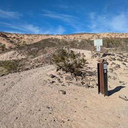
Not to be confused with Valley of fire, the Bowl of Fire lies in a remote area off Northshore Road in the Lake Mead National Recreation Area. This time we hiked North and South bowl of fire that took us almost 7 hours and almost 10 miles round trip because we were exploring but you could hike as far as you want and turn back. This is not a beginner's hike. Directions From Las Vegas, take U.S. Highway 93/95 south to Lake Mead Drive. Go east on state Route 146 for about 10 miles to the Lake Mead National Recreation Area's entrance station, where you will either pay an admission fee or show a pass if you have it. Then drive three-tenths of a mile and go left onto Northshore Road. Follow that for 18.2 miles. Just after mile marker 18, look for a parking pullout on the left side of the road, which serves as the trailhead. From the parking area, head northwest toward the prominent limestone ridge, just follow that path west. Once around this small formation you will be able to see the red rock sandstone outcropping - the Bowl of Fire, which will be your destination. Take plenty of water, food and wear sunscreen. Leave no trace. Happy hiking!


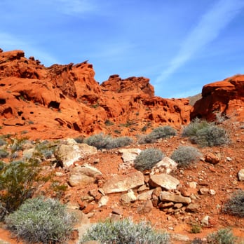
Gorgeous area to hike with some trails that are heavily walked on and places to make your own trail. Easy parking on pull offs as well as on the side of the road leading through the park. There are many photo spots with beautiful colored rocks and interesting rock formations. Make sure you are carrying plenty of water and keep your eyes peeled for critters both big and small. It also helps to have a map and a compass just so you don't get lost! Some areas are uneven so you should be wearing some good and broken in hiking boots or at least tennis shoes!


so beautiful & lightly traveled trail. gorgeous red desert rocks. have to share with the community, the black organisms that live on the rocks is actually a type of algae that takes nearly 200 years to grow. because this trail is so new, there is a lot of life & algae alive and well. make sure, if you do go on this trail, you DO NOT touch this stuff! it will die if it's tampered with by humans. we want our desert to continue to be full of life & beautiful!


One of the many hikes to take advantage of out at LMNRA during the winter months. One of the nice things about this hike is no need for a HCV, the trailhead is just right off the road, but you will need to pay to get into Lake Mead if you don't already have a season pass. The hike starts out on a well marked trail, and it continues to a wash until you hit the actual Bowl of Fire, which is very easy to spot (it's the big red area in the middle of the desert). Once you hit the area of BOF, there are a few spots to scramble up and over, nothing too hard. A few dry waterfalls. We did notice a decent rise in the temps once we hit the canyon area and the red sandstone, the red rocks just grab onto that heat and it really warms you up. Beginning of February, it was 75 degrees and we had all stripped down to our first layer. You will pass lots of interesting areas. Natural arches, areas with tons of holes in the rocks that looks like they could inhabit some creatures. Once you hit the top of BOF, the area of Raven's Balcony, you are overlooking the entire area below and there are a ton of dry washes, it's a pretty cool site from the top. This is where we took a lunch break. There are a few ways to do this hike, we did a loop, one person dropped their car at MM 20.6, and another dropped it at MM 18.2. I prefer loop hikes whenever possible so I can see some different terrain on the way out.


4 years ago
Great hike with Hikerbabes Las Vegas Chapter You can scramble as much as you want or not scramble at all. The views are gorgeous. The sun hitting the sandstone makes for great pictures. Not a lot of parking so get there by 10am and you should be fine. We stopped and had snacks at the bowl, climbed up, took some pictures and hiked back out. Fabulous day with the babes! read more


I've had the good fortune to hike here several times. There are several ways you can do it or you can just walk around and explore and look at the marvelous sandstone formations. Most of the photos I've posted are from 2004 when I first went to the Bowl of Fire. Two routes will get you here as Ron says in his review. For most people, you'll park at around mile 18 on Northshore Road. There's a pull off parking area on the left side of the road. From there, hike across the desert and around the hill. When you get around the hill, you'll see the Bowl of Fire in the distance and the way to go. There are several trails across the desert. The only difficulty here is picking up the trail on the other side of several washes. Once inside the bowl, I usually go to the left and follow the trail around the southern part of the bowl, up a ridge, down the other side, and eventually complete a large loop. There's some rock scrambling to this route and you really should wear something more than sneakers for the hike. Hiking boots will help you keep your traction on the steeper ups and downs. If you go, take plenty of water with you. Also, be aware of where you're going. After awhile, the sandstone may all look alike and you need to know your way out. read more


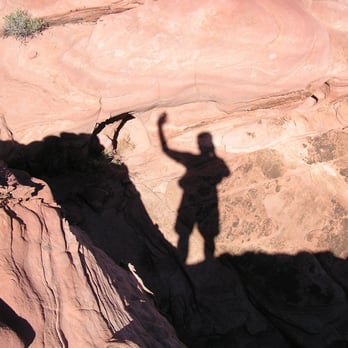


Not to be confused with Valley of fire, the Bowl of Fire lies in a remote area off Northshore Road in the Lake Mead National Recreation Area. This time we hiked North and South bowl of fire that took us almost 7 hours and almost 10 miles round trip because we were exploring but you could hike as far as you want and turn back. This is not a beginner's hike. Directions From Las Vegas, take U.S. Highway 93/95 south to Lake Mead Drive. Go east on state Route 146 for about 10 miles to the Lake Mead National Recreation Area's entrance station, where you will either pay an admission fee or show a pass if you have it. Then drive three-tenths of a mile and go left onto Northshore Road. Follow that for 18.2 miles. Just after mile marker 18, look for a parking pullout on the left side of the road, which serves as the trailhead. From the parking area, head northwest toward the prominent limestone ridge, just follow that path west. Once around this small formation you will be able to see the red rock sandstone outcropping - the Bowl of Fire, which will be your destination. Take plenty of water, food and wear sunscreen. Leave no trace. Happy hiking! read more


9 years ago
Gorgeous area to hike with some trails that are heavily walked on and places to make your own trail. Easy parking on pull offs as well as on the side of the road leading through the park. There are many photo spots with beautiful colored rocks and interesting rock formations. Make sure you are carrying plenty of water and keep your eyes peeled for critters both big and small. It also helps to have a map and a compass just so you don't get lost! Some areas are uneven so you should be wearing some good and broken in hiking boots or at least tennis shoes! read more


5 years ago
so beautiful & lightly traveled trail. gorgeous red desert rocks. have to share with the community, the black organisms that live on the rocks is actually a type of algae that takes nearly 200 years to grow. because this trail is so new, there is a lot of life & algae alive and well. make sure, if you do go on this trail, you DO NOT touch this stuff! it will die if it's tampered with by humans. we want our desert to continue to be full of life & beautiful! read more


One of the many hikes to take advantage of out at LMNRA during the winter months. One of the nice things about this hike is no need for a HCV, the trailhead is just right off the road, but you will need to pay to get into Lake Mead if you don't already have a season pass. The hike starts out on a well marked trail, and it continues to a wash until you hit the actual Bowl of Fire, which is very easy to spot (it's the big red area in the middle of the desert). Once you hit the area of BOF, there are a few spots to scramble up and over, nothing too hard. A few dry waterfalls. We did notice a decent rise in the temps once we hit the canyon area and the red sandstone, the red rocks just grab onto that heat and it really warms you up. Beginning of February, it was 75 degrees and we had all stripped down to our first layer. You will pass lots of interesting areas. Natural arches, areas with tons of holes in the rocks that looks like they could inhabit some creatures. Once you hit the top of BOF, the area of Raven's Balcony, you are overlooking the entire area below and there are a ton of dry washes, it's a pretty cool site from the top. This is where we took a lunch break. There are a few ways to do this hike, we did a loop, one person dropped their car at MM 20.6, and another dropped it at MM 18.2. I prefer loop hikes whenever possible so I can see some different terrain on the way out. read more


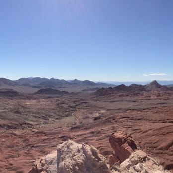


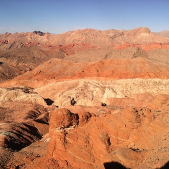


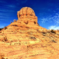
This is an excellent hike to scramble and boulder over some prehistoric RED sandstone from the Jurassic-Age. This is one of those hikes that an out-of-state or even a local hiker might not find without someone showing you. Luckily, I had the privilege of Norm K. of Las Vegas as our guide on this amazing hike. You can find different trail loops to the Bowl of Fire on http://www.birdandhike.com/Hike/LAME/BowlFireN/_BOFloop.htm, but Norm had his own 2.4 mile loop. And as before, Norm is an exceptional hiker and guide! To get to the trailhead for this loop, drive to the Anniversary Narrows trailhead. http://www.yelp.com/biz/anniversary-narrows-henderson Take I-15 North to Lake Mead Parkway exit and head east for 17 miles to Northshore Road. Just before you reach Northshore Road you enter the Lake Mead Recreation Area where you pay a $10.00 entrance fee. Make a quick left on Northshore Road, drive to mile marker 16 and turn into the parking lot on the left side of the road onto Callville Wash Road. If you have a low clearance car, you can park here, which will add 4 miles to the 2.4 mile hike. If not, continue driving up the dirt road and instead of taking a left on 94A to go to Anniversary Narrows, go straight past the Muddy Mountains Wilderness sign. About 1.8 miles from the parking lot off Northshore Road, the bumpy dirt road seems to split in two. Stay to the left and park in front of a large white rock by a fire pit ring. http://www.yelp.com/biz_photos/bowl-of-fire-henderson?select=tMk5Pr2DUyKdmHUfKAte9Q&userid=RoGuDu1egfAvVgb4WmZwUw&utm_campaign=www_photo_share_popup&utm_medium=copy_link&utm_source=(direct) This is the trailhead parking lot for the higher clearance vehicles, exactly 2 miles from the Northshore Road parking lot. To start your hike, follow the wash northwest towards the red sandstone of the Bowl of Fire. You will soon come across a wide two tier step of white glauconitic rock; cross over it and continue walking through the soft red sand and rocks. In 0.52 miles from the large white rock trailhead, you will need to boulder up and over the 'Conglomerate' crevice boulder formation. http://www.yelp.com/biz_photos/bowl-of-fire-henderson?select=MCFU9PXSgSslYTa2yGLMrg&utm_campaign=www_photo_share_popup&utm_medium=copy_link&utm_source=(direct) As you get over this crevice, head to the left towards the bright red sandstone boulders just ahead. What beautiful and amazing ancient formations! At 0.81 miles look up and head towards the notch with the huge rock walls on each side. http://www.yelp.com/biz_photos/bowl-of-fire-henderson?select=EZNTBUowDiVIj_rfcrt0RQ#crB2YuRTTByV88MABq7Ccg You will reach the notch at 0.93 miles, also reaching the highest point of this hike at 1,824 feet. Looking back from the notch is a great view, but the view ahead from the notch is what the Bowl of Fire is all about. And such an experience as you boulder ahead and down into the Bowl! As you reach the final bouldering descent at 1.08 miles, you will find yourself in a wash passage of soft red sand again. Around 1.77 miles in this wash, look for the skeleton of a Bighorn Sheep... or maybe it was a lost Yelper. Continue following this wash to the right, southeast, as you loop back around towards the 'Conglomerate' crevice boulder formation again. This will put you at 1.93 miles. Head back down through the crevice and retrace your path back to your car, stopping at a 2.4 mile hike. I can't wait to hike this again, endeavoring into the unknown bouldering of these Jurassic-Age formations! read more



10 years ago
More info about Bowl of Fire
Northshore Rd & Callville Washington N. Rd
Henderson, NV 89002
Directions
Hours
Outdoor Amenities
Ask the Community - Bowl of Fire
You might also consider



















Bowl of Fire - hiking - Updated May 2026
Best of Henderson
Browse Brands
Related Searches in Henderson, NV
Affordable Kayak Rental Services in Henderson, Nevada
Best Fishing Locations and Guides in Henderson, Nevada
Best Nature Trails for Hiking in Henderson, Nevada
Best Places for Horseback Riding in Henderson, Nevada
Check Out Off Road Trails in Henderson, Nevada
Discover Dog Friendly Trails to Explore in Henderson, Nevada
Discover Scenic Mountain Bike Trails Near Henderson, Nevada
Discover Top Nature Parks to Visit in Henderson, Nevada
Discover Walking Parks in Henderson, Nevada Near You
Discover a Hiking Trail in Henderson, Nevada
Discover the Best Night Hike Trails in Henderson, Nevada
Discover the Best Running Track in Henderson, Nevada
Dog-Friendly Hikes With Dogs in Henderson, Nevada
Enjoy Camping Adventures Around Henderson, Nevada
Enjoy Exciting Mountain Biking Adventures in Henderson, Nevada
Enjoy Kayaking Adventures in Henderson, Nevada
Enjoy Tent Camping Spots Around Henderson, Nevada
Enjoy the Best Walking Path in Henderson, Nevada
Enjoy the Best Walking Trails in Henderson, Nevada
Exciting Cliff Jumping Spots in Henderson, Nevada
Explore Beautiful Parks and Green Spaces in Henderson, Nevada
Explore Easy Hikes Perfect for All in Henderson, Nevada
Explore Fun Activities to Do in Henderson, Nevada
Explore Popular Campgrounds Near Henderson, Nevada
Explore the Best Beach Spots in Henderson, Nevada
Explore the Best Boating Spots in Henderson, Nevada
Explore the Best Swimming Holes Around Henderson, Nevada
Explore the Best Trail Options in Henderson, Nevada
Family Friendly Hiking With Kids in Henderson, Nevada
Find Beautiful Views in Henderson, Nevada
Find Popular Ziplining Spots Around Henderson, Nevada
Find the Best Parks for Picnics in Henderson, Nevada
Find the Best Scenic View Locations in Henderson, Nevada
Great Places to Walk in Henderson, Nevada
Hiking Trails With Waterfalls in Henderson, Nevada
Off Leash Dog Hiking Trails in Henderson, Nevada
Plan a Scenic Drive Route Near Henderson, Nevada
Popular Fishing Spots to Explore in Henderson, Nevada
Popular Outdoor Activities to Try in Henderson, Nevada
Popular Picnic Spots to Visit in Henderson, Nevada
Safe River Swimming Areas in Henderson, Nevada
Safe and Fun Parks for Kids in Henderson, Nevada
Top Climbing Spots and Gyms in Henderson, Nevada
Top Paddleboarding Activities in Henderson, Nevada
Top Running Trails to Explore in Henderson, Nevada
Top Swimming Lakes to Enjoy in Henderson, Nevada
Top Swimming Spots and Pools in Henderson, Nevada
Top Things to Do With Kids in Henderson, Nevada
Browse Articles
People found Bowl of Fire by searching for…
Hiking Trails With Waterfalls in Henderson, NV
Waterfalls and Swimming Holes in Henderson, NV
Walking Trails in Henderson, NV
Parks for Kids in Henderson, NV
Off Road Trails in Henderson, NV
Stroller Friendly Hikes in Henderson, NV
Natural Hot Springs in Henderson, NV
Things to See in Henderson, NV
Dinosaur Park in Henderson, NV
Places to Walk at Night in Henderson, NV
Places to Take Pictures in Henderson, NV
Nature Trails in Henderson, NV
Trending Searches in Henderson, NV
Botanical Gardens near Bowl of Fire
Bounce House Rentals near Bowl of Fire
Cliff Jumping near Bowl of Fire
Dog Friendly Things To Do near Bowl of Fire
Flower Fields near Bowl of Fire
Lakes & Ponds near Bowl of Fire
Movie Theatre near Bowl of Fire
Nurseries & Gardening near Bowl of Fire
Outdoor Activities near Bowl of Fire
Outdoor Furniture Stores near Bowl of Fire
Party Equipment Rentals near Bowl of Fire
Pick Your Own Farms near Bowl of Fire
Picnic Areas near Bowl of Fire
Places To Walk Around near Bowl of Fire
Rainy Day Activities near Bowl of Fire
Running Trails near Bowl of Fire
Scenic Drive near Bowl of Fire
Secret Spots near Bowl of Fire
Strawberry Picking near Bowl of Fire
Sunrise View near Bowl of Fire
Swimming Holes near Bowl of Fire
Things To Do On A Rainy Day near Bowl of Fire


