Cancel

    Open app

    Search

    Boggs Mountain Demonstration State Forest

    4.2 (6 reviews)

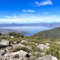
    Boggs Mountain Demonstration State Forest Photos

    You might also consider

    More like Boggs Mountain Demonstration State Forest

    Recommended Reviews - Boggs Mountain Demonstration State Forest

    Your trust is our priority, so businesses can't pay to alter or remove their reviews. Learn more about reviews.
    Yelp app icon
    Browse more easily on the app
    Review Feed Illustration

    13 years ago

    Helpful 3
    Thanks 1
    Love this 0
    Oh no 0
    Photo of Emily B.
    57
    59
    38

    14 years ago

    Helpful 6
    Thanks 0
    Love this 1
    Oh no 1

    14 years ago

    Helpful 4
    Thanks 0
    Love this 1
    Oh no 0
    Photo of T M.
    1
    17
    0

    12 years ago

    Helpful 2
    Thanks 0
    Love this 4
    Oh no 0

    11 years ago

    Helpful 2
    Thanks 0
    Love this 1
    Oh no 0

    15 years ago

    Helpful 0
    Thanks 0
    Love this 0
    Oh no 0

    Ask the Community - Boggs Mountain Demonstration State Forest
    Verify this business for free

    People searched for Parks 523 times last month within 15 miles of this business.

    Verify this business

    Highland Springs

    Highland Springs

    4.2
    (5 reviews)
    12.9 mi

    A pretty, quiet park with fishing access. The reservoir doesn't seem to be as dramatically affected…read moreby the drought compared to places like Clearlake, so the fishing access is better without a vessel. There are bass, catfish and bluegill here. Trails go around the reservoir so you have many options for fishing, or you can take a kayak on the lake and fish anywhere you like. There is also a rope swing along the trail not far from the parking lot that kids use for recreation. There are bathrooms on site and many picnic tables as well.

    We hit this park yesterday for some fun in the sun and it was perfect. The course wasn't crowded,…read morethe weather wasn't too hot (being up in Lake County I expected it to be hotter), and it was beautiful. Old oaks all over the park making some holes challenging but worth the effort. Overall it is well maintained for a disc course. There is a total of 23 holes if you play A-E in the middle of the course. I think it's around hole 14 that you hit these holes which I recommend. Nice rolling terrain with some steep sections that make it a great day out there. We had never been before and did ask a couple times about where the next hole is to be found but honestly it's labeled well enough to figure it out, we just aren't shy to ask. There are several tee boxes for each hole but primary is where you find the tee pad. Many tournaments out here which is the reason for the different starts. I thought it was great. Lots of benches and places to drop your bag by the tee boxes which is nice, garbage cans around the course to keep it clean. Bathrooms after hole 6 up the way a bit by the picnic grounds. Nothing at the start of the course, so ladies be prepared. If you are looking for a new course check this spot out, really pretty and worth the trek.

    Photos
    Fishing at Highland Springs
    Fishing at Highland Springs
    Highland Springs
    Highland Springs

    See all

    Todd Grove Park

    Todd Grove Park

    4.3
    (15 reviews)
    35.3 mi

    The vibes here are awesome minus the tweakers and dog poop. But in this area there is t much else…read moreto do.

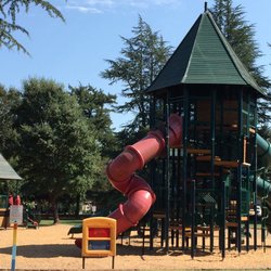
    One of my good friend Yelp friends is famous for reviewing parks. My 2011 New Years Resolution is…read moreto match her park for park. And I will begin my quest with the world's champion of parks. Growing up, this place was known simply as the Ukiah Municipal Park. I'm not sure when the whole Todd Grove thing happened, but it's the in thing to name parks after people. I'm all good with that. Some of the park kid toys are gone, but the giant tractor tires remain. What is it about a giant rubber tire that would get me to spend countless hours entertaining me? The parks iconic symbol to me was always the rocket. Now that was the single biggest childhood attraction for me growing up in the entire town. I still remember the day I felt like one of the big kids when I finally stopped my crying and summited the very top. I swear you could see the Golden Gate Bridge from there. Sir Edmund Hillary has nothing on me. . This park includes two swimming pools, plenty of picnics and countless trees that provide protection and shade from the hot summer sun. I took swimming lessons here as a kid and is where I conquered my fear of the water. I cannot even begin to count the fond memories of this place. From the family summer outings, to the yearly school picnics this place will always hold a special place in my heart.

    Photos
    Love those tractor tires
    Love those tractor tires
    Todd Grove Park
    Todd Grove Park

    See all

    Table Rock

    Table Rock

    4.5
    (15 reviews)
    13.4 mi

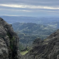
    Table Rock trail is located within Robert Louis Stevenson State Park. The road to get to the…read moretrailhead is directly north of Calistoga on Highway 29-about 20 minutes from the downtown. There are no facilities and parking can be hard to come by, as there are just two small lots. You're competing with other hikers who might be climbing up Mt St Helena. Mileage wise, the trail signs indicate 4.2 miles round trip. So, while the distance is short, the trail itself is moderate to challenging. There are sections both going in and out with an incline. While the inclines and declines aren't terribly steep, it's the loose rocks, downed trees and washed out trail sections that make it more challenging. I do wish I brought hiking poles to navigate the downhills and found myself tripping a few times, The scenery is quite unique with interesting rock formations along the way. The end of this trail, at Table Rock itself is spectacular, especially in winter when the valley below is green. The area did suffer from fires back in 2017 so there are a lot of burned trees and scrubby landscape. Interesting hike and worth checking out at least once. If you're up for more of a challenge, the trail continues to the Palisades trail and eventually connects down to the Oat Hill Mine trail in Calistoga. Good workout, scenic and not too crowded. Bring water and layers. It's exposed for much of the uphills and I was sweating but then cold and windy at the top. Minus 1 star for the challenging parking situation and washed out (but passable) sections.

    Fun little trail with a lot of scenic views, trees, and (currently) greenery. We went today, which…read morehappened to be cold, windy, cloudy, and even hailed a bit, and there were a few downed trees you needed to hop over. I loved the hike. Only saw 4 other people, a couple on their way out and a couple on their way in (when we were on our way out). It was quiet and peaceful. The parking lot adjacent to it was nearly full. There was another trail entrance across the road from this one that seemed more popular.

    Photos
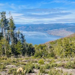
    Views from Table Rock
    Views from Table Rock
    Table rock
    Table rock
    Table Rock

    See all

    Linda Falls Preserve Hiking

    Linda Falls Preserve Hiking

    4.4
    (13 reviews)
    23.7 mi

    So happy to finally be able to cross this hike off my bucket list. It was certainly worth the wait…read more It's not a long hike, but there is a little bit of climbing on rocks, especially towards the end I suggest wearing good shoes with traction The scenery along the way to the falls is lovely and changes throughout the hike. Meadows, fir trees, boulders, and ponds! We made it to the Falls on the last day of April. I would think that during the summer they wouldn't be flowing as greatly as they were now. Sitting below the falls was majestic. We also did the hike at the fork of the road, which eventually ends due to all the brush on the trail, and it was lovely as well with a beautiful pond

    I always enjoy a hike to waterfall but it was quite disappointing that this fall was just a…read moretrickle. Though it's understandable because it is summer that the water flow is probably way better after some good rain. To get here, Google maps was help to get me to the parking lot. However, from the there i was quite confused reading others yelp or goggle reviews. Hopefully I can help those going. When driving up the hill from Napa, on the right you drive pass the Pacific Union College sign then pass by the city Angwin sign, immediately you will turn to your LEFT pass the baseball field into the gravel parking lot. From the baseball parking lot cross the street and walk along the bike path as you are walking against traffic flow. You will go back and pass the Pacific Union college sign and then you will see a bike path sign see pics. You walk on the pavement path for 6 min and then see the sign of Linda Fall preserve. See the map and the caution of the wild mushroom you should not eat. The path to the Falls is about 20 minutes in and 20 minutes out. You wil see your firstb Linda Falls sign. Then you will see a second Linda Falls sign. After the 2nd one be prepared for slippery dry dirt. You will want shoes with good grip. Soon you will be at Falls. Ther are lots of boulders to climb over to get close to the Falls. Its a small area and gets crowded. I suggest going before 11am. In my opinion age 6 and above it accurate. You will have to help kids the last 5- 10 minutes of the hike. Do not suggest infants and or in carriers. Im Glad I did this Falls hike while in Napa so I can write about and tell other people. It's a nice hike to get out with the family and friends, eat a snack or lunch at the Falls and head back. I recommend this hike just wish the beginning of the trail to get there had clear signs up.

    Photos
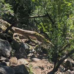
    Fallen tree along the path. Not a huge deal but need to hike over or around it.
    Fallen tree along the path. Not a huge deal but need to hike over or around it.
    Linda Falls Preserve Hiking
    Linda Falls Preserve Hiking

    See all

    Boggs Mountain Demonstration State Forest - parks - Updated July 2026
    Loading...
    Loading...
    Loading...