Blanca Lake Trailhead Photos


You might also consider


More like Blanca Lake Trailhead
Recommended Reviews - Blanca Lake Trailhead
Start your review...



4 years ago
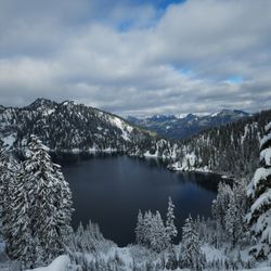
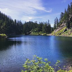
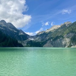
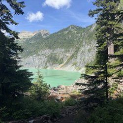
This was both a challenging and rewarding hike! We were staying in a local campground just 5 minutes away from the trailhead making getting an early start easy, and that's not a bad idea cause you might need it! The steep climb of switchbacks makes you certain you're almost at the top around every bend. The husband of mine was about to file for divorce on my 78th "are we theerrre yeeeet??" Inquiry. The 3300 ft elevation gain is really no joke. It claims it's 7.5 miles round trip but our gps watches clocked us closer to 9 miles so not sure what type of pixy dust influenced that, but the last couple miles back definitely felt like we were being tricked by some mischievous fae folk. Your first great view is at the top of the switchbacks which rewards you with a beautiful ridge and mountain view.. but u is not even close to being done! Trail continues through a glorious meadow then to a pond and in your best Flight of The Concords voice you're like- is that it?!? It isn't. It's a frog pond. You go down only to go back up and curse whoever put you on this goose chase (which happened to be myself) and then you begin to descend down into a valley and you're like- damit jim, we gotta go back up this beast?! Then you see it in the distance, that beautiful crisp nearly extraterrestrial looking glacier water, and you never felt thirstier. The husband forgave me and cancelled his divorce plans, my friends who were dying behind us agreed to still be my friends, and we forged ahead for a picnic lunch and polar plunge before making the trip back. The trip back is definitely challenging because you are already tired and you have to go up again before you can start the descent. As some other yelpers have described this hike is no joke and I've done some iconic ones here in the PNW. I'm in good shape and did fine but I was exhausted by the end. My compadres really struggled but made it through. We saw several groups of 20 something's not make it because they started too late, didn't pack enough water (key!), or needed more than their youth to get them through. I wouldn't want to be stranded up there at nightfall which several groups seemed to be set up for. Either plan to backpack and camp or start early. Bring a camelback not just a bottle of water and we had a water purifier to refill at the lake. It's a beautiful view, a great workout, and a proud accomplishment and definitely recommended for experienced well prepared hikers! read more


So I was challenged by Michelle V to attempt this trail and I don't really like to refuse a challenge if I think it's within my grasp. The photos on the Blanca Lake page http://www.yelp.com/biz/blanca-lake-gold-bar were enough to make my mind swarm with anticipation of reaching the lake. It's just so darn beautiful. So I purchased my NW Forest Pass using the link on the WTA website, did a little research on how to get there since sometimes trailheads are hard to find, gassed up my hoopty and sped (literally) up to Blanca Lake. If you're using the Yelp App, I've left a tip that may help you find the trailhead or just send me a message and I can message you back. Anyway, I left early as the website says the parking lot fills up quickly. I got there at about 10am on a Saturday and the lot was full. People park on the side of the road, which is realllllly narrow in places and can really make it hard to anticipate drivers coming at you in the other direction. Also, once you get further up NF-65, the road becomes "primitive". This means that the road isn't maintained by the county and can be full of DEEP divots and potholes. It is also covered with small pebbles with can make it seem like you're driving on a sheet of water (hydroplaning but on rocks). So I caution you to drive the speed limit of 35 mph. Anyway, you came here to hike the trail, right? Ok....well multiple websites I searched as well as the trail information just before you enter the trail states that this trail is very difficult or for expert level hikers. That should have been a note to self for me, but I was like, "Yeah....I got this!" I busted into this trail almost thinking it was too easy. I was about to just turn around and leave because I thought it was just too easy. Boyyyyyyyyyyy was I wrong! Cheeese and crackers this trail kicked my A! Not only does it twist and turn and change gradient and is slick and muddy in many places especially after rain, but it's practically ALL uphill (gain 3300 ft!!). There aren't really many places to regain your composure, breath, or stop when other are trying to pass you. Also, there are several faux trails along the way that can get a person who is not paying attention to go off course. Probably a good thing to register yourself at the entrance signage/map registration box, so they can call for reinforcements if you don't make it back down. Sadly, I had to stop and turn around as my heart felt like it was literally going to claw it's way out of my chest and b*tchslap me for trying to trick it in to working so hard. I almost gave up about 5-7 times but kept pushing, but it was still just too much. I would say I'm an intermediate hiker, so I will get stronger and I WILL go back and try this again. It's a wonderful wonderful trail, but you really need to be focused. It was beautiful nature wise as well and you could hear the rush of water in the background. People brought all size dogs as well, but personally I think it's a bad idea for some of the smaller dogs (just my opinion). Probably don't even bring small children. No strollers. No wheelchairs. Period. Bring more water than you think you'll need...seriously. Wear appropriate footwear. As I was coming down people who looked less prepared than me were asking how long it took me to get to the top, how much longer was it, was there much trail left until the lake. I would say, don't go in to this area focused on how long it will take you. Don't even focus on the reward at the end (the lake). Just focus on putting one foot in front of the other. read more


7 years ago
More info about Blanca Lake Trailhead
Nfd 63 Rd
Skykomish, WA 98288
Directions
Hours
Outdoor Amenities




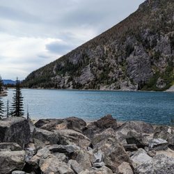
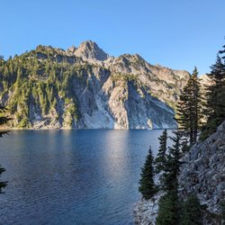

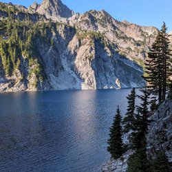
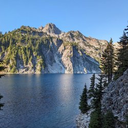















Blanca Lake Trailhead - lakes - Updated May 2026
Best of Skykomish
Browse Brands
Related Searches in Skykomish, WA
Best Fishing Locations and Guides in Skykomish, Washington
Best Nature Trails for Hiking in Skykomish, Washington
Best Parks for Parties and Events in Skykomish, Washington
Best Places for Horseback Riding in Skykomish, Washington
Best Sledding Spots and Fun in Skykomish, Washington
Best Spots for Star Gazing in Skykomish, Washington
Best Water Parks for Kids in Skykomish, Washington
Best Waterfalls and Swimming Holes in Skykomish, Washington
Discover Lakes & Ponds to Explore in Skykomish, Washington
Discover Popular Bike Trails in Skykomish, Washington
Discover Popular Photo Spots in Skykomish, Washington
Discover Stunning Skyline View Spots in Skykomish, Washington
Discover Top Nature Parks to Visit in Skykomish, Washington
Discover the Best Beaches in Skykomish, Washington
Discover the Best Fishing Lake in Skykomish, Washington
Enjoy Scenic Night View Experiences in Skykomish, Washington
Enjoy the Best Night View Spots in Skykomish, Washington
Enjoy the Best Tubing Experiences in Skykomish, Washington
Enjoy the Best Walking Trails in Skykomish, Washington
Exciting Cliff Jumping Spots in Skykomish, Washington
Explore Beautiful Parks and Green Spaces in Skykomish, Washington
Explore Bike Rentals Throughout Skykomish, Washington
Explore Easy Hikes Perfect for All in Skykomish, Washington
Explore Popular Campgrounds Near Skykomish, Washington
Explore Popular Picnic Areas Around Skykomish, Washington
Explore Popular RV Parks Around Skykomish, Washington
Explore Popular Scenic Overlook Points in Skykomish, Washington
Explore Popular Scenic Views Near Skykomish, Washington
Explore Popular View Points Around Skykomish, Washington
Explore Secret Spots Worth Visiting in Skykomish, Washington
Explore the Best Swimming Holes Around Skykomish, Washington
Explore the Best Trail Options in Skykomish, Washington
Find Beautiful Views in Skykomish, Washington
Find Cozy Camping Cabins in Skykomish, Washington
Find Parks and Recreation Activities in Skykomish, Washington
Find Top-Rated Waterfalls in Skykomish, Washington Now
Find the Best Parks BBQ Grills in Skykomish, Washington
Find the Best Playgrounds to Visit in Skykomish, Washington
Hiking Trails With Waterfalls in Skykomish, Washington
Picnic Areas With BBQ Pits Available in Skykomish, Washington
Plan a Scenic Drive Route Near Skykomish, Washington
Popular Kids Activities in Skykomish, Washington
Popular Things to Do in Skykomish, Washington
Safe River Swimming Areas in Skykomish, Washington
Safe and Fun Parks for Kids in Skykomish, Washington
Top Paddleboarding Activities in Skykomish, Washington
Top Running Trails to Explore in Skykomish, Washington
Top Swimming Lakes to Enjoy in Skykomish, Washington
People found Blanca Lake Trailhead by searching for…
Trending Searches in Skykomish, WA
Camping Sites near Blanca Lake Trailhead
Fishing near Blanca Lake Trailhead
Hiking Trails With Waterfalls near Blanca Lake Trailhead
Parks near Blanca Lake Trailhead
Pick Your Own Farms near Blanca Lake Trailhead
Places To Take Pictures near Blanca Lake Trailhead
Pumpkin Patches near Blanca Lake Trailhead
Scenic Drive near Blanca Lake Trailhead


