1. Belcarra Bluffs

0

,

Cancel

Open app

Search

Belcarra Bluffs

5.0 (1 review)

Belcarra Bluffs Photos

Recommended Reviews - Belcarra Bluffs

Your trust is our priority, so businesses can't pay to alter or remove their reviews. Learn more about reviews.
Yelp app icon
Browse more easily on the app
Review Feed Illustration

1 year ago

Helpful 7
Thanks 4
Love this 7
Oh no 0

Verify this business for free

People searched for Hiking 1,073 times last month within 15 miles of this business.

Verify this business

Sasamat Lake

Sasamat Lake

4.3(10 reviews)
2.6 km

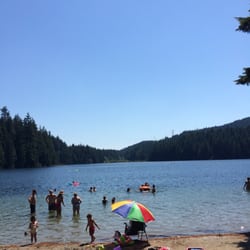
I just love trails n this particular lake has one of the beautiful and easy trails in bc. Some…read morepoints are so picturesque that even a first time photographer would be successful in capturing best shot of their life. Tall trees n glimpse of sunshine just adds to the temptation. The clear water of lake and quiteness that surrounds it , is just breathtaking. Very few people can be gathered at one place as there is not a long stretch of beach or lake shore rather small areas to camp or just to sit. Its great to have a corner of lake to urself or just hide among the trees under the shade and dip your feet in warm lake water. Its a day park/lake/trail. Well maintained as the park staff maintains the cleaning n comes to close the park before 8 pm so yah my fellows, no night camping here. You can have enough of it in a day. No boats or anyother water sport was happening and that could be due to covid else there is a cottage area with a deck and concession store. Big parking lots and there are many of them so make sure to remember ur parking lot number.

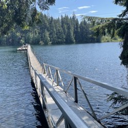
Absolutely in love with this place. So serene!!!! Sasamat Lake has some of the most peaceful views…read more Loved the easy hike around the lake as well as the bridge on the water. Pretty shady for most of the trail and there are also some stairs. Super nice beach at the beginning of the trail head near the parking lot too! Cannot wait to come back, definitely worth visiting.
Photos
Sasamat Lake
Sasamat Lake
Sasamat Lake - March 2, 2025.

See all

March 2, 2025.

Belcarra Park - Woodhaven Swamp Loop Trail.

Belcarra Park

4.3(12 reviews)
3.0 km

Belcarra Regional Park (now re-named to acknowledge the Tsleil-Waututh peoples*) is a 1,100-hectare…read moreregional park. It is an extremely popular regional park with beaches, picnic areas, a lake, and numerous hiking trails of various difficulty levels. There is something for everyone at the park, including decent washrooms. The various trails within the park are: Bedwell Bay Trail, Woodhaven Swamp Loop Trail and Woodhaven Trail, Sasamat Lake Loop Trail, Springboard Trail, Admiralty Point Trail, Jug Island Beach Trail, Sugar Mountain Trail, and Buntzen Ridge Trail (and the nearby Buntzen Lake and Diez Vistas trails). Until recently, I had only hiked the Jug Island and Admiralty Point trails (both excellent, easy to intermediate hikes), and on Sunday I had planned to hike around the Woodhaven Swamp Loop, continue along the Woodhaven Trail to Sasamat Lake, and around the lake with my hiking group. Unfortunately due to a recent windstorm, the Woodhaven Trail leading to Sasamat Lake was closed, but we still enjoyed the lovely hike along the Springboard Trail and around the swamp. It was a very easy hike (pretty much a walk), but the trails were beautiful, and being the off-season, very peaceful. I love Belcarra Regional Park and would like to eventually hike all the trails, as well as re-hike the ones I have already done. Unfortunately it is quite difficult to get there by transit, although it is technically possible -- the #182 bus runs from Moody Centre Station to the park, but it only runs once an hour. During the summer months, the #150 runs to White Pine Beach and the #179 runs to Buntzen Lake (I don't recall if it is once an hour or every half an hour). So because transit is so lousy, most people drive, but parking is very limited -- good luck finding parking after 8am on a weekend during the non-winter months! IDEA: to alleviate the parking issue, have transit run more than once an hour! Despite the horrible transit to the park, at least it is technically possible to get there by bus, and with my hiking group (which focuses on transit accessible hikes), I will definitely be going back to Belcarra. *I cannot include the name in my review as Yelp does not recognize Indigenous script. [Yelp collections: Hiking; Parks and Gardens]

This review is about Admiralty Point Park. For return 6km…read morehike, 2 hours to Burns point. Some sections follow rocky shoreline, beautiful view of Burrard inlet. There are some wooden bridges over creek and well maintained trail. Easy hike and good for family hike. You can find small beaches with clear water. I'm sure I will be back in spring time with kayak.

Photos
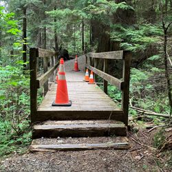
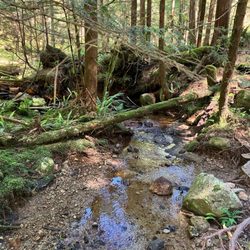
Belcarra Park - Woodhaven Swamp Trail -- bridge is crossable, just missing a couple of planks (May 30, 2026).

Woodhaven Swamp Trail -- bridge is crossable, just missing a couple of planks (May 30, 2026).

Belcarra Park - Woodhaven Trail - March 2, 2025.

Woodhaven Trail - March 2, 2025.

Belcarra Park

See all

Buntzen Lake - Lakeview Trail lookout - August 2026.

Buntzen Lake

4.3(35 reviews)
5.7 km

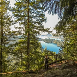
Buntzen Lake, located in the Village of Anmore near Belcarra Regional Park, is named after Johannes…read moreBuntzen, the first general manager of BC Electric Company, predecessor to BC Hydro. The lake is a BC Hydro reservoir and the lake and surrounding area is maintained by BC Hydro. There are beaches and many hiking trails, making the Buntzen Lake recreation area a very popular destination. Due to its popularity, a parking pass is needed from mid-May to Labour Day in September. The parking passes are free, but it can be extremely difficult to get one. However, in the summer, from the end of April to Labour Day, the #179 bus departs from Coquitlam Central Station (Bay 12) every half an hour and goes to Buntzen Lake, but only on weekends and holidays. (It would be so nice if there was year round transit, or at least from March to October, and if during the summer, it wasn't limited to only weekends and holidays.) Due to the limited parking, it's actually far easier to bus there in the summer instead of driving, and you can park for $3, all day, at Coquitlam Central Station. Just take transit! The Buntzen Lake Loop is 10km and approximately three hours, and there is a beach area with picnic tables and clean outhouses along the route. I started a transit accessible hiking group in the summer of 2023, and I went hiking at Buntzen Lake for the first time in May 2024. Due to transit only being available in the summer months on weekends and holidays, I am limited as to when I can go, and so far I have gone seven times -- twice in 2024, twice in 2025, and three times this year. Apparently people go counter-clockwise around the lake, but the first time we went, none of us knew where exactly the start of the trail was located, and we ended up going clockwise. However, we all enjoyed hiking the trail clockwise, so we always go clockwise, which has its benefits: the hardest part is at the beginning, not the end; the west side is more exposed so it's better to do the east side, which has more tree canopy, last, when the sun is hotter; the beach, where we stop for lunch, is at the two hour mark, instead of one hour; and we don't get caught up in other groups of hikers, since everyone is going in the opposite direction. The first six times I have gone to Buntzen Lake, we have done the Buntzen Lake Loop. However, this last time, which was August 22, 2026, we tried the Lakeview Trail. The Lakeview Trail parallels the west side of the Buntzen Lake Loop Trail, and while the trail isn't terribly difficult, it is slightly more difficult and longer than the west side of the Buntzen Lake Loop Trail, and because we were taking our time exploring a new trail, it took us three, instead of two hours, to get to the beach area, making our total hiking time four hours. It was such a nice hike and far less busy than the Buntzen Lake Loop Trail. I can't wait to do this hike again next summer! There are so many other trails in the Buntzen Lake recreation area, such as the Diez Vistas Trail which is very popular, but I need to work my way up to that. [Yelp collections: Hiking]

Gorgeous and peaceful lake. The perimeter around the lake has a 3.5 hour easier moderate trail that…read moreis mostly shaded. Toilets at the start (main beach/waterside area) and at the midway point (outhouse at small beach). Thr main beach area has an enclosed off leash area for dogs, ehoch also has a waterside section. There is a doggie washing station, which is very convenient. The good and bad part about this place is the required reserved parking. The good part is that you know that you will have a parking spot. The bad part is that it's required and they won't let you into the area without it. It was free but had a time restriction.

Photos
Buntzen Lake - Lakeview Trail - August 2026.

Lakeview Trail - August 2026.

Buntzen Lake
Buntzen Lake

See all

Coquitlam Crunch Trail - Top of stairs section~

Coquitlam Crunch Trail

3.4(16 reviews)
8.9 km

I've been meaning to try this hike for a while now. Today was the day. It's not hard, I'm 60 and…read moreit was actually pretty easy. Don't get me wrong I was sweating my bag off when I got to the top but it's not like the Grind or anything. There are some steeper parts but in general it's not too crazy. The stairs itself is pretty short. There are markers that tell you when you start, half way and the end. After the stairs you just keep on going til you reach the road. I went around 10:30am, wasn't too crowded. People seem to be really serious, not too friendly, not like other hikes I've done around Poco. There is I think 2 parking lots, one closer to the starting point. I parked lower down by the park. (that's where google maps directed me to) Free parking. My overall thoughts? Would I come back? Probably not, I live in Burnaby so it's about a 30 min drive, don't think it's worth the effort or gas for me. If I lived around here maybe. It was okay............

Surprisingly nice hike in the middle of nowhere Coquitlam. Had no idea this existed until recently…read more Basically it's the Coquitlam version of the Grouse Grind, but much tamer. 2.92km horizontal, 242m vertical according to the website PDF. The website says 2.2km for some reason - I think they're measuring from the Lansdowne parking lot. From Runnel Drive, it's basically 1/3 the vertical of the Grind, but a longer walk overall. Parking is available in several lots along the length of the path. For the full experience, park at the bottom of the valley (Runnel Drive). There are also parking lots accessible from Lansdowne and Panorama (major streets farther up the mountain), if one wants a shorter version. The path basically follows a set of BC Hydro power lines up the mountain. There are warning signs about potential electric shocks, though I imagine this probably only applies during wet weather. The path itself is divided into several sections. The "crunch" section" is technically the 3rd section of 6 (N side of Lansdowne), where there are 2 sets of stairs (some 500 steps) going up what is arguably the steepest section. Guessing they built 2 sets of stairs to facilitate 2 way traffic. I was told the proper travelling convention is counterclockwise. In other words, take the stairs on the "right" side. The stairs are pretty well built, with wire mesh nailed into the steps to prevent slipping. There are mini signs of encouragement along the way. I got a kick out of these. My only complaint is that the step tread (horizontal "depth") is a bit too wide. As in I couldn't decide whether to go up 1 or 2 steps at a time. This really threw off my pace. After the stairs section, the rest of the Crunch is actually a nice gentle uphill path. There are some more stairs here and there, but nothing too crazy (up to 20 steps at a time). The end of the Crunch is at Eagle Mountain Drive, where there's a 2.25km trail marker. To be honest, they really need to mark the end better. The trail actually continues further up the mountain, and I only knew this was the point to turn around because someone in the group had done it before. After walking all the way up, take a break, and enjoy the walk back down. Great time to take some photos, and look at the Runnel Drive parking lot way at the bottom of the valley. There is a lookout point partially down the length of the stairs section (accessible on the "downhill" steps). To be honest, this is a great alternative to the Grouse Grind. I was actually quite impressed. Nice views, no gondola fee, no seasonal limitations, way fewer people, and non overpriced restaurants nearby. What more can one ask for?
Photos
Coquitlam Crunch Trail

See all

Belcarra Bluffs - hiking - Updated October 2026

Loading...
Loading...
Loading...