Cancel

    Open app

    Search

    Bedford Peak Trail

    4.7 (7 reviews)

    Bedford Peak Trail Photos

    You might also consider

    Recommended Reviews - Bedford Peak Trail

    Your trust is our priority, so businesses can't pay to alter or remove their reviews. Learn more about reviews.
    Yelp app icon
    Browse more easily on the app
    Review Feed Illustration
    Photo of Ed T.
    101
    356
    2829

    3 years ago

    Helpful 6
    Thanks 3
    Love this 3
    Oh no 0

    2 years ago

    Helpful 0
    Thanks 0
    Love this 0
    Oh no 0

    7 years ago

    Helpful 3
    Thanks 0
    Love this 2
    Oh no 0
    Photo of Clara H.
    389
    171
    201

    8 years ago

    Helpful 1
    Thanks 0
    Love this 0
    Oh no 0

    14 years ago

    Helpful 11
    Thanks 0
    Love this 10
    Oh no 0

    4 years ago

    A fun hike in the OC Area and bring water and watch out for bikes and off-road vehicles towards the top :-)

    Helpful 0
    Thanks 0
    Love this 0
    Oh no 0

    13 years ago

    Helpful 2
    Thanks 0
    Love this 0
    Oh no 0

    Ask the Community - Bedford Peak Trail

    You might also consider

    Verify this business for free

    People searched for Hiking 8,257 times last month within 15 miles of this business.

    Verify this business

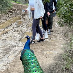
    Black Star Canyon Trail - Peacock on the trail

    Black Star Canyon Trail

    4.4(394 reviews)
    5.6 mi

    Love it! It's a lot of climbing over rocks but it's great exercise. The best part of everything is…read morereaching the falls and eating a good sandwich. I do notice that many people leave their trash behind in this particular trail. PLEASE TAKE YOUR TRASH! You'll definitely get a good nap after getting home.

    First time visiting Black Star Canyon Wilderness Park to check out the "falls" and it was just as…read moreexpected. By doing a little bit of research, we learned it was best to go early - my husband and I got there at 7:45am in October on a Saturday and the lot was already starting to fill up. When we left at 11:30, the lot was very full. There is technically plenty of parking but the busier it is, the farther you would have to go just to get to the trailhead. We had a very good weather for hiking. It was overcast for the first hour or so, and there is shade when hiking along the creek, and it was partly cloudy on our way out. If hiking during the afternoon, I would recommend bringing twice as much water as you think you would need. Overall, the trail was long but not too difficult. The first 3 miles are fairly easy/moderate and only the very end being somewhat difficult because it is steep. We think the total hike was about 7-8 miles round-trip and took 3.5-4 hours at a moderate pace. In October 2025, the falls and creek were dried out after a hot summer and only one storm in months. It made crossing the creek a non-event (only a little mud and puddles in a few areas), but it also meant the waterfalls were non-existent. The trail was still very scenic and a fun hike. The end of the trail is still very beautiful when dry. Note, there are lots of mountain bikers so be alert and stay to the right side of the trail. No bathrooms, trash cans, or water fountains but still very clean; thanks to the regular hikers who help to clean up the trails. Please be kind to others and respectful to nature. Pack it on, pack it out.

    Photos
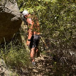
    Black Star Canyon Trail - In the bush

    In the bush

    Black Star Canyon Trail - Big back hiking club

    Big back hiking club

    Black Star Canyon Trail

    See all

    Red Rock Canyon

    Red Rock Canyon

    4.7(135 reviews)
    5.1 mi

    Red Rock Canyon is located in the City of Lake Forest. Who knew one could view glimpses of red rock…read moreformations and plateaus in Orange County? When we arrived around 8:30 on a Saturday morning, the paid parking lot was already full. There are very few parking spaces overall in the paid $3 lot. We ended up as Ralph's customers that morning and found a couple of last-minute items that we needed before starting our hike. It was a nice and cool morning with a slight breeze, which was perfect to kick off our hike. We opted to take the easy trail, Borrego Canyon Trail. There is a lot of soft sand through out parts of the trail, similar to a beach like sensation for your walking pleasure. It also felt like a magical forest during some areas with trickling streams. We also experienced some parts full of various sized rocks. This is NOT a child- friendly trail for little ones. As we approached parts that were more desert like, we got closer to the red rocks. There was much anticipation to the end and the trail concludes with what feels like a small dead end as you gaze into the view of the towering red rocks. Going downhill was much quicker and fun. It was an easy trail with some sections that forced me to go slower as I didn't want to slip on some small rocks. There was so much positivity coming from other hikers and bicyclists. So many good mornings shared, it was contagious. Bicyclists are one-way so they are only coming from behind you and so many were thankful for us moving out of their way. I've never experienced such polite and friendly trail enthusiasts. I'd love to return to experience this beautiful trail again.

    What a great hike! The shade was wonderful, and everyone on the trail was so respectful of space…read more(thank you, bikers). It gets a little narrow as you get closer to the rock formations, but still highly recommend either way.

    Photos
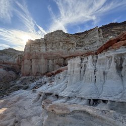
    Red Rock Canyon - I'm definitely on Mars!

    I'm definitely on Mars!

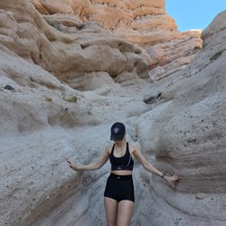
    Red Rock Canyon
    Red Rock Canyon

    See all

    Four Corners via Maple Springs Trucktrail

    Four Corners via Maple Springs Trucktrail

    4.0(2 reviews)
    0.9 mi

    Sunday hike in Orange County for the first time…read more My driving experience up to the trail was death defying...I literally thought I was gonna die! Lots of curves and turns. And the parking lot is a joke, super small with no more than 10 spots. So we ended up parking on the road. A surprising trail that was found by mistake, ended up being a pretty good hike. It was easy...although super duper long...so my legs were aching at the end. Going up was a steady trail that wasn't too steep. Also not very crowded here, mostly mountain bikers, but the trail is very wide, so no worries about getting smashed by a biker. It's windy...so bring a jacket. There were lots of dried berry poop and lizard remains: http://www.yelp.com/biz_photos/SuVGPTy57tycHAGdrcq2ZA?select=uWkk6tJ8T5P4PsxBM3J6nQ But once you get to the top, there are some wonderful views: http://www.yelp.com/biz_photos/SuVGPTy57tycHAGdrcq2ZA?select=jRqsSIQeEzwS5goxe_2EEQ On the way down we took some shortcuts which were more fun to go down...overall, I liked this hike. I think I'd come back with my dog, she'd like it.

    I had planned a hike to the nearby Bedford Peak that started at the same spot, but we missed the…read moreturn off for that trail after the first few hundred meters. My hiking companions and I just continued heading along the paved access road that was at the park entrance. After about a mile and a half or so, the trail starts making switchbacks uphill, which then turns to dirt, though the road itself is still wide enough for motor vehicles to navigate. I knew we weren't on the right trail about 3 miles into the hike. Everyone agreed to just keep going to see what was further up the mountain and trail. Luckily for us, soon afterward a mountain biker passing by informed us that the Four Corners Peak was only about 2 more miles. With knowledge in hand, we continued the descent up the dirt road which consisted of a number switchbacks that snaked up to the top. By the time that you are nearly at the peak, you will pass a sign that marks the 7th mile. Just over 7 miles from parking lot to peak! The peak was windy! Easily 30-40 mph wind gusts, but the views are awesomely panoramic. We chose a great day with very clear skies. You could see the entire spread of the San Gabriel Mountains, Diamond Bar, Chino, Orange County, Catalina Island, Palos Verdes, the coast line stretching up to Long Beach, around the peninsula, south bay, Santa Monica, the Malibu beaches and Point Dume, not to mention the downtown LA skyscrapers majestically reaching towards to the heavens. As we were taking in the sights, another mountain biker informed us that there was a short cut, that ran a tangent across the switchbacks. We decided to take this on the return, which saved us about 2 miles going downhill. A little bit steep heading down, this trail has been in use much less, littered with broken bottles, kicked beer cans, and empty shotgun shells. If you are looking to take the short cut, there a 3 parts, marked by a black, three rung metal railing that looks completely out of place by itself. Look off of the mountain road and you should see the trail. Overall, I would say that this hike is very easy, though very long, just over 14 miles round trip. The elevation grade is not too steep and the mountain road is in excellent shape, This looks to be more of a mountain biking destination, as we saw plenty more bikers than hikers transversing it. Note, that the trail head is in Cleveland National Forest, which requires an Adventure Pass to park. The parking lot here was extremely small, less than ten parking spaces available and we ended up parking back on the road since all of spots were occupied. I suggest doing the same if you want to save some cash on the pass.

    Photos
    Four Corners via Maple Springs Trucktrail
    Four Corners via Maple Springs Trucktrail
    Four Corners via Maple Springs Trucktrail

    See all

    Bedford Peak Trail - hiking - Updated July 2026

    Loading...
    Loading...
    Loading...