Beek’s Place Photos


You might also consider
More like Beek’s Place
Recommended Reviews - Beek’s Place
Start your review...

2 years ago
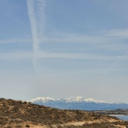
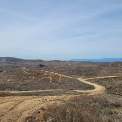
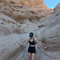
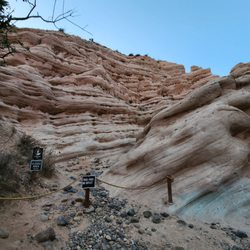
5 miles from the Skyline Drive Trail gate. On clear days can see from downtown LA to Catalina Island. Take ample water and snacks if hiking. read more


More info about Beek’s Place
9429 Black Star Canyon Rd
Silverado, CA 92676
Directions
Hours
Outdoor Amenities
You might also consider


Beek’s Place - hiking - Updated July 2026
Best of Silverado
People found Beek’s Place by searching for…
Hiking Trails in Silverado, CA
Walking Trails in Silverado, CA
Running Trails in Silverado, CA
Places to Walk at Night in Silverado, CA
Off Road Trails in Silverado, CA
Places to Walk in Silverado, CA
Lookout Points in Silverado, CA
Waterfall Hike in Silverado, CA
Fun Things to Do With Kids in Silverado, CA
Chilean Sea Bass in Silverado, CA
Browse Nearby
BEST of Silverado, California Restaurants near Beek’s Place
BEST of Silverado, California Coffee near Beek’s Place
BEST of Silverado, California Things to Do near Beek’s Place
BEST of Silverado, California Breakfast near Beek’s Place
BEST of Silverado, California Horseback Riding near Beek’s Place
Browse Brands
Browse Articles
People who viewed Beek’s Place also viewed
Bedford Peak Trail
7 reviews
Tin Mine Canyon Trail
9 reviews
Santa Ana River Trail - Hidden Valley Wildlife Reserve Entrance
27 reviews
Skyline Drive Trails
137 reviews
Fresno Canyon Trail
10 reviews
Santiago Peak
25 reviews
Santa Ana River Trail
1 review
Indian Truck Trail
4 reviews
Deer Canyon Park Preserve
19 reviews
Eagle Canyon Trail
1 review