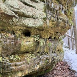
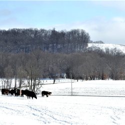
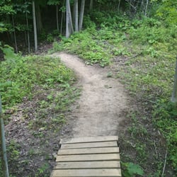
Austin Badger Park Photos


You might also consider
More like Austin Badger Park
Recommended Reviews - Austin Badger Park
Start your review...


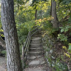
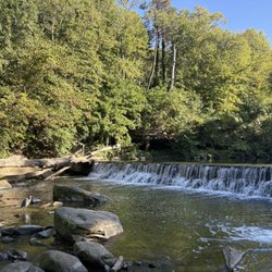
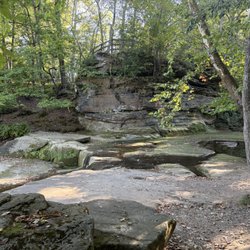
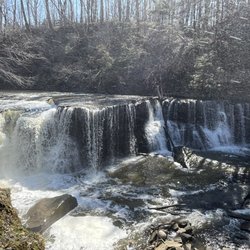
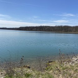
I've lived in Montville Township for 10 months and one of the first parks I found was Austin Badger. I happen to live just a couple blocks away, so it is super convenient for us to visit. The Spokes II Cafe opened recently and after a walk or bike ride in Austin Badger Park, you can stop in for a snack or something to drink. There is also a bike holder that you can work on your bike with. They have an air pump too. We usually walk through the long, paved trails in Austin Badger. I rode my bike through the paved trails back in December, but it was really tiring as there are hills everywhere and no flat sections. You will probably need to be in good shape to enjoy the trails. Casual riders probably won't enjoy the paved or mountain bike trails if they're not in good shape. read more
 - Parks Near Me - Medina, Ohio")


More info about Austin Badger Park
5741 River Styx Rd
Medina, OH 44256
Directions
Hours
Outdoor Amenities


Austin Badger Park - parks - Updated May 2026
Best of Medina
People found Austin Badger Park by searching for…
Trending Searches in Medina, OH
Baseball Fields near Austin Badger Park
Bird Sanctuary near Austin Badger Park
Botanical Gardens near Austin Badger Park
Bounce House Rentals near Austin Badger Park
Campgrounds near Austin Badger Park
Cheap Plants near Austin Badger Park
Cherry Picking near Austin Badger Park
Cliff Jumping near Austin Badger Park
Dog Friendly Things To Do near Austin Badger Park
Dog Friendly Trails near Austin Badger Park
Flower Fields near Austin Badger Park
Flower Shop near Austin Badger Park
Free Picnic Areas near Austin Badger Park
Garage Sales near Austin Badger Park
Garden Center near Austin Badger Park
Hiking near Austin Badger Park
Lakes & Ponds near Austin Badger Park
Nurseries & Gardening near Austin Badger Park
Off Leash Dog Parks near Austin Badger Park
Outdoor Activities near Austin Badger Park
Outdoor Basketball Courts near Austin Badger Park
Outdoor Furniture Stores near Austin Badger Park
Parks For Parties near Austin Badger Park
Party Equipment Rentals near Austin Badger Park
Pedicure near Austin Badger Park
Photo Spots near Austin Badger Park
Picnic Areas near Austin Badger Park
Places To Take Pictures near Austin Badger Park
Places To Take Pictures For Prom near Austin Badger Park
Public Running Track near Austin Badger Park
Rock Quarry near Austin Badger Park
Running Trails near Austin Badger Park
Rv Rental near Austin Badger Park
Secluded Spots near Austin Badger Park
Spray Tanning near Austin Badger Park
Star Gazing near Austin Badger Park
Sunrise View near Austin Badger Park
Swimming Holes near Austin Badger Park
Table And Chair Rentals near Austin Badger Park
Tennis Courts near Austin Badger Park
Walking Trails near Austin Badger Park
Browse Nearby
Browse Brands
Related Searches in Medina, OH
Affordable Bike Repair Services in Medina, Ohio
Affordable Bike Tune Up Services in Medina, Ohio
Affordable Kayak Rental Services in Medina, Ohio
Affordable Tandem Bike Rental in Medina, Ohio
Best Dog Hiking Trails Around Medina, Ohio
Best Electric Bike Rental Services in Medina, Ohio
Best Fishing Locations and Guides in Medina, Ohio
Best Off Leash Dog Parks in Medina, Ohio
Best Parks for Parties and Events in Medina, Ohio
Best Places for Horseback Riding in Medina, Ohio
Best Used Bikes for Sale Near Medina, Ohio
Best Water Parks for Kids in Medina, Ohio
Check Out Great Playgrounds in Medina, Ohio
Check Out Off Road Trails in Medina, Ohio
Discover Baseball Fields Around Medina, Ohio
Discover Beautiful Garden Spots in Medina, Ohio
Discover Dog Friendly Trails to Explore in Medina, Ohio
Discover Free Parking Options in Medina, Ohio
Discover Fun Toddler Parks in Medina, Ohio for Your Little One
Discover Kid Friendly Hiking Trails in Medina, Ohio
Discover Lakes & Ponds to Explore in Medina, Ohio
Discover Popular Bike Tours in Medina, Ohio
Discover Popular Bike Trails in Medina, Ohio
Discover Popular Photo Spots in Medina, Ohio
Discover Scenic Mountain Bike Trails Near Medina, Ohio
Discover Soccer Fields in Medina, Ohio Near You
Discover Top Nature Parks to Visit in Medina, Ohio
Discover Top State Parks to Visit in Medina, Ohio
Discover a Hiking Trail in Medina, Ohio
Discover the Best Beaches in Medina, Ohio
Discover the Best Night Hike Trails in Medina, Ohio
Dog-Friendly Hikes With Dogs in Medina, Ohio
Enjoy Camping Adventures Around Medina, Ohio
Enjoy Hiking Adventures in Medina, Ohio
Enjoy Kayaking Adventures in Medina, Ohio
Enjoy River Tubing Adventures in Medina, Ohio
Enjoy Tent Camping Spots Around Medina, Ohio
Enjoy Water Activities and Fun in Medina, Ohio
Enjoy a Beautiful Waterfall Hike in Medina, Ohio
Enjoy the Best Tubing Experiences in Medina, Ohio
Enjoy the Best Walking Path in Medina, Ohio
Enjoy the Best Walking Trails in Medina, Ohio
Exciting Cliff Jumping Spots in Medina, Ohio
Explore BMX Bike Shops Near Medina, Ohio
Explore Beautiful Botanical Gardens in Medina, Ohio
Explore Beautiful Parks and Green Spaces in Medina, Ohio
Explore Bike Rentals Throughout Medina, Ohio
Explore Easy Hikes Perfect for All in Medina, Ohio
Browse Articles
People who viewed Austin Badger Park also viewed
High Bridge Glens Park
8 reviews
Hinckley Reservation
22 reviews
Towner's Woods Park
7 reviews
Blue Hen Falls
29 reviews
The Ledges Shelter House & Trail
23 reviews
Boettler Park
13 reviews
Portage hike and bike trail
1 review
Fred Fuller Park
1 review
Champion Creek Trail City Trail
1 review
Franklin Mills Riveredge Park
2 reviews