南丫島 Photos

Recommended Reviews - 南丫島
Start your review...


Reviews With Photos


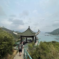
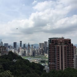
Me and my friend had half a day to spare, and we decided to do it in Lamma Island- turned out as a nice choice! Access to the island is rather easy by dropping off at HK/Central station and walk along the bridge towards the pier, there you can catch a short ferry to one of two stops on the island, we started with the less popular one and walked across the island to the other. We took the ferry back from Yung Shue Wan- You can easily spend a whole day on the island if you're willing to hike outside the main trail, bring lots of water! It's super warm. We started by going to the other side (red circle on the map) and climb to hill to get a panoramic view- this place is mentioned on the main map but if we found the right place it's off trail - means there's no sign next to it, so you'll have to find the trail yourself. After that we went back to walk across the island. We stopped at the top for a refreshing pineapple and some cold drinks, to cool down from the long way up (be prepared!) The way up is pretty long and somewhat steep, but you need just comfy shoes and that's it, it's not a difficult path. The signs are everywhere so it's really hard to get lost, and if you'll walk it like we did- you can even cool down on the beach next to the power station, so bring a bathing suit if you want to. Afterwards you'll get to the more crowded area of the city and can sit down and relax or just walk around and enjoy the atmosphere before you had back to busy Hong Kong. Nice experience which seems to me like a place which is off the map for the usual tourists.
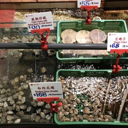

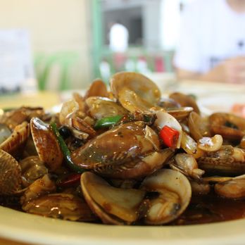
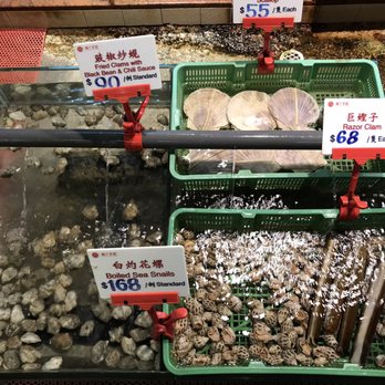
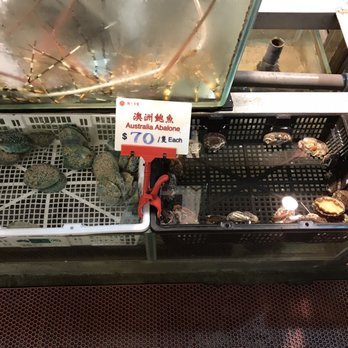
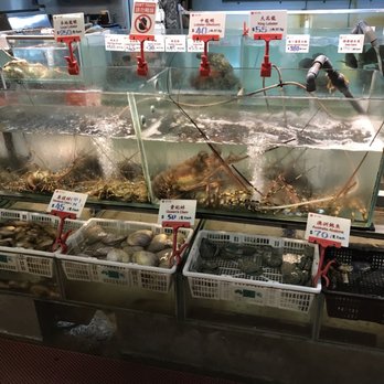
Sok kwu wan in Lamma island is a seafood restaurant that you have to ride a cruise for 30mins from Hong Kong Island! It has the normal seafood dishes like shrimps, clams, scallops, lobster and vegetable. Me and my family didn't have steam fish and Crabs because if we came in 4 we will have steam fish but we are only 3 in a family. So no steam fish for us! its a great place for fresh seafood!


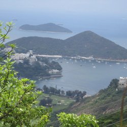
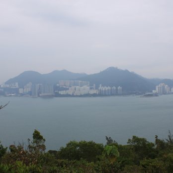
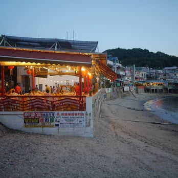
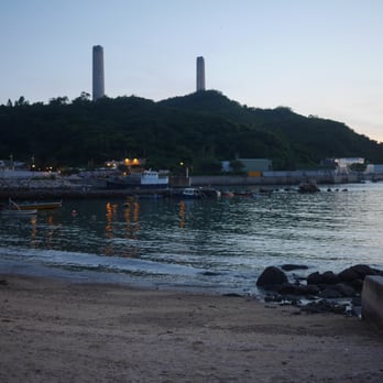
I spontaneously decided to go to Lamma Island for hiking on a Saturday morning. That meant I got there in the afternoon, not the greatest time for that as it was pretty hot and humid. However, I did enjoy the day, the landscape, the villages and the beaches over there; they make you feel like you've left Hong Kong for a while or at least the Hong Kong many of us think about most of the time. I took a ferry from Central to Sok Kwu Wan that took around 40 minute. At arrival, you are welcome by a row of small seafood restaurants. I had packed some emergency food and decided to carry on the route to the closest beach, Lo So Shing. It was a little crowded and after a quick break, I decided to carry on. I wasn't aware most of the path is not shaded and I wasn't wearing a cup. In fact, the nature there is wild but most of the bushes are very low so you're completely exposed (to the sun, in my case). So caps and sunscreen are advisable. Obviously, I got burnt. On my way there I met a guy who was coming back and going to Lo So Shing because he was a little disappointed with Hung Shing Yeh, the beach I was heading to. Nevertheless, I carried on, arrived there, sat down and drank a ton of water. The beach isn't big, but it was less crowded and it is, in my opinion, a much nicer one. Yeah, you see the power station from there but I've you've been hiking, you've seen it along the way, so you know it's still going to be there when you walk down to the shore. It's not a great view (so I cropped all my pictures afterwards!) but it's part of the landscape. I met an expat who had been living in Lamma for a few years. She found it a lot quieter, more peaceful and she wanted to stay long...live there is definitely another story. At the end of the afternoon I walked to Yung Shue Wan to take the ferry from there (this time, only 30 minutes). While waiting for the ferry I sat down at a bench close to the pier and admire such beautiful view, I couldn't get enough!


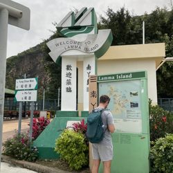
Experience fishing villages, temples, beaches, cafes and bars on a Lamma Island hike. Day trips to Lamma is good with family, friends & dogs. The Island is small so you can walk from one side to the other. If you do plan to spend the day then I suggest getting to Yung Shue Wan, Lamma Island: Take a ferry from Central Pier No. 4 to Yung Shue Wan. It takes about 30 minutes. Then leaving from Sok Kwu Wan, Lamma Island: Take a ferry from Sok Kwu Wan to Central or Aberdeen. Stop 1: Yung Shue Wan the main residential area on Lamma Island, with shops, bars, cafes and restaurants. Stop 2: Hung Shing Yeh Beach (Around a 20-minute walk from Yung Shue Wan Pier) white sandy beach, you can enjoy the sun, sand and water. Stop 3: Tin Hau Temple Stop 4: Sok Kwu Wan This tiny village is still very much focused on fishing. The seafood restaurants along the bay are great! read more



10 years ago
Although Lamma Island comes highly rated on Trip Advisor and Lonely Planet's 2015 Travel Guide, it's a huge tourist trap and doesn't necessarily capture the beauty of Hong Kong's countryside. From Pier 4 at Central, there are two ferries to take to/from Lamma Island's two main piers: Yung Shue Wan and Sok Kwu Wan, with the former being more popular and running more frequently. Most visitors hike the Family Walk, which is a ~4 km long trail (~2 hours slow-paced walking with stopping for breaks and photos), from one pier to the other. The power plant at Yung Shue Wan is an eyesore, but there are a few other lookout spots on Lamma Island that provide stunning views of the fishing villages, beaches, and sparkling waters. I recommend Sai Kung over Lamma Island for a half day trip, but Lamma Island is still a good option for those who prefer mild hiking (ie: not too long or difficult in elevation). read more


quaint island, supposedly the third largest in hong kong, that's about a 30 minute ferry ride from hong kong island. stayed here a couple nights with an expat friend who moved here to escape the crowded bustle of hong kong. cheaper rents and a lot more chill here. this island is so quaint that normal automobiles are not allowed here. instead, there are small truck carts for transporting goods. the main road runs through yung shue wan village where an assortment of chinese seafood restaurants, british pubs, and various international restaurants line it. unfortunately didn't get to visit the beach due to the tsunami and my short stay here. overall, a good change of pace from the heavily populated hong kong island. read more


Me and my friend had half a day to spare, and we decided to do it in Lamma Island- turned out as a nice choice! Access to the island is rather easy by dropping off at HK/Central station and walk along the bridge towards the pier, there you can catch a short ferry to one of two stops on the island, we started with the less popular one and walked across the island to the other. We took the ferry back from Yung Shue Wan- You can easily spend a whole day on the island if you're willing to hike outside the main trail, bring lots of water! It's super warm. We started by going to the other side (red circle on the map) and climb to hill to get a panoramic view- this place is mentioned on the main map but if we found the right place it's off trail - means there's no sign next to it, so you'll have to find the trail yourself. After that we went back to walk across the island. We stopped at the top for a refreshing pineapple and some cold drinks, to cool down from the long way up (be prepared!) The way up is pretty long and somewhat steep, but you need just comfy shoes and that's it, it's not a difficult path. The signs are everywhere so it's really hard to get lost, and if you'll walk it like we did- you can even cool down on the beach next to the power station, so bring a bathing suit if you want to. Afterwards you'll get to the more crowded area of the city and can sit down and relax or just walk around and enjoy the atmosphere before you had back to busy Hong Kong. Nice experience which seems to me like a place which is off the map for the usual tourists. read more


8 years ago
Sok kwu wan in Lamma island is a seafood restaurant that you have to ride a cruise for 30mins from Hong Kong Island! It has the normal seafood dishes like shrimps, clams, scallops, lobster and vegetable. Me and my family didn't have steam fish and Crabs because if we came in 4 we will have steam fish but we are only 3 in a family. So no steam fish for us! its a great place for fresh seafood! read more




I spontaneously decided to go to Lamma Island for hiking on a Saturday morning. That meant I got there in the afternoon, not the greatest time for that as it was pretty hot and humid. However, I did enjoy the day, the landscape, the villages and the beaches over there; they make you feel like you've left Hong Kong for a while or at least the Hong Kong many of us think about most of the time. I took a ferry from Central to Sok Kwu Wan that took around 40 minute. At arrival, you are welcome by a row of small seafood restaurants. I had packed some emergency food and decided to carry on the route to the closest beach, Lo So Shing. It was a little crowded and after a quick break, I decided to carry on. I wasn't aware most of the path is not shaded and I wasn't wearing a cup. In fact, the nature there is wild but most of the bushes are very low so you're completely exposed (to the sun, in my case). So caps and sunscreen are advisable. Obviously, I got burnt. On my way there I met a guy who was coming back and going to Lo So Shing because he was a little disappointed with Hung Shing Yeh, the beach I was heading to. Nevertheless, I carried on, arrived there, sat down and drank a ton of water. The beach isn't big, but it was less crowded and it is, in my opinion, a much nicer one. Yeah, you see the power station from there but I've you've been hiking, you've seen it along the way, so you know it's still going to be there when you walk down to the shore. It's not a great view (so I cropped all my pictures afterwards!) but it's part of the landscape. I met an expat who had been living in Lamma for a few years. She found it a lot quieter, more peaceful and she wanted to stay long...live there is definitely another story. At the end of the afternoon I walked to Yung Shue Wan to take the ferry from there (this time, only 30 minutes). While waiting for the ferry I sat down at a bench close to the pier and admire such beautiful view, I couldn't get enough! read more


12 years ago
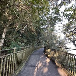
Probably my favorite island in Hong Kong. It's only a short boat ride from Central / Aberdeen. Lamma Island is a quaint little town - bearable even on weekends. It has the best of both worlds in terms of food - with the traditional Chinese seafood restaurants on both ends of the island near the pier and western restaurants to entertain. It also has a few craft shops. The walk from Sok Kwu Wan to Yung Shue Wan (or vice versa) is very scenic and great for beginners. You can take as few or as many stops as you wish along the way. There is a beach (Hung Shing Yeh Beach) at the midway point, which is great for picnic or even a dip! And then there is a wind farm, which is great for selfie lovers and photography enthusiasts. read more





12 years ago