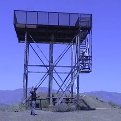
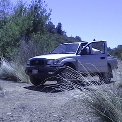
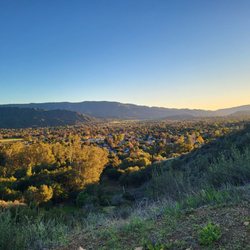
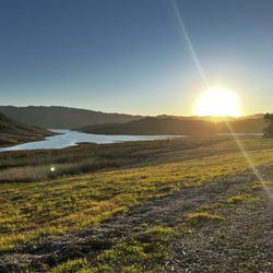
Willett Hot Springs Photos


You might also consider
More like Willett Hot Springs
Recommended Reviews - Willett Hot Springs
Start your review...


3 years ago


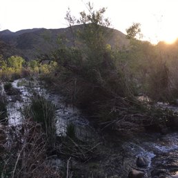
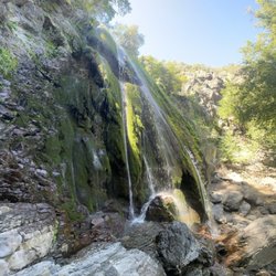
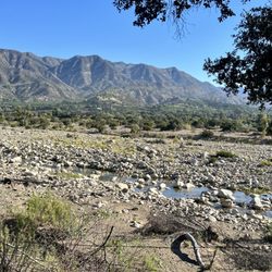
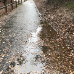
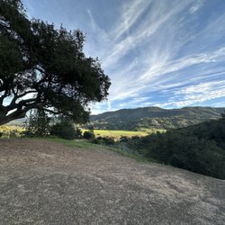
So a friend emailed me last week saying he was planning an overnight backpacking trip in the Sespe Wilderness to Willett Hot Springs and asked if I wanted to join on the trek. Heck yes! I had a week to research and read up about the area, and I was poking around online I felt there was no detailed directions of the trail to the hot springs, just a few nondescript write ups and summaries here and there. So this review, I hope will help others find the hot spring easier since we got lost for over an hour in rain.... Backpacked 11/2/15-11/3/15 Miles: 20 miles out and back Time took: 30 hours (we overnighted it) elevation gain: less than 400 ft Adventure Pass needed Water: there were 2-3 spots to filter water Directions: on Google maps, type in Piedra Blanca Trailhead. Piedra Blanca Trailhead and Sespe River Trail start at the same parking lot, so it pulls up and you can use the app when you loose cell service. We came from LA, so we ended up taking the 33N to Rose Valley Rd, this area is considered Ventura County Trailhead: Adventure pass is needed to park here. There are pit toilets, when I went they also had toilet paper and weren't too dirty. There's some informational sign around here talking about the local animals you can find, a trail map, and some shaded picnic benches where you can have a nice picnic. The hike: we started at 9:45 AM Monday morning, the first 2-3 miles in the trail was dry with no sight on water. Do not be discouraged, right around 2-3 miles, we didn't spot it right away, but when we hiked further up, we spotted a pool of water off the trail. So if it had been necessary, we would have gone off trail to that water source. But at 3 miles in, I heard running water. We hiked off trail and found the source and actually filtered at this spot. It's a nondescript spot, you just have to keep alert of the sound of running water. Going to this spot was unnecessary though, if you know the trail well, you know that Bear Canyon Campground is right around the corner at 3.5 miles in and there is a spring fed pond here with moving water that is easier to filter at. We talked to a guy here and he said there seems to always be water here and it's a good swimming hole. The trail is decently well beaten and well marked. About 8 miles in you will come upon a big metal trail sign. It's faded and kind of hard to read, but points you in the direction of Ladybug Campground and Hines Peak. Scratched into the sign it says Willett and tell you to stay on the trail you are at. Shortly after that sign, keep a look out for the trail sign on the right. We actually got lost here and walked past it. If you walked past it and come to a camp spot with a fire circle and shovel, you've come too far. We scrambled in the river wash for a while here having lost the trail. Back track and find that small trail sign, it makes you cross the river wash here. Once you cross the river wash, the trail keeps going. look for a fork in the trail and go left. It's a pretty small fork, we put up cairns here the other day, but it is easy to miss. We got lost here too and had to keep backtracking. You cross a swampy area right here. Right when you cross and get to the other side, you will shortly come across the house/shack/a fenced area. Woohoo! You are almost there! Go past that house. With the house behind you, you will see a stone stack/chimney, take the trail above and to the right of it. From there, it's an upward climb, but you're only a few hundred yards away from the Willett Hot Spring tub. You will first come across a small camp spot here. There was a fire ring here the other day. Go past that, and into the foresty area and go up. There you will find the tub, wedged into the crevice of the mountain. Tips: bring a water filter. Depending on time of year, be prepared for rain. Bring sandals if you don't want to go barefoot in the tub, and a towel to dry off. Don't give up. We soaked in the hot spring for a good hour Tuesday morning and had the place all to ourselves. Temp we would guess was around 108 degrees. There are scrubs left there to scrub some of the sliminess. I didn't care, I got right in. Good luck! read more


7 years ago
9 years ago
A pretty awesome hike into the hot springs. If you're into chaparral type terrain this is definitely the spot. There's basically endless camping spots on your way into the hot spring.... just be careful not to step on a rattlesnake! read more


11 years ago
Willet Hot Springs.what can i say.i have backpacked here twice and every time i have had a blast.The hike is a bit strenuous especially in the heat but definitely worth it.I don't think i would recommend it to a beginner backpacker since it pretty challenging but if your in decent shape,i think you would be able to pull it off.It gets really really hot since there is barely any shade on the trail.The first 5 miles,there is no water so bring enough to drink.You will have to cross some streams so water shoes are ideal if you don't mind getting your shoes wet then thats not a problem.When you get to Willet hot spring campground,there is plenty of space to camp at.In addition,there are little cabins that are first come first serve.Overall the Hot springs are the best i have been to in California. read more


7 years ago
9 years ago
12 years ago
More info about Willett Hot Springs
Los Padres National Forest
Ojai, CA 93243
Directions
Hours
Outdoor Amenities
Ask the Community - Willett Hot Springs
Are the current forest fires affecting this hiking area? Is it closed and/or unsafe to hike on?
You might also consider


Willett Hot Springs - hiking - Updated May 2026
Best of Ojai
People found Willett Hot Springs by searching for…
Trending Searches in Ojai, CA
Boat Rental near Willett Hot Springs
Botanical Gardens near Willett Hot Springs
Bounce House Rentals near Willett Hot Springs
Campgrounds near Willett Hot Springs
Cherry Picking near Willett Hot Springs
Cliff Jumping near Willett Hot Springs
Dog Friendly Things To Do near Willett Hot Springs
Flower Fields near Willett Hot Springs
Flower Shop near Willett Hot Springs
Garage Sales near Willett Hot Springs
Lakes & Ponds near Willett Hot Springs
Nurseries & Gardening near Willett Hot Springs
Outdoor Activities near Willett Hot Springs
Outdoor Furniture Stores near Willett Hot Springs
Party Equipment Rentals near Willett Hot Springs
Pedicure near Willett Hot Springs
Pick Your Own Farms near Willett Hot Springs
Picnic Areas near Willett Hot Springs
Places To Take Pictures near Willett Hot Springs
Plant Nursery near Willett Hot Springs
Rock Quarry near Willett Hot Springs
Running Trails near Willett Hot Springs
Scenic Drive near Willett Hot Springs
Secret Spots near Willett Hot Springs
Strawberry Picking near Willett Hot Springs
Sunrise View near Willett Hot Springs
Swimming Holes near Willett Hot Springs
Browse Articles
Browse Nearby
BEST of Ojai, California Things to Do near Willett Hot Springs
BEST of Ojai, California Coffee near Willett Hot Springs
BEST of Ojai, California Restaurants near Willett Hot Springs
BEST of Ojai, California Walking Trails near Willett Hot Springs
BEST of Ojai, California Parks near Willett Hot Springs
BEST of Ojai, California Breakfast near Willett Hot Springs
BEST of Ojai, California Campgrounds near Willett Hot Springs
BEST of Ojai, California Sightseeing near Willett Hot Springs
BEST of Ojai, California Visitor Centers near Willett Hot Springs
Browse Brands
Related Searches in Ojai, CA
Affordable Kayak Rental Services in Ojai, California
Best Fishing Locations and Guides in Ojai, California
Best Places for Horseback Riding in Ojai, California
Best Waterfalls and Swimming Holes in Ojai, California
Check Out Off Road Trails in Ojai, California
Discover Dog Friendly Trails to Explore in Ojai, California
Discover Kid Friendly Hiking Trails in Ojai, California
Discover Scenic Waterfall Spots in Ojai, California
Discover a Hiking Trail in Ojai, California
Discover the Best Night Hike Trails in Ojai, California
Discover the Best Running Track in Ojai, California
Dog-Friendly Hikes With Dogs in Ojai, California
Enjoy Camping Adventures Around Ojai, California
Enjoy Exciting Mountain Biking Adventures in Ojai, California
Enjoy Kayaking Adventures in Ojai, California
Enjoy Tent Camping Spots Around Ojai, California
Enjoy a Beautiful Waterfall Hike in Ojai, California
Enjoy a Peaceful Nature Walk in Ojai, California
Enjoy the Best Picnic Spots and Ideas in Ojai, California
Enjoy the Best Walking Path in Ojai, California
Enjoy the Best Walking Trails in Ojai, California
Exciting Cliff Jumping Spots in Ojai, California
Explore Beautiful Parks and Green Spaces in Ojai, California
Explore Easy Hikes Perfect for All in Ojai, California
Explore Fun Activities to Do in Ojai, California
Explore Popular Campgrounds Near Ojai, California
Explore the Best Beach Spots in Ojai, California
Explore the Best Swimming Holes Around Ojai, California
Explore the Best Trail Options in Ojai, California
Family Friendly Hiking With Kids in Ojai, California
Find Beautiful Views in Ojai, California
Find Popular Ziplining Spots Around Ojai, California
Find the Best Parks for Picnics in Ojai, California
Find the Best Scenic View Locations in Ojai, California
Great Places to Walk in Ojai, California
Hiking Trails With Waterfalls in Ojai, California
Plan a Scenic Drive Route Near Ojai, California
Play at a Splash Pad Park in Ojai, California
Popular Outdoor Activities to Try in Ojai, California
Popular Picnic Spots to Visit in Ojai, California
Safe River Swimming Areas in Ojai, California
Safe and Fun Parks for Kids in Ojai, California
Top Climbing Spots and Gyms in Ojai, California
Top Paddleboarding Activities in Ojai, California
Top Places for Snorkeling in Ojai, California
Top Running Trails to Explore in Ojai, California
Top Swimming Lakes to Enjoy in Ojai, California
Top Swimming Spots and Pools in Ojai, California
People who viewed Willett Hot Springs also viewed
Rose Valley Falls
56 reviews
Santa Paula Canyon Falls
17 reviews
Ojai Valley Land Conservancy
7 reviews
Lake Casitas Hiking Trail
1 review
Cozy Dell Trail
8 reviews
Piedra Blanca Formations
4 reviews
Dennison Park
38 reviews
Nordhoff Ridge Road
4 reviews
Santa Paula Punch Bowls
68 reviews
Middle Lion Campground
6 reviews