North Fork Matilija Creek Trail Photos


You might also consider


More like North Fork Matilija Creek Trail
Recommended Reviews - North Fork Matilija Creek Trail
Start your review...


Reviews With Photos


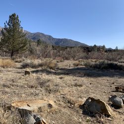
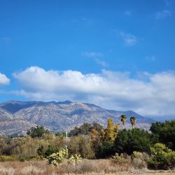
This is a great trailhead, and leads to many choices for the adventurous or less adventurous as you may choose. Serenity can be encountered here, in this creek-blessed valley featuring Oaks, Cottonwood, Chaparral, Manzanita, Yucca, Wild Poppies, Lupine, Sticky Monkey Flower (Mimulus aurantiacus), Palmer's Indian Mallow, Indian Paintbrush, wild wheat, Purple Sage, White Sage, Fiddleneck (Phacelia Tanacetifolia), foxtail grass. I frequent the trails with hiking companions, and see occasional kind locals as well, some with dogs on leashes in the morning. Less adventurous, or with less rugged shoes: walk politely through the trail easement at the Historical property, proceed along the fire road. Trails lead off to the right (to the falls) and to the left (creek crossings and gentle meandering single track trails). A simple 5-mile, fire road hike leads straight onward to a fork in the road, take the left fork and proceed up the fire road that leads up the mountainside. As wind permits, you may hear the stream's babble from below on your left. Some Manzanita and Oak have survived the flames, and the wildflowers have burst back. I see a negative review below from someone who saw alot of poison oak. I assure you, as the tragic Thomas fires have wiped clean the canyon, there is little fear of poison oak now, even on one of the meandering side trails to the campgrounds, which the unfortunate reviewer must have taken, alas for him! May it go more pleasantly for you, dear hiker.


You know how you or your friends see a gorgeous photo on social media of a hike and are amazed by the way it looks and somehow aren't phased by the fine print? This hike can be added to that category. Ten miles. Pfft. We thought. It showed us. Parking here requires you to show up at sunrise because the lot can respectfully hold 12 cars maximum. This is a bonus however, because you do NOT want to start this hike in the heat, during the afternoon sun. This hike will have you asking "am I there yet?" repeatedly, as you follow a stream of varying water levels. Promise, you'll know when you're there. There are trail markers but they're either spray painted onto rocks, or stacked rocks. That's all you've got going for you, so pay attention! You're going to need lots of water, and sunscreen. Water shoes are incredibly helpful too. This is NOT for kids, or dogs. You're going to be scrambling over rocks and reaching. Yes, you see snakes around - the ones I saw were completely harmless garter snakes and some went for a swim. They aren't water snakes ,they just cooled down. Leaves of three. You leave them be. Once this trail kicks your butt, you'll be rewarded with the falls, so don't give up!!! read more


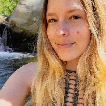


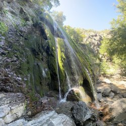
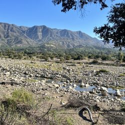
This summer, I'm chasing waterfalls! I'm proclaiming waterfall chasing to be thee best unofficial summer sport during these COVID-19 times :) . As it's possible to socially distance on the trail, wear masks and enjoy the beautiful outdoors! Wasn't too busy here this past weekend -possibly because weather reached 100F degrees. Very limited parking, so come early -we arrived at 7:30AM and it was packed! There's always more than one way of getting to the falls, although I recommend the path of least resistance. As when you follow the dirt path, stay to the path on the left. Pass all the private property and you'll eventually hike through a wood archway/fence that'll have you pass a private ranch with apple orchard. You can follow the river all the way up to the falls (I hear), but if you follow the cleared path you'll hopefully get to the dry part of a riverbed where you'll see a round, concrete piping. The concrete piping "thing," will lead you to a clear trail that will go up the mountain. I would suggest hiking up the mountain a bit, as it's a clear path and less rocks to dodge. Keep going left, stay to the left side of the mountain -as there is a path to follow. I'm grateful to have a friend who is familiar with most of the trails, as she volunteers for LA Forestry services and got us around. Total hike is about 10-11 miles to see both of the falls. The third falls, I didn't get to -as I was too chicken to repel down the rock to reach it. The red rope to repel down to the 3rd falls, looked sketchy (had duct tape enforcing some parts of it together). Bring gloves, for extra grip to climb the ropes and gloves will be useful as you'll be doing a bit of rock scrambling too. Bring lots of hydration during the summer heat and especially bring sun protection: hat, sunblock and/or sun protective clothing. You'll be exposed to the sun, most of the time hiking -minimal shade. Tons of poison oak along the trail and I saw a water snake peep his head out of the river, when my friends and I took a splash to cool off a bit. read more


"Do one thing every day that scares you"-Eleanor Roosevelt Let me help everyone out in the things I wish we knew ahead of time -Parking is limited. Very Limited! We came during the week and we were fine but I imagine if you come on the weekend you're going to have a serious problem with parking. The residence around the area does not want the hikers to hike there so they've made the first 5 miles of the road no parking so you literally only have that one parking lot to park or you're pretty much screwed. To be able to hike you would have to walk over 5 miles to get to the hike if there's no parking so you might want to get there really early if you come on a weekend or be willing to pay a ticket which I hear they do often. -This trail is confusing so let me help you through the route. When you walk through you will see signs that help you get to the trail in the beginning but when you get to the second sign you will see the trail says go to the right and you will have to walk through a barn area. At first, I thought we wouldn't be able to go through since it's private property but the hike is actually through the Brown gate that's opened. There's pretty much only one way to go but when we got there we were confused if we could walk through. -There are not clear signs through this trail on which way to go however once you get off the main trail along the river it gets confusing so just follow the river up. There's no right answer but people put three rocks along the way to help you find the direction. However, sometimes it seems like you're off-trail because there's no direct trail to walk-through. Plan on climbing boulders and walking through the river lots of times. Eventually, we realized it was easier to walk to the river then climb boulders in certain areas. -There are several snakes on this hike( including water snakes). I only saw one when I was there but other people have seen 3 that day. All hikes obviously have snakes but I've heard this trail has a little more than normal. -As you start going up the river you will see many waterfalls and lots of pools of water. Once you go to the left at the end there's the first waterfall. It also seems hard to get to but just walk closer to the river, on the right side, that will be the easiest route. After that, you will continue up the hill to the second waterfall. We didn't make it there on this particular day but we saw pictures and there is a rope at that waterfall to climb up to the next. You're going to be able to have to pull yourself up and be in some kind of good shape to do this so keep that in mind if you want to get to the third waterfall. I heard the waterfalls keep on going but unless you're an experience hey girl you're probably not going to get past the three. -On this site, it says it's 8.8 miles and 3 1/2 hours to do but this took a 6 1/2 hours along with some other experience hikers we were walking with. They made it up to the third waterfall and they were hiking for almost 8 hours. What makes it take so long is trying to figure out how to navigate through the rocks to get up to the waterfall, and it's very easy to get lost there and back. We even missed the trail on the way back but someone helped us find another way to get back. I would definitely give yourself 6 to 8 hours to finish this hike especially if you want some time to swim in the waterfalls. -I was also told the second waterfall is deep so if you want to jump in you can, so it's great for swimming so bring your bathing suit. -On this particular day, I didn't encounter many bugs so I didn't need bug spray but you might find yourself needing more water than normal on a hot day since one of our hikers ran out of water. Plus it's probably nice to have a snack by the waterfall and relax since this is a longer hike. -My last suggestion is to probably download the AllTrails app and upgrade since you will have no phone reception the whole entire time. We didn't even get reception back until we were 10 minutes down the road leaving the hike. Life is not a matter of milestones but of moments... read more


8 years ago
This is a great trailhead, and leads to many choices for the adventurous or less adventurous as you may choose. Serenity can be encountered here, in this creek-blessed valley featuring Oaks, Cottonwood, Chaparral, Manzanita, Yucca, Wild Poppies, Lupine, Sticky Monkey Flower (Mimulus aurantiacus), Palmer's Indian Mallow, Indian Paintbrush, wild wheat, Purple Sage, White Sage, Fiddleneck (Phacelia Tanacetifolia), foxtail grass. I frequent the trails with hiking companions, and see occasional kind locals as well, some with dogs on leashes in the morning. Less adventurous, or with less rugged shoes: walk politely through the trail easement at the Historical property, proceed along the fire road. Trails lead off to the right (to the falls) and to the left (creek crossings and gentle meandering single track trails). A simple 5-mile, fire road hike leads straight onward to a fork in the road, take the left fork and proceed up the fire road that leads up the mountainside. As wind permits, you may hear the stream's babble from below on your left. Some Manzanita and Oak have survived the flames, and the wildflowers have burst back. I see a negative review below from someone who saw alot of poison oak. I assure you, as the tragic Thomas fires have wiped clean the canyon, there is little fear of poison oak now, even on one of the meandering side trails to the campgrounds, which the unfortunate reviewer must have taken, alas for him! May it go more pleasantly for you, dear hiker. read more


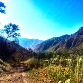


I liked this trail. Ok to enter respectfully thru private property per signage. Array of colors, wildflowers, varying terrain, can get rocky-rated as medium but not hard. Rarely saw other hikers so it was a nice serene hike with soothing sounds of creek when you approach it. There is a steep drive up the mountain to get there, and plenty of mosquitos and flying bugs, so cover up your skin, apply strong bug repellent and sun screen, water. Watch where you're going to avoid poison ivy, but overall good hike. Be smart and wear long pants and long sleeve, hat and bring a scarf to cover up neck. Go early in summer so it's not too hot. A local favorite. I recommend it. read more




More info about North Fork Matilija Creek Trail
Matilija Canyon Rd
Ojai, CA 93023
Directions
Hours
Outdoor Amenities
You might also consider



















North Fork Matilija Creek Trail - hiking - Updated May 2026
Best of Ojai
People found North Fork Matilija Creek Trail by searching for…
Things to Do in Ojai, California
Hiking Trails With Waterfalls in Ojai, California
River Swimming in Ojai, California
Off Road Trails in Ojai, California
Easy Hikes in Ojai, California
Places to Take Pictures in Ojai, California
Waterfalls and Swimming Holes in Ojai, California
Sunrise Hike in Ojai, California
Walking Trails in Ojai, California
Swimming Lakes in Ojai, California
Shaded Hike in Ojai, California
Beautiful Views in Ojai, California
Things to Do at Night in Ojai, California
Running Trails in Ojai, California
Hiking Trails Kid Friendly in Ojai, California
Sunrise View in Ojai, California
Trending Searches in Ojai, CA
Boat Rental near North Fork Matilija Creek Trail
Botanical Gardens near North Fork Matilija Creek Trail
Bounce House Rentals near North Fork Matilija Creek Trail
Campgrounds near North Fork Matilija Creek Trail
Cliff Jumping near North Fork Matilija Creek Trail
Dog Friendly Things To Do near North Fork Matilija Creek Trail
Flower Fields near North Fork Matilija Creek Trail
Flower Shop near North Fork Matilija Creek Trail
Hair near North Fork Matilija Creek Trail
Lakes & Ponds near North Fork Matilija Creek Trail
Movie Theatre near North Fork Matilija Creek Trail
Nurseries & Gardening near North Fork Matilija Creek Trail
Outdoor Activities near North Fork Matilija Creek Trail
Outdoor Furniture Stores near North Fork Matilija Creek Trail
Party Equipment Rentals near North Fork Matilija Creek Trail
Pedicure near North Fork Matilija Creek Trail
Pick Your Own Farms near North Fork Matilija Creek Trail
Picnic Areas near North Fork Matilija Creek Trail
Places To Walk Around near North Fork Matilija Creek Trail
Rainy Day Activities near North Fork Matilija Creek Trail
Rock Quarry near North Fork Matilija Creek Trail
Running Trails near North Fork Matilija Creek Trail
Scenic Drive near North Fork Matilija Creek Trail
Secret Spots near North Fork Matilija Creek Trail
Strawberry Picking near North Fork Matilija Creek Trail
Sunrise View near North Fork Matilija Creek Trail
Swimming Holes near North Fork Matilija Creek Trail
Things To Do On A Rainy Day near North Fork Matilija Creek Trail
Browse Articles
Browse Nearby
BEST of Ojai, California Things to Do near North Fork Matilija Creek Trail
BEST of Ojai, California Restaurants near North Fork Matilija Creek Trail
BEST of Ojai, California Coffee near North Fork Matilija Creek Trail
BEST of Ojai, California Breakfast near North Fork Matilija Creek Trail
BEST of Ojai, California Swimming Holes near North Fork Matilija Creek Trail
BEST of Ojai, California Horseback Riding near North Fork Matilija Creek Trail
BEST of Ojai, California Hotels near North Fork Matilija Creek Trail
BEST of Ojai, California Campgrounds near North Fork Matilija Creek Trail
Browse Brands
Related Searches in Ojai, CA
Affordable Kayak Rental Services in Ojai, California
Best Fishing Locations and Guides in Ojai, California
Best Places for Horseback Riding in Ojai, California
Best Waterfalls and Swimming Holes in Ojai, California
Check Out Off Road Trails in Ojai, California
Discover Dog Friendly Trails to Explore in Ojai, California
Discover Kid Friendly Hiking Trails in Ojai, California
Discover Scenic Waterfall Spots in Ojai, California
Discover a Hiking Trail in Ojai, California
Discover the Best Night Hike Trails in Ojai, California
Discover the Best Running Track in Ojai, California
Dog-Friendly Hikes With Dogs in Ojai, California
Enjoy Camping Adventures Around Ojai, California
Enjoy Exciting Mountain Biking Adventures in Ojai, California
Enjoy Kayaking Adventures in Ojai, California
Enjoy Tent Camping Spots Around Ojai, California
Enjoy a Beautiful Waterfall Hike in Ojai, California
Enjoy a Peaceful Nature Walk in Ojai, California
Enjoy the Best Picnic Spots and Ideas in Ojai, California
Enjoy the Best Walking Path in Ojai, California
Enjoy the Best Walking Trails in Ojai, California
Exciting Cliff Jumping Spots in Ojai, California
Explore Beautiful Parks and Green Spaces in Ojai, California
Explore Easy Hikes Perfect for All in Ojai, California
Explore Fun Activities to Do in Ojai, California
Explore Popular Campgrounds Near Ojai, California
Explore the Best Beach Spots in Ojai, California
Explore the Best Swimming Holes Around Ojai, California
Explore the Best Trail Options in Ojai, California
Family Friendly Hiking With Kids in Ojai, California
Find Beautiful Views in Ojai, California
Find Popular Ziplining Spots Around Ojai, California
Find the Best Parks for Picnics in Ojai, California
Find the Best Scenic View Locations in Ojai, California
Great Places to Walk in Ojai, California
Hiking Trails With Waterfalls in Ojai, California
Plan a Scenic Drive Route Near Ojai, California
Play at a Splash Pad Park in Ojai, California
Popular Outdoor Activities to Try in Ojai, California
Popular Picnic Spots to Visit in Ojai, California
Safe River Swimming Areas in Ojai, California
Safe and Fun Parks for Kids in Ojai, California
Top Climbing Spots and Gyms in Ojai, California
Top Paddleboarding Activities in Ojai, California
Top Places for Snorkeling in Ojai, California
Top Running Trails to Explore in Ojai, California
Top Swimming Lakes to Enjoy in Ojai, California
Top Swimming Spots and Pools in Ojai, California
People who viewed North Fork Matilija Creek Trail also viewed

Rose Valley Falls
56 reviews

Ojai Valley Land Conservancy
7 reviews

Santa Paula Canyon Falls
17 reviews

Cozy Dell Trail
8 reviews

Lake Casitas Hiking Trail
1 review

Santa Paula Punch Bowls
68 reviews

Wheeler Gorge Nature Trail
1 review

Piedra Blanca Formations
4 reviews

Nordhoff Ridge Road
4 reviews

Dennison Park
38 reviews