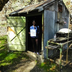
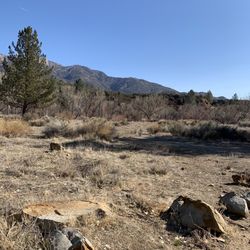
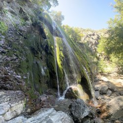
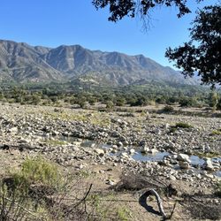
Shelf Road Trail Photos


You might also consider
More like Shelf Road Trail
Recommended Reviews - Shelf Road Trail
Start your review...

Reviews With Photos

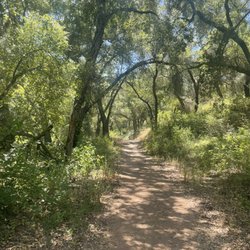
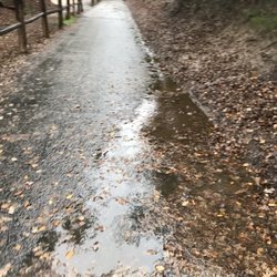
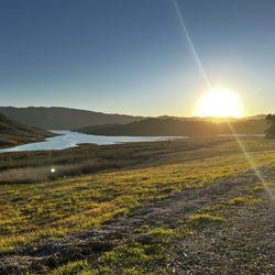
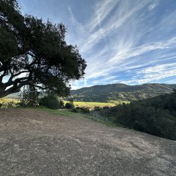
This is one of the trails found inside the Valley View Preserve in Ojai. It's named appropriately- it definitely felt like walking along a road more so than an actual hiking trail - which is the reason for my 4 star rating. But I still loved it!! This trail was a great way to kick of our day of trail hopping - it's a great warm up - I'd say it's a very easy trail. Mostly flat - we did 3.5 miles and only gained 361 feet in elevation. The biggest issue was the mud - I doubt it's usually a problem but it was pretty muddy from all the rain lately. The trail winds around Shelf Rd and takes you past sweeping views of the Ojai valley - and with the rain clouds on and off over the distant mountains, it was just gorgeous!! There's a bench maybe about halfway for you to sit and take it all in if you like. Towards the other end of the trail you get to walk by orange and avocado orchards!! They smell amazing and look so beautiful! We saw tons of birds and a surprising amount of deer as well! There are tons of other trailheads along the way - I believe the Valley View Preserve has a lot of trails off in here - so you could easily make a day of it and extend to more "natural" looking paths. They're all easily identifiable and well marked. There are a few parking spots at the trailhead - we didn't really have any issues parking - we arrived mid morning. Parking was pretty full by the time we got started but empty-ish when we left. Seems like this is more a trail for the locals - we saw many couples walking up from the residential areas below with their doggies. Overall I'd say it's a great trail for an easy meander around a very peaceful area!

Came here on a weekday and didn't have trouble finding parking. The trail has great views of Ojai valley. You can see the orchards and vineyards down below. The trail is all exposed though, so definitely wear a hat and sunscreen and bring plenty of water. Try to come here in the early morning or evening if you can to avoid the heat.

This is an enjoyable, peaceful, and mostly flat hike with terrific views of the valley below. There is practically no shade, so I advise an early start when it's a bit cooler and bring plenty of water, especially f you have a dog. Parking is minimal (I counted about 6-7 cars). We walked there from our hotel which added about 3-4 more miles to the experience but it was worth it and not difficult if you go early. Overall it's about a 2-2.5 hour round trip hike not including getting there. I found it safe and clean, and the people and dogs we met were all friendly so that was nice. Technically, off-leash is not permitted but when there is no one around it's probably not a big deal if your dog is well trained.

A day trip in this beautiful part of town included going for a quick hike in hopes of finding a spectacular view before sunset. Parking near the trailhead was around a local neighborhood, meaning potentially limited spots in a slightly narrowing road during the weekend and busy season. This trail is fairly simple with some incline though nothing major. While the road is pretty well maintained, there are some bits of rocky and uneven areas to be aware of. If I recall correctly, it's a little more than 1.5 miles one way along the mountain over to where vehicle traffic continues. Along the route, the view is lush and tranquil with the town below and the air was refreshingly light. Most of the others on the trail stopped where we planned to for the sunset. It's a simple spot but has a clear view of the sky and several stones nearby to sit down. The sunset was awe-inspiring, and just as quickly as the sun disappeared from the horizon, we too decided to head down. read more


Fantastic hike from Gridley Road all the way to signal Street on shelf Road trail. It was a beautiful morning with the clouds lifting and then descending throughout the entire hike. Nice cool temperatures before the heat comes on for the week starting tomorrow. Plenty of wildflowers blooming in a small stream at the river crossings in the canyon. Such a delightful way to spend your morning in Ohio. read more


This is one of the trails found inside the Valley View Preserve in Ojai. It's named appropriately- it definitely felt like walking along a road more so than an actual hiking trail - which is the reason for my 4 star rating. But I still loved it!! This trail was a great way to kick of our day of trail hopping - it's a great warm up - I'd say it's a very easy trail. Mostly flat - we did 3.5 miles and only gained 361 feet in elevation. The biggest issue was the mud - I doubt it's usually a problem but it was pretty muddy from all the rain lately. The trail winds around Shelf Rd and takes you past sweeping views of the Ojai valley - and with the rain clouds on and off over the distant mountains, it was just gorgeous!! There's a bench maybe about halfway for you to sit and take it all in if you like. Towards the other end of the trail you get to walk by orange and avocado orchards!! They smell amazing and look so beautiful! We saw tons of birds and a surprising amount of deer as well! There are tons of other trailheads along the way - I believe the Valley View Preserve has a lot of trails off in here - so you could easily make a day of it and extend to more "natural" looking paths. They're all easily identifiable and well marked. There are a few parking spots at the trailhead - we didn't really have any issues parking - we arrived mid morning. Parking was pretty full by the time we got started but empty-ish when we left. Seems like this is more a trail for the locals - we saw many couples walking up from the residential areas below with their doggies. Overall I'd say it's a great trail for an easy meander around a very peaceful area! read more


Came here on a weekday and didn't have trouble finding parking. The trail has great views of Ojai valley. You can see the orchards and vineyards down below. The trail is all exposed though, so definitely wear a hat and sunscreen and bring plenty of water. Try to come here in the early morning or evening if you can to avoid the heat. read more

4 years ago
This is an enjoyable, peaceful, and mostly flat hike with terrific views of the valley below. There is practically no shade, so I advise an early start when it's a bit cooler and bring plenty of water, especially f you have a dog. Parking is minimal (I counted about 6-7 cars). We walked there from our hotel which added about 3-4 more miles to the experience but it was worth it and not difficult if you go early. Overall it's about a 2-2.5 hour round trip hike not including getting there. I found it safe and clean, and the people and dogs we met were all friendly so that was nice. Technically, off-leash is not permitted but when there is no one around it's probably not a big deal if your dog is well trained. read more


2 years ago
Came on a Sunday afternoon, there are plenty of spaces to park and they open up quickly, beginner hike with smooth trails and a beautiful overlook of Ojai valley read more

5 years ago
More info about Shelf Road Trail
Shelf Rd
Ojai, CA 93023
Directions
Hours
Outdoor Amenities
Ask the Community - Shelf Road Trail
You might also consider


Shelf Road Trail - hiking - Updated June 2026
Best of Ojai
People found Shelf Road Trail by searching for…
Easy Hikes in Ojai, California
Hiking Trails in Ojai, California
Off Road Trails in Ojai, California
Scenic View in Ojai, California
Dog Friendly Hiking Trails in Ojai, California
Sunset View in Ojai, California
Natural Hot Springs in Ojai, California
Things to Do in Ojai, California
Beautiful Views in Ojai, California
Things to Do on a Rainy Day in Ojai, California
Swimming Holes in Ojai, California
Running Trails in Ojai, California
Shaded Hike in Ojai, California
Walking Trails in Ojai, California
Things to Do at Night in Ojai, California
Scenic Overlook in Ojai, California
Hikes With Dogs in Ojai, California
Night Hike in Ojai, California
Restaurants With a View in Ojai, California
Trending Searches in Ojai, CA
Black Owned Nail Salons near Shelf Road Trail
Boat Rental near Shelf Road Trail
Cliff Jumping near Shelf Road Trail
Day Trips near Shelf Road Trail
Dog Friendly Trails near Shelf Road Trail
Fishing Spots near Shelf Road Trail
Jet Ski Rental near Shelf Road Trail
Kayak Rental near Shelf Road Trail
Lakes & Ponds near Shelf Road Trail
Off Road Trails near Shelf Road Trail
Outdoor Activities near Shelf Road Trail
Places To Walk Around near Shelf Road Trail
Public Pools near Shelf Road Trail
Public Shower near Shelf Road Trail
River Swimming near Shelf Road Trail
Rock Quarry near Shelf Road Trail
Scenic Night View near Shelf Road Trail
Scenic Overlook near Shelf Road Trail
Secluded Spots near Shelf Road Trail
Soccer Store near Shelf Road Trail
Splash Pad near Shelf Road Trail
Strawberry Picking near Shelf Road Trail
Sunrise View near Shelf Road Trail
Swimming Holes near Shelf Road Trail
Swimming Lakes near Shelf Road Trail
U Pick Farms near Shelf Road Trail
Watch Sunset near Shelf Road Trail
Browse Articles
Browse Nearby
BEST of Ojai, California Things to Do near Shelf Road Trail
BEST of Ojai, California Coffee near Shelf Road Trail
BEST of Ojai, California Restaurants near Shelf Road Trail
BEST of Ojai, California Parks near Shelf Road Trail
BEST of Ojai, California Swimming Holes near Shelf Road Trail
BEST of Ojai, California Breakfast near Shelf Road Trail
Browse Brands
Related Searches in Ojai, CA
Affordable Kayak Rental Services in Ojai, California
Best Fishing Locations and Guides in Ojai, California
Best Places for Horseback Riding in Ojai, California
Best Waterfalls and Swimming Holes in Ojai, California
Check Out Off Road Trails in Ojai, California
Discover Dog Friendly Trails to Explore in Ojai, California
Discover Kid Friendly Hiking Trails in Ojai, California
Discover Scenic Waterfall Spots in Ojai, California
Discover a Hiking Trail in Ojai, California
Discover the Best Night Hike Trails in Ojai, California
Discover the Best Running Track in Ojai, California
Dog-Friendly Hikes With Dogs in Ojai, California
Enjoy Camping Adventures Around Ojai, California
Enjoy Exciting Mountain Biking Adventures in Ojai, California
Enjoy Kayaking Adventures in Ojai, California
Enjoy Tent Camping Spots Around Ojai, California
Enjoy a Beautiful Waterfall Hike in Ojai, California
Enjoy a Peaceful Nature Walk in Ojai, California
Enjoy the Best Picnic Spots and Ideas in Ojai, California
Enjoy the Best Walking Path in Ojai, California
Enjoy the Best Walking Trails in Ojai, California
Exciting Cliff Jumping Spots in Ojai, California
Explore Beautiful Parks and Green Spaces in Ojai, California
Explore Easy Hikes Perfect for All in Ojai, California
Explore Fun Activities to Do in Ojai, California
Explore Popular Campgrounds Near Ojai, California
Explore the Best Beach Spots in Ojai, California
Explore the Best Swimming Holes Around Ojai, California
Explore the Best Trail Options in Ojai, California
Family Friendly Hiking With Kids in Ojai, California
Find Beautiful Views in Ojai, California
Find Popular Ziplining Spots Around Ojai, California
Find the Best Parks for Picnics in Ojai, California
Find the Best Scenic View Locations in Ojai, California
Great Places to Walk in Ojai, California
Hiking Trails With Waterfalls in Ojai, California
Plan a Scenic Drive Route Near Ojai, California
Play at a Splash Pad Park in Ojai, California
Popular Outdoor Activities to Try in Ojai, California
Popular Picnic Spots to Visit in Ojai, California
Safe River Swimming Areas in Ojai, California
Safe and Fun Parks for Kids in Ojai, California
Top Climbing Spots and Gyms in Ojai, California
Top Paddleboarding Activities in Ojai, California
Top Places for Snorkeling in Ojai, California
Top Running Trails to Explore in Ojai, California
Top Swimming Lakes to Enjoy in Ojai, California
Top Swimming Spots and Pools in Ojai, California