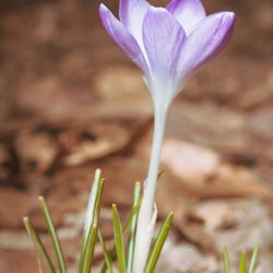
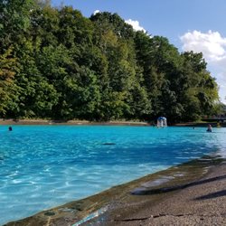
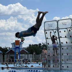
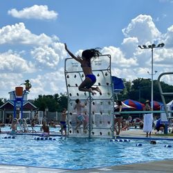
Washington Park Photos


More like Washington Park
Recommended Reviews - Washington Park
Start your review...

11 months ago


2 years ago
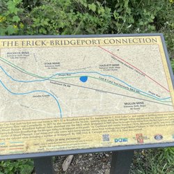
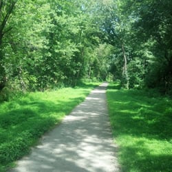
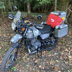
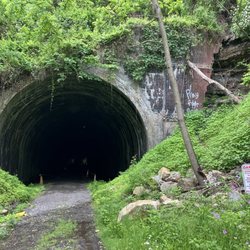
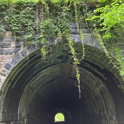
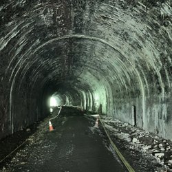
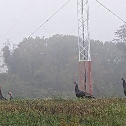
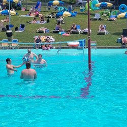
This is a small park in downtown Washington with a few baseball fields, playgrounds, pavilions, a pool and a few old historic buildings. There's a nice wooded/ paved loop running through out the park it's self. It's pretty easy to find and fun to venture off the path to bike on some hidden features. The whole loop it's self is around 5 miles or so. There is not a lot of trail markings but there's signs saying no motor vehicles on trail. By the pool there is a small mountain bike trail with a few rock gardens and root systems as well as a hand built bridge over the creek. There's a few hill climbs as well as two really awesome historic buildings that you run into. The park keeps up finely with making sure there's no litter around. There is a few bathrooms that did seem to be in working order. Sadly there's no stations for water fill up so come prepared with hydration. read more


More info about Washington Park
283 Dunn Ave
Washington, PA 15301
Directions
Hours
Outdoor Amenities


Washington Park - hiking - Updated June 2026
Best of Washington
People found Washington Park by searching for…
Parks in Washington, Pennsylvania
Things to Do in Washington, Pennsylvania
Playgrounds in Washington, Pennsylvania
Hiking Trails With Waterfalls in Washington, Pennsylvania
Secret Spots in Washington, Pennsylvania
Running Trails in Washington, Pennsylvania
Scenic Views in Washington, Pennsylvania
Playgrounds for Kids in Washington, Pennsylvania
Parks for Kids in Washington, Pennsylvania
Fun Things to Do at Night in Washington, Pennsylvania
Off Road Trails in Washington, Pennsylvania
Electric Bikes in Washington, Pennsylvania
Walking Trails in Washington, Pennsylvania
Secluded Spots in Washington, Pennsylvania
Dog Friendly Trails in Washington, Pennsylvania
Fun Things in Washington, Pennsylvania
Dog Walking Areas in Washington, Pennsylvania
Off Leash Dog Hikes in Washington, Pennsylvania
Hiking With Kids in Washington, Pennsylvania
River Swimming in Washington, Pennsylvania
Open Fields Trails in Washington, Pennsylvania
Places to Take Pictures for Prom in Washington, Pennsylvania
Trending Searches in Washington, PA
Black Owned Nail Salons near Washington Park
Boat Rental near Washington Park
Cliff Jumping near Washington Park
Day Trips near Washington Park
Dog Friendly Trails near Washington Park
Fireworks near Washington Park
Fishing Spots near Washington Park
Jet Ski Rental near Washington Park
Kayak Rental near Washington Park
Lakes & Ponds near Washington Park
Mountain Biking near Washington Park
Outdoor Activities near Washington Park
Picnic Areas near Washington Park
Public Pools near Washington Park
Public Shower near Washington Park
River Swimming near Washington Park
Rock Quarry near Washington Park
Scenic Night View near Washington Park
Scenic Overlook near Washington Park
Secluded Spots near Washington Park
Soccer Store near Washington Park
Splash Pad near Washington Park
Star Gazing near Washington Park
Strawberry Picking near Washington Park
Sunrise View near Washington Park
Swimming Holes near Washington Park
Swimming Lakes near Washington Park
Watch Sunset near Washington Park
Browse Articles
Browse Nearby
BEST of Washington, Pennsylvania Restaurants near Washington Park
BEST of Washington, Pennsylvania Coffee near Washington Park
BEST of Washington, Pennsylvania Parks near Washington Park
BEST of Washington, Pennsylvania Things to Do near Washington Park
BEST of Washington, Pennsylvania Walking Trails near Washington Park
BEST of Washington, Pennsylvania Campgrounds near Washington Park
BEST of Washington, Pennsylvania Breakfast near Washington Park
BEST of Washington, Pennsylvania Day Trips near Washington Park
BEST of Washington, Pennsylvania Lodging near Washington Park
Browse Brands
Related Searches in Washington, PA
Affordable Bike Repair Services in Washington, Pennsylvania
Affordable Bike Tune Up Services in Washington, Pennsylvania
Affordable Kayak Rental Services in Washington, Pennsylvania
Affordable Tandem Bike Rental in Washington, Pennsylvania
Best Dirt Bike Riding Spots in Washington, Pennsylvania
Best Dog Hiking Trails Around Washington, Pennsylvania
Best Fishing Locations and Guides in Washington, Pennsylvania
Best Places for Horseback Riding in Washington, Pennsylvania
Best Sledding Spots and Fun in Washington, Pennsylvania
Best Used Bikes for Sale Near Washington, Pennsylvania
Check Out Off Road Trails in Washington, Pennsylvania
Discover Dog Friendly Trails to Explore in Washington, Pennsylvania
Discover Popular Bike Tours in Washington, Pennsylvania
Discover Popular Bike Trails in Washington, Pennsylvania
Discover Scenic Mountain Bike Trails Near Washington, Pennsylvania
Discover a Hiking Trail in Washington, Pennsylvania
Discover the Best Night Hike Trails in Washington, Pennsylvania
Discover the Best Running Track in Washington, Pennsylvania
Dog-Friendly Hikes With Dogs in Washington, Pennsylvania
Enjoy Camping Adventures Around Washington, Pennsylvania
Enjoy Exciting Mountain Biking Adventures in Washington, Pennsylvania
Enjoy Hiking Adventures in Washington, Pennsylvania
Enjoy Kayaking Adventures in Washington, Pennsylvania
Enjoy River Tubing Adventures in Washington, Pennsylvania
Enjoy Scenic Night View Experiences in Washington, Pennsylvania
Enjoy Tent Camping Spots Around Washington, Pennsylvania
Enjoy the Best Tubing Experiences in Washington, Pennsylvania
Enjoy the Best Walking Trails in Washington, Pennsylvania
Exciting Cliff Jumping Spots in Washington, Pennsylvania
Experience Thrilling White Water Rafting in Washington, Pennsylvania
Explore BMX Bike Shops Near Washington, Pennsylvania
Explore Beautiful Parks and Green Spaces in Washington, Pennsylvania
Explore Bike Rentals Throughout Washington, Pennsylvania
Explore Easy Hikes Perfect for All in Washington, Pennsylvania
Explore Electric Bikes Available in Washington, Pennsylvania
Explore Fun Activities to Do in Washington, Pennsylvania
Explore Nature Spots Around Washington, Pennsylvania
Explore Popular Campgrounds Near Washington, Pennsylvania
Explore Popular Scenic Overlook Points in Washington, Pennsylvania
Explore Scenic Lakes to Visit in Washington, Pennsylvania
Explore Secret Spots Worth Visiting in Washington, Pennsylvania
Explore the Best Beach Spots in Washington, Pennsylvania
Explore the Best Boating Spots in Washington, Pennsylvania
Explore the Best Swimming Holes Around Washington, Pennsylvania
Family Friendly Hiking With Kids in Washington, Pennsylvania
Find Beautiful Views in Washington, Pennsylvania
Find Cheap Bike Rentals Around Washington, Pennsylvania
Find Cozy Camping Cabins in Washington, Pennsylvania
Find Fun Kids Activities Outdoor in Washington, Pennsylvania
Find Parks and Recreation Activities in Washington, Pennsylvania