Cancel

Open app

Search

Coal and Coke Trail

4.5 (2 reviews)

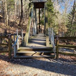
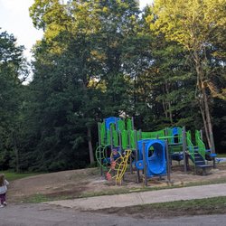
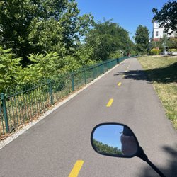
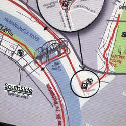
Coal and Coke Trail Hiking Photos

Recommended Reviews - Coal and Coke Trail

Your trust is our priority, so businesses can't pay to alter or remove their reviews. Learn more about reviews.
Yelp app icon
Browse more easily on the app
Review Feed Illustration
Photo of Susan D.
202
828
14

13 years ago

Helpful 2
Thanks 1
Love this 3
Oh no 0

5 years ago

Great place to walk. You can choose to challenge yourself or take it easy. Got lots of great pics as well

Helpful 0
Thanks 0
Love this 0
Oh no 0

Verify this business for free

People searched for Hiking 262 times last month within 15 miles of this business.

Verify this business

Dead Man's Hollow - The first early signs of Spring!  It looks like it will be a good one.  Beautiful crocus flower near the catfish pond area.

Dead Man's Hollow

4.1(9 reviews)
21.2 mi

This lovely conservation area is 450 acres of beautiful forest with lots to see and a very shadowy…read morepast. The ruins of an old pipe factory are very visible and there are informative signs that tell the story. These occurrences took place in the 1800's. There is history of criminals murdered, accidental death(pipe factory), a hanging, an explosion, a drowning, a giant snake sighting, all taking place in the park. For this reason many people think that the sight is haunted by the people who met their fate here. I hate to burst the excitement, but I have never experienced ghosts, or any other paranormal activity while spending time there. In fact, despite it's dark past Dead Man's Hollow is a very tranquil place. If you have been there during May when Spring season really kicks off you will see tons of wildflowers that are spectacular. The pipe factory had a fire and the ground was burned. This happens to be very good for re-growth and as a result we get to experience a lot of beautiful flora. Also, the old pipe factory remains are covered with cool graffiti. The trails are at times narrow, but they are very clean. You are at some point going to climb up and down hills, so it is a very good workout. I would say that the hiking is a bit more challenging. To find it I would suggest searching via a trailhead name and not just the park name. One example would be "cat fish pond trail." There is a nice parking area near that trailhead. There is also another parking area on the other side of the park(more on that later). This other side is closer to the ruins.

We checked out the catfish pond today. It looked promising at first but soon discovered that there…read moreis very little accessibility to fish there. The spots that are open are at an incline sloped towards the pond and are very slippery and hazardous. I do not recommend taking young kids there. My daughter and I fished for an hour or so and only saw bluegill in the 3-4" range and smaller minnows. We used lures and worms and had many bites but the fish were too small to get hooked. We did see many water turtles and even a few babies whose shell was about 2-3" in diameter. We also saw one large snapping turtle appear for a few seconds. There are also a bunch of bullfrog minnows whose bodies were the size of golf balls (early June). It's a cool place to see but we won't be returning to fish.

Photos
Dead Man's Hollow - Beautiful crocus flowers near the catfish pond area.

Beautiful crocus flowers near the catfish pond area.

Dead Man's Hollow - The "cloth of gold" crocus flower.

The "cloth of gold" crocus flower.

Dead Man's Hollow - Just two dudes hiking the trail.

See all

Just two dudes hiking the trail.

Laurel Hill State Park - You can see wood frogs here during the Spring season.

Laurel Hill State Park

4.6(14 reviews)
18.9 mi

As if there wasn't enough parks in the Laurel Highlands, there is Laurel Hill State Park a 3,935…read moreacre natural area of beautiful forest, overlooks, ponds and streams. My recent visit was promising at first, but the rain just kept coming all day long and it "dampened" my spirits completely. I stopped by the main office and got directions to the Jones Mill Dam. Since it was raining so much I gave it some time to clear up, but to no avail. This park is certainly worth checking out and it will be super beautiful later on in the Spring. The wood frogs, spring peepers and other animals will be active. On the same road that this park lies on is two other parks: Kooser State Park and Laurel Ridge State Park, so it is possible to hit those up while in the area. I will certainly make the trip out here later on towards May.

I was staying at Hidden Valley recently and I was looking for a cool place to hike in the area that…read moreI hadn't been to before and I happen to discover this gem. What a great spot for a hike, but an even better place for a swim, relaxing, a picnic on the grass or some sun on the sand by the water. So after we arrived we hit the trail that ran along the water while taking in the small but beautiful lake. We then proceeded to head into the woods. It was a great little hike and the trails were very easy. After we were done hiking we got the huge blanket and the cooler with snacks and drinks in it out of the car and headed over to a shaded spot under the trees. We sat in the grass area in the left corner of the parking lot and listened to music, ate, drank and enjoyed each other's company for a good while. Then after that we packed up our stuff in the car and headed down to the water and enjoyed the lake which is very clean and refreshing and the scenery is absolutely beautiful. I love that they have sand and everyone looked so happy. They also have an area where you can purchase food and beverages but they also have many other great amenities which I am sure can be discovered on here or on their website. I am so glad I discovered this place. I will most definitely be stopping by again when I am in the area. Enjoy :)

Photos
Laurel Hill State Park - A wood frog in their vernal pool near the stream.

A wood frog in their vernal pool near the stream.

Laurel Hill State Park

See all

Montour Trail Council - Chartiers Creek Bridge

Montour Trail Council

4.8(8 reviews)
28.6 mi

Although this trail is pretty, and well-kept, I prefer the Yough Trail. If this one had been closer…read moreto where I lived, I might have been here more frequently. Take your pick, but do try them both!! Whitney B. is right on - this trail is a real asset. Crushed limestone surface is great for running, but it's long enough for a serious bike ride. As always, don't forget to pass on the left and hail when passing!

Running, biking, skating, strolling, walking, frolicking, sprinting, slacking - all things that can…read morebe done on the Montour Trail. As Miriam W. mentioned, Arrowhead Trail is a subsection of Montour Trail and that's the area I most frequently use as well. In the spring, summer, fall, and the mild winter months it's such a great place to get outside and get in some exercise. Depending on the season and time of day you decide to go, it can get fairly crowded. But it doesn't bother me too much b/c most people are courteous of others and give you your space. But if you are fortunate enough to find a time of day when it's not so crowded, it's a great place to go and be quiet with your own thoughts in the outdoors. I have seen some squirrels, deers, and wild turkeys roaming about. Kinda freaks me out when I'm by myself - not the squirrels so much as the deers and wild turkeys. I think they are so used to seeing humans they don't scare off very easily.

Photos
Montour Trail Council
Montour Trail Council - Chilly morning on the trail

Chilly morning on the trail

Montour Trail Council - Beautiful  Forsythis blooming! Birdhouse in background  (right).

See all

Beautiful Forsythis blooming! Birdhouse in background (right).

Great Allegheny Passage - Waterfront

Great Allegheny Passage

5.0(5 reviews)
21.8 mi

I can't believe I haven't reviewed the Great Allegheny Passage Rail Trail until now. It is such a…read morejewel and where I spend a lot of my free time riding my bicycle, especially during this crazy time we're in at the moment with COVID-19. (Note that it is not just for bicycles; walkers and runners also utilize the trail, just not motorized vehicles, so you don't have to compete with cars.) I won't go into all the details of the trail; that is interesting in itself regarding its history, how long it's taken to get the land for the different sections, its steepness grade or lack thereof, all the different towns it goes through, etc. For all of that, I'll give you the very useful link:https://gaptrail.org/ What I will do is give you some highlights and what makes it a jewel to me. It is 150 miles of mostly packed crushed limestone (with a bit of it paved between Pittsburgh and McKeesport) from the Pittsburgh Point Fountain (there's a marker on the ground near it) to Cumberland, MD. Most of it is on what used to be railroad beds and a bit of it is on streets (near downtown Pittsburgh and some in McKeesport). Because of the railroad bed usage, the path follows that grade (meaning gradual steepness with the sharpest elevation gain/loss being between the Eastern Continental Divide and Cumberland). What all the preceding paragraph means is that it is a quite doable trail and comfortable to ride. The packed gravel means it is pretty close to riding on a road surface because it is so packed. The only time that is not true is usually after a downpour when there might be parts of it that retain water. The grade following the grade of the railroads means the gradual incline (if you're going from Pittsburgh to Cumberland) is pretty gradual and a steady 10mph is doable. From the Continental Divide to Cumberland is downhill and is quite easy; coming back is a bit more strenuous -- see the afore-mentioned link to see mileage and grade of that section. I remember when I first heard about the trail; I had no concept of a rail trail to begin with so did not know what to expect in the least. If you're in the same boat, I will say that the trail is open from sun-up to sun-down, there are no street lights lighting the path on purpose though where it travels in spots may have lights for other purposes. It is mostly wide enough for say three bikes across, but don't do that! There is trail etiquette; learn it for everyone's safety and enjoyment -- stay to the right, single file and if you are riding 2 across for any reason, then pay close attention to passers; you'll need to be sure to listen to "on your left' or a bell or some audible signal that someone needs to pass you. On the converse side, if you're passing, pass on the left and issue an audible signal, etc. Just share the trail! Also, some parts of the trail are shaded by trees lining the trail; other parts are in the sun for extended periods so wear sunscreen. There are amenities all along the trail. That was important for me as a first-timer to know because I couldn't grasp at first if it was secluded, wilderness, or what. The GAP trail has so many towns, ballfields, restaurants, ice cream stands, portable restrooms every so many miles and parking trailheads plus a number of other cyclists on the trail that you won't feel that isolated and except for a couple spots (downtown Pittsburgh or Ohiopyle for example) you won't feel the trail is too crowded, either. Take water, snacks, an extra tube and you'll find you'll have what you need. Do you need certain size tires (mountain bike/hybrid/road bike)? Some people debate that. I have a hybrid bike and am happy enough. Favorite parts of the trail for me? I love the section between Myersdale, PA and Frostburg, MD. In that section is the Mason-Dixon line and the Eastern Continental Divide. I also love riding between Homestead and downtown Pittsburgh. Along that route is the Hays Eagle nest. And being downtown Pittsburgh on my bike is so much easier than navigating and parking a car. And when you want to go further on your adventure than Cumberland, MD? It hooks up directly with the C & O Tow Path for another 184.5 miles to get you all the way to Washington, D.C. for a total of 334.5 miles. Many of us have taken several days in one stretch to ride the entire length between Pittsburgh and D.C. and it is quite the trip, and well worthwhile, as are many of the many sections of the GAP trail. It has such unique personalities with wildlife (there are deer, owls, groundhogs, rabbits just to name a few) and so many wildflowers along the way. You're following rivers along the route, as well, plus get to take advantage of PA's lovely state park, Ohiopyle. There are several campsites, hotels, and bed and breakfasts along the way, too. I could go on and on but I recommend talking to others who have ridden the trail, look up Facebook webpages related to the GAP, get a trail book and google for more info.

We are so fortunate to have this trail run right into downtown Pittsburgh. Today I rode from…read moredowntown to Homestead and back. 13 miles and, boy is my butt sore! Someday I hope to ride all the way to DC. They'll probably have to bring me home in a giant butt sling, but I don't care! Riding along the river is so beautiful on a warm fall day. Whether you go five miles or five hundred, don't miss an opportunity to bike, walk, or skate along this treasured trail.

Photos
Great Allegheny Passage
Great Allegheny Passage - Crossing the Hot Metal Bridge to get from Downtown to the Great Allegheny Passage Trail.

See all

Crossing the Hot Metal Bridge to get from Downtown to the Great Allegheny Passage Trail.

Coal and Coke Trail - hiking - Updated May 2026

Loading...
Loading...
Loading...