Walhalla State Fish Hatchery Photos


More like Walhalla State Fish Hatchery
Recommended Reviews - Walhalla State Fish Hatchery
Start your review...

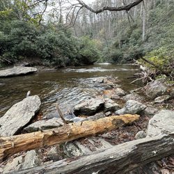
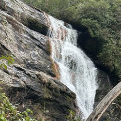
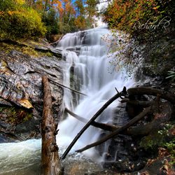
The fish hatchery offers self gu8ded tours all day long and closes at 4 on daily. The drive to it is absolutely stunning, a picturesque road that turns into fish hatchery drive which is narrow and full of hair pin turns. Take it at the speed limit that they say, especially if it's unfamiliar terrain. Next door to the hatchery, sharing a parking lot is a picnic area and hiking path. The picnic area is really over grown, there are signs that wood has recently been cut, but the grass is high and covering the grills making them useless. Some of the tables too, are beyond useable. There is one covered structure that seems in good repair, but the path up to it is over grown az well. read more


More info about Walhalla State Fish Hatchery
198 Fish Hatchery Rd
Mountain Rest, SC 29664
Directions
(864) 638-2866
Call Now
Hours
Outdoor Amenities
Other Amenities


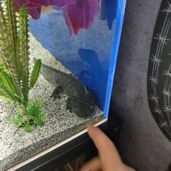


Walhalla State Fish Hatchery - aquariums - Updated July 2026
Best of Mountain Rest
People found Walhalla State Fish Hatchery by searching for…
Fishing in Mountain Rest, South Carolina
Zoos in Mountain Rest, South Carolina
Tours in Mountain Rest, South Carolina
Picnic Areas in Mountain Rest, South Carolina
Walking Trails in Mountain Rest, South Carolina
Fun Things to Do With Kids in Mountain Rest, South Carolina
Field Trips in Mountain Rest, South Carolina
Parks for Picnics in Mountain Rest, South Carolina
Arts & Entertainment in Mountain Rest, South Carolina
Running Trails in Mountain Rest, South Carolina
Scenic Views in Mountain Rest, South Carolina
Historical Sites in Mountain Rest, South Carolina
Kids Birthday Places in Mountain Rest, South Carolina
Picnic Spots in Mountain Rest, South Carolina
Aquarium Museum in Mountain Rest, South Carolina
Attractions in Mountain Rest, South Carolina
Historical Tours in Mountain Rest, South Carolina
Things to Do in Mountain Rest, South Carolina
Photo Spots in Mountain Rest, South Carolina
Off Leash Dog Hikes in Mountain Rest, South Carolina
Indoor Attractions in Mountain Rest, South Carolina
Hiking Trails in Mountain Rest, South Carolina
Browse Brands
Browse Articles
People who viewed Walhalla State Fish Hatchery also viewed
Pisgah Center for Wildlife Education
1 review
The Pines Recreation Area
2 reviews
Fairfield Lake
5 reviews
Little Tennesee River Greenway
2 reviews
Upper Whitewater Falls
27 reviews
Silvermont Park & Mansion
3 reviews
Sliding Rock
7 reviews
Turtleback Falls
4 reviews
Whiteside Mountain Trail
22 reviews
Glen Falls Trail
17 reviews