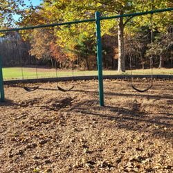
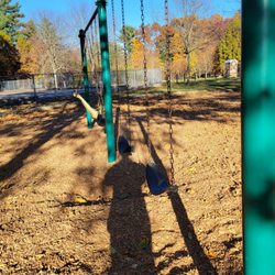
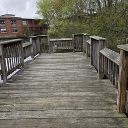
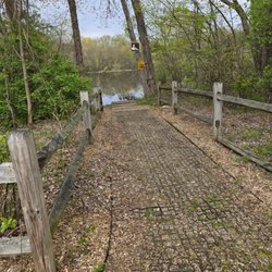
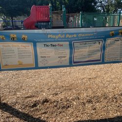
Trestle Park Photos


You might also consider
More like Trestle Park
Recommended Reviews - Trestle Park
Start your review...

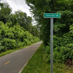
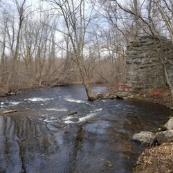
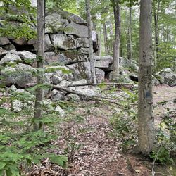
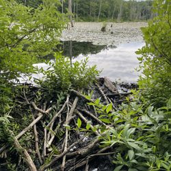
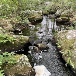
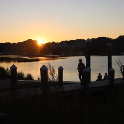
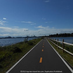
Literally so much but such an amazing site to see. This spot is right off the side of the road, and probably only has enough spots for 3 cars tops and I'm not lying. You park and there's a bench you can sit and look at the water. There's not many places to walk around but could make for some nice pictures. Above this though is a trail, a walking or bike trail for sure check that out, I've never been on it but I always hear people going over this park. This is a quiet place to just meditate really briefly and then leave, or listen to birds and go about your day. You'll probably miss it, they don't have big signs. But I would check it out if I were you. read more


More info about Trestle Park
511 RI-117
Coventry, RI 02816
Directions
Hours
Outdoor Amenities
You might also consider


Why does Yelp recommend reviews?
1 review that is not currently recommended
The reviews below are not factored into the business's overall star rating.
2 years ago
Trestle Park - parks - Updated June 2026
Best of Coventry
People found Trestle Park by searching for…
Things to Do in Coventry, Rhode Island
Water Parks in Coventry, Rhode Island
Places to Take Pictures in Coventry, Rhode Island
Walking Trails in Coventry, Rhode Island
Secluded Spots in Coventry, Rhode Island
Bird Sanctuary in Coventry, Rhode Island
Photo Spots in Coventry, Rhode Island
Picnic Areas in Coventry, Rhode Island
Bike Paths in Coventry, Rhode Island
Hiking Trails in Coventry, Rhode Island
Off Road Trails in Coventry, Rhode Island
Running Trails in Coventry, Rhode Island
Trail in Coventry, Rhode Island
Running Tracks Open to the Public in Coventry, Rhode Island
Waterfalls in Coventry, Rhode Island
Fishing Spots in Coventry, Rhode Island
View Points in Coventry, Rhode Island
Must See in Coventry, Rhode Island
Easy Hikes in Coventry, Rhode Island
Jogging Trails in Coventry, Rhode Island
Places to Swim in Coventry, Rhode Island
Playgrounds in Coventry, Rhode Island
Trending Searches in Coventry, RI
Amusement Parks near Trestle Park
Baseball Fields near Trestle Park
Black Owned Nail Salons near Trestle Park
Cliff Jumping near Trestle Park
Dog Friendly Beaches near Trestle Park
Fishing Spots near Trestle Park
Free Kids Activities near Trestle Park
Free Things To Do With Kids near Trestle Park
Jet Ski Rental near Trestle Park
Kids Activities Outdoor near Trestle Park
Outdoor Basketball Courts near Trestle Park
Parks With Pull Up Bars near Trestle Park
Pick Your Own Farms near Trestle Park
Public Beaches near Trestle Park
Soccer Store near Trestle Park
Strawberry Picking near Trestle Park
Swimming Holes near Trestle Park
Swimming Lakes near Trestle Park
Swimming Pools near Trestle Park
Browse Articles
Browse Nearby
Browse Brands
Related Searches in Coventry, RI
Best Off Leash Dog Parks in Coventry, Rhode Island
Best Parks for Parties and Events in Coventry, Rhode Island
Best Places for Stunning Views in Coventry, Rhode Island
Best Water Parks for Kids in Coventry, Rhode Island
Check Out Great Playgrounds in Coventry, Rhode Island
Discover Baseball Fields Around Coventry, Rhode Island
Discover Fun Toddler Parks in Coventry, Rhode Island for Your Little One
Discover Lakes & Ponds to Explore in Coventry, Rhode Island
Discover Popular Photo Spots in Coventry, Rhode Island
Discover Public Beaches to Visit in Coventry, Rhode Island
Discover Scenic Bike Paths in Coventry, Rhode Island
Discover Soccer Fields in Coventry, Rhode Island Near You
Discover Top Nature Parks to Visit in Coventry, Rhode Island
Discover the Best Beaches in Coventry, Rhode Island
Discover the Best Kids Park Spots in Coventry, Rhode Island
Enjoy the Best Picnic Spots and Ideas in Coventry, Rhode Island
Enjoy the Best Walking Trails in Coventry, Rhode Island
Explore Easy Hikes Perfect for All in Coventry, Rhode Island
Explore Family-Friendly Zoos and Wildlife in Coventry, Rhode Island
Explore Free Picnic Areas Around Coventry, Rhode Island
Explore Fun Activities to Do in Coventry, Rhode Island
Explore Parks With Pull Up Bars in Coventry, Rhode Island
Explore Popular Campgrounds Near Coventry, Rhode Island
Explore Popular Picnic Areas Around Coventry, Rhode Island
Explore Popular RV Parks Around Coventry, Rhode Island
Explore Popular Scenic Views Near Coventry, Rhode Island
Explore Scenic Lakes to Visit in Coventry, Rhode Island
Explore Top Dog Parks in Coventry, Rhode Island Near You
Explore Top Water Parks in Coventry, Rhode Island Today
Find Parks and Recreation Activities in Coventry, Rhode Island
Find Picnic Tables for Outdoor Fun in Coventry, Rhode Island
Find Public Tennis Courts in Coventry, Rhode Island
Find Top Dog Friendly Parks to Visit in Coventry, Rhode Island
Find Top Skate Parks in Coventry, Rhode Island for All Skill Levels
Find a Park With BBQ Pits in Coventry, Rhode Island
Find the Best Parks BBQ Grills in Coventry, Rhode Island
Find the Best Parks for Picnics in Coventry, Rhode Island
Have Fun at a Splash Pad in Coventry, Rhode Island
Locate Tennis Courts Around Coventry, Rhode Island
Parks With Basketball Courts for Games in Coventry, Rhode Island
Picnic Areas With BBQ Pits Available in Coventry, Rhode Island
Play at a Splash Pad Park in Coventry, Rhode Island
Popular Fishing Spots to Explore in Coventry, Rhode Island
Popular Places to Take Pictures in Coventry, Rhode Island
Top Hiking Trails to Explore in Coventry, Rhode Island
Top Running Trails to Explore in Coventry, Rhode Island
Top Swimming Lakes to Enjoy in Coventry, Rhode Island
Top-Rated Hikes in Coventry, Rhode Island to Explore