Stevenson Creek Falls Photos


You might also consider

More like Stevenson Creek Falls
Recommended Reviews - Stevenson Creek Falls
Start your review...



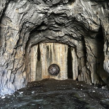
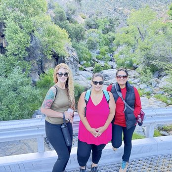
Prep for the trip: Plan for plenty of water to take with you! Wear good shoes. Plan something for using the restroom, we took wet wipes and bags. We planned small healthy snacks. We planned to leave early in the day knowing there was not a lot of shade. We used GPS and advised everyone to leave GPS open because cell service goes out up there, if you leave it open you can follow the road backwards. Take sunscreen and water. Roads are paved. GPS takes you directly to the large metal gate that was closed and locked. Find parking along the road. LEAVE GPS OPEN. There is a large beige colored metal gate. This is the beginning of the trail. Cave: About one mile in there is a cave on the right hand side. Yesterday (June 21,2025) there was a front loader on the right side and then two large piles of white rock and that's where the cave entrance was. This gave us a nice cool break and a spot to take beautiful pictures. Walk to the falls: paved the entire way. There is a cattle grate in the beginning and at the falls. The one at the falls is damaged near the middle and is a tripping hazard. The trail is slightly uphill and downhill. The falls are located directly on the path. At the Falls: there isn't a safe area to swim. The falls consist of a bridge in the middle with steep drop offs on both sides. The side past the falls has a rocky area that makes for a nice backdrop for pictures and to sit have a snack and rest your feet. 2nd cave. Just on the other side of the bridge from the fall is a second smaller cave. Walk back to gate: same uphill downhill path that is paved. Things to note.. no restrooms, no utilities, mostly no shade, start early bring water and snacks. I recommend arriving early and having sunscreen. This was my first official hike. I do have lots of medical issues. I kept a slow and steady pace and was able to complete the course. read more


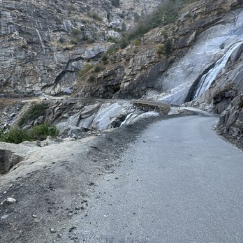

This was an experience. You have to walk 7 miles. 3.50 going up and 3.5 coming back. Plan accordingly. Don't forget your water and some healthy snacks. There is no shade it's mainly walking on cement the whole time up and down. Try to be early as it gets hot because the sun is on you the whole trip. If you are looking for some tan and exercise this is the place for you. The waterfall is beautiful!! Once you are there in front of it you forget the walk you just did. Also to get to the point that you need to start walking you have to drive an hour from Fresno. There are single roads so be aware of Other cars coming your way. Be very careful. Would I go back again maybe if I go in March and at earliest time of the day. We didn't take enough water and we were Dying lol! Please don't make the same mistake. There is a little man made cave in the side of the waterfall. You can stay there covering your self from the sun and refresh a little. We made it!! So proud of myself. read more


More info about Stevenson Creek Falls
North Fork, CA 93643
Directions
Hours
Outdoor Amenities