Manzanita Lake Photos


You might also consider
More like Manzanita Lake
Recommended Reviews - Manzanita Lake
Start your review...

3 years ago
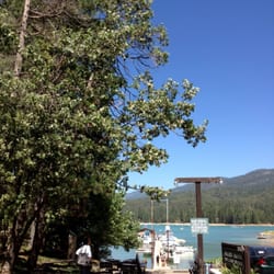
Nice lil lake in the town of north fork. A nice lake perfect for families w small children. It's not too deep as long as you keep an eye on your littles. Having your kids use a life jacket is a good idea, just in case, it can get deep for non swimmers. Small canoes or floating gear a good idea for fun. Several picnic tables. We visited early August. Only One bathroom. It's much smaller than Bass Lake which is just north and a short drive from manzanita. Bring your own bbq or use the ones available if they are clean. read more


2 years ago
3 years ago
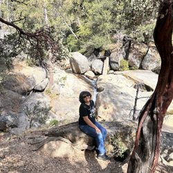
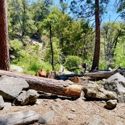
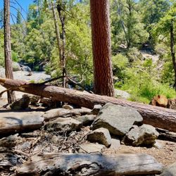
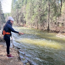
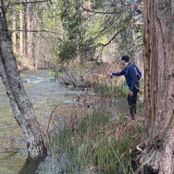
Cute little lake that's more like a pond , however it's in a very peaceful and quiet setting. There's a little trail that takes you to the dam and the water was a runoff today. A couple of people were fishing and they had quite a few catch of trouts. Nice clean picnic tables , trash cans are located by each picnic area which is convenient. BBQ pits in the area also. Surprisingly the pit toilet was pretty clean for being out in the nature. Geese and ducks were having fun in the sun. It's a good place for anyone who is looking for a peace and quiet. Doesn't get crowded like the neighboring lake, Bass Lake. On the way here we saw a young buck and the do crossing the street. Neat sighting. read more

More info about Manzanita Lake
North Fork, CA 93643
Directions
Hours
Outdoor Amenities


Manzanita Lake - lakes - Updated May 2026
Best of North Fork
People found Manzanita Lake by searching for…
Things to Do in North Fork, CA
Fishing Spots in North Fork, CA
Swimming Holes in North Fork, CA
Trout Fishing in North Fork, CA
Picnic Areas in North Fork, CA
Fishing Ponds in North Fork, CA
Picnic Areas BBQ Pits in North Fork, CA
Swimming Lakes in North Fork, CA
Picnic Spots in North Fork, CA
Hiking Trails in North Fork, CA
Lakes & Ponds in North Fork, CA
Fishing Lake in North Fork, CA
Natural Hot Springs in North Fork, CA
Scenic Drive in North Fork, CA
Kid Friendly Hiking Trails in North Fork, CA
Dog Swimming in North Fork, CA
Canoe Rental in North Fork, CA
Fun Things to Do With Kids in North Fork, CA
Browse Nearby
BEST of North Fork, California Swimming Holes near Manzanita Lake
BEST of North Fork, California Campgrounds near Manzanita Lake
BEST of North Fork, California Parks near Manzanita Lake
BEST of North Fork, California Restaurants near Manzanita Lake
BEST of North Fork, California Coffee near Manzanita Lake
BEST of North Fork, California Things to Do near Manzanita Lake
BEST of North Fork, California Sledding near Manzanita Lake
BEST of North Fork, California Natural Hot Springs near Manzanita Lake
BEST of North Fork, California Breakfast near Manzanita Lake