Skyline Ridge Preserve Photos


You might also consider


More like Skyline Ridge Preserve
Recommended Reviews - Skyline Ridge Preserve
Start your review...


Reviews With Photos


For the past year, I've been wanting to find female friends to do outdoor activities with. So I was excited to go hiking with 2 co-workers on a Sat in Sep. (coincidence to be Chinese Mid Autumn Fest). The weather forecasted 20% rain, so I calculated that as 80% probability of no rain. But my math was wrong, it rained. But the good news was that we had the entire area to ourselves, we did not see anyone else crazy enough to hike in the mist, drizzle, rain. We arrived at the empty free parking lot at 10am. It took us 45 min to walk 2 loops of Horseshoe Lake loop, ~3 miles. It was a good time to chill with friends, share snacks, get our hiking shoes muddy, and enjoy the fresh air in the beautiful outdoors.


I love hiking at Skyline Ridge Open Space Preserve. The park is located about 20-25 minutes from Saratoga up several winding roads. The trails are pretty moderate. The park has two lakes- Alpine Pond and Horseshoe Lake. Horseshoe Lake is pretty close to the main parking lot off Highway 35, while Alpine Lake is a few miles into the park. The park also has some nice overlooks off the Ipiwa Trail, which starts at the parks main trailhead. The park has a variety of both sunny and covered sections. Skyline Ridge also connects to two more parks- Long Ridge and Russian Ridge OSP for those looking for an extra long trail run or hike. The main parking lot is located off Highway 35 (Skyline Blvd). This parking lot has plenty of parking and bathrooms. If you come early enough, there should be no problems finding parking. Happy trails!


Beware - very windy road to get to. I get car sick so I made sure to eat before driving. Lots of cyclists on the windy roads so be careful. I got there at noon on Sunday and got the last available parking spot. Clearly marked trails. The Horseshoe Lake and Alpine Lake were ok. Very muddy. A few ducks. Lots of groups of kids and no masks. Bring a warm parka! I never get cold and I was shivering.


Last hike park 4/4 - we did Russian Ridge, Coal Creek, Monte Bello, and last Skyline Ridge. This park is nice because it's got a view of the Horseshoe Lake - it was blue is all I remember, I didn't take a pic then when I asked my friend he said we weren't going there or seeing it again I was so bummed. So if you see something nice just take the damn picture!!! There was a nice overlook that I took pictures at. They have a nice Nature Center that inside the volunteer told me about the live garter snake inside the tank. I was rushing to get there since it was a bit after 4pm, lucky for us it was open until 5pm! It's a seasonal Nature Center so check their website for hrs. Nice pond you can look at right outside their doors. Worth a visit and good for kids. Parking is across the street at Russian Ridge. You walk under a tunnel that's cool!


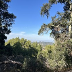
Growing up in northern California has had a big influence on my love and respect for the outdoors. When I lived in Oakland, we would think nothing of driving to Half Moon Bay and Santa Cruz one day and then driving to the foothills of the Sierras the next day -- Tom Hanks The Santa Cruz Mountains are one of the most gorgeous areas of hiking that is also very close to a major population area. I have been to most of the State & County Parks in this area but based on Bradley N's 01-17-13 review of Skyline Ridge, I decided to give this Preserve a chance. Bradley wrote what probably is the definitive review so I will just add that he is right and I will include some photos of the amazing views. There is a small lake and nature center but the "show piece" part of this park is the mile trail after the rattlesnake sign with a spectacular visage out to the Pacific Ocean. Well worth a stop off of Skyline Blvd...see attached photos... Highly Recommended!


I keep having to pass up hike events posted by Yelpers because let's face it, I am out of shape. So, Sunday, after eating a Super Burrito al Pastor (nom nom nom), doing something active seemed much more prudent than watching TV, playing video games, or even -gasp- Yelping. If only those things burned calories! So, I pulled out the easy hikes guide, went to DSW for some hiking shoes, and hit the trail. It was cool, so I didn't worry about the rattlesnakes and I went from Horseshoe lake (probably the easiest hike from the parking lot) and then a steep climb to Russian Ridge, passing another lake, some rabbits, and then up to a hill. It was a wet weekend, and that made the trails from the parking lots very muddy and difficult. Ultra slippery and I almost lost my shoe in it after stopping for some water. SportsTrack of the hike, complete with elevation, my slow pace, pictures, and music playlist: http://sportstracker.nokia.com/nts/workoutdetail/index.do?id=950379 The elevation oscillated from 1900 - 2400ft but for the most part rolling hills so it wasn't difficult once past the mud.


I signed up for a docent led hike through Openspace.org, a great resource for local bay area hikers and totally free. Our docent brought along his grandson who was a mere 12 years old. But this kid sure knew his stuff on plants and local animals. The hike was about the many plants in the area, used for medicine, mostly. At first I was a little concerned that we would not be getting any shade on this path, from the parking lot, located at Russian Ridge Preserve, it seemed fairly dry and not very cool. Luckily we did walk by some cool patches that trees canopied over, mostly oaks. About three fourths in to the hike we ascended some hills and stopped at a good view of the reserve, trees, birds, and more trees were visible from this point. On the way up we spotted a rattle snake, hiding in between two rocks attempting to blend in and cool off. Near the end of the journey we stopped by some benches and had a peaceful lunch while listening to our docents history of the preserve and where it's name originated. We stopped along the nature center and got a great few of the small lake that mirrors the center. This was a very short easy hike, only two miles long, but it was so warm that day that I was red and sweaty anyway.


Skyline Ridge is one of those parks that has played two different roles in my adult life. Firstly as an outdoor destination with the kids (when they were very young). That's because it featured some short loop hikes, and these circled picturesque lakes (with the bonus of fish, bird and frog watching). And it was relatively easy to get to. It's second role started a several years ago, when I started to do much longer hikes through this area. I was amazed at the trails I had missed in this park, and discovered some wonderful spots to linger. As the name suggests, Skyline Ridge covers part of the upper reaches of the Santa Cruz range. But it's not the only one - There are four other parks next door: Russian Ridge OSP, Monte Bello OSP, Los Trancos OSP, and Coal Creek OSP.. In fact it is possible to visit all five parks in one, 9-mile loop hike, as I did recently with a group. (A much longer loop - about 16 mi - could be made if nearby Long Ridge OSP were added to the mix) And since Skyline Ridge is not on most hiking top ten lists, it's not a bad place to start a big loop hike. The main parking lot holds about 30 cars and is almost never full, even on beautiful days. But for avid hikers, there's a catch. There really aren't any good, long loop hikes contained solely within the park. Sure, there are some longer trails that drop down into canyons (Lambert Creek Trail; Old Page Mill Trail) but these terminate at dead-ends. So the only choice is a there-and back hike. Other trails, like the Ipiwa trail, connect the southern section to the northern section of the park, but alternate return trails (e.g. Sunny Jim) are scrappy, eroded, steep or downright ugly. So really, the only options for good, long loop hikes must include other nearby parks. On the plus side, Skyline Ridge is one of the only parks in the Santa Cruz range with lakes - not just one, but two. Alpine Pond is on the northern side of the park and is most easily accessed from the parking lot at Russian Ridge OSP. A short trail circumnavigates the pond and there's an excellent nature center with a dock. Horseshoe Lake is on the southern end of the park and is well-named for it's shape. A hike around this lake involves a bit more climbing, but those above the age of 5 or so should have no problem. And the lake (and views) are a little more impressive. There is one other shining jewel in this park that I discovered only a few years ago - the Gene Sheehan Overlook on the Ipiwa trail has become one of my favorite spots in the Santa Cruz range. It's at a point where the trail circumvents a rocky knob, and the steep drop-off reveals gorgeous views to the southwest. Two miles away (and 1700 ft below) is the secluded, old-growth forest of Peter's Creek. The hills of Pescadero Creek County Park rise beyond that; and further beyond lie the ridges of Butano. On non-foggy days, the ocean is visible through a couple of gaps in the distant peaks. I don't know what it is about this spot. Maybe it's the consistent, updraft breeze from the redwood valleys below; or maybe it's the ever-present hawks circling for their lunch. But I've never spent less than 15 minutes here drinking in the scenery. Here are a few short hike suggestions within Skyline Ridge: -- Horsehoe Lake loop (1.4 mi): From the Skyline main parking lot, follow signs to the Horseshoe Loop trail, which will circle the lake and eventually return you to where you started -- Alpine Pond mini-loop (0.7 mi) From the main parking lot at Russian Ridge OSP, enter Skyline ridge park through the under-road tunnel. Take the loop hike around the pond and visit the nature center on the way -- Lake-to-lake loop (4.3 mi). Starting at Skyline Ridge parking, visit the Horseshoe Lake per the hike above, but shortly after crossing the dam, head steeply uphill on the Sunny Jim Trail until you reach the Ipiwa Trail. Take the Ipiwa trail all the way to end, via beautiful vistas, where you will eventually encounter Alpine Pond and the nature center. Re-trace your steps, but on the return trip take the Ipiwa trail all the way back to parking. Rating this park is tough. Skyline Ridge OSP doesn't really offer enough for those who want to hike for an entire afternoon and see a wide variety of terrain. In that respect, it doesn't hold a candle to the likes of Purisima, Butano or Portola Redwoods. Grading on a "hiking curve" it really only garners an average rating. But some of its offerings are unique among the Skyline Rd. parks, so I'll add one more star. Hiking Spot Checklist: -- Parking: Yes; medium dirt lot that is rarely full; overflow parking also available -- Bathrooms: Pit toilets at main parking; pit toilets at Russian Ridge when visiting Alpine pond -- Potable water provided: Yes, but only at nature center next to Alpine Pond -- Maps provided: Yes -- Highlights: Two lakes; a gorgeous overlook; kid-friendly hikes My Peninsula Hike Collection is here: (https://www.yelp.com/collection/qBI6U6Lz9LJQjnGjFW6ubg)


Michael and I came here on a lovely spring evening when the half-moon was high. Alpine Pond is a magical misty place, full of energy and life... and the hilltop beyond the lake was reminiscent of the legendary Tor at Glastonbury. Ducks and cormorants floated along the rippling dark waters, and a bench at the far side provided views of the mirroring surface. Such an amazing, spirit-connected place...


The official Skyline OSP parking lot is off Skyline Blvd. and it is in the middle between their two main trail lines (Horseshoe Lake and Alpine Pond at opposite ends). The unofficial parking lot is at Russian Ridge OSP Download the trail map here https://www.openspace.org/sites/default/files/map_SR.pdf If you are parking at the Skyline OSP parking lot, you can start with the Horseshoe Lake trail, extend to and through the Fir Knoll Trail and Tree Farm Trail, for about 2 Miles, loop back to the parking lot and start towards Alpine Pond on Ipiwa Trail, loop the Alpine Pond, come back on Sunny Jimmy Trail and cut through Butano View Trail, for about 3 Miles. Overall, great trail, more than half of the trails are shaded, the Butano View Trail offers the best view IMO There is a restroom in the parking lot, no water fountain. There is also a disability parking lot as well

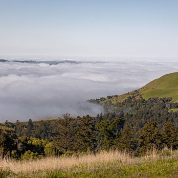
Visited Skyline on a Saturday in July at 9am! Decided to do the Horseshoe lake, Alpine pond, and Borel Hill trail counterclockwise and the parking lot was right by the trailhead. Trail was well-maintained and there were markers throughout. Didn't encounter too many other people. Nice views of the Bay Area - the park is high up so it was cool being above the clouds! Took me about 2 hours and 30 min to finish and I would say the hike was easy-moderate! The roads leading up to the park are a bit windy so just be mindful of that. Would recommend to those looking for beginner friendly hikes! read more


Ridge Over Troubled Water 2,143-acre park located in La Honda, whose landscape is expansive from ridge vistas to lush meadows. The Good: *Free! *David C. Daniels Nature Center *Mountain Biking trails available (see website) *Equestrian Trails available (see website) *Restrooms *Several small loop trails (Alpine Lake & Horseshoe loop) makes this a very kid-frendly place to bring children. *Amazing views The Meh: *No dogs *Nature Center is only open Sat & Sun and hours are seasonal (see website for details). *The drive here ain't no picnic The Ugly: *Parking is limited and can be tough to find during busier times/seasons. Conclusion: Fantastic park with plenty of trails and views. read more




For the past year, I've been wanting to find female friends to do outdoor activities with. So I was excited to go hiking with 2 co-workers on a Sat in Sep. (coincidence to be Chinese Mid Autumn Fest). The weather forecasted 20% rain, so I calculated that as 80% probability of no rain. But my math was wrong, it rained. But the good news was that we had the entire area to ourselves, we did not see anyone else crazy enough to hike in the mist, drizzle, rain. We arrived at the empty free parking lot at 10am. It took us 45 min to walk 2 loops of Horseshoe Lake loop, ~3 miles. It was a good time to chill with friends, share snacks, get our hiking shoes muddy, and enjoy the fresh air in the beautiful outdoors. read more


I love hiking at Skyline Ridge Open Space Preserve. The park is located about 20-25 minutes from Saratoga up several winding roads. The trails are pretty moderate. The park has two lakes- Alpine Pond and Horseshoe Lake. Horseshoe Lake is pretty close to the main parking lot off Highway 35, while Alpine Lake is a few miles into the park. The park also has some nice overlooks off the Ipiwa Trail, which starts at the parks main trailhead. The park has a variety of both sunny and covered sections. Skyline Ridge also connects to two more parks- Long Ridge and Russian Ridge OSP for those looking for an extra long trail run or hike. The main parking lot is located off Highway 35 (Skyline Blvd). This parking lot has plenty of parking and bathrooms. If you come early enough, there should be no problems finding parking. Happy trails! read more

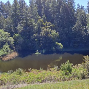


Beware - very windy road to get to. I get car sick so I made sure to eat before driving. Lots of cyclists on the windy roads so be careful. I got there at noon on Sunday and got the last available parking spot. Clearly marked trails. The Horseshoe Lake and Alpine Lake were ok. Very muddy. A few ducks. Lots of groups of kids and no masks. Bring a warm parka! I never get cold and I was shivering. read more


Last hike park 4/4 - we did Russian Ridge, Coal Creek, Monte Bello, and last Skyline Ridge. This park is nice because it's got a view of the Horseshoe Lake - it was blue is all I remember, I didn't take a pic then when I asked my friend he said we weren't going there or seeing it again I was so bummed. So if you see something nice just take the damn picture!!! There was a nice overlook that I took pictures at. They have a nice Nature Center that inside the volunteer told me about the live garter snake inside the tank. I was rushing to get there since it was a bit after 4pm, lucky for us it was open until 5pm! It's a seasonal Nature Center so check their website for hrs. Nice pond you can look at right outside their doors. Worth a visit and good for kids. Parking is across the street at Russian Ridge. You walk under a tunnel that's cool! read more


Growing up in northern California has had a big influence on my love and respect for the outdoors. When I lived in Oakland, we would think nothing of driving to Half Moon Bay and Santa Cruz one day and then driving to the foothills of the Sierras the next day -- Tom Hanks The Santa Cruz Mountains are one of the most gorgeous areas of hiking that is also very close to a major population area. I have been to most of the State & County Parks in this area but based on Bradley N's 01-17-13 review of Skyline Ridge, I decided to give this Preserve a chance. Bradley wrote what probably is the definitive review so I will just add that he is right and I will include some photos of the amazing views. There is a small lake and nature center but the "show piece" part of this park is the mile trail after the rattlesnake sign with a spectacular visage out to the Pacific Ocean. Well worth a stop off of Skyline Blvd...see attached photos... Highly Recommended! read more



6 years ago
Really fun, theres a loop trail called "horseshoe" and that's a short one for views and scenery. The other trails take you deeper into the woods and that's just all you see. Not much after that. read more


I keep having to pass up hike events posted by Yelpers because let's face it, I am out of shape. So, Sunday, after eating a Super Burrito al Pastor (nom nom nom), doing something active seemed much more prudent than watching TV, playing video games, or even -gasp- Yelping. If only those things burned calories! So, I pulled out the easy hikes guide, went to DSW for some hiking shoes, and hit the trail. It was cool, so I didn't worry about the rattlesnakes and I went from Horseshoe lake (probably the easiest hike from the parking lot) and then a steep climb to Russian Ridge, passing another lake, some rabbits, and then up to a hill. It was a wet weekend, and that made the trails from the parking lots very muddy and difficult. Ultra slippery and I almost lost my shoe in it after stopping for some water. SportsTrack of the hike, complete with elevation, my slow pace, pictures, and music playlist: http://sportstracker.nokia.com/nts/workoutdetail/index.do?id=950379 The elevation oscillated from 1900 - 2400ft but for the most part rolling hills so it wasn't difficult once past the mud. read more


16 years ago
I signed up for a docent led hike through Openspace.org, a great resource for local bay area hikers and totally free. Our docent brought along his grandson who was a mere 12 years old. But this kid sure knew his stuff on plants and local animals. The hike was about the many plants in the area, used for medicine, mostly. At first I was a little concerned that we would not be getting any shade on this path, from the parking lot, located at Russian Ridge Preserve, it seemed fairly dry and not very cool. Luckily we did walk by some cool patches that trees canopied over, mostly oaks. About three fourths in to the hike we ascended some hills and stopped at a good view of the reserve, trees, birds, and more trees were visible from this point. On the way up we spotted a rattle snake, hiding in between two rocks attempting to blend in and cool off. Near the end of the journey we stopped by some benches and had a peaceful lunch while listening to our docents history of the preserve and where it's name originated. We stopped along the nature center and got a great few of the small lake that mirrors the center. This was a very short easy hike, only two miles long, but it was so warm that day that I was red and sweaty anyway. read more


Skyline Ridge is one of those parks that has played two different roles in my adult life. Firstly as an outdoor destination with the kids (when they were very young). That's because it featured some short loop hikes, and these circled picturesque lakes (with the bonus of fish, bird and frog watching). And it was relatively easy to get to. It's second role started a several years ago, when I started to do much longer hikes through this area. I was amazed at the trails I had missed in this park, and discovered some wonderful spots to linger. As the name suggests, Skyline Ridge covers part of the upper reaches of the Santa Cruz range. But it's not the only one - There are four other parks next door: Russian Ridge OSP, Monte Bello OSP, Los Trancos OSP, and Coal Creek OSP.. In fact it is possible to visit all five parks in one, 9-mile loop hike, as I did recently with a group. (A much longer loop - about 16 mi - could be made if nearby Long Ridge OSP were added to the mix) And since Skyline Ridge is not on most hiking top ten lists, it's not a bad place to start a big loop hike. The main parking lot holds about 30 cars and is almost never full, even on beautiful days. But for avid hikers, there's a catch. There really aren't any good, long loop hikes contained solely within the park. Sure, there are some longer trails that drop down into canyons (Lambert Creek Trail; Old Page Mill Trail) but these terminate at dead-ends. So the only choice is a there-and back hike. Other trails, like the Ipiwa trail, connect the southern section to the northern section of the park, but alternate return trails (e.g. Sunny Jim) are scrappy, eroded, steep or downright ugly. So really, the only options for good, long loop hikes must include other nearby parks. On the plus side, Skyline Ridge is one of the only parks in the Santa Cruz range with lakes - not just one, but two. Alpine Pond is on the northern side of the park and is most easily accessed from the parking lot at Russian Ridge OSP. A short trail circumnavigates the pond and there's an excellent nature center with a dock. Horseshoe Lake is on the southern end of the park and is well-named for it's shape. A hike around this lake involves a bit more climbing, but those above the age of 5 or so should have no problem. And the lake (and views) are a little more impressive. There is one other shining jewel in this park that I discovered only a few years ago - the Gene Sheehan Overlook on the Ipiwa trail has become one of my favorite spots in the Santa Cruz range. It's at a point where the trail circumvents a rocky knob, and the steep drop-off reveals gorgeous views to the southwest. Two miles away (and 1700 ft below) is the secluded, old-growth forest of Peter's Creek. The hills of Pescadero Creek County Park rise beyond that; and further beyond lie the ridges of Butano. On non-foggy days, the ocean is visible through a couple of gaps in the distant peaks. I don't know what it is about this spot. Maybe it's the consistent, updraft breeze from the redwood valleys below; or maybe it's the ever-present hawks circling for their lunch. But I've never spent less than 15 minutes here drinking in the scenery. Here are a few short hike suggestions within Skyline Ridge: -- Horsehoe Lake loop (1.4 mi): From the Skyline main parking lot, follow signs to the Horseshoe Loop trail, which will circle the lake and eventually return you to where you started -- Alpine Pond mini-loop (0.7 mi) From the main parking lot at Russian Ridge OSP, enter Skyline ridge park through the under-road tunnel. Take the loop hike around the pond and visit the nature center on the way -- Lake-to-lake loop (4.3 mi). Starting at Skyline Ridge parking, visit the Horseshoe Lake per the hike above, but shortly after crossing the dam, head steeply uphill on the Sunny Jim Trail until you reach the Ipiwa Trail. Take the Ipiwa trail all the way to end, via beautiful vistas, where you will eventually encounter Alpine Pond and the nature center. Re-trace your steps, but on the return trip take the Ipiwa trail all the way back to parking. Rating this park is tough. Skyline Ridge OSP doesn't really offer enough for those who want to hike for an entire afternoon and see a wide variety of terrain. In that respect, it doesn't hold a candle to the likes of Purisima, Butano or Portola Redwoods. Grading on a "hiking curve" it really only garners an average rating. But some of its offerings are unique among the Skyline Rd. parks, so I'll add one more star. Hiking Spot Checklist: -- Parking: Yes; medium dirt lot that is rarely full; overflow parking also available -- Bathrooms: Pit toilets at main parking; pit toilets at Russian Ridge when visiting Alpine pond -- Potable water provided: Yes, but only at nature center next to Alpine Pond -- Maps provided: Yes -- Highlights: Two lakes; a gorgeous overlook; kid-friendly hikes My Peninsula Hike Collection is here: (https://www.yelp.com/collection/qBI6U6Lz9LJQjnGjFW6ubg) read more



Michael and I came here on a lovely spring evening when the half-moon was high. Alpine Pond is a magical misty place, full of energy and life... and the hilltop beyond the lake was reminiscent of the legendary Tor at Glastonbury. Ducks and cormorants floated along the rippling dark waters, and a bench at the far side provided views of the mirroring surface. Such an amazing, spirit-connected place... read more


10 years ago
The official Skyline OSP parking lot is off Skyline Blvd. and it is in the middle between their two main trail lines (Horseshoe Lake and Alpine Pond at opposite ends). The unofficial parking lot is at Russian Ridge OSP Download the trail map here https://www.openspace.org/sites/default/files/map_SR.pdf If you are parking at the Skyline OSP parking lot, you can start with the Horseshoe Lake trail, extend to and through the Fir Knoll Trail and Tree Farm Trail, for about 2 Miles, loop back to the parking lot and start towards Alpine Pond on Ipiwa Trail, loop the Alpine Pond, come back on Sunny Jimmy Trail and cut through Butano View Trail, for about 3 Miles. Overall, great trail, more than half of the trails are shaded, the Butano View Trail offers the best view IMO There is a restroom in the parking lot, no water fountain. There is also a disability parking lot as well read more


9 years ago

13 years ago
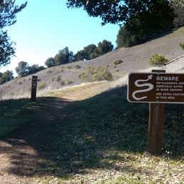
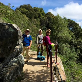
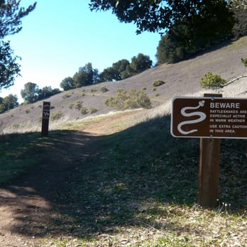
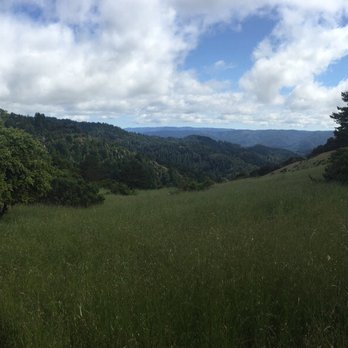
Accessibility is underrated. At least this is generally the case with me, especially when I am hiking in the Santa Cruz Mountains. The more remote, steep, and inaccessible, the better! That's why I didn't visit Skyline Ridge OSP for several years, despite having spent considerable time in its surrounding preserves and parks - Russian Ridge, Monte Bello, Long Ridge, Stevens Creek, Butano Ridge, Big Basin, Pescadero Creek, and Portola Redwoods. It seemed, well, TOO accessible: a nature center, lakes for the kids, wide, multi-use trails for horses and bikes. Even a U-Pick chestnut orchard and Christmas tree farm, for goodness sake! So I wisely left Skyline to those people living on the Peninsula who appreciated things like accessibility, while I roamed the far reaches of places like Purisima, El Corte de Madera, or the Peters Creek Grove alone. It seemed like a good system. But then I realized that I was missing out on what Skyline Ridge has to offer: it's so obvious that I missed it for many years. What did I miss? What was so obvious? The name! Skyline Ridge. Not Horseshoe Lake or Daniels Nature Center or "that place with the chestnuts and Christmas tree farm." There is an actual ridge here ("literally!", as the late Huell Howser might have said): a North to South trending spine of stone, trees, and grassy meadows. It does what all great ridges in the area do. It elevates you to a location where panoramas are possible, vistas that are never the same thing twice: of Monte Bello Ridge, exposed and elemental in mid-morning sun; of redwood-crusted Butano Ridge looming like the back of an emerald green, sleeping dragon; of small creeks and steep ravines and hidden watersheds that descend from Skyline to the Pacific Ocean, which you'll see on the horizon, deep, eternal, and blue. And no matter how times I gaze upon the Pacific from 2,000 feet above, I just can't get enough. It's the mother of all views, and one major reason why these particular preserves are so special and deserving of public use. So, if you want to experience Skyline Ridge the Santa Cruz Mountain way, head out on foot on the Ipiwa Trail, beginning at the Horseshoe Lake parking area. It's just down the road on Skyline Boulevard from the Alpine Road and Page Mill Road intersection. Avoid the multi-use trails if you can, as they get muddy and rutted from bike tires and horses' hooves. Once you climb above the lake and see the Rattlesnake Sign (http://www.yelp.com/biz_photos/skyline-ridge-open-space-preserve-los-altos#ItbFn4fGbejK_8FbOym-Rw), you'll know you are on the right path. From there, the next mile is spectacular, if the skies are clear and the foot traffic light. It's a microcosm of what makes the West Side open space preserves so wonderful. Behind you, Monte Bello Ridge and the Black Mountain summit rise up from Stevens Creek (http://www.yelp.com/biz_photos/skyline-ridge-open-space-preserve-los-altos#msnmkZfCfQ4UEmAK17ZJdw), while above the grass-covered hillsides shimmer in seasonal colors - yellow, gold, or green depending on the time of year (http://www.yelp.com/biz_photos/skyline-ridge-open-space-preserve-los-altos#guJeLWY5a0JByEDdjgeXFA). The trail itself winds around the ridge edging even closer to the ocean, with simple but satisfying views of the landscape below, heading towards Pescadero (http://www.yelp.com/biz_photos/skyline-ridge-open-space-preserve-los-altos#sLLpc1vI_nDTqroZgkYKHw). Nothing snow-capped here, no alpine lakes and rocky ramparts, but beautiful in a serene kind of way (http://www.yelp.com/biz_photos/skyline-ridge-open-space-preserve-los-altos#cBB0VKjoUrqOrLjouRQQ8Q). If there is no fog that day, you'll soon spot the blue horizon of the Pacific, just enough to attract your eye's attention (http://www.yelp.com/biz_photos/skyline-ridge-open-space-preserve-los-altos#ubaRNUxeHvYLteYA3njHJA). Soon enough you'll approach the Notch, a stone outcropping secured with cables and poles for those who might be inclined to imitate the birds by attempting to soar into space (http://www.yelp.com/biz_photos/skyline-ridge-open-space-preserve-los-altos#xgz5Yl7WdIBznBskOEH1RA), and then you'll reach the Eberhardt Bench (http://www.yelp.com/biz_photos/skyline-ridge-open-space-preserve-los-altos#Yeke9s8tsqQH_RYLJo8nag), a worn wooden resting spot named for a hiker, nature lover, and advocate of the Mid-Peninsula regional open space movement (http://www.yelp.com/biz_photos/skyline-ridge-open-space-preserve-los-altos#Alx4xQiQYV3unKx4nCS_wA). There's more to Skyline than the Ipiwa Trail, which does double duty as a leg on the Bay Area Ridge trail (and thus can be hiked through as part of a point-to-point hike to Saratoga Gap and beyond). But for me, this tiny stretch of single-track trail is the heart and soul of the place: quintessential Santa Cruz Mountains. It's so simple to find, but it's really hard to forget. Accessibility. It has its appeal ... read more


14 years ago

17 years ago

17 years ago


16 years ago

15 years ago

14 years ago

Has nothing on Russian Ridge, but it has some nice views to the coast, an old farm area that seems to be a favorite for deer, and a nice pond with ducks. The southern part of the preserve is a major letdown; everything is between two crests, so there are no views, and the trails are not well kept. read more


8 years ago

9 years ago
This is beautiful for sight seeing but easy on exercise. It didn't feel like a workout, but more like a beautiful walk. Stunningly beautiful vista point and a picturesque lake. read more



15 years ago
17 years ago

9 years ago
15 years ago

11 years ago

16 years ago

12 years ago
14 years ago
Peaceful place to go for a walk and to break up the drive on Skyline. Come prepared for a range of weather as even in summer the fog can be super cold. read more

12 years ago
More info about Skyline Ridge Preserve
Ask the Community - Skyline Ridge Preserve
Review Highlights - Skyline Ridge Preserve
You might also consider












Why does Yelp recommend reviews?


Skyline Ridge Preserve - hiking - Updated May 2026
Best of La Honda
People found Skyline Ridge Preserve by searching for…
Stargazing in La Honda, California
Great View Points in La Honda, California
Star Gazing in La Honda, California
Horseback Riding in La Honda, California
Meteor Shower in La Honda, California
Scenic Night View in La Honda, California
Fishing Spots in La Honda, California
Dog Friendly Hiking Trails in La Honda, California
Hiking Trails in La Honda, California
Skyline View in La Honda, California
Fall Foliage in La Honda, California
Water Parks in La Honda, California
Pick Your Own Farms in La Honda, California
Fishing in La Honda, California
Beautiful Views in La Honda, California
Pump Track in La Honda, California
Photo Spots in La Honda, California
Fishing Lake in La Honda, California
Scenic Places to Walk in La Honda, California
Fall Colors in La Honda, California
Picnic Areas in La Honda, California
Trending Searches in La Honda, CA
Boat Rental near Skyline Ridge Preserve
Botanical Gardens near Skyline Ridge Preserve
Bounce House Rentals near Skyline Ridge Preserve
Campgrounds near Skyline Ridge Preserve
Cliff Jumping near Skyline Ridge Preserve
Dog Friendly Things To Do near Skyline Ridge Preserve
Flower Fields near Skyline Ridge Preserve
Flower Shop near Skyline Ridge Preserve
Hair near Skyline Ridge Preserve
Lakes & Ponds near Skyline Ridge Preserve
Movie Theatre near Skyline Ridge Preserve
Nurseries & Gardening near Skyline Ridge Preserve
Outdoor Activities near Skyline Ridge Preserve
Outdoor Furniture Stores near Skyline Ridge Preserve
Party Equipment Rentals near Skyline Ridge Preserve
Pedicure near Skyline Ridge Preserve
Pick Your Own Farms near Skyline Ridge Preserve
Picnic Areas near Skyline Ridge Preserve
Places To Walk Around near Skyline Ridge Preserve
Rainy Day Activities near Skyline Ridge Preserve
Rock Quarry near Skyline Ridge Preserve
Running Trails near Skyline Ridge Preserve
Scenic Drive near Skyline Ridge Preserve
Secret Spots near Skyline Ridge Preserve
Strawberry Picking near Skyline Ridge Preserve
Sunrise View near Skyline Ridge Preserve
Swimming Holes near Skyline Ridge Preserve
Things To Do On A Rainy Day near Skyline Ridge Preserve
Browse Articles
Browse Nearby
Browse Brands
Related Searches in La Honda, CA
Best Fishing Locations and Guides in La Honda, California
Best Places for Horseback Riding in La Honda, California
Best Waterfalls and Swimming Holes in La Honda, California
Check Out Off Road Trails in La Honda, California
Discover Dog Friendly Trails to Explore in La Honda, California
Discover Scenic Hiking Trails in La Honda, California
Discover Scenic Mountain Bike Trails Near La Honda, California
Discover Scenic Waterfall Spots in La Honda, California
Discover Walking Parks in La Honda, California Near You
Discover a Hiking Trail in La Honda, California
Discover the Best Night Hike Trails in La Honda, California
Dog-Friendly Hikes With Dogs in La Honda, California
Enjoy Camping Adventures Around La Honda, California
Enjoy Exciting Mountain Biking Adventures in La Honda, California
Enjoy Kayaking Adventures in La Honda, California
Enjoy Tent Camping Spots Around La Honda, California
Enjoy a Beautiful Waterfall Hike in La Honda, California
Enjoy a Dog Beach Day in La Honda, California
Enjoy the Best Picnic Spots and Ideas in La Honda, California
Enjoy the Best Walking Trails in La Honda, California
Explore Beautiful Parks and Green Spaces in La Honda, California
Explore Easy Hikes Perfect for All in La Honda, California
Explore Popular Campgrounds Near La Honda, California
Explore Scenic Lakes to Visit in La Honda, California
Explore Top Dog Parks in La Honda, California Near You
Explore the Best Beach Spots in La Honda, California
Explore the Best Swimming Holes Around La Honda, California
Explore the Best Trail Options in La Honda, California
Family Friendly Hiking With Kids in La Honda, California
Find Beautiful Views in La Honda, California
Find Fun Kids Activities Outdoor in La Honda, California
Find Parks and Recreation Activities in La Honda, California
Find Popular Ziplining Spots Around La Honda, California
Find the Best Parks BBQ Grills in La Honda, California
Find the Best Parks for Picnics in La Honda, California
Find the Best Playgrounds to Visit in La Honda, California
Find the Best Scenic View Locations in La Honda, California
Hiking Trails With Waterfalls in La Honda, California
Off Leash Dog Hiking Trails in La Honda, California
Plan a Scenic Drive Route Near La Honda, California
Popular Picnic Spots to Visit in La Honda, California
Safe and Fun Parks for Kids in La Honda, California
Top Climbing Spots and Gyms in La Honda, California
Top Playgrounds for Kids to Enjoy in La Honda, California
Top Running Trails to Explore in La Honda, California
Top Swimming Lakes to Enjoy in La Honda, California
Top Swimming Spots and Pools in La Honda, California
Top Things to Do With Kids in La Honda, California
People who viewed Skyline Ridge Preserve also viewed

Monte Bello Open Space Preserve
56 reviews

Black Mountain Trail
41 reviews

Long Ridge Open Space Preserve
25 reviews

Hunter's Point
37 reviews

Tony Look Trail
18 reviews

Picchetti Ranch Open Space Preserve
57 reviews

Shoreline Parklands At Mountain View
27 reviews

Byrne Preserve
7 reviews

Upper Stevens Creek County Park
13 reviews

Saratoga Quarry Park
21 reviews