Upper Stevens Creek County Park Photos


You might also consider
More like Upper Stevens Creek County Park
Recommended Reviews - Upper Stevens Creek County Park
Start your review...

Reviews With Photos

And so begins my foray into the most fertile hiking territory of all the Bay Area: the Skyline/Page Mill area. With 6 Open Space Preserves and a County Park, there's no shortage of trail combinations you can make. One of the more popular hikes to do around here is a 10-mile loop through Upper Stevens Creek and Long Ridge involving the Grizzly Flat, Table Mountain, Hickory Flat and Peters Creek Trails. In my old age, I stick to shorter hikes, so I did a 5-6 mile loop of Charcoal Road and Table Mountain trails. Scenery is pleasant if generic, although the flat meadows of Table Mountain were pretty unique. Note that whichever hikes you do in this park, you'll be climbing on the return trip. Also note that a portion of Charcoal Road goes through Saratoga Gap Open Space Preserve, which I don't plan to review separately as it doesn't really have any hikes to speak of, unless you count a stretch of the Bay Area Ridge Trail that just parallels Skyline.

I was not sure which trail was part of Upper Stevens Creek Country park since all these trails are so connected. Anyway, last week was my first time I mountain bike from Skid Trail to Canyon Trail and then up Grizzly Flat. The downhill section at Skid trail was fun and not very steep but mainly single trail. It will connect to Canyon Trail and if you turn left, it bring you to Monte Bello Parking. Make sure you keep right to continue to Canyon Trail which is 2 miles long and mainly fire road. There are hikers on these trail and make sure to slow down at turn. Canyon Trail are main shaded with some open areas. Look for intersection to Grizzly Flat (deceiving name) which is uphill 1,043ft and 2.3 miles long which will test your endurance. You will cross a small creek which is closed during winter and wet seasons. Make sure you bring plenty of water and food since you will be out of gas after the long climb. I love all the trail here and they are well marked with sign at intersection and maps are available at parking lots. I don't think I will ride up the slope again again since the climb was so painful and long. Grizzly are shaded and very quite and lonely at times.


1 year ago


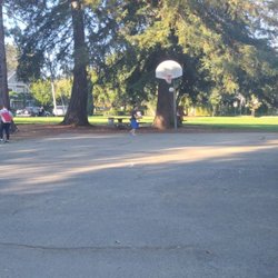
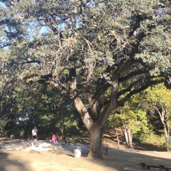
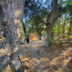
The park's name is appropriate, since it forms one side of the upper watershed of Stevens Creek. (The other side of the valley is mostly occupied by Monte Bello OSP, which is the true source of the creek.) As most south-bayers know, Stevens Creek eventually hits flatter terrain, then meanders through suburbia on the way to the bay (after having a road and several car dealerships named after it). This particular park is actually part of a larger Stevens Creek County Park system, the majority of which lies at a lower elevation; around a reservoir, and is 3 miles to the northeast. But this upper park is mostly mountainous, and is only accessible from Skyline Drive. It's not clear why these totally separate pieces of land are lumped together like this; they couldn't be more different, but I'm glad others had have had the sense to keep them separate on Yelp. A map for the Stevens Creek park system is at the following link, with this upper park at the bottom left: (https://www.sccgov.org/sites/parks/parkfinder/documents/stcrkmainfinal.pdf) But enough about maps and city planning (or lack thereof). Upper Stevens Creek County Park is another fairly average park for the area, offering a normal variety of hilly terrain, and featuring a lush creekside trail at the valley bottom. Trees here are predominantly oak, bay, and madrone with a smattering of pines and firs. On the downside, there aren't any spectacular vistas here, nor are there waterfalls, rock formations or old growth woods. Also, most of the trails are fire roads, with only a handful of single-track trails. For loop hikes, there are two main choices: -- Table Mtn loop: (~5 miles) From Skyline, you hike DOWN to Table Mtn (which is odd) on either a single track trail or a fire road, and then return the other route. It's very exposed in spots and can get quite parched in summer. Views are mainly of hilltop houses. -- Grizzly Flat loop: (~4 miles) More of figure-eight than a loop, along two, mostly-parallel trails that descend to the main creek below. Primarily shaded, so not a bad choice for summer. This hike can be extended by adding additional mileage along the shady creek. Upper Stevens Creek park forms sort of a "U" shape that is wrapped around private land; so it's hard to do a larger loop hike between the two sections listed above without walking on Skyline Dr for a few miles (not my favorite option); or by taking a longer detour through Long Ridge OSP. But if I'm going to hike 10 miles, then I can think of several other spots I'd go first before heading here. I'm not saying it's bad, just not above average. Hiking Spot Checklist: -- Parking: Roadside only; along Skyline Dr. -- Bathrooms: No -- Potable water: No -- Maps provided: Yes, but 0.2 miles in from the road on the Table Mtn side -- Highlights: relatively quiet My Peninsula Hike Collection is here: (https://www.yelp.com/collection/qBI6U6Lz9LJQjnGjFW6ubg) read more


And so begins my foray into the most fertile hiking territory of all the Bay Area: the Skyline/Page Mill area. With 6 Open Space Preserves and a County Park, there's no shortage of trail combinations you can make. One of the more popular hikes to do around here is a 10-mile loop through Upper Stevens Creek and Long Ridge involving the Grizzly Flat, Table Mountain, Hickory Flat and Peters Creek Trails. In my old age, I stick to shorter hikes, so I did a 5-6 mile loop of Charcoal Road and Table Mountain trails. Scenery is pleasant if generic, although the flat meadows of Table Mountain were pretty unique. Note that whichever hikes you do in this park, you'll be climbing on the return trip. Also note that a portion of Charcoal Road goes through Saratoga Gap Open Space Preserve, which I don't plan to review separately as it doesn't really have any hikes to speak of, unless you count a stretch of the Bay Area Ridge Trail that just parallels Skyline. read more


I was not sure which trail was part of Upper Stevens Creek Country park since all these trails are so connected. Anyway, last week was my first time I mountain bike from Skid Trail to Canyon Trail and then up Grizzly Flat. The downhill section at Skid trail was fun and not very steep but mainly single trail. It will connect to Canyon Trail and if you turn left, it bring you to Monte Bello Parking. Make sure you keep right to continue to Canyon Trail which is 2 miles long and mainly fire road. There are hikers on these trail and make sure to slow down at turn. Canyon Trail are main shaded with some open areas. Look for intersection to Grizzly Flat (deceiving name) which is uphill 1,043ft and 2.3 miles long which will test your endurance. You will cross a small creek which is closed during winter and wet seasons. Make sure you bring plenty of water and food since you will be out of gas after the long climb. I love all the trail here and they are well marked with sign at intersection and maps are available at parking lots. I don't think I will ride up the slope again again since the climb was so painful and long. Grizzly are shaded and very quite and lonely at times. read more

12 years ago
This place is so big! You'll never finish. Lots of shade also. Maps & mile markers are available but for some strange reason, it's never helpful to us or we never understood the calculation. read more


13 years ago
Best place to mountain bike near Cupertino with lot of shade. You may see large birds(6ft) I believe are Emus. read more

16 years ago
18 years ago
10 years ago
More info about Upper Stevens Creek County Park
Ask the Community - Upper Stevens Creek County Park
Review Highlights - Upper Stevens Creek County Park
You might also consider


Upper Stevens Creek County Park - parks - Updated May 2026
Best of Los Gatos
People found Upper Stevens Creek County Park by searching for…
Redwood Trees in Los Gatos, California
Hiking in Los Gatos, California
Redwood Forest in Los Gatos, California
Hiking Trails With Waterfalls in Los Gatos, California
Creeks in Los Gatos, California
Water Parks in Los Gatos, California
Shaded Hike in Los Gatos, California
Mountain Bike Trails in Los Gatos, California
Public Running Track in Los Gatos, California
View Points in Los Gatos, California
Skyline View in Los Gatos, California
Lookout Points in Los Gatos, California
Hidden Spots in Los Gatos, California
Waterfalls in Los Gatos, California
Free Things to Do in Los Gatos, California
Off Road Trails in Los Gatos, California
Picnic Areas in Los Gatos, California
Scenic Night View in Los Gatos, California
Scenic Drive in Los Gatos, California
Secret Spots in Los Gatos, California
Scenic Spots in Los Gatos, California
Waterfalls and Swimming Holes in Los Gatos, California
Trending Searches in Los Gatos, CA
Baseball Fields near Upper Stevens Creek County Park
Boat Rental near Upper Stevens Creek County Park
Botanical Gardens near Upper Stevens Creek County Park
Bounce House Rentals near Upper Stevens Creek County Park
Campgrounds near Upper Stevens Creek County Park
Cherry Picking near Upper Stevens Creek County Park
Cliff Jumping near Upper Stevens Creek County Park
Dog Friendly Things To Do near Upper Stevens Creek County Park
Fishing Lake near Upper Stevens Creek County Park
Flower Shop near Upper Stevens Creek County Park
Garage Sales near Upper Stevens Creek County Park
Hair near Upper Stevens Creek County Park
Nurseries & Gardening near Upper Stevens Creek County Park
Off Leash Dog Parks near Upper Stevens Creek County Park
Outdoor Activities near Upper Stevens Creek County Park
Outdoor Basketball Courts near Upper Stevens Creek County Park
Outdoor Furniture Stores near Upper Stevens Creek County Park
Party Equipment Rentals near Upper Stevens Creek County Park
Pedicure near Upper Stevens Creek County Park
Pick Your Own Farms near Upper Stevens Creek County Park
Picnic Spots near Upper Stevens Creek County Park
Places To Take Pictures near Upper Stevens Creek County Park
Plant Nursery near Upper Stevens Creek County Park
Public Beaches near Upper Stevens Creek County Park
Rock Quarry near Upper Stevens Creek County Park
Scenic Drive near Upper Stevens Creek County Park
Splash Pad near Upper Stevens Creek County Park
Strawberry Picking near Upper Stevens Creek County Park
Browse Articles
Browse Nearby
BEST of Los Gatos, California Coffee near Upper Stevens Creek County Park
BEST of Los Gatos, California Restaurants near Upper Stevens Creek County Park
BEST of Los Gatos, California Things to Do near Upper Stevens Creek County Park
BEST of Los Gatos, California Hiking near Upper Stevens Creek County Park
BEST of Los Gatos, California Breakfast near Upper Stevens Creek County Park
BEST of Los Gatos, California Beaches near Upper Stevens Creek County Park
Browse Brands
Related Searches in Los Gatos, CA
Best Nature Trails for Hiking in Los Gatos, California
Best Off Leash Dog Parks in Los Gatos, California
Best Parks for Parties and Events in Los Gatos, California
Best Water Parks for Kids in Los Gatos, California
Check Out Great Playgrounds in Los Gatos, California
Discover Baseball Fields Around Los Gatos, California
Discover Beautiful Garden Spots in Los Gatos, California
Discover Fun Toddler Parks in Los Gatos, California for Your Little One
Discover Lakes & Ponds to Explore in Los Gatos, California
Discover Popular Photo Spots in Los Gatos, California
Discover Public Beaches to Visit in Los Gatos, California
Discover Soccer Fields in Los Gatos, California Near You
Discover Top Nature Parks to Visit in Los Gatos, California
Discover Top State Parks to Visit in Los Gatos, California
Discover Walking Parks in Los Gatos, California Near You
Discover the Best Beaches in Los Gatos, California
Discover the Best Kids Park Spots in Los Gatos, California
Enjoy the Best Picnic Spots and Ideas in Los Gatos, California
Enjoy the Best Walking Trails in Los Gatos, California
Explore Family-Friendly Zoos and Wildlife in Los Gatos, California
Explore Free Picnic Areas Around Los Gatos, California
Explore Parks With Pull Up Bars in Los Gatos, California
Explore Popular Campgrounds Near Los Gatos, California
Explore Popular Picnic Areas Around Los Gatos, California
Explore Popular RV Parks Around Los Gatos, California
Explore Popular Recreation Centers Around Los Gatos, California
Explore Scenic Lakes to Visit in Los Gatos, California
Explore Top Dog Parks in Los Gatos, California Near You
Explore Top Water Parks in Los Gatos, California Today
Explore the Best Trail Options in Los Gatos, California
Find Parks and Recreation Activities in Los Gatos, California
Find Top Dog Friendly Parks to Visit in Los Gatos, California
Find Top Skate Parks in Los Gatos, California for All Skill Levels
Find a Park With BBQ Pits in Los Gatos, California
Find the Best Parks BBQ Grills in Los Gatos, California
Find the Best Parks for Picnics in Los Gatos, California
Have Fun at a Splash Pad in Los Gatos, California
Indoor Playgrounds to Explore in Los Gatos, California
Locate Tennis Courts Around Los Gatos, California
Parks With Basketball Courts for Games in Los Gatos, California
Picnic Areas With BBQ Pits Available in Los Gatos, California
Play at a Splash Pad Park in Los Gatos, California
Popular Children Playgrounds to Visit in Los Gatos, California
Popular Places to Take Pictures in Los Gatos, California
Top Dog Trails for Walking and Hiking in Los Gatos, California
Top Hiking Trails to Explore in Los Gatos, California
Top Running Trails to Explore in Los Gatos, California
Top-Rated Hikes in Los Gatos, California to Explore
People who viewed Upper Stevens Creek County Park also viewed
Pearson Arastradero Preserve
117 reviews
Skyline Ridge Preserve
40 reviews
Long Ridge Open Space Preserve
25 reviews
The Dish - Stanford Foothills
521 reviews
Skyline Trail
6 reviews
Zinfandel Trail
9 reviews
Tony Look Trail
18 reviews
Los Trancos Open Space Preserve
23 reviews
Maisie's Peak
10 reviews
Byrne Preserve
7 reviews