The Roaring Run Natural Area is located some 55 miles east of Pittsburgh and it's a part of the Forbes State Forest. Indeed the whole area is made up of a chain of state parks and forests running southwest from Donegal, PA to Ohiopyle and including Laurel Hill State Park, Laurel Ridge State Park, and Ohiopyle State Park. The Roaring Run Natural Area consists of 3500+ acres and is located on the west west slope of Laurel Ridge in Westmoreland County. Roaring Run Natural Area is mostly woodlands with second and third growth forests. In the early 1900s, this area was used for logging. This reapeated logging has caused the forest here to be quite varied in age and composition. In it, you'll find northern hardwoods and many oak species as you hike through it. The area was also used for farming and you can find somewhat recently abandoned fields as well as older farmlands which have completely reverted to forest.
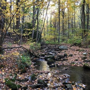
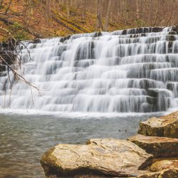
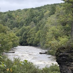
Roaring Run Natural Area features a complete mountain stream protected within its watershed. Roaring Run is spring fed near the summit of Laurel Ridge. The stream drops
1,220' in elevation, over a length of 5 miles, before ending at its confluence with Indian Creek in the village of Champion. Roaring Run is designated as a Wilderness Trout Stream and Exceptional Value Stream.
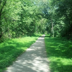
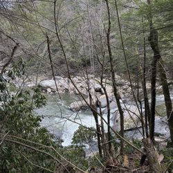
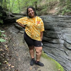
The area also has several miles of good hiking trails within its boundaries and me and my girlfriends came out here for just that. Many of the trails were built on the paths of the old logging railroads, so in some ways they're rails-to-trails conversions. The trails vary in difficulty level and are duly marked with blue and yellow blazes. Blue denotes trails maintained for cross-country skiing, while yellow denotes trails maintained for foot traffic only. There are no bicycles permitted on any of the trails. We began our hiking from one of the parking lots off of Painter Rock Road. Painter Rock Road appears to dead end into one of the trails and there is no parking at that point. Most of the trails form loops and we decided to walk in a counter clockwise direction, beginning by hiking up the road a little bit until we came to the McKenna Trail. We turned left on the McKenna until it met up with the North Loop Trail. Don't let the map fool you--the North Loop Trail is 4.5 miles long, but it's on the old logging railroad grades. We hiked the length of that until we reached the Painter Rock Trail. We made a right and followed that around to the Roaring Run Trail, which of course follows the stream by the same name. We made a left on that and did another 2 miles. Again, the trail follows the old logging railroad grade. We had many good views of the stream from here. When we got to the junction of the Roaring Run Trail and the Painter Rock Trail, I had to stop and take a sugar break (I'm a type-1 diabetic).
So we followd the Roaring Run Trail down to the Hillside Trail, which is really just a short connector of about a mile over to the Jones Mill Run Trail. This trail follows Jones Mill Run creekbed for its length. We followed that trail for a mile and took another rest break at one of the parking lots. We took a look at the map and noticed that the Cherry Trail follows Jones Mill Run south and out of the Natural Area into Laurel Hill State Park. From there we could have hiked back up the Red Creek Trail, but our answer was "No Way!" We were getting a little tired at this point and as I mentioned, some of these trails are really rugged in here. So we looped back another couple of miles on the McKenna Trail to our starting point. All in all, I'd say we hiked a good 10 miles. And we're going to have to visit some of the other areas I mentioned in this review. The Forbes State Forest, of which the Roaring Run Natural Area is a part of, comprises about 60,000 acres located in Westmoreland, Somerset and Fayette Counties.
This is a terrific place to hike and explore. Just remember a few key things.
1) Make sure you wear good, sturdy hiking shoes. Many of these trails are very rugged and have sticks and stones which could cut your feet. Not only that, hiking shoes will give you great traction, support, and balance so your feet won't feel so tired when you're done.
2) Plan ahead--make sure you bring a map. Also make sure you bring food and water. There are no places to obtain any of these in the park. Apples, dried fruits, and nuts will give your body plenty of carbs and energy. A PBJ sandwich is highly recommended. make sure your cel phone is fully charged.
3) Never, ever hike in here alone. This park has some very isolated sections and if something was to happen to you, it's possible no one would ever find you.
4) Stay on the blazed trails.
5) Take only photographs, leave only footprints. read more