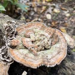
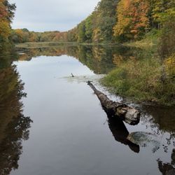
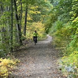
Riverfront Park Photos


You might also consider
More like Riverfront Park
Recommended Reviews - Riverfront Park
Start your review...

8 months ago


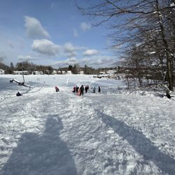
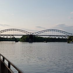
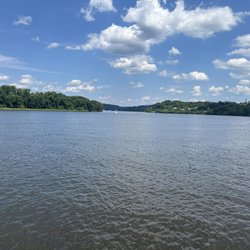
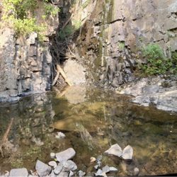
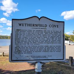
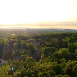
The Riverfront Park is a nice outdoor space in Portland on the CT River. Volunteers have worked hard over the last few years to clear walking trails and make it a nice little spot to visit. There is a walking trail with beautiful views of the river, as well as picnic tables, brownstone benches and a Pavillion area, that can be rented for events. Just in the last year they added restrooms (much better than the porta potties) and a covered stage area for bands and other entertainment. In the month of August there is a summer concert series with local bands. It is a great community event. The park is located very close to the Brownstone Exploration Park, which is also another great outdoor activity to check out in Portland. read more
More info about Riverfront Park
284 Brownstone Ave
Portland, CT 06480
Directions
Hours
Outdoor Amenities


Riverfront Park - parks - Updated July 2026
Best of Portland
People found Riverfront Park by searching for…
Walking Trails in Portland, Connecticut
Things to Do in Portland, Connecticut
Scenic View in Portland, Connecticut
Picnic Areas in Portland, Connecticut
Picnic Spots in Portland, Connecticut
Places to Take Pictures in Portland, Connecticut
Fun Things to Do at Night in Portland, Connecticut
Scenic Drive in Portland, Connecticut
Running Trails in Portland, Connecticut
Scenic Overlook in Portland, Connecticut
Hiking Trails in Portland, Connecticut
River Swimming in Portland, Connecticut
Photo Spots in Portland, Connecticut
Running Tracks Open to the Public in Portland, Connecticut
Park With BBQ Pits in Portland, Connecticut
Parks for Picnics in Portland, Connecticut
Scenic Spots in Portland, Connecticut
Beautiful Views in Portland, Connecticut
Swimming Lakes in Portland, Connecticut
Playgrounds in Portland, Connecticut
Places to Visit in Portland, Connecticut
Nature Preserve in Portland, Connecticut
Trending Searches in Portland, CT
4th Of July Fireworks near Riverfront Park
Black Owned Nail Salons near Riverfront Park
Boat Rental near Riverfront Park
Cliff Jumping near Riverfront Park
Day Trips near Riverfront Park
Dog Friendly Beaches near Riverfront Park
Fireworks near Riverfront Park
Fishing Spots near Riverfront Park
Jet Ski Rental near Riverfront Park
Kayak Rental near Riverfront Park
Kids Activities Outdoor near Riverfront Park
Outdoor Basketball Courts near Riverfront Park
Paddle Boat Rentals near Riverfront Park
Public Beaches near Riverfront Park
Public Pools near Riverfront Park
River Swimming near Riverfront Park
Soccer Store near Riverfront Park
Splash Pad near Riverfront Park
Strawberry Picking near Riverfront Park
Swimming Holes near Riverfront Park
Swimming Lakes near Riverfront Park
Things To Do With Kids near Riverfront Park
Browse Articles
Browse Nearby
BEST of Portland, Connecticut Coffee near Riverfront Park
BEST of Portland, Connecticut Playgrounds near Riverfront Park
BEST of Portland, Connecticut Restaurants near Riverfront Park
BEST of Portland, Connecticut Walking Trails near Riverfront Park
BEST of Portland, Connecticut Things to Do near Riverfront Park
BEST of Portland, Connecticut Breakfast near Riverfront Park
BEST of Portland, Connecticut Campgrounds near Riverfront Park
Browse Brands
Related Searches in Portland, CT
Best Off Leash Dog Parks in Portland, Connecticut
Best Parks for Parties and Events in Portland, Connecticut
Best Water Parks for Kids in Portland, Connecticut
Check Out Great Playgrounds in Portland, Connecticut
Discover Baseball Fields Around Portland, Connecticut
Discover Beautiful Garden Spots in Portland, Connecticut
Discover Fun Activities to Do in Portland, Connecticut
Discover Lakes & Ponds to Explore in Portland, Connecticut
Discover Popular Photo Spots in Portland, Connecticut
Discover Top Nature Parks to Visit in Portland, Connecticut
Discover Top State Parks to Visit in Portland, Connecticut
Discover the Best Beaches in Portland, Connecticut
Enjoy the Best Picnic Spots and Ideas in Portland, Connecticut
Enjoy the Best Walking Trails in Portland, Connecticut
Explore Beautiful Botanical Gardens in Portland, Connecticut
Explore Family-Friendly Zoos and Wildlife in Portland, Connecticut
Explore Free Picnic Areas Around Portland, Connecticut
Explore Fun Activities to Do in Portland, Connecticut
Explore Parks With Pull Up Bars in Portland, Connecticut
Explore Popular Campgrounds Near Portland, Connecticut
Explore Popular Picnic Areas Around Portland, Connecticut
Explore Popular RV Parks Around Portland, Connecticut
Explore Popular Scenic Views Near Portland, Connecticut
Explore Popular View Points Around Portland, Connecticut
Explore Scenic Lakes to Visit in Portland, Connecticut
Explore Top Dog Parks in Portland, Connecticut Near You
Explore Top Gyms in Portland, Connecticut Now
Explore Top Water Parks in Portland, Connecticut Today
Explore Volleyball Courts Available in Portland, Connecticut
Find Beautiful Views in Portland, Connecticut
Find Picnic Tables for Outdoor Fun in Portland, Connecticut
Find Top Dog Friendly Parks to Visit in Portland, Connecticut
Find Top Skate Parks in Portland, Connecticut for All Skill Levels
Find a Park With BBQ Pits in Portland, Connecticut
Find the Best Parks BBQ Grills in Portland, Connecticut
Find the Best Parks for Picnics in Portland, Connecticut
Find the Best Swimming Pools in Portland, Connecticut Today
Indoor Playgrounds to Explore in Portland, Connecticut
Locate Tennis Courts Around Portland, Connecticut
Must-See Tourist Attractions Around Portland, Connecticut
Parks With Basketball Courts for Games in Portland, Connecticut
Picnic Areas With BBQ Pits Available in Portland, Connecticut
Popular Fishing Spots to Explore in Portland, Connecticut
Popular Kids Activities in Portland, Connecticut
Popular Outdoor Activities to Try in Portland, Connecticut
Popular Places to Take Pictures in Portland, Connecticut
Top Hiking Trails to Explore in Portland, Connecticut
Top Running Trails to Explore in Portland, Connecticut