Ramapo Mountain State Forest Photos


You might also consider
More like Ramapo Mountain State Forest
Recommended Reviews - Ramapo Mountain State Forest
Start your review...

Reviews With Photos

Any hike with ruins pretty much gets an automatic five stars from me, but I thought Ramapo's ruins were especially beautiful (with a bit of a sad and short history behind them, if you care to look into it). Fairly well preserved and easy to climb, perfect for photo shoots and adventurous kids alike. Trails are moderate, well maintained, and good for all levels. Besides the ruins, there are also some nice views.

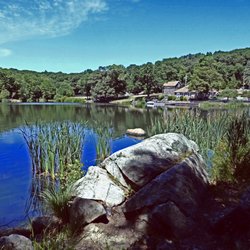
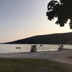
There is a well-marked network of trails here. I met up with a local hiking group in the upper lot on Skyline Drive. In my previous visit to this park, I'd begun at the lower lot. We followed the yellow Hoeferlin Trail which was a rocky descent from Skyline Drive to Ramapo Lake. Ramapo Lake is a man-made lake. It is 120 acres now and began as a 25-acre pond. Continuing around the lake we continued onto the white trail and our ascent to the Van Slyke Castle.

Gorgeous day for a hike (low 60s)...we parked at the lower parking lot, took the Blue Trail (very pretty right from the get go, rocky incline hiking...season streams depending on amount of rain fall, etc). We took the Blue trail to the White Castle Loop, turning right onto the Castle loop. About 2.3 miles of hiking brought us to the upper parking lot, and we proceeded along the White trail and got our first glimpse of some ruins on the next ridge. After passing what we called a watch tower, we made it to the main ruins site. Just past them we got a view of the NYC skyline. Hiking back down toward the intersection of the white/blue trails we spotted a black bear. Other hikers said they saw one the day before, but w got a glimpse too! Round trip was 4.5 miles from the lower parking lot the castle loop and back.

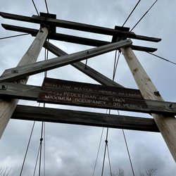
Ramapo Mountain State Park is 4,268 square miles with 30 miles of trails. The trails are well marked and worn but there are nine distinct trails and while it is difficult to get permanently lost you could end up well out of your way. Of the nine trails the easiest is the Ramapo Lake trail. It is scenic, flat and 4 miles long. There are two convenient entrances and parking lots on Skyline Drive which is about .03 miles from exit 57 off of Route 287. All the other trails are considered difficult as designated by the NJ Parks and Forest Service. I consider the trails moderate to moderately difficult. The Castle Point trail which is one mile long takes you to the ruins of a stone castle and it is quite interesting to see. There is a Native Preservation plant center along the Ramapo lake trail which is colorful to see in the summer.The Cannonball trail is six miles long and was used to transport cannon balls during the Revolutionary war to Stony Point, New York. Pets are allowed. Fishing with a NJ license is allowed however swimming is not. I saw quite a few dogs taking the plunge.The Ramapo Mountain State Park app has a GPS and other valuable features and is free and can be downloaded at the website: state.nj.us/dep/parksand forests. Look on the right side of the web page for the NJ State Parks and Forest Guide download. A New Jersey Trails Map can be purchased online for $9.95 and $1.50 for postage and handling. The Adjacent Ringwood State Park Office also has topographical maps. their phone # is 973-962-7031. If you like hiking this is a great hike with a lot of scenic diversity.

Lovely hiking trails with awesome views. My daughter and I are budding photographers and nature always manages to give us some of our best photo ops. The trails aren't really difficult and the lake is a beautiful area to stop, take it all in and just enjoy the beauty of it all. After the hike up to the lake we continued on a trail to the castle ruins which are something of a highlight here. We went to the highest point and had a great view of what I think was NYC! There was some sort of wall that you have to climb up and then down again to get to the highest point but it was doable for my 7 year old and also for a grandma that was hiking with family members of all ages. All in all a great way to enjoy nature, chill and get some great pictures.

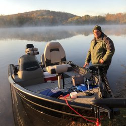
I am not sure which amazes me more: that I have lived in NJ for 6 years now, and only JUST discovered this place, or that I am the First to review it! This is the best natural area I have yet discovered within a reasonable distance of my home. Over 1400 acres, with several different parking areas, Ramapo Mountain State Forest crosses several towns, and two counties: Bergen and Passaic. There are multiple parking areas, offering access to different trail heads, as well as a road which leads to a boat launch. Activities include hiking, fishing, boating, cross-country skiing and mountain biking. There is no swimming, and the park is carry-in, carry-out, and the garbage bag dispenser is well-stocked with trash bags for you. There are several major trails, which are generally very well blazed, however people have carved out unofficial trails which can confuse you if you aren't careful. The majority of the trails are listed as "difficult", but I would call them "moderate to difficult". Supposedly some trails offer views of the NYC skyline, but we took trails that offer mountain views instead. At the apex of the "Castle Point" trail, one of the ones we took, there is the ruins of a manor home, built in 1910. It is fantastic, (See pics) and a nice reward for a hike. We saw a variety of wildlife, including an endangered eastern box turtle. We also saw mushrooms and flora of many types. This is my new favorite place to explore! Please note, although the state forest is managed by the Ringwood State Parks system (and they use that park for phone calls, this is really a very different experience, and in a different area.

Amazing place. 1) Take the yellow trail as a warm up. 2) Once you have reached the lake, look for the blue trail. 3) Start walking on the blue trail, and you will find a sign for the Castle point trail. 4) Use the Castle point trail (white trail) to see the Foxcroft Mansion. The hike here is somewhat challenging, unlike the other parts which is just walking. Come. Relax. Enjoy.

Ramapo Mountain is a great place for a hike if you live near NYC/Bergen County. The main "attraction" is the Ramapo Lake and the Castle Ruins. There are many trails you can follow so it can be confusing. I started at the parking lot on Skyline Drive. I used the Horferlin Trail (yellow) and MacEvoy Trail (Blue) and saw the Ramapo Lake in between. Then I got to the Castle Point Trail and followed it to the Castle ruins. With few rests, it took me 3 hours to go up and come back down using the same trails. On the NJ state park website, it says the trails are "difficult" but it's not too difficult even for a beginner. The trails do have uphills but those sections are not too hard. You can also download the NJ state park App on your phone for the address for the parking lot and a map of the forest.

Lovely state park in New Jersey, just 45 minutes from NYC. They have trails of varying difficult and a lovely lake. I went recently for a 5 mile wintery nature walk/hike. The trails are well traveled and marked nicely. I was surprised how many people were there and many with their dogs (for a wintery day). I wish there was a map at the entrance that showed all the trails and where they went. Some trails were closed due to hurricane/ super storm Sandy. I would def recommend and return.


A nice area for hiking with castle ruins and a lake and changing elevations. There are some paved roads but also trails off that path. You can hear the sound of cars on the highway both at the end and beginning of the hikes. Lots of dogs off leash even though there are signs that say to leash all dogs. The parking lot can get crowded later in the afternoon especially in the spring and summer, but there were plenty of spots on a Sunday morning at 9:30. read more


My 350th Yelp review is a banger. I try to stop by Ramapo at least once a year, usually at the beginning of hiking season; there's a nice 5- or 6-mile route I do in there that helps me build up for the more hardcore hikes later in the year, and it's unusual for me to do this one so late into the actual summer. Boy, is this a different hike in June. Ask the gazillion bears I saw. Yesterday I did about 6 miles, starting at the Ramapo Lake Trailhead parking lot, going on the blue trail to the aforementioned lake and then turning left onto N Shore Drive. I then veered off toward the castle ruins but made a pretty quick right before the path up to said ruins onto Cannonball to Skyline Drive, joining up with the Castle Point Trail back to and through the castle ruins, before heading down back to the lakefront and continuing all the way around the lake until getting back to the blue trail and the parking lot. The official hike in my book says it's 6.6 miles when you include an additional loop to the south of the lake that gets you very close to 287, but i bypassed that today. One of the big issues with this section of Ramapo is the parking situation. I can't tell you how many times I've had to pivot and do a different hike because this Ramapo Lake parking lot was completely full by mid-morning, and the powers that be insist on plastering no parking signs in every other conceivable area going literally miles down Skyline Drive. I get that Skyline is a busy road but there ARE sections where you can theoretically park safely on the shoulder without bothering anyone else - I think there's a compromise here somewhere, but because they don't have one, this lot is usually full by 8:30am on a nice day, and then you have vulture cars just lurking in the middle of the lot for ages waiting for hikers to come back so they can immediately grab the new spot. You can't tell me that's much safer than the alternative. Anyway. The other mild annoyance for me is that you can often hear car traffic, especially in the southern section by 287, but it is what it is. The lake and the castle are the real selling points here, especially the castle. Ruins are one of my all-time favorite hiking kinks, and this adventure has them in droves. The one drawback (again, because of the time of year) is that it gets overgrown with foliage very quickly, so this is a rare instance where I would recommend exploring it in the early spring before you're bushwhacking to get through. Very cool optics though, and a definite must at some point if you're in the area. The wildlife situation? Man. This was one for the books. I usually see one or two bears a year, but I saw that many today, and numerous hikers told me they'd encountered others as well. It was insane and I've never seen anything like it. I got a picture of the biggest one I saw (attached) as I was slowly backing away, and I'd guess this was a 700 pounder? Big boy, and wasn't particularly fazed by my bear horn (though he did ultimately wander off after a few toots on it). Absolutely would not do this hike without a bear horn. I don't even want to ponder what would have happened otherwise. Neither of the bears seemed aggressive but you just never know, and if cubs had been around? Ugh. I encountered a park ranger toward the end of the hike who said it had been insane bear-wise the entire summer and they're just getting more comfortable with humans so again, be careful, use common sense, etc. The trail conditions were pretty decent. Some of the blazes/markers were not the best, and a few sections of Cannonball were one way (meaning you had to keep turning around to confirm the markers because they were only on one side of the trees/poles). As mentioned, the trail section by the castle is overgrown right now but I'm not crazy about advocating for maintenance in an area that by definition should probably be preserved and as authentic as possible. To me there aren't too many significant inclines on the trail (there's one small section very close to the parking lot where you have to take a minute for footing on the rocks, as well as the climb up to the castle if you're going on that trail) but it's definitely rocky and not particularly flat except by the lake. This is one of the better hikes in the area but it's not my absolute favorite - it's crowded and a little too close to civilization. But arguably the bears cancel some of that out. Memorable day. read more


For our annual fall hike, my husband and I did the Van Slyke Castle Loop trail, which All Trails lists as moderate and I would say that it's pretty accurate. It starts off as a nice, flat trail. The area by the lake is paved. After the lake is when it gradually starts getting harder. There are castle ruins at the top, and getting to the top was the tricky part, though not impossible - even for beginner-ish hikers like us. We got there at around 10:15 on a Wednesday morning. By the time we got up to the castle, it was probably around 11:30. We had the entire place to ourselves, which we loved. We probably spent half an hour up there just hanging out, exploring, and taking photos, and not one person came by. It sounds a little eery but it was actually amazing. I can see it getting extremely packed during the weekends. I would highly recommend taking a random day off work like we did, if you plan on visiting here, just so you can avoid the crowds. Here are a few tips: 1. The entrance where you need to park is very easy to miss. And if you miss it (like we did), you'll have to drive for a few miles before you can make a turn back round. If you see a sign for Ramapo State Forest, pull in there (even if Google maps will try to take you to a different location for the trailhead) 2. Once you get back down and onto the trail loop, pay attention to the white trail markers. The marker where you need to turn to start exiting is really easy to miss - especially since there is fork right next to it, which leads to a straight trail and looks like it leads to the parking lot but it most definitely does not. We learned this the hard way I would do this trail again if someone hasn't been and wanted to check it out. It's a pretty unique trail. read more

Any hike with ruins pretty much gets an automatic five stars from me, but I thought Ramapo's ruins were especially beautiful (with a bit of a sad and short history behind them, if you care to look into it). Fairly well preserved and easy to climb, perfect for photo shoots and adventurous kids alike. Trails are moderate, well maintained, and good for all levels. Besides the ruins, there are also some nice views. read more


7 years ago
There is a well-marked network of trails here. I met up with a local hiking group in the upper lot on Skyline Drive. In my previous visit to this park, I'd begun at the lower lot. We followed the yellow Hoeferlin Trail which was a rocky descent from Skyline Drive to Ramapo Lake. Ramapo Lake is a man-made lake. It is 120 acres now and began as a 25-acre pond. Continuing around the lake we continued onto the white trail and our ascent to the Van Slyke Castle. read more


Gorgeous day for a hike (low 60s)...we parked at the lower parking lot, took the Blue Trail (very pretty right from the get go, rocky incline hiking...season streams depending on amount of rain fall, etc). We took the Blue trail to the White Castle Loop, turning right onto the Castle loop. About 2.3 miles of hiking brought us to the upper parking lot, and we proceeded along the White trail and got our first glimpse of some ruins on the next ridge. After passing what we called a watch tower, we made it to the main ruins site. Just past them we got a view of the NYC skyline. Hiking back down toward the intersection of the white/blue trails we spotted a black bear. Other hikers said they saw one the day before, but w got a glimpse too! Round trip was 4.5 miles from the lower parking lot the castle loop and back. read more


6 years ago
Ramapo Mountain State Park is 4,268 square miles with 30 miles of trails. The trails are well marked and worn but there are nine distinct trails and while it is difficult to get permanently lost you could end up well out of your way. Of the nine trails the easiest is the Ramapo Lake trail. It is scenic, flat and 4 miles long. There are two convenient entrances and parking lots on Skyline Drive which is about .03 miles from exit 57 off of Route 287. All the other trails are considered difficult as designated by the NJ Parks and Forest Service. I consider the trails moderate to moderately difficult. The Castle Point trail which is one mile long takes you to the ruins of a stone castle and it is quite interesting to see. There is a Native Preservation plant center along the Ramapo lake trail which is colorful to see in the summer.The Cannonball trail is six miles long and was used to transport cannon balls during the Revolutionary war to Stony Point, New York. Pets are allowed. Fishing with a NJ license is allowed however swimming is not. I saw quite a few dogs taking the plunge.The Ramapo Mountain State Park app has a GPS and other valuable features and is free and can be downloaded at the website: state.nj.us/dep/parksand forests. Look on the right side of the web page for the NJ State Parks and Forest Guide download. A New Jersey Trails Map can be purchased online for $9.95 and $1.50 for postage and handling. The Adjacent Ringwood State Park Office also has topographical maps. their phone # is 973-962-7031. If you like hiking this is a great hike with a lot of scenic diversity. read more


Lovely hiking trails with awesome views. My daughter and I are budding photographers and nature always manages to give us some of our best photo ops. The trails aren't really difficult and the lake is a beautiful area to stop, take it all in and just enjoy the beauty of it all. After the hike up to the lake we continued on a trail to the castle ruins which are something of a highlight here. We went to the highest point and had a great view of what I think was NYC! There was some sort of wall that you have to climb up and then down again to get to the highest point but it was doable for my 7 year old and also for a grandma that was hiking with family members of all ages. All in all a great way to enjoy nature, chill and get some great pictures. read more


I am not sure which amazes me more: that I have lived in NJ for 6 years now, and only JUST discovered this place, or that I am the First to review it! This is the best natural area I have yet discovered within a reasonable distance of my home. Over 1400 acres, with several different parking areas, Ramapo Mountain State Forest crosses several towns, and two counties: Bergen and Passaic. There are multiple parking areas, offering access to different trail heads, as well as a road which leads to a boat launch. Activities include hiking, fishing, boating, cross-country skiing and mountain biking. There is no swimming, and the park is carry-in, carry-out, and the garbage bag dispenser is well-stocked with trash bags for you. There are several major trails, which are generally very well blazed, however people have carved out unofficial trails which can confuse you if you aren't careful. The majority of the trails are listed as "difficult", but I would call them "moderate to difficult". Supposedly some trails offer views of the NYC skyline, but we took trails that offer mountain views instead. At the apex of the "Castle Point" trail, one of the ones we took, there is the ruins of a manor home, built in 1910. It is fantastic, (See pics) and a nice reward for a hike. We saw a variety of wildlife, including an endangered eastern box turtle. We also saw mushrooms and flora of many types. This is my new favorite place to explore! Please note, although the state forest is managed by the Ringwood State Parks system (and they use that park for phone calls, this is really a very different experience, and in a different area. read more


12 years ago
Amazing place. 1) Take the yellow trail as a warm up. 2) Once you have reached the lake, look for the blue trail. 3) Start walking on the blue trail, and you will find a sign for the Castle point trail. 4) Use the Castle point trail (white trail) to see the Foxcroft Mansion. The hike here is somewhat challenging, unlike the other parts which is just walking. Come. Relax. Enjoy. read more


Ramapo Mountain is a great place for a hike if you live near NYC/Bergen County. The main "attraction" is the Ramapo Lake and the Castle Ruins. There are many trails you can follow so it can be confusing. I started at the parking lot on Skyline Drive. I used the Horferlin Trail (yellow) and MacEvoy Trail (Blue) and saw the Ramapo Lake in between. Then I got to the Castle Point Trail and followed it to the Castle ruins. With few rests, it took me 3 hours to go up and come back down using the same trails. On the NJ state park website, it says the trails are "difficult" but it's not too difficult even for a beginner. The trails do have uphills but those sections are not too hard. You can also download the NJ state park App on your phone for the address for the parking lot and a map of the forest. read more


13 years ago
Lovely state park in New Jersey, just 45 minutes from NYC. They have trails of varying difficult and a lovely lake. I went recently for a 5 mile wintery nature walk/hike. The trails are well traveled and marked nicely. I was surprised how many people were there and many with their dogs (for a wintery day). I wish there was a map at the entrance that showed all the trails and where they went. Some trails were closed due to hurricane/ super storm Sandy. I would def recommend and return. read more

Skyline drive was closed due to recent bear activity.. We accessed the park at a different unidentifiable access point and followed the white trail where it lead us to a warehouse but still had great. Views on a beautiful fall day. read more


10 years ago
Great place to come hiking! Get right off of Skyline drive and park. The blue trail is a little bit hilly and rocky to start, so be prepared for that. There are a lot of trails, and there's also a lake to walk around. Plan to explore more here. read more

12 years ago
12 years ago
11 years ago
13 years ago
10 years ago
13 years ago
11 years ago
More info about Ramapo Mountain State Forest
1304 Sloatsburg Rd
Ringwood, NJ 07456
Directions
(973) 962-7031
Call Now
Visit Website
http://www.state.nj.us
Hours
Indoor Amenities
Outdoor Amenities
Ask the Community - Ramapo Mountain State Forest
Review Highlights - Ramapo Mountain State Forest


Why does Yelp recommend reviews?
2 reviews that are not currently recommended
The reviews below are not factored into the business's overall star rating.
2 years ago
10 years ago
Ramapo Mountain State Forest - hiking - Updated June 2026
Best of Ringwood
People found Ramapo Mountain State Forest by searching for…
Things to Do in Ringwood, New Jersey
Off Road Trails in Ringwood, New Jersey
Sunrise View in Ringwood, New Jersey
Hiking Trails With Waterfalls in Ringwood, New Jersey
Boating in Ringwood, New Jersey
Fishing Spots in Ringwood, New Jersey
Mountain Biking in Ringwood, New Jersey
Scenic Drive in Ringwood, New Jersey
Scenic View in Ringwood, New Jersey
Fishing Lake in Ringwood, New Jersey
Sunset View in Ringwood, New Jersey
Boat Launch in Ringwood, New Jersey
Walking Trails in Ringwood, New Jersey
Photo Spots in Ringwood, New Jersey
Beautiful Views in Ringwood, New Jersey
Running Trails in Ringwood, New Jersey
Scenic Overlook in Ringwood, New Jersey
Marinas in Ringwood, New Jersey
Dog Swimming in Ringwood, New Jersey
Skyline View in Ringwood, New Jersey
Natural Hot Springs in Ringwood, New Jersey
Trending Searches in Ringwood, NJ
Bait And Tackle Shop near Ramapo Mountain State Forest
Black Owned Nail Salons near Ramapo Mountain State Forest
Boat Rental near Ramapo Mountain State Forest
Cliff Jumping near Ramapo Mountain State Forest
Crabbing Location near Ramapo Mountain State Forest
Day Trips near Ramapo Mountain State Forest
Dog Friendly Trails near Ramapo Mountain State Forest
Fishing Charter near Ramapo Mountain State Forest
Fishing Spots near Ramapo Mountain State Forest
Jet Ski Rental near Ramapo Mountain State Forest
Kayak Rental near Ramapo Mountain State Forest
Lakes near Ramapo Mountain State Forest
Lakes & Ponds near Ramapo Mountain State Forest
Off Road Trails near Ramapo Mountain State Forest
Outdoor Activities near Ramapo Mountain State Forest
Picnic Spots near Ramapo Mountain State Forest
Places To Walk Around near Ramapo Mountain State Forest
Public Pools near Ramapo Mountain State Forest
Public Shower near Ramapo Mountain State Forest
River Swimming near Ramapo Mountain State Forest
Rock Quarry near Ramapo Mountain State Forest
Scenic Drive near Ramapo Mountain State Forest
Scenic Night View near Ramapo Mountain State Forest
Scenic Overlook near Ramapo Mountain State Forest
Secluded Spots near Ramapo Mountain State Forest
Soccer Store near Ramapo Mountain State Forest
Splash Pad near Ramapo Mountain State Forest
Strawberry Picking near Ramapo Mountain State Forest
Sunrise View near Ramapo Mountain State Forest
Sunset Cruise near Ramapo Mountain State Forest
Swimming Holes near Ramapo Mountain State Forest
Swimming Lakes near Ramapo Mountain State Forest
U Pick Farms near Ramapo Mountain State Forest
Watch Sunset near Ramapo Mountain State Forest
Browse Nearby
BEST of Ringwood, New Jersey Restaurants near Ramapo Mountain State Forest
BEST of Ringwood, New Jersey Coffee near Ramapo Mountain State Forest
BEST of Ringwood, New Jersey Things to Do near Ramapo Mountain State Forest
BEST of Ringwood, New Jersey Breakfast near Ramapo Mountain State Forest
BEST of Ringwood, New Jersey Wineries near Ramapo Mountain State Forest
Browse Brands
Related Searches in Ringwood, NJ
Affordable Fishing Rental Services in Ringwood, New Jersey
Affordable Kayak Rental Services in Ringwood, New Jersey
Best Crabbing Locations to Visit in Ringwood, New Jersey
Best Fishing Locations and Guides in Ringwood, New Jersey
Best Nature Trails for Hiking in Ringwood, New Jersey
Best Places for Horseback Riding in Ringwood, New Jersey
Best Pontoon Boat Rentals Near Ringwood, New Jersey
Best Waterfalls and Swimming Holes in Ringwood, New Jersey
Book Top Fishing Trips in Ringwood, New Jersey Today
Check Out Off Road Trails in Ringwood, New Jersey
Discover Dog Friendly Trails to Explore in Ringwood, New Jersey
Discover Exciting Adventure Options in Ringwood, New Jersey
Discover Lakes & Ponds to Explore in Ringwood, New Jersey
Discover Scenic Mountain Bike Trails Near Ringwood, New Jersey
Discover Scenic Running Paths in Ringwood, New Jersey
Discover Scenic Waterfall Spots in Ringwood, New Jersey
Discover Top Boat Tours in Ringwood, New Jersey for All Ages
Discover a Hiking Trail in Ringwood, New Jersey
Discover the Best Night Hike Trails in Ringwood, New Jersey
Discover the Best Sunset Cruise Tours in Ringwood, New Jersey
Dog-Friendly Hikes With Dogs in Ringwood, New Jersey
Enjoy Camping Adventures Around Ringwood, New Jersey
Enjoy Exciting Mountain Biking Adventures in Ringwood, New Jersey
Enjoy Fishing Pier Spots in Ringwood, New Jersey With Scenic Views
Enjoy Fishing With Kids in Ringwood, New Jersey Safely
Enjoy Hiking Adventures in Ringwood, New Jersey
Enjoy Jet Ski Adventures in Ringwood, New Jersey
Enjoy Kayaking Adventures in Ringwood, New Jersey
Enjoy Sailing Adventures in Ringwood, New Jersey
Enjoy Tent Camping Spots Around Ringwood, New Jersey
Enjoy Water Activities and Fun in Ringwood, New Jersey
Enjoy Whale Watching Experiences in Ringwood, New Jersey
Enjoy a Beautiful Waterfall Hike in Ringwood, New Jersey
Enjoy a Scenic Boat Ride in Ringwood, New Jersey
Enjoy the Best Walking Path in Ringwood, New Jersey
Enjoy the Best Walking Trails in Ringwood, New Jersey
Exciting Cliff Jumping Spots in Ringwood, New Jersey
Experience Deep Sea Fishing Adventures in Ringwood, New Jersey
Experience Scenic Boat Cruises in Ringwood, New Jersey
Experience Thrilling White Water Rafting in Ringwood, New Jersey
Experienced Fishing Guides Available in Ringwood, New Jersey
Explore Beautiful Parks and Green Spaces in Ringwood, New Jersey
Explore Easy Hikes Perfect for All in Ringwood, New Jersey
Explore Fishing Tackle Choices in Ringwood, New Jersey
Explore Fun Activities to Do in Ringwood, New Jersey
Explore Popular Boat Charters Near Ringwood, New Jersey
Explore Popular Campgrounds Near Ringwood, New Jersey
Explore Scenic Lakes to Visit in Ringwood, New Jersey
Browse Articles
People who viewed Ramapo Mountain State Forest also viewed
Franklin Lakes Nature Preserve
16 reviews
Pompton Valley Rail Trail
2 reviews
Breakneck Ridge
79 reviews
Sterling Forest State Park
20 reviews
Farny State Park
5 reviews
Black Rock Forest Consortium
6 reviews
Norvin Green State Forest
29 reviews
New Jersey Botanical Garden
20 reviews
Lenoir Preserve
13 reviews
7 Lakes Drive
20 reviews