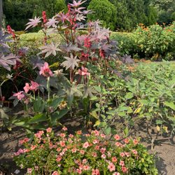
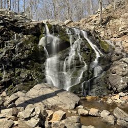
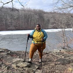
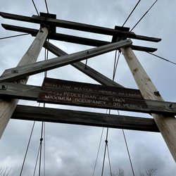
Shepherd Lake Photos


More like Shepherd Lake
Recommended Reviews - Shepherd Lake
Start your review...

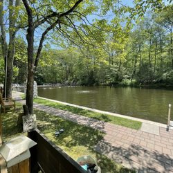
I think this place is a hidden gem. There's not a lot of natural lakes that you can swim in. Of course when I went, they were closed for swimming and they even have a dock with boat rentals, which was also closed. I'll be sure to come back to swim in the lake and maybe take a boat around. I don't think the boat is quite big ending for a boat ride that will get my adrenaline flowing, but a canoe or paddle board would be cool. But even closed, this is a great place to go for picnicking or hiking with free parking. There's picnic tables, a jungle gym, bathrooms and I'm sorry I didn't check to see if the showers were working if you wanted to use them. Now, this is important. I started walking around the lake, around the lake wound be going to the left, but the trail went right. I went left, there was a rock wall and I figured I'd follow it and it would bring me back to around the lake. It didn't, I ended up crossing into New York and wandering around Sterling Forest until I eventually found my self on the main road. After walking about 3 more miles, I was actually able to find a trail that lead back to the lake, of course when that trail reached the road for the lake, I walked a mile in the wrong direction, my point is FOLLOW THE TRAIL! The lake is in Ringwood state park and right by the NJ Botanical Gardens and also Skyland Manor. read more


4 years ago
The lake itself was beautiful and the kayak, row boat and peddle boat rentals were reasonably priced. It was a nice excursion on the water except for the constant gun shots from skeet shooting taking place nearby. If you can drown out the noise from that it is a very serene experience. The staff at the boathouse was friendly and helpful. read more
We took a nice late afternoon drive up Skyline Drive to Ringwood State Park. Mostly just checked out Shepherd Lake, but drove around afterwards. We only got there around 5pm, the day had cooled down some, very few people there so social distancing was VERY easy. Nobody at the stations at least when we go there, so we enjoyed free parking as well. Nice little outing. read more


4 years ago
7 years ago
8 years ago
7 years ago
8 years ago
4 years ago
9 years ago
11 years ago
8 years ago
More info about Shepherd Lake
Ringwood State Park
Ringwood, NJ 07456
Directions
(973) 962-7031
Call Now
Hours
Outdoor Amenities
Ask the Community - Shepherd Lake
Hi. Is this park dog friendly? TIA
I’m not sure. If the state of NJ owns it, probably not. NJ State doesn’t allow dogs many places. County properties are different. Go to website or call for info.
When do they open for the season and are there certain days/hours for swimming?


Shepherd Lake - parks - Updated June 2026
Best of Ringwood
People found Shepherd Lake by searching for…
Beaches in Ringwood, New Jersey
Swimming Lakes in Ringwood, New Jersey
Fishing in Ringwood, New Jersey
Secret Spots in Ringwood, New Jersey
Things to Do With Kids in Ringwood, New Jersey
Walking Trails in Ringwood, New Jersey
Playgrounds in Ringwood, New Jersey
Scenic Drive in Ringwood, New Jersey
Scenic View in Ringwood, New Jersey
Picnic Areas in Ringwood, New Jersey
Beautiful Views in Ringwood, New Jersey
Park With BBQ Pits in Ringwood, New Jersey
Parks BBQ Grills in Ringwood, New Jersey
Outdoor Gym in Ringwood, New Jersey
Free Parking in Ringwood, New Jersey
Fishing Spots in Ringwood, New Jersey
Hiking Trails in Ringwood, New Jersey
Pedal Boat in Ringwood, New Jersey
Picnic Spots in Ringwood, New Jersey
Natural Hot Springs in Ringwood, New Jersey
Places to Take Pictures in Ringwood, New Jersey
Trending Searches in Ringwood, NJ
Baseball Fields near Shepherd Lake
Black Owned Nail Salons near Shepherd Lake
Boat Rental near Shepherd Lake
Cliff Jumping near Shepherd Lake
Dog Friendly Beaches near Shepherd Lake
Fishing Spots near Shepherd Lake
Free Picnic Areas near Shepherd Lake
Free Water Parks near Shepherd Lake
Jet Ski Rental near Shepherd Lake
Kayak Rental near Shepherd Lake
Kids Activities Outdoor near Shepherd Lake
Nature Trails near Shepherd Lake
Outdoor Basketball Courts near Shepherd Lake
Public Beaches near Shepherd Lake
Public Pools near Shepherd Lake
River Swimming near Shepherd Lake
Soccer Store near Shepherd Lake
Strawberry Picking near Shepherd Lake
Swimming Holes near Shepherd Lake
Swimming Lakes near Shepherd Lake
U Pick Farms near Shepherd Lake
Browse Articles
Browse Nearby
BEST of Ringwood, New Jersey Restaurants near Shepherd Lake
BEST of Ringwood, New Jersey Coffee near Shepherd Lake
BEST of Ringwood, New Jersey Things to Do near Shepherd Lake
BEST of Ringwood, New Jersey Hiking near Shepherd Lake
BEST of Ringwood, New Jersey Breakfast near Shepherd Lake
BEST of Ringwood, New Jersey Thrift Stores near Shepherd Lake
Browse Brands
Related Searches in Ringwood, NJ
Best Nature Trails for Hiking in Ringwood, New Jersey
Best Off Leash Dog Parks in Ringwood, New Jersey
Best Parks for Parties and Events in Ringwood, New Jersey
Best Water Parks for Kids in Ringwood, New Jersey
Check Out Great Playgrounds in Ringwood, New Jersey
Discover Baseball Fields Around Ringwood, New Jersey
Discover Fun Toddler Parks in Ringwood, New Jersey for Your Little One
Discover Lakes & Ponds to Explore in Ringwood, New Jersey
Discover Popular Photo Spots in Ringwood, New Jersey
Discover Soccer Fields in Ringwood, New Jersey Near You
Discover the Best Beaches in Ringwood, New Jersey
Discover the Best Kids Park Spots in Ringwood, New Jersey
Enjoy the Best Picnic Spots and Ideas in Ringwood, New Jersey
Enjoy the Best Walking Trails in Ringwood, New Jersey
Explore Easy Hikes Perfect for All in Ringwood, New Jersey
Explore Family-Friendly Zoos and Wildlife in Ringwood, New Jersey
Explore Free Picnic Areas Around Ringwood, New Jersey
Explore Fun Activities to Do in Ringwood, New Jersey
Explore Parks With Pull Up Bars in Ringwood, New Jersey
Explore Popular Campgrounds Near Ringwood, New Jersey
Explore Popular Picnic Areas Around Ringwood, New Jersey
Explore Popular RV Parks Around Ringwood, New Jersey
Explore Popular Recreation Centers Around Ringwood, New Jersey
Explore Scenic Lakes to Visit in Ringwood, New Jersey
Explore Top Dog Parks in Ringwood, New Jersey Near You
Explore Top Water Parks in Ringwood, New Jersey Today
Explore the Best Swimming Holes Around Ringwood, New Jersey
Find Parks and Recreation Activities in Ringwood, New Jersey
Find Top Dog Friendly Parks to Visit in Ringwood, New Jersey
Find Top Skate Parks in Ringwood, New Jersey for All Skill Levels
Find a Park With BBQ Pits in Ringwood, New Jersey
Find the Best Parks BBQ Grills in Ringwood, New Jersey
Find the Best Parks for Picnics in Ringwood, New Jersey
Find the Best Swimming Pools in Ringwood, New Jersey Today
Have Fun at a Splash Pad in Ringwood, New Jersey
Locate Tennis Courts Around Ringwood, New Jersey
Parks With Basketball Courts for Games in Ringwood, New Jersey
Picnic Areas With BBQ Pits Available in Ringwood, New Jersey
Play at a Splash Pad Park in Ringwood, New Jersey
Popular Children Playgrounds to Visit in Ringwood, New Jersey
Popular Fishing Spots to Explore in Ringwood, New Jersey
Popular Outdoor Activities to Try in Ringwood, New Jersey
Popular Places to Take Pictures in Ringwood, New Jersey
Top Dog Trails for Walking and Hiking in Ringwood, New Jersey
Top Hiking Trails to Explore in Ringwood, New Jersey
Top Running Trails to Explore in Ringwood, New Jersey
Top Swimming Lakes to Enjoy in Ringwood, New Jersey
Top-Rated Hikes in Ringwood, New Jersey to Explore