Cancel

    Open app

    Search

    Poudre River Canyon

    5.0 (2 reviews)

    Poudre River Canyon Photos

    You might also consider

    Recommended Reviews - Poudre River Canyon

    Your trust is our priority, so businesses can't pay to alter or remove their reviews. Learn more about reviews.
    Yelp app icon
    Browse more easily on the app
    Review Feed Illustration

    1 year ago

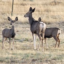
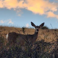
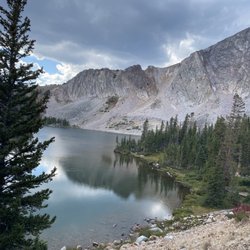
    Best scenic view. Wandering canyons. Streams. Wildlife. Unbelievable views. Going back in time.

    Helpful 0
    Thanks 0
    Love this 0
    Oh no 0
    Photo of Jean V.
    23
    45
    45

    15 years ago

    Helpful 0
    Thanks 0
    Love this 1
    Oh no 0

    Verify this business for free

    People searched for Hiking 335 times last month within 15 miles of this business.

    Verify this business

    Alberta Falls - Alberta falls

    Alberta Falls

    4.9(18 reviews)
    49.3 km

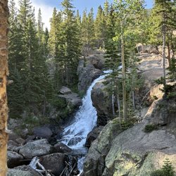
    With the mandatory timed entry to Bear Lake Road, we got lucky to secure a time to explore this…read morearea of Rocky Mountain National Park. This was our first stop on our hike heading into the forrest and it was an easy climb. These falls are loud and proud plus incredibly pretty. The falls thunder down Glacier Creek due to the heavy snowmelt. It's definitely a favorite spot for many people as it's only 1.6 miles so it's easy to access. Remember to pace yourself due to the altitude. I witnessed lots of huffing and puffing from people having to stop and catch their breath. We stayed long enough to take some pics and watch the falls and then moved on. Plenty of seating all around the falls for everyone. It's great short hike for those that just want to feel like they are "out there". Views are truly epic as is the entire park. Parking earlier in the day can be challenging. I recomment arriving very early or come later in the afternoon to secure a spot. Remember to pack in, pack out and LEAVE NO TRACE.

    We picked this hike on our 1 day visit to RMNP and it was a great choice. It's a short 2 mile…read moreround trip from the Bear Lake parking area. This was our first time in park and we came in late May so did not expect all the snow and the slush on the trail so that was really awesome. Lots of elevation change as you climb up and down the trail and several small bridges that traverse all the small mountain springs. We saw a few blooming flowers, blue jays,chipmunks, and we spotted a baby rainbow trout hiding in a little pool in one of the springs. Incredible views of the Rocky Mountains and one you get to the falls it's a nice place to take a nice relaxing break in the many rock formations. Great hike.

    Photos
    Alberta Falls - Photography

    Photography

    Alberta Falls - On the trail

    On the trail

    Alberta Falls - Fall colors

    See all

    Fall colors

    Bear Lake - Aster

    Bear Lake

    4.8(51 reviews)
    61.7 km

    This is a gorgeous part of Rocky Mountain National Park and definitely worth visiting. I highly…read morerecommend booking well in advance (think 2 months) for timed entry. I was a few days into the month when the timed entry opened for the dates we were visiting and I got a 12pm entry as the morning times had already been booked. Closer to the date you won't find anything until a few spots open up the night before. When we visited we did the park and ride which took us past a couple trailheads before getting to Bear Lake. The lake itself is absolutely gorgeous. The walk nearby is flat and easy to do - a good option for anyone with accessibility issues. We spent some time here before hiking up to Nymph Lake which was also a beauty. There are a few more lakes you can continue hiking toward from Bear Lake to extend your visit. Our trip around Bear Lake, up to Nymph Lake and back took around 1 and a half hour with stopping a few times along the way to admire the natural beauty. I think you could easily spend half a day here doing some of the connecting hikes. We loved our visit here and would certainly come back!

    The serenity and beauty are 5 star without a doubt. The lake is probably the single most visited…read morelocation in the entire RMNP. As such, it is incredibly over-crowded and over-touristed. The parking lots to the lake are full by 7am. The Park Service runs a shuttle from Estes Park (the visitor center) which is the way to go. You still need to buy an entrance permit to the park and a $2 permit to visit the lake, but avoiding the hassle of having a car in the park is worth it. The shuttle runs on a defined schedule which is available in the visitor center. They run a tight ship so buses leave promptly. If you do the shuttle (which is free) you need to buy a 1 day untimed pass to the national park (no vehicle). For the Bear Lake pass, you need to go online (recreation.gov) for RMNP the day before you intend to travel at 7pm. Do it quickly because spaces sell out quickly. You will want to reserve a specific time to get on the bus. For example, we did the 10am bus. The shuttle bus schedule is in the visitor center. They send your pass to your email that you show to driver. The lake itself is beautiful. The lake is a 256 feet "hike" from the entrance to the lake. In other words, it is so easy and accessible that everyone does it. When I say everyone, I mean imagine half the population of Manhattan. There are so many people that it is impossible to find any peace or quiet. Some people call this escaping to nature. At the Bear Lake entrance there are other hikes that range in length. The trip to Emerald lake is 1.8 miles and also very popular so expect large crowds. Overall, it is great to be in nature but the big downside is the crowds.

    Photos
    Bear Lake
    Bear Lake
    Bear Lake - Bear Lake Ranger Station and Visitors Shuttle

    See all

    Bear Lake Ranger Station and Visitors Shuttle

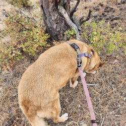
    Turtle Rock - Our dog cooking off in the river! There's a nice tree root that gives a perfect bench here

    Turtle Rock

    4.5(2 reviews)
    65.0 km

    Absolutely beautiful hike! Turtle rock and the surrounding rocks are beautiful, with truly…read morephenomenal patterns eroded into them. It's a very easy hike, well maintained and mediocrely signed, that takes you all the way around the monolith. We didn't see any moose, though we passed two people who had on one of the side trails. There was also lots of evidence of the moose, including plants they'd picked clean and beds where they had recently slept. It's a longish loop that passes through several patches of still water and a short part of one river. Mostly shaded, so it was a comfortable temperature even in mid-July. The biggest negative was a couple bad mosquito bites, so bring your bug spray! I don't know if this will be true after 2023, but the flora here is incredible. The huge amount of water the west got this winter is really revealing in the massive wildflower beds. Including what was nearly a field of Sego Lillies! Lots of other flowers as well, including Indian paintbrush, monkshood, and wild roses.

    This review is actually for Turtle Rock, Phallic, Valley Mastiff, Regolith and Skeleton Loop…read more 7/6/2021 tuesday arrived around 10 am. got the last spot in teh parking lot. There are not a lot of spots so be prepared for that. There is a bathroom at the trailhead. There is not hand sanitizer though, so bring some with you. Also there are no trash cans or dog poop bags. If you are bringing your pups be sure to bring some bags with you and also be sure to pack out what you pack in (including the dog poop!) The turtle rock portion of this trail is pretty well shaded and some water and is what there is signage on the trail for. Though you do have to look for it. Those are brown signs on the trees with an arrow and sometimes a small "trail" written above it. This particular loop is not signed. Honestly NOTHING other than the turtle rock is signed. So if you go wanting to do this loop, be sure you have the map downloaded or that you have a fully charged phone so you can access all trails while on the trail to make sure you are going the right direction. I have t-mobile service and i did have service the whole trail so was able to keep tabs on where we were. There was several times that we ended up back tracking though. There are a lot of random dirt paths out there so following intuition i dont think would really cut it. There is one point you will need to crawl over and under a fence. Also there are parts where the trail is not obvious. We walked past a few of the turns multiple times. Be prepared for a couple of marshy areas. There is no way to avoid it. So your shoes will get mucky. Also one point that you need to cross the river. I just crossed in my boots and got wet. When we got up near cow and regolith trail. The trail was not really existent as according to this map. We ended up needing to cut through some wildflowers and cross the river and saw the trail over there. But my phone charge was down at that point to like 45% so we opted to go on cow trail back to the forest service road and then back up turtle. We did hike around 8.85 miles. I think loop may actually be longer than what it says if you do what is listed here. We would have been game for trying it all IF i was not worried my phone would die and then it would be a heck of a lot more challenging to find our way back to the car. The positives : the wild flowers are absolutely beautiful here right now! The fields were bursting with color! There were so many birds and butterflies and bees. The trail is definitely less traveled. only really saw people on the turtle rock trail. We did not see any moose which was a little bit of a bummer. Had left the pups at home as so many had said they had seen moose here. A friend did hike turtle rock a couple of weeks ago and said she saw a moose and calf. Its a great trail just be prepared for teh fact that a fair amount of it is pretty primitive and you will need navigation to be able to find this particular loop. Some parts are clear but there are lots of splits.

    Photos
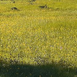
    Turtle Rock - Super bloom! Lots and lots of flowers!

    Super bloom! Lots and lots of flowers!

    Turtle Rock - A tiny side trail onto a meadow

    A tiny side trail onto a meadow

    Turtle Rock

    See all

    Poudre River Canyon - hiking - Updated August 2026

    Loading...
    Loading...
    Loading...