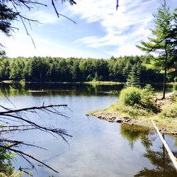
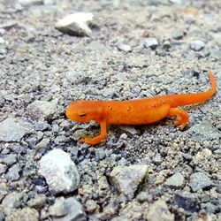
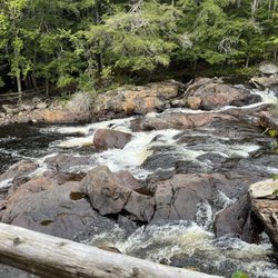
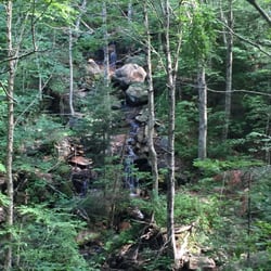
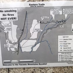
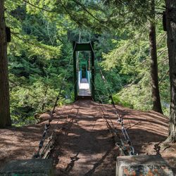
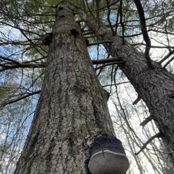
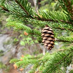
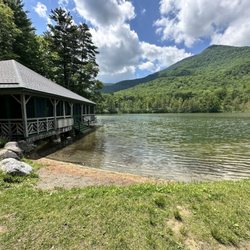
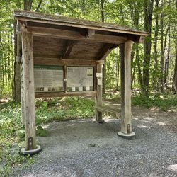
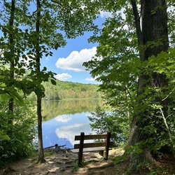
Pine Hill Park Photos


More like Pine Hill Park
Recommended Reviews - Pine Hill Park


More info about Pine Hill Park


Pine Hill Park - mountainbiking - Updated July 2026
Best of Rutland
People found Pine Hill Park by searching for…
Things to Do in Rutland, Vermont
Waterfalls in Rutland, Vermont
Parks for Kids in Rutland, Vermont
Off Road Trails in Rutland, Vermont
Scenic Views in Rutland, Vermont
Swimming Holes in Rutland, Vermont
Walking Trails in Rutland, Vermont
Off Leash Dog Hikes in Rutland, Vermont
Hiking Trails in Rutland, Vermont
Fun Things to Do With Kids in Rutland, Vermont
Playgrounds in Rutland, Vermont
Running Trails in Rutland, Vermont
Hiking With Kids in Rutland, Vermont
What to Do in Rutland, Vermont
Stuff to Do in Rutland, Vermont
Fun Things to Do at Night in Rutland, Vermont
Fall Foliage in Rutland, Vermont
Attractions in Rutland, Vermont
Nature Center in Rutland, Vermont
Trending Searches in Rutland, VT
Browse Articles
Browse Nearby
BEST of Rutland, Vermont Things to Do near Pine Hill Park
BEST of Rutland, Vermont Restaurants near Pine Hill Park
BEST of Rutland, Vermont Coffee near Pine Hill Park
BEST of Rutland, Vermont Hiking Trails near Pine Hill Park
BEST of Rutland, Vermont Breakfast near Pine Hill Park
BEST of Rutland, Vermont Parks near Pine Hill Park
BEST of Rutland, Vermont Caves near Pine Hill Park
BEST of Rutland, Vermont Campgrounds near Pine Hill Park
BEST of Rutland, Vermont Natural Hot Springs near Pine Hill Park
Browse Brands
Related Searches in Rutland, VT
Affordable Bike Repair Services in Rutland, Vermont
Affordable Cheap Bike Tune Up Services in Rutland, Vermont
Affordable Kayak Rental Services in Rutland, Vermont
Best Dog Hiking Trails Around Rutland, Vermont
Best Fishing Locations and Guides in Rutland, Vermont
Best Places for Horseback Riding in Rutland, Vermont
Best Sledding Spots and Fun in Rutland, Vermont
Best Water Parks for Kids in Rutland, Vermont
Best Waterfalls and Swimming Holes in Rutland, Vermont
Check Out Off Road Trails in Rutland, Vermont
Convenient Bike Sharing Programs in Rutland, Vermont
Discover Dog Friendly Trails to Explore in Rutland, Vermont
Discover Kid Friendly Hiking Trails in Rutland, Vermont
Discover Lakes & Ponds to Explore in Rutland, Vermont
Discover Popular Bike Tours in Rutland, Vermont
Discover Popular Bike Trails in Rutland, Vermont
Discover Scenic Mountain Bike Trails Near Rutland, Vermont
Discover a Hiking Trail in Rutland, Vermont
Discover the Best Beaches in Rutland, Vermont
Discover the Best Night Hike Trails in Rutland, Vermont
Dog-Friendly Hikes With Dogs in Rutland, Vermont
Enjoy Exciting Mountain Biking Adventures in Rutland, Vermont
Enjoy Hiking Adventures in Rutland, Vermont
Enjoy Off Leash Dog Hikes in Rutland, Vermont
Enjoy River Tubing Adventures in Rutland, Vermont
Enjoy Tent Camping Spots Around Rutland, Vermont
Enjoy the Best Tubing Experiences in Rutland, Vermont
Enjoy the Best Walking Trails in Rutland, Vermont
Exciting Snow Tubing Experiences in Rutland, Vermont
Explore Beautiful Parks and Green Spaces in Rutland, Vermont
Explore Bike Rentals Throughout Rutland, Vermont
Explore Easy Hikes Perfect for All in Rutland, Vermont
Explore Fun Activities to Do in Rutland, Vermont
Explore Popular Campgrounds Near Rutland, Vermont
Explore Popular Scenic Views Near Rutland, Vermont
Explore Scenic Lakes to Visit in Rutland, Vermont
Explore Secret Spots Worth Visiting in Rutland, Vermont
Explore Top Dog Parks in Rutland, Vermont Near You
Explore the Best Boating Spots in Rutland, Vermont
Explore the Best Rock Climbing Areas in Rutland, Vermont
Explore the Best Swimming Holes Around Rutland, Vermont
Family Friendly Hiking With Kids in Rutland, Vermont
Find Beautiful Views in Rutland, Vermont
Find Exciting Tours to Take in Rutland, Vermont
Find Popular Ziplining Spots Around Rutland, Vermont
People who viewed Pine Hill Park also viewed
Bucklin Trail
1 review
White Rocks National Recreation Area
1 review
Appalachian Trail Adventures
7 reviews
Woodstock Wheels
2 reviews
Base Camp
14 reviews
Middlebury Snowbowl
14 reviews
Bald Mountain Trail
2 reviews
Stay Bent Fishing Tours
7 reviews
Half Moon State Park
6 reviews
Ticonderoga Bicentennial Park
1 review