Cancel

    Open app

    Search

    Page Hill Trails

    5.0 (2 reviews)
    Open 6:00 am - 5:30 AM (Next day)

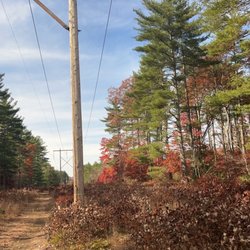
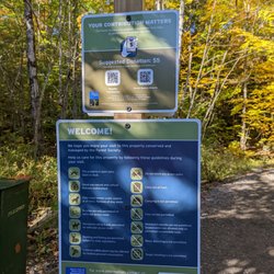
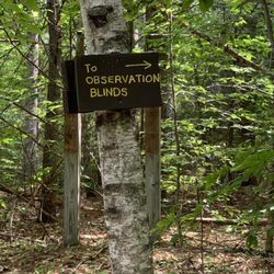
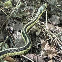
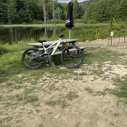
    Page Hill Trails Photos

    You might also consider

    Recommended Reviews - Page Hill Trails

    Your trust is our priority, so businesses can't pay to alter or remove their reviews. Learn more about reviews.
    Yelp app icon
    Browse more easily on the app
    Review Feed Illustration

    4 years ago

    Helpful 0
    Thanks 0
    Love this 0
    Oh no 0

    13 years ago

    Helpful 1
    Thanks 0
    Love this 0
    Oh no 0

    Ask the Community - Page Hill Trails

    Verify this business for free

    People searched for Hiking 281 times last month within 15 miles of this business.

    Verify this business

    Table Rock Trail

    Table Rock Trail

    5.0(2 reviews)
    43.3 mi

    Anytime of the year is perfect for the rewarding view. Maybe a little tough during snow and mud…read moreseason, but still doable. Table Rock faces the Bellows Falls are from New Hampshire, just across the Connecticut River. We're in our 60s and needed to stop a few times on the way up, but it was never too steep or treacherous, just a long steady hike. You want bring good hiking shoes with serious treads. No fees. Dogs allowed.

    Phenomenal trail!! Definitely in my top 5 fave hikes - especially for the fall colors (my visit was…read morein early October)!! And it's a killer workout too! The view from the top is breathtaking- but not for the faint of heart - I have a fear of heights and it took me a while to work up the nerve to go sit on the edge lol! AllTrails has this trail labeled as "moderate" - but it was insanely muddy and very wet when I hiked it - took me ages and totally wore me out - so in those conditions I'd call it moderate-hard. And also with the rock scrambling at the top - it can be quite difficult. Very steep and especially narrow at the top - can be dangerous if you're not careful. I did a total of 2 miles round trip - it's an out and back trail. In those 2 miles, my tracker showed an 800 foot elevation gain so it's definitely a butt burner. And along the trail there are numerous areas of rock scrambling (some are very steep) and stream crossings during the wet season - get ready to be covered in mud lol! You will definitely need decent hiking shoes - and poles would've been so helpful I think! There were quite a few other hikers around. The trails are very well marked with colorful tree badges - but in some spots between the markers, I needed my trail map bc the ground was covered in leaves and mud and it wasn't as obvious. Once you get to the top of Table Rock, the stunning view will absolutely take your breath away! It's a sweeping vista of the entire forest area with the lake and resort below to the left and the long stretch of road through the park to the right - perfect for taking in all the colorful autumn splendor!! The top is a long, very narrow and flat tableau. It seems pretty stable - but has extremely steep (and deadly!) drop offs either side and no safety rails or fencing or anything so be aware. Drones aren't allowed in the park (according to the State Park website) but someone was flying one and buzzing us closely at the top which made it very distracting and scary unfortunately. Dogs are allowed - there were many on the trail and at the top. Parking is a small dirt lot pull out on the side of the road at the trailhead - Google maps took me right to it (just put in Table Rock Trailhead). It's located in Dixville Notch State Park (you can see my review of that for more detailed info). The park doesn't have bathrooms that I could find. And I think it's free. I didn't see any fee areas and their website doesn't list it as a fee area.

    Photos
    Table Rock Trail
    Table Rock Trail - Another stream crossings along the trail

    Another stream crossings along the trail

    Table Rock Trail - Gorgeous fall colors all along the trail (early October)!

    See all

    Gorgeous fall colors all along the trail (early October)!

    Clark Lookout Trail - Tree restoration

    Clark Lookout Trail

    5.0(2 reviews)
    13.6 mi

    The views at the top of this short walk are amazing. It's a relaxing walk from the trailhead and…read moreonly .8 miles round trip. Great photo opportunities and it's a good place to walk your dog. There is small chestnut tree restoration farm along the way as well as a stone wall that lines the trail. Well worth a visit to see the beautiful vista at the end of this short and easy trail.

    The Kearsarge/Lake Sunapee area is post-card beautiful, and residents and visitors enjoy the active…read morelifestyle and the plethora of things to do. One of the many four-season things available is hiking. And a gem in the hiking category is the Davis Hill and Clark Lookout Trail. The first thing is that almost anyone can negotiate the trail. It is only 0.7 miles long out and back in its totality. But still, visitors should plan an hour. That's because the Clark Lookout Trail provides a spectacular, I mean, write home to mom kind of beautiful, view of Lake Sunapee and Mount Sunapee. A camera or a good quality smartphone is a must, as the views here are amazing. The Clark Lookout property cuts through a neighborhood of million-dollar homes and was made available to the residents through the generosity of Sydney L. Crook and Mary D. Haddad, who donated land and funding to the town of New London for conservation and recreation use. The trail is managed by the New London Conservation Commission. Much of the land and its conservation easements are held by the area's prime land conservation organization, the Ausbon Sargent Land Preservation Trust. For a family traveling on the Interstate that wishes to have a nice break, this spot is optimum. It is also a must for anyone visiting for the first time, as you will fall in love with the area on the spot. The trail is also amazingly dog friendly (on a leash) and poopy bag dispensers are available indifferent places. The Clark Lookout Trail starts on Rt 103-A, across from the Park and Ride lot near Exit 12 on Rte. 89. From that point, the trail climbs only 100 feet. From the Conservation Commission's description, "heading up the trail, the first point of interest is the trail kiosk, which has information about the history of the trail and includes a bulletin board where notices and information are posted. Near it is the libary box, where hikkers can borrow or lend books when they visit. Turn left at the kiosk to continue up the trail. Further on is the four corner road intersection (turn right) which is the last turn before proceeding to the lookout summit". Once on top, a majestic view of Lake Sunapee, Lake Sunapee and the surrounding area greets the visitor. During the Covid-19 pandemic, Clark Lookout is one of these places where you can see the beauty of nature and feel optimistic again.

    Photos
    Clark Lookout Trail - Vista of Sunapee Lake

    Vista of Sunapee Lake

    Clark Lookout Trail - Vista

    Vista

    Clark Lookout Trail - Lookout at top of trail

    See all

    Lookout at top of trail

    Friends of the Northern Rail Trail - Trail Scene at Eagle Pond in Danbury NH

    Friends of the Northern Rail Trail

    4.0(4 reviews)
    6.2 mi

    It was my sincere intention to fully enjoy the healing and therapeutic value of hiking along the…read morerail trails, and the solo camping along the way. I was SO excited, I was all prepared (over-prepared actually) and had been planning this excursion for months. I didn't get very far, as fear basically paralyzed me the minute that I touched down at the trail. For some reason ALL of the local ATV riders were hyper-aware of my presence (I wonder why that is) and so they were recurrently, in unison, revving up their engines as loud as they possibly could, in some kind of a group signal regarding my being there, alone, hiking, not bothering anyone - but not about anyone else there hiking apparently. Just me. How interesting. My original plan was to stay much longer, hiking to the mountains in the North, but on day 2 I heard someone nailing something against a tree near my tent. When I came out of the tent the next day I saw that someone had nailed a NO TRESPASSING sign riddled with bullets near my camp. On public land. That was really kind of whoever felt that was appropriate. So someone went out of their way to vandalize state park property simply to terrorize me. That was nice. I have attached those photos of the lovely, bullet riddled sign that was meant for me specifically. Thank you for your welcoming spirit New Hampshire. My visit wasn't traumatic at all.

    Been on this trail many times the past couple of years. Still plan to do a long distance ride from…read moreone end of the trail to the other end on my vacation this year.

    Photos
    Friends of the Northern Rail Trail - Danbury Country Store from the trail.

    Danbury Country Store from the trail.

    Friends of the Northern Rail Trail - Danbury NH Country Store at edge of the Northern Trail

    Danbury NH Country Store at edge of the Northern Trail

    Friends of the Northern Rail Trail - Keniston Bridge at Andover NH

    See all

    Keniston Bridge at Andover NH

    Davis Path at The Esther Currier Wildlife Management Area - Trails to observation points from the Davis Trail

    Davis Path at The Esther Currier Wildlife Management Area

    5.0(1 review)
    12.2 mi

    The Esther Currier Wildlife Management Area and the Davis Path within it are amazing conservation…read moreareas that contribute in great part, to the immense quality of life in New London. It is a superb area for admiring wildlife, beaver dams, bog vegetation and contemplation. It is also a superb 2.2 mile flat hike, suitable for families with children, pets and elderly. It is a postcard scenic area during Fall's Foliage. And a great area for hiking, snowshoeing and Nordic skiing in the Winter. The Esther Currier Wildlife Management Area at Low Plain is preserved through the efforts of a diverse group of citizen councils and nonprofit organizations. The New London Conservation Commission, and elected body, manages the area in conjunction with the Ausbon Sargent Land Preservation Trust, the Elkins Fish & Game Club, and the NH Fish & Game Department. A self guided trail map with notes is available at the Route 11 entrance and also through their website. The trails can be accessed from the parking area off Route 11 or from a parking area on Mountain Road. Most of this material is taken from the New London Conservation Commission's trail description. The main trail is named the Davis Path. It is a gated gravel road running between Route 11 and Mountain Road. Hikers can also take side trails that lead to several overlook spots and observation blinds along the edge of an active Beaver Pond. In addition, there is a quaking bog that may be viewed from a boardwalk on the trail to the Marsh Point blind. A high water bridge, built by Elkins Fish and Game Club, takes visitors over the waters that flood a portion of Davis Path during Spring thaw (bridge is shown at the right). A geological exhibit (boulder collection) and a salamander pool are visible from the Davis Path. The Davis Path is 1.13 miles in length (one way). A half mile loop trail to Shepard Spring is also shown across Mountain Road from the Davis Path. Parking is available along Mountain Road. The trail is only marked for a clockwise trip around the loop. The Conservation Commission has also developed a Forestry Management Cover Map and Forestry Plan for the Low Plain area. An unbeatable location to enjoy a couple of hours with family or simply, to admire nature in its very best.

    Photos
    Davis Path at The Esther Currier Wildlife Management Area
    Davis Path at The Esther Currier Wildlife Management Area - Well maintained trail

    Well maintained trail

    Davis Path at The Esther Currier Wildlife Management Area

    See all

    Bald Knob - View of Lake Winni from near the top!

    Bald Knob

    4.3(4 reviews)
    26.9 mi

    Steep. ?Private. Rocky. Good exercise. Great views of Lake Winnipesaukee. More to come . . .read more

    Also known as Bald Peak (and lending it's name to the nearby Bald Peak Colony Club) this little…read moremountain is a decent size to get in a half-day hike, depending on your ability, a picnic lunch, and some incredible views. It's a popular trek. There are also several hiking paths nearby which are maintained by the Castle Preservation Society, as well as Castle in the Clouds itself, and hiking trails at Mt. Shaw (I believe) nearby. I recommend sticking to the path along the eastern side (right-hand side as you approach the base) of the mountain. There are several very interesting places to explore just off the path, however they can get steep. The path travels up around the back of the rocky area. As you approach the outcropping, you will have an impressive view of Lake Winnipesaukee. When I was last there, there was a picnic table and camp fire as well. There are horse trails from the summit that travel west to Castle in the Clouds, but it's a long haul to get over there! (These trails are free and open to the public, but the Castle charges admission.) I believe I read that there are some geocaching spots up there as well. Parking is along the road right at the Tuftonboro/Moultonboro border by the town sign honoring local Olympians Hannah Hardaway and Wolfgang Moser.

    Photos
    Bald Knob - Cute little Eastern ribbon snake sunning itself.

    Cute little Eastern ribbon snake sunning itself.

    Bald Knob - Solomon's Plume

    Solomon's Plume

    Bald Knob - Sign at the trailhead.

    See all

    Sign at the trailhead.

    Highland Mountain Bike Park - Chunk on the double black technical trails

    Highland Mountain Bike Park

    4.4(63 reviews)
    13.8 mi

    As others have said, this place gets a 5-star because:…read more * Great staff. From the guy that checks you in to the guy who handles fitting you for rentals (and was the same guy that gave our group their lesson), to the people in the restaurant that carried our food all the way out to a picnic table outside * Full breadth of trails for all abilities -- long, interesting trails that are very well maintained * Priced right for what you get We had done zip lining at a different place earlier in the week and the price for the zip lining was almost the same as the "Find Your Ride" package that included a full day lift ticket, bike rental (along with helmet and pads), and an almost 2 hour lesson that included a trip down the Freedom Trail (easiest trail). The bikes were all in very good working condition and were prepared for us prior to arrival based on the height and weight info we provided during registration. There is far more physical fitness required for this than expected. It's not like zip lining where you just sit in a harness and hang on. Your quads and upper arms and hands will all feel the burn after the second ride down -- we did 5 rides and were absolutely exhausted by the end -- and we consider ourselves rather fit. The good news is that the food options were great (more than just hotdogs and chicken fingers -- check out the menu online) and they have a dozen decent beers on tap so if some of your group wants to pack it in after a couple rides, there is enough to keep them occupied while waiting. There are picnic tables with umbrellas or you can sit inside. Our biggest complaint is the online waiver process. It is so long and doesn't account for families signing up -- all the information had to be repeated multiple times. It also asked for things like Drivers License # and that seems over the top for a MINOR's waiver! Please, this needs to be more reasonable and ask for names, birthdates, and phone number and email address -- and if the parent is filling it out for the kid, it should only require name and birthday -- the kid doens't have any ID documents.

    Throughout the summer, I visit multiple bike parks, and this one stacks up for many reasons. they…read morehave bike repair, giftshop parts and riding gear for sale along with a really nice restaurant and bar, and a very good use of course throughout the property for Mtb riding. all skill levels. and the dudes that work here absolutely shred the place. if you're into riding and you enjoy nature, and you wanna have trails of all ability, go out of your way to get here and you'll be happy you did.

    Photos
    Highland Mountain Bike Park
    Highland Mountain Bike Park - Step-up wall ride on the double black flow trails

    Step-up wall ride on the double black flow trails

    Highland Mountain Bike Park

    See all

    Page Hill Trails - hiking - Updated May 2026

    Loading...
    Loading...
    Loading...