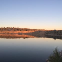
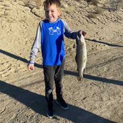
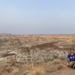
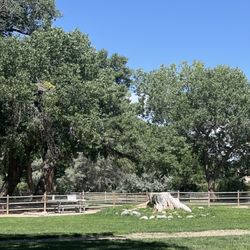
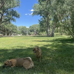
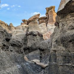
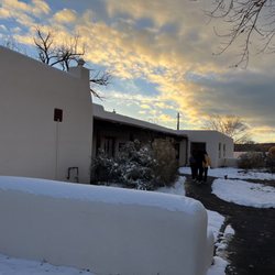
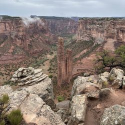
Oscar Thomas Park Photos


More like Oscar Thomas Park
Recommended Reviews - Oscar Thomas Park


More info about Oscar Thomas Park
110 W Pinon St
Farmington, NM 87401
Directions
Hours
Outdoor Amenities


Oscar Thomas Park - parks - Updated May 2026
Best of Farmington
People found Oscar Thomas Park by searching for…
Things to Do in Farmington, New Mexico
View Points in Farmington, New Mexico
Picnic Areas in Farmington, New Mexico
Fun Things to Do With Kids in Farmington, New Mexico
Public Showers in Farmington, New Mexico
Photo Spots in Farmington, New Mexico
Kids Birthday Places in Farmington, New Mexico
Fun Places for Kids in Farmington, New Mexico
Bathroom in Farmington, New Mexico
Playgrounds for Kids in Farmington, New Mexico
Things to See in Farmington, New Mexico
Kids Sports in Farmington, New Mexico
Running Trails in Farmington, New Mexico
Indoor Playground in Farmington, New Mexico
Parks for Picnics in Farmington, New Mexico
Kids Party Places in Farmington, New Mexico
Stuff to Do in Farmington, New Mexico
Family Fun in Farmington, New Mexico
What to Do in Farmington, New Mexico
Fun Things to Do at Night in Farmington, New Mexico
Places to Take Pictures in Farmington, New Mexico
Kids in Farmington, New Mexico
Trending Searches in Farmington, NM
Bounce House Rentals near Oscar Thomas Park
Campgrounds near Oscar Thomas Park
Floral Designers near Oscar Thomas Park
Flower Shop near Oscar Thomas Park
Kids Activities near Oscar Thomas Park
Nurseries & Gardening near Oscar Thomas Park
Off Road Trails near Oscar Thomas Park
Outdoor Furniture Stores near Oscar Thomas Park
Party Equipment Rentals near Oscar Thomas Park
Pedicure near Oscar Thomas Park
Photo Spots near Oscar Thomas Park
Picnic Areas near Oscar Thomas Park
Playgrounds near Oscar Thomas Park
Public Shower near Oscar Thomas Park
Browse Articles
Browse Nearby
BEST of Farmington, New Mexico Restaurants near Oscar Thomas Park
BEST of Farmington, New Mexico Things to Do near Oscar Thomas Park
BEST of Farmington, New Mexico Coffee near Oscar Thomas Park
BEST of Farmington, New Mexico Museums near Oscar Thomas Park
BEST of Farmington, New Mexico Breakfast near Oscar Thomas Park
BEST of Farmington, New Mexico Shopping near Oscar Thomas Park
Browse Brands
Related Searches in Farmington, NM
Affordable Gym Membership Deals in Farmington, New Mexico
Affordable Kayak Rental Services in Farmington, New Mexico
Best Fishing Locations and Guides in Farmington, New Mexico
Best Fun Things to Do in Farmington, New Mexico
Best Kids Playgrounds to Visit in Farmington, New Mexico
Best Places for Horseback Riding in Farmington, New Mexico
Best Play Place Options for Families in Farmington, New Mexico
Best Things to Do on a Rainy Day in Farmington, New Mexico
Best Water Parks for Kids in Farmington, New Mexico
Best Waterfalls and Swimming Holes in Farmington, New Mexico
Check Out Great Playgrounds in Farmington, New Mexico
Check Out Off Road Trails in Farmington, New Mexico
Discover Gyms With Steam Room Options in Farmington, New Mexico
Discover Kids Play Area Spots in Farmington, New Mexico
Discover Popular Bike Trails in Farmington, New Mexico
Discover Top Nature Parks to Visit in Farmington, New Mexico
Discover the Best Fishing Lake in Farmington, New Mexico
Discover the Best Night Hike Trails in Farmington, New Mexico
Dog-Friendly Hikes With Dogs in Farmington, New Mexico
Effective Strength Training Near Farmington, New Mexico
Enjoy Hiking Adventures in Farmington, New Mexico
Enjoy Indoor Lap Pool Facilities in Farmington, New Mexico
Enjoy Tent Camping Spots Around Farmington, New Mexico
Enjoy the Best Night View Spots in Farmington, New Mexico
Enjoy the Best Walking Trails in Farmington, New Mexico
Experience Stunning Sunset Views in Farmington, New Mexico
Experience the Best Family Fun in Farmington, New Mexico for All
Explore Beautiful Parks and Green Spaces in Farmington, New Mexico
Explore Boxing Gyms in Farmington, New Mexico
Explore Free Picnic Areas Around Farmington, New Mexico
Explore Free Things to Do Around Farmington, New Mexico
Explore Fun Activities to Do in Farmington, New Mexico
Explore Landmarks & Historical Buildings in Farmington, New Mexico
Explore Popular Campgrounds Near Farmington, New Mexico
Explore Popular Picnic Areas Around Farmington, New Mexico
Explore Popular RV Parks Around Farmington, New Mexico
Explore Popular Scenic Views Near Farmington, New Mexico
Explore Popular View Points Around Farmington, New Mexico
Explore Scenic Lakes to Visit in Farmington, New Mexico
Explore Secret Spots Worth Visiting in Farmington, New Mexico
Explore Summer Camps for All Ages in Farmington, New Mexico
Explore Top Gyms in Farmington, New Mexico Now
Explore the Best Crossfit Gyms in Farmington, New Mexico
Explore the Best Rock Climbing Areas in Farmington, New Mexico
Explore the Best Trail Options in Farmington, New Mexico
Find Beautiful Views in Farmington, New Mexico
Find Fun Things to Do With Kids in Farmington, New Mexico
Find Picnic Tables for Outdoor Fun in Farmington, New Mexico
Find Top Workout Classes Available in Farmington, New Mexico