Cancel

    Open app

    Search

    Berg Park

    4.3 (3 reviews)

    Berg Park Photos

    Recommended Reviews - Berg Park

    Your trust is our priority, so businesses can't pay to alter or remove their reviews. Learn more about reviews.
    Yelp app icon
    Browse more easily on the app
    Review Feed Illustration

    7 years ago

    Helpful 63
    Thanks 0
    Love this 53
    Oh no 0

    7 years ago

    Helpful 3
    Thanks 0
    Love this 0
    Oh no 0

    7 years ago

    Helpful 0
    Thanks 0
    Love this 0
    Oh no 0

    Verify this business for free

    Get access to customer & competitor insights.

    Verify this business

    Angel Peak Scenic Area - Angel Peak

    Angel Peak Scenic Area

    4.7(3 reviews)
    22.1 mi

    The best free campsite I've been to, hands down. On BLM land. Beautiful sunsets. Clean outhouses.read more

    Angel Peak Scenic Area was one of the best free campsites I came upon during my cross country road…read moretrip. I found this place by using the app CAMPENDIUM from my phone. I swear Campendium was so useful and helpful to me while along my journey. Whenever I needed a last second or spontaneous place to camp out for the night....Campendium had all the answers and solved all my problems, lol. For all the adventurers out there, I highly recommend downloading this app. It's free to use as well! So yeah I found Angel Peak Scenic Area...and not only was it free to camp for the evening...but the best part of it all was that the area was surrounded by a spectacular background of colorful purple and gray badlands!!! Yeah, just...it was so surprising that this place even existed! Because...it's located in Northwestern New Mexico near a town I had never heard called Bloomfield. But yeah...here was Angel Peak...what a hidden gem! Alright...so to get to the camping area....this was the one slight hindrance about this place...I had to drive a 7 mile dirt road. Okay yeah....the road was bumpy at times. But for my simple midsize car...there were no issues. Well, one other possible problem was that at the end of the road...there weren't many campsites or camp spaces available. It's not like Angel Peak was crowded....there just weren't many spots open and available to camp at. I fortunately found maybe 1 of the last spots around, and this was about 5pm on a Thursday in the middle of the month of September. So, for those who are interested in camping here...I'd recommend to arrive early. Overall, the ambiance here was a Perfect 10! After I found a camping space, got myself settled and set up my tent, I then walked over to the viewpoint and was quite impressed. It's just funny how you never hear of some places, they're so under the radar, and yet here I randomly at the spur of the moment found Angel Peak and was enjoying a terrific sunset immersed among inspiring badlands. You talk about the ideal place to camp out....and then to sit back and appreciate a late summer sunset....it really helped me put things into perspective....and just how much I've traveled to get here at this moment. Lol, alright I'll stop with the deep and intense talk. I'm glad I got a chance to review Angel Peak Scenic Area. This place certainly deserved a spot on Yelp and I'm glad to be the first to do it.

    Photos
    Angel Peak Scenic Area - Angel Peak (the less scenic view)

    Angel Peak (the less scenic view)

    Angel Peak Scenic Area - Appreciating the colorful badlands.

    Appreciating the colorful badlands.

    Angel Peak Scenic Area - Before heading to the campground area I made a quick stop here at the Badlands Overlook.

    See all

    Before heading to the campground area I made a quick stop here at the Badlands Overlook.

    Bisti/De-Na-Zin Wilderness - Look ma, I'm on top of the world !

    Bisti/De-Na-Zin Wilderness

    4.5(13 reviews)
    34.3 mi

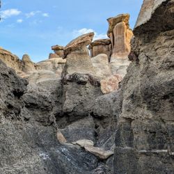
    If you're unfamiliar with the area but an avid hiker, Bisti Badlands is an amazing area to check…read moreout on your own, so long as you've come prepared with GPS coordinates, maps, and parking advice. I have no affiliation with it, but we used Firefall Photography's website for excellent resources on all of that, including pinpoints for the north/south parking areas. As experienced hikers (Grand Canyon, Utah parks, Himalayas, etc.), we know our limitations, including the fact that our GPS apps often make quirky jumps in extremely remote areas, so we tried to pick and choose our priorities, ultimately deciding that we could manage the Bisti portion by ourselves. (We did the De-Na-Zin side the following day, with a guide. We had limited time to explore and didn't want to waste it false-navigating to permitted parking sites or major landmarks on our own, especially in monsoon season, so we signed up for the Ah-Shi-Sle-Pah tour offered by Navajo Wilderness Adventures for that area -- absolutely wonderful!) On our independent day at Bisti, we arrived around 3 p.m., and a few sprinkles started just after 7 p.m., cutting off our desire to stay into the golden/blue hours, but it's worth visiting no matter the time of day. Since we had only one sunrise moment to spend there, we decided to end at Wings, despite having read that the Eggs don't photograph well in brighter light, and we were pleased with that choice in the end, since we had "near sunset" at the gorgeous hill of wings. Overall, in just under five hours, we made it from the Eggs to the Wings and hit nearly every major formation in between, including the Rock Garden, petrified wood, Hoodoo City, Vanilla Hoodoos, Manta Ray, and more. We found that some of our GPS points didn't quite match the Firefall map (including at the Beige Hoodoos and Manta Ray), but going armed with general AllTrails locations, Firefall and AllTrails maps, Gaia, and a tiny print map with photos made it all come together, allowing us plenty of time to photograph the landscape from vantages up, down, and all around. The relatively flat terrain made our nine miles of hiking relatively simple (but do avoid it after rain where possible), and it was a fantastic journey -- such mesmerizing formations and astounding landscape!

    This is one of my favorite places I have ever been to! I took a tour through Navajo tours and he…read moredid an excellent job showing us the great rock formations and the petrified wood. It is a little remote and had little service, so be aware!

    Photos
    Bisti/De-Na-Zin Wilderness - Instagram: @telephonesmoothie

    Instagram: @telephonesmoothie

    Bisti/De-Na-Zin Wilderness - Instagram: @telephonesmoothie

    Instagram: @telephonesmoothie

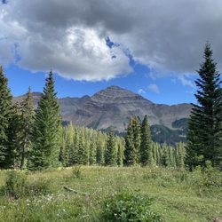
    Bisti/De-Na-Zin Wilderness - We loved it here!!
    See all

    We loved it here!!

    Canyon de Chelly National Monument - Bathrooms at White House trail end

    Canyon de Chelly National Monument

    4.6(74 reviews)
    80.9 mi

    I visited here a few times in high school when I did volunteer trips to the reservation. We would…read morevisit Canyon de Chelly on our free day after a long week of work. Canyon de Chelly National Monument is a huge canyon park on tribal lands that was habited by several Native American peoples many years ago. There are many areas that you can explore that have overlooks, hiking trails and remains of ancient Pueblo villages. The biggest attractions are the 800-feet tall Spider Rock spire and the White House ruin. Canyon de Chelly (pronounced de-SHAY) is located near Chinle in Northeastern Arizona. Even though it is a National Monument, the Navajo Nation entirely owns it. Around forty Navajo families live in the park. Other than the White House Trail, access to the canyon floor is restricted unless you book a tour guide. There are roads on both the North and South Rim where you can see ancient ruins and geologic structures. Canyon De Chelly has a visitor center with park rangers on hand and a gift shop. I was here recently and did the South Rim Drive. You can see ruins from the overlooks on South Rim Drive if you have binoculars. They are a little hard to see without them. This drive is the more popular side of the canyon because you can see Spider Rock and the White House ruin while on this road. On this drive are the Tunnel, Tsegi, Junction, White House, Sliding House, Face Rock and Spider Rock overlooks. Each overlook offers a unique perspective of the canyon floor and Navajo farmlands. We were able to do the White House Trail while here. It is the only trail that allows you to visit the bottom of the canyon without a guide. The hike is 2.5-miles round trip and descends nearly 600 feet to the canyon floor and back up. There are a few spots that can be a little slippery when raining. The end of the trail allows you to get up close to the White House ruin. This famous 1,000-year-old cliff dwelling was built by Ancestral Puebloans around 1060 AD. The White House has around 80 rooms and is named for the white plaster still visible on the walls. The hike itself isn't bad and worth it if you have some time. We had a nice time here at Canyon de Chelly. It brought back many memories of when I came here as a teenager. There are vendors at some of the overlooks that sell jewelry and other items. I wish we had more time to do the North Rim Drive to see the Massacre Cave Overlook. A sad event occurred here in 1805 when over a hundred Navajo people were murdered by the Spanish military while hiding in a cave.

    I unfortunately didn't have time to go on a guided tour of Canyon de Chelly (it's located in the…read moreNavajo Nation, so you need to have a licensed tour guide to enter the majority of the Canyon), but I visited the welcome center, both the north and south rim drives, and hiked the White House Trail. The welcome center is staffed with NPS rangers and volunteers. There's a small gift shop and museum area with exhibits. There's also a hogan outside and you can ask the ranger to give a hogan talk and even enter it. The rim drives are gorgeous, although dusk and dawn really bring out the colors. The canyon rims are quite sheer which is different from a lot of other canyons. Pueblos can be seen from several lookouts, so bring binoculars. There tends to be people selling artwork and jewelry at the lookouts, so if you're interested, bring cash. The White House Trail is the only publicly accessible trail without a guide. It starts at the lookout, and you can see the structure from the parking lot, or decide to hike down to get a closer look (it's fenced off with a chain link fence to avoid people not respecting it). The hike is 2.5 miles round trip with little shade (although does have two cool tunnels), so bring water.

    Photos
    Canyon de Chelly National Monument - Face Rock Overlook View Finder

    Face Rock Overlook View Finder

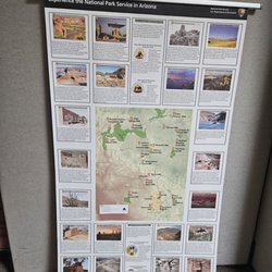
    Canyon de Chelly National Monument - National Park map

    National Park map

    Canyon de Chelly National Monument - Visitor Center

    See all

    Visitor Center

    Berg Park - hiking - Updated September 2026

    Loading...
    Loading...
    Loading...