Cancel

    Open app

    Search

    Old Growth Trail

    5.0 (2 reviews)

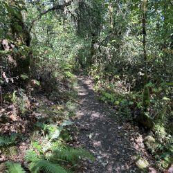
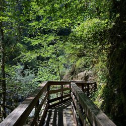
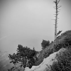
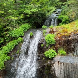
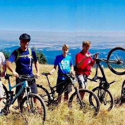
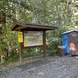
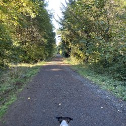
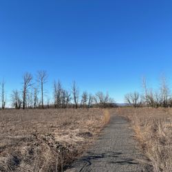
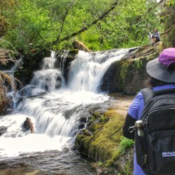
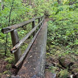
    Old Growth Trail Photos

    Recommended Reviews - Old Growth Trail

    Your trust is our priority, so businesses can't pay to alter or remove their reviews. Learn more about reviews.
    Yelp app icon
    Browse more easily on the app
    Review Feed Illustration

    10 years ago

    Helpful 14
    Thanks 0
    Love this 11
    Oh no 0

    11 years ago

    Helpful 3
    Thanks 0
    Love this 1
    Oh no 0

    Verify this business for free

    People searched for Hiking 287 times last month within 15 miles of this business.

    Verify this business

    Sweet creek trail - Bridges to pass.

    Sweet creek trail

    4.9(27 reviews)
    50.5 mi

    Many waterfalls and swimming holes along this amazing and shaded trail…read more Love mossy rocks? How about lush ferns? How do you feel about cascading water? Do you enjoy dipping your feet into cold water on a hot summer day? Or how about swimming among giant redwood trees? If any of this sounds appealing you need to visit Sweet Creek Falls. We came in the middle of summer and it was the perfect way to spend an afternoon hiking, meditating, and swimming. There are 11 waterfalls ranging in size and close to 2.5 miles all together of shaded trails to explore, rustic bridges included. This was definitely one of the highlights of our trip to Oregon last summer. Know before you go: Parking lots at each trailhead. Super stinky bathroom located only at Homestead Trailhead. Dog friendly. And most importantly FREE! *Don't be surprised to see topless women swimming. We all have breasts and it's a beautiful thing to be free especially in a place like this. If this bothers you just look away. *Don't use Yelp directions as they'll take you to the wrong place. Use Google instead. I've reported this several times but like nearly everything I report Yelp ignores it. And Happy Earth Day! If you haven't discovered what nature can do for your soul I highly recommend getting away from the daily grind, turning your phone off, and just enjoying what places like this can do for you. It's truly magical.

    Awesome trail with multiple waterfalls. Trails were nice and clear of debris and branches. A few…read morespots with bigger rocks, roots, and water. Gorgeous scenery! There are so many photo opportunities. Many different bridges along the trail allow you to walk over the water. There is a part of the trail where you have to walk through a small stream. I wasn't wearing the proper gear and didn't want wet shoes and socks, so we headed back at that point and headed towards the upper parking lot. The upper trail still had snow on the ground, and the parking area was pretty soggy. Overall, we thoroughly enjoyed our time here. We would love to come back again during a drier season. Highly recommend!

    Photos
    Sweet creek trail - Cascading water along the trail.

    Cascading water along the trail.

    Sweet creek trail - Just a happy banana slug.

    Just a happy banana slug.

    Sweet creek trail - Perfect summer afternoon as most of the trail is shaded.

    See all

    Perfect summer afternoon as most of the trail is shaded.

    Marys Peak - Artesian spring

    Marys Peak

    4.9(7 reviews)
    15.6 mi

    Mary's Peak, highest of the Oregon coastal range, was a terrific day trip for our group, Eugene…read moreBurnbootcamp. Our 10:30 meet was in flux for a few days at the gym. Without confirmation, I proceeded and without incident arrived solo at Conner's Trailhead. At this point, I attempted calling the lead, who started their ascent along the summit trail. Still no contact, which usually indicated that I had not gone far enough. The lure of an artesian spring led to a brief stop and subsequent text- "Hey guys, where are you? Was it a scrub?" The sound of crunching gravel beneath my tires on the shoulder calmed my nerves a bit. That, and the fascination of an artesian well flowing off a mountainside. Two stops before the parking lot above, I encountered a small group of campers. At the Campsite, the chemical toilet was a welcome amenity. I usually find the camp signs to be interesting reading, and probably spotted the dogs on leashes or notification right away. Last stop before the top and still no word. The parking lot above is open with minimal vehicle activity. Trails are well marked and spring abounds. I set off toward the There is a group of 10-12 hikers flopped on their day packs sipping water, nibbling munchies, regarding the city beneath fog. It's also the rooster crew looking for photo ops taking a break. Several call out to me, "Look who it is." I'm splurging now on red and green Holiday Reindeer gummies and taking sips from the Camelbak. Although my trip was much shorter, uncertainty multiplied the effects of altitude. It's good to see these faces becoming more familiar in this outdoor light. I recommend familiarity with the Internet trail maps in preparation for the Mary's Peak trip. I like to have face to face contact and phone checks with others, a pancho, and small flashlight. Water, and something to chew on is a good idea. Check with the park website for rules regarding your pets. Be safe, have fun!

    Just went on this hike last weekend with my fiancé and our two eight year old boys, we had a great…read moretime! The views are pretty stunning and the hike was moderate, easy trails to follow, different terrain made it fun, we even saw snow at one edge which the kids got to make snow balls with! Wasn't too busy on a Saturday afternoon either, highly recommend this adventure.!

    Photos
    Marys Peak - Our MTB crew!! Pedaled 7 miles to Mary's Peak from the north side fire road.

    Our MTB crew!! Pedaled 7 miles to Mary's Peak from the north side fire road.

    Marys Peak - Hike up to the peak

    Hike up to the peak

    Marys Peak

    See all

    Silver Falls State Park - Information desk

    Silver Falls State Park

    4.7(361 reviews)
    35.5 mi

    If you're gonna do the Trail of 10 Falls (or 8 as it was recently due to northside trail closure),…read moreI recommend a counter-clockwise route starting at South Falls to avoid crowds and work your way up the magnificence scale. Also helps to get there early as you can. Trails were wet from recent showers but well-maintained and not slick. If it's really been raining and the falls are pumping, be prepared for standing water behind a couple of the falls. (Luckily someone had put out small stones to balance on, but from the looks of their wet shoes many people were unlucky in their attempts to cross.) Walking sticks can be helpful in the steeper grades. It now costs $10 to park unless you've got an annual pass

    Daily parking permits are $10 per day, per vehicle for Oregon residents, and $12 per day otherwise…read more There are machines that sell the permits at the parking lots, so it's a pretty straightforward process. I went when there was a lot of rainfall, and so there was actually an emergency trail closure that spanned the majority of the park. Fortunately, the Canyon trail between the South Falls and the Lower South Falls was still open, and so I hiked that trail. It was absolutely amazing!! The falls were roaring and the creek was almost overflowing. The hike began with dark clouds and rain. As the trail led down and behind South Falls, the spray from the falls was heavier than the rain, soaking you from head to toe. The path then hugs the creek, which threatened to take over the trail at some points. There's a flight of stairs right before the Lower Falls, and at this point you can hear the thundering crash of the falls. As you go behind the falls, a shroud of darkness envelops you and you realize that suddenly you're fording through ankle deep water. With the loss of sight comes with the deafening noise of the tumbling water, and the spray attacks you every which way. Stumbling through, you emerge and find that the rain has stopped. As you crest up the path, the sun breaks, filtering through the trees with only the silence of the forest, punctuated with the occasional plop-plops of the trees shedding the water drops of the earlier rain. The silence is almost deafening. Good thing that the trail takes you right to the Lodge, which has a roaring fire inside to dry yourself with! There are also cool nature exhibits inside, as well as a small cafe to get drinks to warm yourself from the inside too. I would come here again, rain or shine!

    Photos
    Silver Falls State Park - South Falls, Silver Falls State Park, Oregon.

    South Falls, Silver Falls State Park, Oregon.

    Silver Falls State Park - Bridges

    Bridges

    Silver Falls State Park - Love a stone paved bridge

    See all

    Love a stone paved bridge

    Abiqua Falls Trailhead - The ropes section of the hike wasn't as daunting as initially feared.

    Abiqua Falls Trailhead

    4.4(10 reviews)
    41.1 mi

    Abiqua Falls! I just visited this beautiful 92-foot waterfall sort of in the middle of nowhere in…read moreOregon but located about 50 miles south of Portland. I have a lot to relay about the experience. This review could take the maximum 5000 words, lol, but I'll try my best to keep things as concise as possible... There are many questions about what to expect from Abiqua Falls. Even myself, I had concerns and doubts. But...I survived and it's an easy adventure to a very secluded waterfall. I'll try and answer the following questions... - Can you drive to the trailhead? From my POV, it's a VERY ROUGH ROAD down to the bottom. There's one specific section (and you'll recognize it immediately) where the road is practically cracked in half with divots and potholes. I actually witnessed a Ford Explorer trying to drive over it on the way back up and it was a big struggle for them! They eventually got past it, but I thought they were stuck. You absolutely need a high clearance 4x4 vehicle to make it down to the base to access the trailhead to Abiqua Falls. For me...I have a Suburu and I parked 2 miles away at the Abiqua Falls "Parking Lot" (according to Google) and then walked 2 miles down to the bottom and 2 miles back up. There was no way I was risking a flat tire, especially with not knowing how to change a tire and there barely being cell phone reception in the area. Btw...just to arrive at the Abiqua Falls parking lot, you must first drive 1.5 miles on a dirt road. For me, dirt and gravel roads are like nails on a chalkboard. I cringe driving over them. - Where is the trailhead located? This is a good question because there's no specific sign for Abiqua Falls, but it's easy to discover. Here's how...the road down to the bottom only goes so far. Eventually, you'll confront a white fence where you can leave your car (if you drove). But...there's a clear opening to the forest on the left-hand side of the road as you're going down. People say it's hard to find, but truly...you can't miss it. If you're any sort of outdoors enthusiast, it's simple. The hike is 7/10ths of a mile out and back. That's it! Again...there's barely any hiking involved, especially if you drive down to the base. - What is the ropes section like on the trail? I must be transparent. I read other people's AllTrails and Google reviews, and this can be deceiving. Let me explain... There were many reviews saying how the ropes section is intense and you're practically repelling down the cliff side. WRONG! WRONG! WRONG! It's an easy pathway. The ropes are no big deal. I have a serious fear of heights, and I casually made my down to the creek. Using the ropes was necessary for the most part, but it wasn't scary. It didn't strain my hands. IT IS NOT STRESSFUL! I'd rate the trail as easy - moderate. Do not fear the incline/decline slope. There's nothing of that sort. It is 100% safe to get up and down the trail. Once down at the bottom of the creek, hang on the left hand side. You'll notice the trail continuing around the bend that leads straight to Abiqua Falls. It's easy. I had no problems at any point in time. I've been on much, much rougher trails during my explorations. I visited on a random Thursday morning at the end of August and pretty much had the falls to myself. There were a few people that came along towards the middle of the day. I believe if you're coming to Abiqua Falls, you must bring a bathing suit and towel. I think it's a right of passage. The waterfall is scenic and the setting is charming, but other than admiring the views and maybe having a picnic, you must take the plunge in the pool of water that Abiqua Falls splashes down into. - Was the water cold? Absolutely! Lol, I was dreading the cold water but made the premeditated decision that I was swimming to have a fun memory. It wasn't even hot outside as well, but I forced myself in and I'm glad I just did it. Obviously, your body adjusts to the cold and it's not too extreme. Overall, the ambiance at Abiqua Falls was liberating. The canyon walls sort of engulf you from high above. You're standing at this dramatic waterfall and when the sun reaches above the tree line, you can notice some slight coloring in the waters which can make for a magical moment. In all, maybe you need a few hours to hang out at the falls before returning to the ropes section and heading back up to the trailhead and road. Again, the hike back up to the top is barely strenuous. It's a slight workout. Most folks can handle it. Lastly, if you're someone who left their car all the way at the top of the road (like I did), it is possible that you may get offered a lift from those hikers who took a chance driving their cars down to the base. If so, hop in, lol. It'll save time not having to trek back uphill. In the end, I enjoyed getting to witness Abiqua Falls. The journey to arrive here was not as daunting as I initially anticipated. And again, from my POV, be kind to your car tires. Don't risk the drive.

    Extremely steep. Rope system down to the bottom. I ended up fracturing my spine in 2 places due to…read morea fall. But if you're able to make it then go. Physical fitness is a MUST But a stunning falls to see

    Photos
    Abiqua Falls Trailhead - The trailhead to Abiqua Falls. It's located on the left hand side of the road.

    The trailhead to Abiqua Falls. It's located on the left hand side of the road.

    Abiqua Falls Trailhead - This is Abiqua Falls, a fantastic under the radar  Oregon waterfall.

    This is Abiqua Falls, a fantastic under the radar Oregon waterfall.

    Abiqua Falls Trailhead - Had Abiqua Falls Trail pathway saved on my phone, just in case I got lost.

    See all

    Had Abiqua Falls Trail pathway saved on my phone, just in case I got lost.

    Alsea Falls Recreation Site - Alsea falls

    Alsea Falls Recreation Site

    4.0(1 review)
    23.9 mi

    I'll be up front. I love Oregon. I love how beautiful it is here. I love the slower pace of life. I…read morelove the food. I love that people here have manners. Actual manners! Sh*t, I haven't experienced anything like this since living in New England (shoutout to NH, VT, and ME). But I digress. Dealing with folks takes a toll on me so I knew I wanted to grab a couple close friends and find a serene spot in a forest somewhere to recharge my batteries. Oregon delivered as usual. Alsea Falls Recreation Site (AFRS) is a picturesque area located 30 minutes southwest of Corvallis and boasts gorgeous forests of red cedars, maples, and Douglas firs as well as two waterfalls. I thought hiking trails here were pleasant. They offer plenty of shade and aren't very strenuous. Alsea Falls is located rather close to the day use parking lot, but there is a 1.4 mile trail leading to Green Peak Falls if you walk across the wooden bridge. The trail is poorly marked so you may lose it when you end up at McBee Park campground. Stick to the right and you will find two trails. Take the right official trail with the trail post. The left trail is shorter but there are stinging nettles along the way. Green Peak is the larger of the two falls and it is possible to climb to the top via the adjacent trail (right side), but it is steep so be careful. O T H E R I N F O -Day use parking is $3. Fill out an envelope. Drop off the envelope with payment in the receptacle across from the outhouse. Keep the stub in your vehicle. -Amenities within the campground include drinking water and vault toilets. Several campsites can accommodate large RVs or trailers; up to 32 feet long. -Dogs are allowed on a leash so bring the family pup along! -Salmon and steelhead fishing during the winter months. -The park is clean. Keep it that way and pack your trash until you find a rubbish bin. -Pack a camera. Take plenty of photos. Collect memories instead of things.

    Photos
    Alsea Falls Recreation Site - On the trail to Green Peak Falls

    On the trail to Green Peak Falls

    Alsea Falls Recreation Site - Loving the PNW vibes. Found a waterfall and decided to just chill out.

    Loving the PNW vibes. Found a waterfall and decided to just chill out.

    Alsea Falls Recreation Site - Alsea Falls

    See all

    Alsea Falls

    Tamolitch Blue Pools - You've passed the blue pools if you see this bridge!

    Tamolitch Blue Pools

    4.7(13 reviews)
    66.2 mi

    This is my second time completing this trail. It is very popular so make sure to get here early if…read moreyou don't want to park far from the trailhead. There are dig out restrooms available at the trailhead as well as a trash bin. The trail is easy though there are some boulders you need to scramble over in the lava fields. You will walk along a beautiful river and cross a couple foot bridges and streams along the way. Once at the blue pool you will truly see that the photos you've seen online are not edited! The water is unbelievable. You can walk down to the water but it is not recommended to jump in unless you are experienced. The water is 30 degrees year around and several injuries have occurred here- so be wise and have fun.

    It rained the whole drive over it seemed! But the trees kept the hike dry. Free parking and porta…read morepotties at the front entrance. The trail is a fairly easy one but you have to watch where you step. The first .75 miles was quite flat but the next .75 miles was fairly rocky. My husband and I both rolled our ankles at different points. Once you get to the actual spot to see the blue pools, there is one sign that says no biking. At that point, veer off towards the water area to see the pool! We missed it and were in the zone of walking and we ended up going too far! Don't go to the bridge that only has one side to hold on to. That means you've gone too far

    Photos
    Tamolitch Blue Pools
    Tamolitch Blue Pools - Standing at a ledge overlooking the Blue Pool.

    Standing at a ledge overlooking the Blue Pool.

    Tamolitch Blue Pools - Mossy rocks

    See all

    Mossy rocks

    Old Growth Trail - hiking - Updated May 2026

    Loading...
    Loading...
    Loading...