Old Bear River Bridge Photos


More like Old Bear River Bridge
Recommended Reviews - Old Bear River Bridge
Start your review...



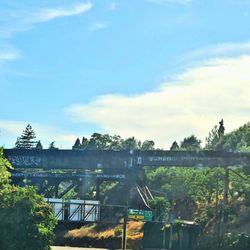
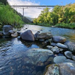
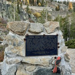
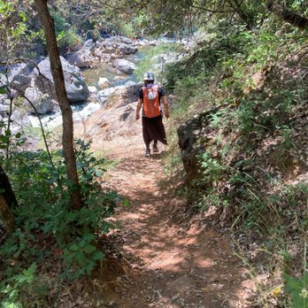
Old Bear River Bridge, also called, "Bear River Historic Bridge," is located near Colfax, CA. The bridge is located next to a taller and more modern bridge that is part of Route 174. This pair of bridges is about two miles to the north of Route 80. From Colfax, take Route 174 (also called, Colfax Highway) to the north. Route 174 crosses over a modern bridge, and once you've crossed this modern bridge you will find a turn-off that brings you into a dirt parking lot. Park your car in this lot. At one end of this parking lot is a stone monument with a plaque on it. Just beyond this stone monument is the north side of Old Bear River Bridge. The bridge is great for pedestrians, and vistors can gaze at the rushing waters arriving from Lake Rollins to the east. Visitors can also gaze at the waters rushing to the west and tumbling over boulders in the Bear River. Bear River continues for about nine miles until it reaches Lake Combie. The plaque has the following paragraph of writing on it: "OLD BEAR RIVER BRIDGE. Since 1852 bridges near this site have served as the gateway to western Nevada County. This 1924 span was the first concrete bridge at this site and features a Roman style single arch design, constructed in a continuous pour method. The Colfax Highway Association led a citizens group that saved the bridge from the wrecker's ball in 1986, and placed this monument in 1992." The pedestrian walkway on Old Bear River Bridge is about 20 feet lower down than Route 174, which crosses over the modern bridge. Because Old Bear River Bridge is lower, the modern bridge does not obscure the views to the west. An interesting sight from the southern end of Old Bear River Bridge is an aqueduct. This aqueduct is built on a hill rising from the southern banks of Bear River. Regarding the northern bank of Bear River, what is found here is a hiking trail that follows the river and takes you in a westerly direction. The trailhead is located near the stone monument (mentioned above), and the trail first takes you under the modern bridge, and then into a forest. I took this trail for about 20 minutes through the forest. From this trail, you are rewarded with occasional views of the Bear River below. Also, from this trail that are several small dirt trails that branch off from the main trail and lead you along a 50-foot descent down to the river's edge. ATTACHED PHOTOGRAPHS. 1. Plaque installed at north side of Old Bear River Bridge. 2. View downstream of Old Bear River Bridge, showing that the modern bridge is about 20 feet higher up than Old Bear River Bridge. 3. View of most of Old Bear River Bridge. I took this photograph from the trail that passes under the modern bridge (and under Route 174). 4. Aqueduct that is visible from the southern end of Old Bear River Bridge. 5. Looking east from Old Bear River Bridge. You can see little waterfalls. 6. Looking west from Old Bear River Bridge. From this vantage spot, you can see little waterfalls. 7. View of the dirt trail, showing a hiker wearing an orange backpack. 8. View of Bear River from the dirt trail. read more




3 years ago