1. Northwest Lancaster County River Trail

0

Marietta, PA

Cancel

Open app

Search

Northwest Lancaster County River Trail

4.4 (8 reviews)

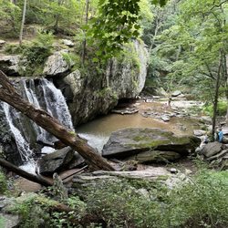
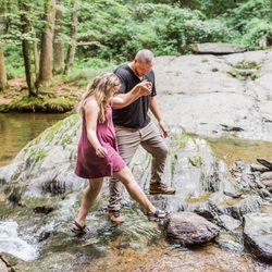
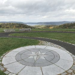
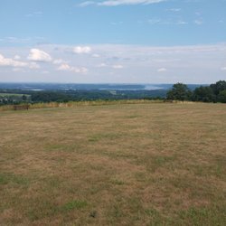
Northwest Lancaster County River Trail Photos

More like Northwest Lancaster County River Trail

Recommended Reviews - Northwest Lancaster County River Trail

Your trust is our priority, so businesses can't pay to alter or remove their reviews. Learn more about reviews.
Yelp app icon
Browse more easily on the app
Review Feed Illustration

6 years ago

Helpful 28
Thanks 1
Love this 31
Oh no 0

8 years ago

Helpful 1
Thanks 0
Love this 0
Oh no 0

9 years ago

Helpful 2
Thanks 0
Love this 1
Oh no 0

10 years ago

Helpful 2
Thanks 0
Love this 2
Oh no 0

4 years ago

Helpful 1
Thanks 0
Love this 1
Oh no 0

6 years ago

Helpful 0
Thanks 0
Love this 0
Oh no 0

8 years ago

Helpful 0
Thanks 0
Love this 0
Oh no 0

10 years ago

Helpful 0
Thanks 0
Love this 0
Oh no 0

Ask the Community - Northwest Lancaster County River Trail

Verify this business for free

People searched for Hiking 670 times last month within 15 miles of this business.

Verify this business

Chickies Rock County Park - View from Chickie's Rock

Chickies Rock County Park

4.6(13 reviews)
4.4 mi

This was stop #2 on a beautiful late-September Sunday adventure. I'd done my homework ahead of time…read moreand planned to tackle the Chickie's Rock Overlook Trail first, then swing by the nearby Breezyview Overlook (just a 4-minute drive away). Chickie's Rock Overlook Trail: Parking was plentiful, and I appreciated the history sign at the trailhead--it turns out this path was once a trolley line leading to an amusement park near Chickie's Rock. So you're not just walking, you're walking through history. The trail itself is wide, relatively flat, and about a 20-minute walk to the overlook if you're taking your time (we were chatting the whole way--it was Sunday morning, not a cardio day). Pro Tip: Not far from the parking lot, the trail forks. Go LEFT for the easy stroll. Go RIGHT if you want a steeper climb and some cardio. Either way, the two trails meet up again before the overlook. When you arrive, the payoff is worth it: a panoramic view of the Susquehanna River and classic Central PA scenery--rolling hills, farmland, distant ridges, train tracks running at the base, and acorns plinking down around you. Pure magic. Just note: the overlook itself requires scrambling over some big rocks to get to the railing. Sneakers or boots are a must, and it's not super friendly for little kids or anyone with mobility challenges. Bonus history fact: Chickie's Rock was actually used as a Union lookout post during the Civil War in 1863, when Confederate troops invaded PA. That blew my mind. Breezyview Overlook: From Chickie's Rock, it's a quick 4-minute drive to Breezyview Overlook. This one's a lot easier--park, take a few steps on grass, and you're there. You even get the fun perspective of looking back at Chickie's Rock and seeing where you'd just been. Parking was easy, and they had a port-a-john if needed. The view is nice, but not nearly as epic as Chickie's Rock. Then again, the best things usually require a little extra effort. Overall, this was the perfect low-impact Sunday adventure. Bring water, pack out your trash, and don't forget to smile and say hi to fellow hikers along the way. If you're looking for an accessible trail with a stunning payoff, Chickie's Rock is a must.

This is a straightforward hiking path - pretty much straight and up to be rewarded with a beautiful…read moreview of the Susquehanna River. If you are lucky, like we were, you will see a low flying plane from the nearby military base. We stopped during the week, but I could imagine the parking at this area could get filled and you may have to wait for a spot. I'm seeing from other reviews that there are other parking spots and entrances, but the one we were at seemed fairly direct to the overlook. It was a beautiful quick hike to see some impressive views.

Photos
Chickies Rock County Park

See all

Highpoint Scenic Vista & Recreation Area - Sumit view of the Susquehanna River

Highpoint Scenic Vista & Recreation Area

4.2(6 reviews)
5.5 mi

Awesome workout and awesome view to reward yourself with after that tough walk. Also many places to…read moresit down and watch the view. I highly recommend coming here in summer and watching a sunset, it's mesmerizing. I actually asked my gf out here so it'll always have a special place in my heart. Also very cool place to bring your dog!

After my Yelp friend David H. posted about this small gem last month, I had to take a look myself…read moreas I have been in the area numerous times but had honestly never heard about this place. Just to keep the history lesson short, it was built by York County in 2007 and it is one of a series of ten overlooks that are at different points in the county all of which give views of the Susquehanna River. susquehannariverlands.com/the-great-outdoors/scenic-overlooks/highpoint-scenic-vista-rec-area/ The set up is fairly simple. There is a small parking lot at the base of the overlook on Hilt Road. At the base there is a picnic bench and a port-a-blaster along with some literature about York County parks/area trails. From there it's up and around the trail which is a 1/2 mile loop with five way point stops that I guess are made to have you appreciate the view from different angles? At the top the view is very nice. It's literally the same as if you were over at Samuel S. Lewis State Park except that now you're two-ish miles closer to the river. The overlook from Samuel S. Lewis is higher and is visible from here and the top of the vista here is very visible from Sam Lewis. We were here around 35 minutes and the parking lot was packed but people were at different point of the incline and on other trails nearby so things never felt cramped or rushed. While I'm not necessarily sure that this place needs a return visit, I'm glad we came and I appreciate David putting this one on my/everyone's Yelp radar as it is a unique spot worth a brief stop.

Photos
Highpoint Scenic Vista & Recreation Area - Beautiful view.

Beautiful view.

Highpoint Scenic Vista & Recreation Area - Same one

Same one

Highpoint Scenic Vista & Recreation Area - View of York county

See all

View of York county

Samuel S. Lewis State Park

Samuel S. Lewis State Park

4.9(7 reviews)
4.9 mi

Let me tell you something. During this time of Covidiousness, we've certainly done our fair share…read moreof outdoorsy types of things. While coming to a state park like this in York County may not seem like an obvious choice, it's actually been the perfect place. I'm not going to go in to any history or backstory (I covered that in my initial musings several years ago) but what sets this park apart from most PA state parks is its size. While the park is only 85 acres (PA has 121 state parks and some of them clock in at north of 15K acres just for a sense of scope) it's layout allows for things to feel more spread out than you would assume. The main road that wraps around the park is great for walking but there are also two miles of trails which if done in a clockwise direction are actually somewhat challenging with how it'll be mostly uphill. There is also a disc gold course, a rock formation that kids will love to climb on, a few small swing sets placed at different spots and a large open field at the top of hill with one hell of a view towards the Susquehanna River, Wrightsville and Columbia. The best part about this place is that it's rural enough so that it's never too busy. We've made trips to some state parks closer to us (Jacobsburg-Nockamixon-Lehigh Gorge) recently and they have been consistently packed. Here, not so much. The drive here is easy. There is an amazing view. There is usually more than enough space for everyone to spread out and do whatever they want. Sounds perfect to me and we'll be back this weekend.

Samuel S. Lewis State Park does not offer you a bunch of amenities. There's no amazing new…read moreplayground for the kiddies (although there are some swings and such throughout). There's very few short trails around the park (but enough to satisfy my dogs and if you go the "right" way, you get quite a workout hiking uphill). However, what you DO get is gorgeous views of the river and landscape from atop Mt. Pisgah. You also get open space to roam and run around. And my son's favorite part are the rocks! He loves to climb and explore. It's almost possible for me to give any park less than five stars--especially one with such a beautiful view. You won't regret the trip to visit this park. I'm just lucky that it's only 15 minutes from home. P.S. Go read Christopher C.'s review--it's very thorough and well-written.

Photos
Samuel S. Lewis State Park

See all

Tucquan Glen Nature Preserve

Tucquan Glen Nature Preserve

4.8(8 reviews)
19.2 mi

This loop hike is absolutely one of the best hiking experiences I've had. We had two children ages…read more6 and 9, and they were beside themselves with excitement the whole time! Be prepared to climb rocks, hoist yourself over tree trunks and get a little wet! It is a fairly difficult trail at some points- please beware of slippery rocks and other obstacles! If you have balance issues this may not be the trail for you. Bring a camera- there are beautiful water falls on the second half of the trip! *Tip: Pack an extra set of clothing and some water shoes! There are great places to splash around when you reach the midway mark in the trail!

This is one of my new favorite hiking spots. Private parking spot (small) but your car is safe away…read morefrom the road. They have four trails, blue, yellow, white and orange (which is the Conestoga Trail). We hiked the yellow and blue. Each is on either side of the creek. The trails follow the creek out to the Susquehanna. When you are nonspot hiking takes between 1-2 hours to finish the whole thing. It is so beautiful here. The path directly follows the river and it varies in difficulty from flat ground to stepping over rocks to boulder climbing. It is fantastic! You can cross various fallen trees to get to the other side of the creek (it is safe the trees are stable and huge). So peaceful and quiet, until you hear the many waterfalls and rapids! Definitely going back to cheek out more trails. Only downside is limited parking. Went on a cloudy day.

Photos
Tucquan Glen Nature Preserve

See all

Grubb Lake - Lacey

Grubb Lake

4.1(12 reviews)
7.8 mi

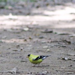
I didn't know this 54-acre park existed until I went searching for parks around Lancaster…read moreyesterday. I'm so glad I decided to visit on my day off: a beautiful oasis close to where I live. Lake Grubb (13-acre) is a manmade lake in the ore pit of the old iron mine excavated on the site in the 1800s. At one time, it was used as a water supply but that stopped around 2000, and in July 2003, it was turned into Lake Grubb Nature Park (LGNP). Here are some amenities: * There is a one-mile trail around the lake. It is well-maintained but I've read that it can be muddy at times. The trail is almost all shaded and a fairly, easy hike. There are a couple of spots where there is an incline. * Lots of benches * 2 Pavilions with electrical outlets and can hold up to 100 people for events * Restrooms * Fishing is allowed. * No dogs/pets allowed, swimming or boating. * Lake Grubb has some spots as deep as 180-feet deep. * The website says there is a playground but I didn't see one? For me, I rate places based on solitude. LGNP was perfect for me. I was there on a Monday morning and I did see people while I was hiking but most of the time, I was alone. It was quiet except for the birds tweeting and the cicadas chirping. I was delighted to see a Green Heron at the water's edge. It let me take several photos. I also saw an American Goldfinch on the trail. At one point, there was a "butterfly bush" and lots of butterflies flying around. Great for photographers. I will definitely be back. :)

I like this park. It is peaceful and there is plenty of parking. There is a monster hill. So beware…read moreif you are not in shape. My only issue with this park is that it prohibits dogs. It isn't just dogs not on leashes. I was so sad to read the signs for no dogs at all. I also read that there have been some geese that are very territorial at this park. That is a more recent situation.

Photos
Grubb Lake - American Goldfinch

American Goldfinch

Grubb Lake - Use rocks for checkers

Use rocks for checkers

Grubb Lake

See all

The Pinnacle

The Pinnacle

5.0(15 reviews)
47.3 mi

Came here on Sat 10/25 to hike with a couple gf's and brought my doggo, Linc, since it's a dog…read morefriendly trail. I work out but I wasn't ready for this trail as a first time hiker lol! I wore sneakers but would have greatly benefited from hiking boots for more ankle support after slipping and tripping my way along the dense leaf covered dirt trail that continued to get more rocky on the ascent. Also, you will need to climb some legit large rocks/boulders to reach the Pulpit Rock overlook but the challenge was well worth it for the views! My gf's & I chose the easy way down which was to take the gravel road alongside the observatory that eventually transitions to pavement. Even the decline of this road was steep in itself. No easy way up or down haha! I saw people of all ages and fitness levels along my hike and plenty of cute dogs! Bring snacks and water to re-energize during a rest break. My one friend packed some TP and I thought it was a great idea cuz you just never know when you might have to go! Parking lot is a joke with ~20-25 spots but many ppl, including us, parked along Reservoir Rd so make sure to get here early in the morning or expect to walk a couple extra miles just to reach the start of the trail.

Great spot for a day hike, with beautiful views at the two main lookouts - Pulpit Rock and the…read morePinnacle. The hardest part of the hike is getting to Pulpit Rock, as it starts with a fairly steep road to get to the trail, and then some more elevation climb as you get up to the lookout. From there, it's probably another 2.5 miles or so to get to the Pinnacle, but the elevation gain is minimal. Both of these stops provide great views, with lots of raptors flying around if you're lucky! Bring snacks and water, especially on a hot day, and cameras to take pictures!

Photos
The Pinnacle - Jerico and myself on a pinnacle hiking adventure  Loving life and the gifts God provides

Jerico and myself on a pinnacle hiking adventure Loving life and the gifts God provides

The Pinnacle - Pulpit Rock overlook with my pup

Pulpit Rock overlook with my pup

The Pinnacle

See all

Northwest Lancaster County River Trail - hiking - Updated October 2026

Loading...
Loading...
Loading...