Cancel

Open app

Search

Nob Hill Trail Park

4.5 (6 reviews)

Nob Hill Trail Park Photos

You might also consider

Recommended Reviews - Nob Hill Trail Park

Your trust is our priority, so businesses can't pay to alter or remove their reviews. Learn more about reviews.
Yelp app icon
Browse more easily on the app
Review Feed Illustration

Reviews With Photos

Korina Y.

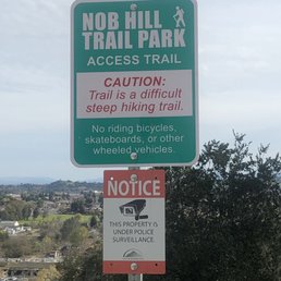
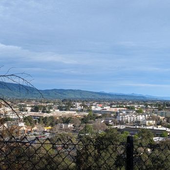
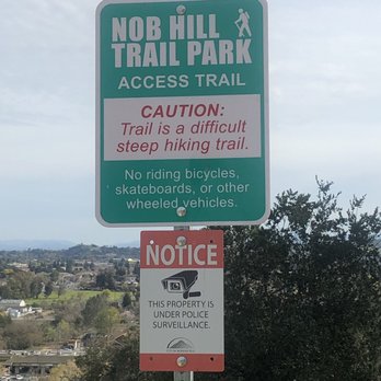
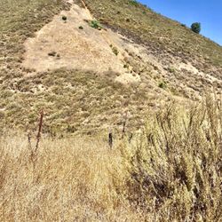
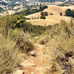
2/23/2019 Saturday It's a cute little park/hiking trail up to a water tank on top of a hill. The trail is very short like a mile at the most, but it's got a bunch of exercise equipment type of thing laid out throughout , and there are some slides you can go down which is fun for the little ones. On Saturday afternoon, we only saw like a dozen people here. Kids seemed to be having a good time going down the slides from top of the hill but you have to come back up on stairs which gives you a good workout. We happened to stumble across this place after exploring the downtown area of Morgan Hill but I wouldn't go out of my way to come here just for this place. The view is not all that great, nothing like from Twin Peaks in San Francisco but pretty nice because it's peaceful and quiet.

Looking North over Del Monte Ave,

See all

3 months ago

Helpful 0
Thanks 0
Love this 0
Oh no 0

3 years ago

Helpful 3
Thanks 0
Love this 3
Oh no 0
Photo of Michele C.
577
693
4723

4 years ago

Helpful 5
Thanks 0
Love this 3
Oh no 0

7 years ago

Helpful 5
Thanks 0
Love this 1
Oh no 0

5 years ago

Helpful 1
Thanks 0
Love this 1
Oh no 0
Photo of R T.
0
48
4

6 years ago

Great hidden gem close to downtown. Has a ling fun slide and nice views all around. A little steep but not too hard.

Helpful 0
Thanks 0
Love this 0
Oh no 0

Ask the Community - Nob Hill Trail Park

You might also consider

Verify this business for free

People searched for Hiking 1,154 times last month within 15 miles of this business.

Verify this business

Coyote Valley Open Space Preserve - Coyote Valley Open Space Preserve

Coyote Valley Open Space Preserve

4.4(28 reviews)
5.4 mi

Back Valley Located…read morebetween San José and Morgan Hill is a gorgeous ±348-acre park that offers a no-frills hiking experience and superlative views of The Valley. This is one of OSP's smallest parks, but what it lacks in size it more than makes up for in quality. The Good: * Free to visit! * Mountain biking on certain trails (check map & signage) * Horseback riding on certain trails (check map & signage) * Restrooms in the parking lot * Picnic tables along the trails * The Arrowhead Trail Loop (±4 miles) is fairly easy, but does have a few decent uphills. However, we did it with three young children of varying ages, so it really wasn't an issue. * Great place for wildflower viewing--especially one year we barely had to leave the parking lot to be ensconced in Poppies! The Meh: * No dogs allowed * No trash cans, so pack it in and pack it out The Ugly: * The parking lot seems to have doubled since the last time we were here, which is a good thing because it used to fill up fast. It is still fairly small and only holds 27 cars--assuming no horse trailers are parked. There is also NO parking on Palm Ave. Conclusion: Small but mighty!

I hiked Sat 4/17/21 at Coyote Valley OSP, Morgan Hill. It's a 40min drive from North Fremont, Free…read moreparking, but on Saturdays have to be there before 8am. Park opens 7am-Sunset. Only 1 unisex vault toilet, it had tp and hand sanitizer. We did the 4mile loop hike: Heart's Delight Trail and Arrowhead Loop Trai, it's a One-Way trail due to Covid19. Gentle hills so there is climbing, they call it challenging, but it's really just moderate. Some views. Nice short hike in Morgan Hill.

Photos
Coyote Valley Open Space Preserve - Coyote Valley Open Space Preserve

Coyote Valley Open Space Preserve

Coyote Valley Open Space Preserve - Coyote Valley Open Space Preserve

Coyote Valley Open Space Preserve

Coyote Valley Open Space Preserve - Coyote Valley Open Space Preserve

See all

Coyote Valley Open Space Preserve

Henry W Coe State Park - View towards the top of Steer Ridge Road

Henry W Coe State Park

4.2(127 reviews)
7.2 mi

Henry Coe has been in my "to hike" list for quite a while. It's the largest in the State Parks…read moresystem and while, technically, in the South Bay, requires a long, windy drive once you're off the 101. It can seem overwhelming to pick a day hike, given the vastness of the park, so I'd recommend coepark.net. That site lists several day hikes and shares route maps. It was a huge help to me, when deciding to hike the trail to Frog Lake. Henry Coe is popular for backpacking but moderate day hikes can be found and the loop to Frog Lake and back was a wonderland of green hills, tiny wildflowers and vast views of the Diablo Range. It's more about the journey than the destination and I enjoyed hiking through various eco systems that included marsh-like trails, rolling green hills, woodland and a small lake. Parking is self-paid or via the CA State Parks pass. There's a nice visitor center with rangers helping to acclimate you to the park, along with flush toilets and a small gift shop. You feel like you're in the foothills, while really, just a 30 minute drive from Morgan Hill. Now that I've acclimated a bit to the park and its hikes, I'm finally going to add Henry Coe to my State Parks rotation

Wonderful start park with various options for different levels of outdoor enthusiasts. If you are…read morelooking to camp and hike, you can make a reservation for either the camping site or the backpacking site. For the camping site, all you need to is drive up to your reserved camping spot, and start unpacking, then you have access to water, bathrooms and many hiking trails. The backpacking site will require to hike in and then set up all your gear. Be sure to do your research so that you're not stuck out there without water. This state park affords to the visitor extremely beautiful sunsets and sunrises at the campsite and nearby viewpoints. Astronomy hobbyists will also enjoy the evening scenery, where many astronomical phenomena are visible. As a precaution avoid the yellow grass as ticks do make these areas their habitat!

Photos
Henry W Coe State Park - Tons of ladybugs by creek before The Shortcut 10/29/23

Tons of ladybugs by creek before The Shortcut 10/29/23

Henry W Coe State Park - 10/29/23

10/29/23

Henry W Coe State Park

See all

El Toro Mountain - Good morning.

El Toro Mountain

5.0(1 review)
1.1 mi

So easy to get distracted these days by things that don't matter, or matter a lot but are then…read moretwisted by people that don't matter into tools for deception and sheep herding. Fall down this rabbit hole to your great detriment. For those that have fallen and are in the rabbit hole, fear not. The rabbit hole only feels durable. As a matter of fact, it isn't. It's paper. You can tear a hole in it and be free. El Toro Mountain will tear a hole in your rabbit hole wall. Wake up early because in afternoon summertime Morgan Hill has a temperature equivalent of a stage in the inferno below. But in the morning it's generally cool and still and there aren't a ton of humans out and you can get up and down this mountain in like an hour if you hustle and an hour of exertion in this space with the view at the top and birds and dust and voila, no more rabbit hole. On the way up the steep bit all you're thinking about is damn this is steep and not much else. At the top after good exertion you're rewarded by a view, maybe a fellow traveler, and the realization that this is what matters, not what they're trying to do to us. If I lived in The Hill I'd be up this mountain once a week come rain or come shine. In rain I bet it's a messy affair. There are two ways up. I've so far only sampled one. Go to the West Hills Church on DeWitt. You can park down DeWitt from the church or on Spring Avenue. Walk onto the property with the church on your left then up the paved driveway to the school. Keep the school on your left and head for the back of its parking lot and there you'll find the trailhead. Which is dirt road for access to a water tank and the powerlines and it's gated and ppl say you aren't supposed to be going up there but ppl do and you should too. Probably don't go on school days and don't park in the school lot even if the gate is open bc somebody could close it while you're escaping the rabbit hole and you'd come back and be locked in and that would be a drag. Be it El Toro or Diablo or Mt. Umunhum or whatever is closest to your backyard - sample it on a regular basis. Keep yourself sane. Keep your heart strong. Do it for you and the folks that love you. You'll be a whole lot more fun to be around.

Photos
El Toro Mountain - View of El Toro from DeWitt Avenue

View of El Toro from DeWitt Avenue

El Toro Mountain
El Toro Mountain - Bernie's path to a 2020 victory is steep and rocky ...

See all

Bernie's path to a 2020 victory is steep and rocky ...

Anderson Lake County Park - This is a photo of my LCD screen on my camera "Black Phoebe

Anderson Lake County Park

3.7(55 reviews)
2.7 mi

Ok so supposedly it cost six dollars to get in to the parking lot. Um... the parking lot I went…read moreinto had nowhere to pay, none, zip,zippo, nadda "not that I'm complaining lol!! Looks like they are doing seismic retrofitting stuff so we couldn't walk over this cool bridge that was over the stream, lots of chain link fence and construction going on... sad face. Wifey and I were able to sit on a bench near the stream "which honestly was quite beautiful if you didn't look to far up" We sat there for about 2 hours watching the Black Phoebe's fly around catching bugs. Beyond that there doesn't seem to be much else going on in this parking lot site. There is another entrance, haven't been there as of yet, maybe that entrance will be better.

Lake it Easy This…read more±4,300sq ft county park is home to Santa Clara County's largest reservoir at a whopping ±1,300sq ft. (±7 miles long). The Good: *Visitor Center at 19425 Malaguerra Ave, Morgan Hill, CA *First come, first served picnic tables *hiking trails *Horses welcome *Dogs are welcome The Meh: *Only a few miles of trails are currently open *$6/day entrance fee The Ugly: *A large part of the park is currently closed due to seismic retrofit construction project and not expected to re-open until 2030--if we're lucky! *Access to the lake--including fishing--is currently prohibited due to the construction. Conclusion: Not really worth a visit until after the construction project is done.

Photos
Anderson Lake County Park

See all

Middle Ridge Trail - Another weirdly-shaped dead tree next to the trail. - - - Tom Brody

Middle Ridge Trail

5.0(2 reviews)
7.2 mi

REVIEW OF MIDDLE RIDGE TRAIL. The areas of Henry Coe Park nearest the headquarters (elevation…read more2,800 feet) include Flat Frog Trail, a valley with Coyote Creek (elevation 2,100 feet) running down the middle, Middle Ridge (elevation 2,900 feet), and another valley (elevation 1,640 feet). Beyond this other valley is Mt. Sizer and Blue Ridge Road (elevation 3,274 feet). Middle Ridge is flanked by these two valleys. This info from topo map available from hikingproject dot com. Our hike of March 7, 2021 took us from park headquarters, north along Flat Frog Trail, north along the short Frog Lake Trail, and towards the southeast on Middle Ridge Trail. Then, we took Fish Trail and descended into the valley with Coyote Creek, crossed the creek, and ascended the opposite side of the valley on Fish Trail. Coyote Creek can easily be crossed by stepping from stone to stone. Our starting and ending point was a trail marker located near park headquarters, where this trail marker has arrows pointing to Flat Frog Trail, to Fish Trail, and to Forest Trail. The length of this hiking loop, consisting of Flat Frog Trail, Frog Lake Trail, Middle Ridge Trail, and Fish Trail, was 6 1/2 miles. Most of Middle Ridge Trail is on a 100 foot wide, fairly flat meadow, situated at the very top of Middle Ridge. The meadow is peppered with many trees, and many areas are free of impenetrable tangles of bushes, vines, and weeds. Along the trail are many patches of Indian Warrior plants. Indian Warrior is related to Indian Paintbrush. Indian Warrior is a parasitic plant that thrives by attaching itself ot the roots of manzanita, including the bigberry manzanita found at Henry Coe State Park. PHOTOGRAPHS of MIDDLE RIDGE TRAIL, FISH TRAIL (return route), and COYOTE CREEK (needs to be crossed during return route). ( 1 ) Trail marker pointing to Middle Ridge Trail. The marker states that Middle Ridge Trail is 0.8 miles ahead. ( 2 ) Many large pine cones are found near Middle Ridge Trail. I placed it in a tree and took a photo of it. ( 3 ) Weirdly shaped dead tree and nearby Indian Warrior. The wood is entirely gray colored. ( 4 ) Bird's eye view of an Indian Warrior plant. ( 5 ) Field of about 50 Indian Warriors near Middle Ridge Trail. ( 6 ) Y-Shaped part of a dead tree. Each branch of the Y has a crevice that is long and narrow, where each crevice is surrounded by sinuous streaks of white-colored wood and light brown-colored wood. Obviously, this Y-shaped object is a space alien, and likely a distant relative of E.T. ( 7 ) Another weirdly-shaped dead tree near Middle Ridge Trail. ( 8 ) Typical view of Middle Ridge Trail, showing a well-worn dirt path surrounded by grassy areas that are flat and free of bushes. ( 9 ) Photo of trail marker on Middle Ridge Trail that identifies Fish Trail. You need to take Fish Trail in order to return to Park Headquarters. Fish Trail leads you down the slope of Middle Ridge and to Coyote Creek. Once you have crossed this creek, you will find another trail, and this is also called, Fish Trail. ( 10 ) Photograph of a gruesome-looking pumpkin growing on a manzanita. This is next to the descending part of Fish Trail. ( 11 ) Photo of a manzanita next to Fish Trail, where half of the tree-trunk is covered with orange bark, where the other half is gray-colored and is free of orange bark. The photo also shows part of the trail decorated with a pattern of shadows created by the sunrays passing through branches of nearby trees. ( 12 ) Hiker crossing Coyote Creek. ( 13 ) Photo showing Coyote Creek and of the ascending part of Fish Trail on the far side of Coyote Creek. ( 14 ) Mossy stones sitting in Coyote Creek. REFERENCES ( 1 ) Teddy Goodrich (2005) Names on the Land. A History of Henry W. Coe State Park. ( 2 ) Robert J. Keiffer (2012) Indian Warriors Welcome Spring at HREC. University of California Hopland Research and Extension Center. ( 3 ) Michele Driggs (2013) The Record Searchlight. Redding, CA. ( 4 ) Toni Corelli (Botanist, Curator Emeritus of the Carl Sharsmith Herbarium) Plants That Like Hosts.
Nice trail to combine with other trails if you are visiting the park. Beautiful, peaceful and…read moremoderately trafficked on a Saturday afternoon.

Photos
Middle Ridge Trail - Indian Warrior plant.  Many of these are next to Middle Ridge Trail.

Indian Warrior plant. Many of these are next to Middle Ridge Trail.

Middle Ridge Trail - Hiker beginning to cross Coyote Creek.  Fish Trail is located on both sides of this creek.

Hiker beginning to cross Coyote Creek. Fish Trail is located on both sides of this creek.

Middle Ridge Trail - Coyote Creek with ascending part of Fish Trail on the other side of the creek. - - -Tom Brody

See all

Coyote Creek with ascending part of Fish Trail on the other side of the creek. - - -Tom Brody

Flat Frog Trail - From flat frog trail looking into the canyon

Flat Frog Trail

5.0(2 reviews)
7.2 mi

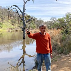
FINDING FLAT FROG TRAIL. My first visit ever to Henry Coe State Park was on my birthday, March…read more7th. My goal was to take the 6 1/2 mile loop trail, consisting of: (1) Flat Frog Trail, (2) Frog Lake Trail (a short connecting trail), (3) Middle Ridge Trail, and (4) Fish Trail. The parking lot is situated at the edge of Dunne Avenue. A one minute walk further along Dunne Ave. brings you to Coe Ranch Headquarters. About 50 feet east of Coe Ranch Headquarters is Corral Trail. Corral Trail takes you to Springs Trail, and Springs Trail takes you to a trail marker. The trail marker is at the branching point of three trails, Flat Frog Trail (to your left), Fish Trail (in the middle), and Forest Trail (to you right). The photo of me, with a tall dead tree behind me, was taken near this trail marker. Once you reach Middle Ridge Trail, you will find many bright red Indian Warrior plants. These plants are parasitic, and they acquire nutrients from roots of the bigberry manzanita. The only steep areas on the entire loop trail (described above) are on the parts of Fish Trail that descend into the valley to Coyote Creek, or that ascend out of this valley. FLAT FROG TRAIL and FROG LAKE. Flat Frog Trail follows the contour of the land, the trail loops out where a hillock of earth protrudes, and then loops back in, where there is a naturally occurring gulch. My photos show a manzanita where the outer covering of orange-colored bark includes areas of separation, where the orange bark separates from itself, and exposes the gray-colored wood under the orange bark. Where Flat Frog Trail meets Frog Lake Trail, you will encounter a trail sign (see, my photo) pointing to Frog Lake, to Middle Ridge Trail, and to Hobbs Road. Hobbs Road is named after Louis Hobbs and Estelle Hobbs, who were married in the year, 1904. Mr. Hobbs owned two saloons in San Jose. Eventually, in the year 1919, Estelle sold her homestead to Rhoda Coe. In 1953, the Coe family transferred their property to Santa Clara County, as a park to be used by the public and in 1958 the land was donated to the State of California. A dam resulted in the creation of Frog Lake. Before that, what was situated here was a spring called, "Boden's Spring," named after homesteader Henry Boden. The homestead claim was made in the year, 1886. PHOTOS ALONG FLAT FROG TRAIL & FROG LAKE TRAIL. (1) Tall gnarly tree near the trailhead to, Flat Frog Tr., Fish Tr, and Forest Tr.; (2) Me in front of the gnarly tree, holding a triangle rock with a white interior (resembling a Hostess Twinkie) surrounded by green mineral, probably serpentine; (3) Trailhead for the above three trails; (4) Grand vista of valley to east of Flat Frog Trail; (5) View from Flat Frog Trail of massive cliffs on Middle Ridge; (6) Huge manzanita near Flat Frog Tr.; (7) Tattered manzanita near Flat Frog Tr.; (8) Boulder next to Flat Frog Tr.; (9) Sign reading, CAUTION BICYCLE WALK on Flat Frog Tr.; (10) End of Flat Frog Tr. where sign points to Frog Lake Trail; (11) Orange lichen next to Frog Lake Trail; (12) Mossy stones by Frog Lake Trail; (13) Me standing next to Frog Lake, holding same triangle rock. REFERENCES ( 1 ) Teddy Goodrich (2005) Names on the Land. A History of Henry W. Coe State Park. ( 2 ) Robert J. Keiffer (2012) Indian Warriors Welcome Spring at HREC. University of California Hopland Research and Extension Center. ( 3 ) Michele Driggs (2013) The Record Searchlight. Redding, CA. ( 4 ) Toni Corelli (Botanist, Curator Emeritus of the Carl Sharsmith Herbarium) Plants That Like Hosts.

Beautiful scenery and very peaceful. This trail wasn't too busy on a Saturday afternoon. I would do…read morethis one again.

Photos
Flat Frog Trail - At edge of Frog Lake Trail is this rock covered with orange lichen.

At edge of Frog Lake Trail is this rock covered with orange lichen.

Flat Frog Trail - Thank you fir the clarification

Thank you fir the clarification

Flat Frog Trail - This is me at Frog Lake.  At side of this lake is a huge cluster of tall reeds.  In middle is a tall dead tree.  I'm holding triangle rock.

See all

This is me at Frog Lake. At side of this lake is a huge cluster of tall reeds. In middle is a tall dead tree. I'm holding triangle rock.

Nob Hill Trail Park - hiking - Updated May 2026

Loading...
Loading...
Loading...