Flat Frog Trail Photos


You might also consider


More like Flat Frog Trail
Recommended Reviews - Flat Frog Trail
Start your review...



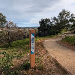
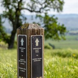
FINDING FLAT FROG TRAIL. My first visit ever to Henry Coe State Park was on my birthday, March 7th. My goal was to take the 6 1/2 mile loop trail, consisting of: (1) Flat Frog Trail, (2) Frog Lake Trail (a short connecting trail), (3) Middle Ridge Trail, and (4) Fish Trail. The parking lot is situated at the edge of Dunne Avenue. A one minute walk further along Dunne Ave. brings you to Coe Ranch Headquarters. About 50 feet east of Coe Ranch Headquarters is Corral Trail. Corral Trail takes you to Springs Trail, and Springs Trail takes you to a trail marker. The trail marker is at the branching point of three trails, Flat Frog Trail (to your left), Fish Trail (in the middle), and Forest Trail (to you right). The photo of me, with a tall dead tree behind me, was taken near this trail marker. Once you reach Middle Ridge Trail, you will find many bright red Indian Warrior plants. These plants are parasitic, and they acquire nutrients from roots of the bigberry manzanita. The only steep areas on the entire loop trail (described above) are on the parts of Fish Trail that descend into the valley to Coyote Creek, or that ascend out of this valley. FLAT FROG TRAIL and FROG LAKE. Flat Frog Trail follows the contour of the land, the trail loops out where a hillock of earth protrudes, and then loops back in, where there is a naturally occurring gulch. My photos show a manzanita where the outer covering of orange-colored bark includes areas of separation, where the orange bark separates from itself, and exposes the gray-colored wood under the orange bark. Where Flat Frog Trail meets Frog Lake Trail, you will encounter a trail sign (see, my photo) pointing to Frog Lake, to Middle Ridge Trail, and to Hobbs Road. Hobbs Road is named after Louis Hobbs and Estelle Hobbs, who were married in the year, 1904. Mr. Hobbs owned two saloons in San Jose. Eventually, in the year 1919, Estelle sold her homestead to Rhoda Coe. In 1953, the Coe family transferred their property to Santa Clara County, as a park to be used by the public and in 1958 the land was donated to the State of California. A dam resulted in the creation of Frog Lake. Before that, what was situated here was a spring called, "Boden's Spring," named after homesteader Henry Boden. The homestead claim was made in the year, 1886. PHOTOS ALONG FLAT FROG TRAIL & FROG LAKE TRAIL. (1) Tall gnarly tree near the trailhead to, Flat Frog Tr., Fish Tr, and Forest Tr.; (2) Me in front of the gnarly tree, holding a triangle rock with a white interior (resembling a Hostess Twinkie) surrounded by green mineral, probably serpentine; (3) Trailhead for the above three trails; (4) Grand vista of valley to east of Flat Frog Trail; (5) View from Flat Frog Trail of massive cliffs on Middle Ridge; (6) Huge manzanita near Flat Frog Tr.; (7) Tattered manzanita near Flat Frog Tr.; (8) Boulder next to Flat Frog Tr.; (9) Sign reading, CAUTION BICYCLE WALK on Flat Frog Tr.; (10) End of Flat Frog Tr. where sign points to Frog Lake Trail; (11) Orange lichen next to Frog Lake Trail; (12) Mossy stones by Frog Lake Trail; (13) Me standing next to Frog Lake, holding same triangle rock. REFERENCES ( 1 ) Teddy Goodrich (2005) Names on the Land. A History of Henry W. Coe State Park. ( 2 ) Robert J. Keiffer (2012) Indian Warriors Welcome Spring at HREC. University of California Hopland Research and Extension Center. ( 3 ) Michele Driggs (2013) The Record Searchlight. Redding, CA. ( 4 ) Toni Corelli (Botanist, Curator Emeritus of the Carl Sharsmith Herbarium) Plants That Like Hosts. read more




5 years ago
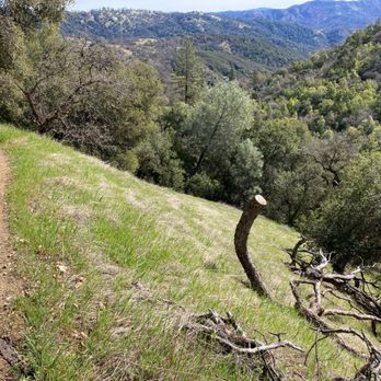
Beautiful scenery and very peaceful. This trail wasn't too busy on a Saturday afternoon. I would do this one again. read more


More info about Flat Frog Trail
9000 E Dunne Ave
Morgan Hill, CA 95037
Directions
(408) 779-2728
Call Now
Hours
Outdoor Amenities