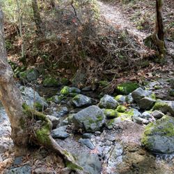
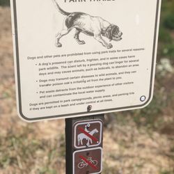
El Toro Mountain Photos


You might also consider
More like El Toro Mountain
Recommended Reviews - El Toro Mountain
Start your review...

So easy to get distracted these days by things that don't matter, or matter a lot but are then twisted by people that don't matter into tools for deception and sheep herding. Fall down this rabbit hole to your great detriment. For those that have fallen and are in the rabbit hole, fear not. The rabbit hole only feels durable. As a matter of fact, it isn't. It's paper. You can tear a hole in it and be free. El Toro Mountain will tear a hole in your rabbit hole wall. Wake up early because in afternoon summertime Morgan Hill has a temperature equivalent of a stage in the inferno below. But in the morning it's generally cool and still and there aren't a ton of humans out and you can get up and down this mountain in like an hour if you hustle and an hour of exertion in this space with the view at the top and birds and dust and voila, no more rabbit hole. On the way up the steep bit all you're thinking about is damn this is steep and not much else. At the top after good exertion you're rewarded by a view, maybe a fellow traveler, and the realization that this is what matters, not what they're trying to do to us. If I lived in The Hill I'd be up this mountain once a week come rain or come shine. In rain I bet it's a messy affair. There are two ways up. I've so far only sampled one. Go to the West Hills Church on DeWitt. You can park down DeWitt from the church or on Spring Avenue. Walk onto the property with the church on your left then up the paved driveway to the school. Keep the school on your left and head for the back of its parking lot and there you'll find the trailhead. Which is dirt road for access to a water tank and the powerlines and it's gated and ppl say you aren't supposed to be going up there but ppl do and you should too. Probably don't go on school days and don't park in the school lot even if the gate is open bc somebody could close it while you're escaping the rabbit hole and you'd come back and be locked in and that would be a drag. Be it El Toro or Diablo or Mt. Umunhum or whatever is closest to your backyard - sample it on a regular basis. Keep yourself sane. Keep your heart strong. Do it for you and the folks that love you. You'll be a whole lot more fun to be around. read more


More info about El Toro Mountain
16695 Dewitt Ave
Morgan Hill, CA 95037
Directions
Hours
Outdoor Amenities
You might also consider


El Toro Mountain - hiking - Updated July 2026
Best of Morgan Hill
People found El Toro Mountain by searching for…
Parks in Morgan Hill, California
Hiking Trails With Waterfalls in Morgan Hill, California
Things to Do in Morgan Hill, California
Walking Trails in Morgan Hill, California
Beautiful Views in Morgan Hill, California
Running Trails in Morgan Hill, California
Scenic View in Morgan Hill, California
Shaded Hike in Morgan Hill, California
Trail in Morgan Hill, California
Fall Foliage in Morgan Hill, California
Easy Hiking Trails in Morgan Hill, California
Views in Morgan Hill, California
To Do in Morgan Hill, California
Off Road Trails in Morgan Hill, California
Waterfall in Morgan Hill, California
Places to Walk in Morgan Hill, California
Places to Take Pictures in Morgan Hill, California
Hidden Spots in Morgan Hill, California
Swimming Lakes in Morgan Hill, California
Nature in Morgan Hill, California
Places to Visit in Morgan Hill, California
Stroller Friendly Hikes in Morgan Hill, California
Trending Searches in Morgan Hill, CA
Black Owned Nail Salons near El Toro Mountain
Boat Rental near El Toro Mountain
Cliff Jumping near El Toro Mountain
Day Trips near El Toro Mountain
Dog Friendly Trails near El Toro Mountain
Dog Swimming near El Toro Mountain
Jet Ski Rental near El Toro Mountain
Kayak Rental near El Toro Mountain
Lakes & Ponds near El Toro Mountain
Off Road Trails near El Toro Mountain
Outdoor Activities near El Toro Mountain
Places To Walk Around near El Toro Mountain
Pool Day Pass near El Toro Mountain
Public Pools near El Toro Mountain
Public Shower near El Toro Mountain
River Swimming near El Toro Mountain
Rock Quarry near El Toro Mountain
Scenic Night View near El Toro Mountain
Scenic Overlook near El Toro Mountain
Secluded Spots near El Toro Mountain
Soccer Store near El Toro Mountain
Splash Pad near El Toro Mountain
Strawberry Picking near El Toro Mountain
Sunrise View near El Toro Mountain
Swimming Holes near El Toro Mountain
Swimming Lakes near El Toro Mountain
Watch Sunset near El Toro Mountain
Browse Articles
Browse Nearby
BEST of Morgan Hill, California Coffee near El Toro Mountain
BEST of Morgan Hill, California Restaurants near El Toro Mountain
BEST of Morgan Hill, California Things to Do near El Toro Mountain
BEST of Morgan Hill, California Walking Trails near El Toro Mountain
BEST of Morgan Hill, California Parks near El Toro Mountain
BEST of Morgan Hill, California Breakfast near El Toro Mountain
BEST of Morgan Hill, California Hot Springs near El Toro Mountain
BEST of Morgan Hill, California Campgrounds near El Toro Mountain
BEST of Morgan Hill, California Sledding near El Toro Mountain
Browse Brands
Related Searches in Morgan Hill, CA
Affordable Kayak Rental Services in Morgan Hill, California
Best Fishing Locations and Guides in Morgan Hill, California
Best Nature Trails for Hiking in Morgan Hill, California
Best Places for Horseback Riding in Morgan Hill, California
Check Out Off Road Trails in Morgan Hill, California
Discover Dog Friendly Trails to Explore in Morgan Hill, California
Discover Kid Friendly Hiking Trails in Morgan Hill, California
Discover Scenic Hiking Trails in Morgan Hill, California
Discover Scenic Mountain Bike Trails Near Morgan Hill, California
Discover Scenic Waterfall Spots in Morgan Hill, California
Discover Top Nature Parks to Visit in Morgan Hill, California
Discover Walking Parks in Morgan Hill, California Near You
Discover a Hiking Trail in Morgan Hill, California
Discover the Best Night Hike Trails in Morgan Hill, California
Dog-Friendly Hikes With Dogs in Morgan Hill, California
Enjoy Camping Adventures Around Morgan Hill, California
Enjoy Exciting Mountain Biking Adventures in Morgan Hill, California
Enjoy Kayaking Adventures in Morgan Hill, California
Enjoy Tent Camping Spots Around Morgan Hill, California
Enjoy a Beautiful Waterfall Hike in Morgan Hill, California
Enjoy a Peaceful Nature Walk in Morgan Hill, California
Enjoy the Best Walking Path in Morgan Hill, California
Enjoy the Best Walking Trails in Morgan Hill, California
Exciting Cliff Jumping Spots in Morgan Hill, California
Experience Thrilling White Water Rafting in Morgan Hill, California
Explore Beautiful Parks and Green Spaces in Morgan Hill, California
Explore Easy Hikes Perfect for All in Morgan Hill, California
Explore Fun Activities to Do in Morgan Hill, California
Explore Popular Campgrounds Near Morgan Hill, California
Explore the Best Beach Spots in Morgan Hill, California
Explore the Best Trail Options in Morgan Hill, California
Family Friendly Hiking With Kids in Morgan Hill, California
Find Popular Ziplining Spots Around Morgan Hill, California
Find the Best Parks for Picnics in Morgan Hill, California
Find the Best Scenic View Locations in Morgan Hill, California
Great Places to Walk in Morgan Hill, California
Hike the Popular Waterfall Trail in Morgan Hill, California
Hiking Trails With Waterfalls in Morgan Hill, California
Off Leash Dog Hiking Trails in Morgan Hill, California
Plan a Scenic Drive Route Near Morgan Hill, California
Popular Outdoor Activities to Try in Morgan Hill, California
Popular Picnic Spots to Visit in Morgan Hill, California
Safe River Swimming Areas in Morgan Hill, California
Safe and Fun Parks for Kids in Morgan Hill, California
Top Climbing Spots and Gyms in Morgan Hill, California
Top Paddleboarding Activities in Morgan Hill, California
Top Running Trails to Explore in Morgan Hill, California
Top Swimming Spots and Pools in Morgan Hill, California
Walk Dog Friendly Hiking Trails in Morgan Hill, California
Walk the Best Paved Walking Trails in Morgan Hill, California
People who viewed El Toro Mountain also viewed
Chitactac-Adams County Park
9 reviews
Rancho Cañada del Oro Open Space Preserve
20 reviews
Calero Creek Trail
3 reviews
Almaden Valley
Máyyan 'Ooyákma - Coyote Ridge Open Space Preserve
5 reviews
Coyote Creek Trail and Bike Path
45 reviews
San Vicente Redwoods
2 reviews
Flat Frog Trail
2 reviews
Roosevelt Park
18 reviews
Downtown
Lions Creek Trail
1 review
Pioneer Memorial Park
13 reviews