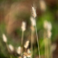
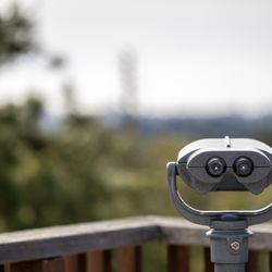
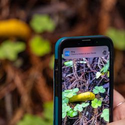
Sprig Trail Day Use Area Photos


You might also consider
More like Sprig Trail Day Use Area
Recommended Reviews - Sprig Trail Day Use Area
Start your review...

This is a great stop along the way on Hecker Pass. I will tell you if you take the trail to the left which is directly from the parking lot - it is a steady incline. I would not recommend bringing small children on this ridge trail - but there are others not as strenuous. Not intended for bikes or horses - but there are other trails here that accommodate both. There is also parking for horse trailers. This is a beautiful place - I am ready to go back and discover more along the trails! read more


3 years ago
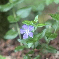
From out of town, went out of my way to take my dogs here after a long drive. The directions take you to the middle of a bleeping intersection surrounded by condominium complexes and strip mall. I don't know what the flip is going on. I wish the reviewer before me took a picture of the parking lot and incline she was describing instead of an effing mushroom. Muster solved: the new condos paved over the trail. read more
More info about Sprig Trail Day Use Area
CA-152 & Hecker Pass Rd
Gilroy, CA 95020
Directions
Hours
Outdoor Amenities
You might also consider


Sprig Trail Day Use Area - hiking - Updated May 2026
Best of Gilroy
People found Sprig Trail Day Use Area by searching for…
Hiking Trails in Gilroy, California
Places to Take Pictures in Gilroy, California
Walking Trails in Gilroy, California
Picnic Areas in Gilroy, California
Free Things to Do in Gilroy, California
Photo Spots in Gilroy, California
Tourist Attractions in Gilroy, California
State Park in Gilroy, California
Redwood Forest in Gilroy, California
Fun Places to Go in Gilroy, California
Easy Hikes in Gilroy, California
Hiking Trails Kid Friendly in Gilroy, California
Kids Park in Gilroy, California
Pokemon Go in Gilroy, California
Running Trails in Gilroy, California
Things to Do at Night in Gilroy, California
Dog Swimming in Gilroy, California
Off Road Trails in Gilroy, California
Jumping for Kids in Gilroy, California
Running Tracks Open to the Public in Gilroy, California
Places to Walk in Gilroy, California
Trending Searches in Gilroy, CA
Baseball Fields near Sprig Trail Day Use Area
Botanical Gardens near Sprig Trail Day Use Area
Bounce House Rentals near Sprig Trail Day Use Area
Campgrounds near Sprig Trail Day Use Area
Cherry Picking near Sprig Trail Day Use Area
Cliff Jumping near Sprig Trail Day Use Area
Floral Designers near Sprig Trail Day Use Area
Flower Fields near Sprig Trail Day Use Area
Flower Shop near Sprig Trail Day Use Area
Garage Sales near Sprig Trail Day Use Area
Garden Center near Sprig Trail Day Use Area
Lakes & Ponds near Sprig Trail Day Use Area
Mens Suits near Sprig Trail Day Use Area
Nurseries & Gardening near Sprig Trail Day Use Area
Outdoor Activities near Sprig Trail Day Use Area
Outdoor Basketball Courts near Sprig Trail Day Use Area
Outdoor Furniture Stores near Sprig Trail Day Use Area
Parks near Sprig Trail Day Use Area
Parks For Parties near Sprig Trail Day Use Area
Party Equipment Rentals near Sprig Trail Day Use Area
Pedicure near Sprig Trail Day Use Area
Photo Spots near Sprig Trail Day Use Area
Picnic Areas near Sprig Trail Day Use Area
Places To Take Pictures near Sprig Trail Day Use Area
Plant Nursery near Sprig Trail Day Use Area
Playgrounds near Sprig Trail Day Use Area
Public Running Track near Sprig Trail Day Use Area
Public Shower near Sprig Trail Day Use Area
Rock Quarry near Sprig Trail Day Use Area
Running Trails near Sprig Trail Day Use Area
Scenic Drive near Sprig Trail Day Use Area
Scenic Night View near Sprig Trail Day Use Area
Sunrise View near Sprig Trail Day Use Area
Swimming Holes near Sprig Trail Day Use Area
Table And Chair Rentals near Sprig Trail Day Use Area
Tennis Courts near Sprig Trail Day Use Area
Browse Nearby
BEST of Gilroy, California Walking Trails near Sprig Trail Day Use Area
BEST of Gilroy, California Coffee near Sprig Trail Day Use Area
BEST of Gilroy, California Restaurants near Sprig Trail Day Use Area
BEST of Gilroy, California Things to Do near Sprig Trail Day Use Area
BEST of Gilroy, California Parks near Sprig Trail Day Use Area
BEST of Gilroy, California Breakfast near Sprig Trail Day Use Area
BEST of Gilroy, California Campgrounds near Sprig Trail Day Use Area
BEST of Gilroy, California Hotels near Sprig Trail Day Use Area
Browse Brands
Related Searches in Gilroy, CA
Affordable Kayak Rental Services in Gilroy, California
Best Fishing Locations and Guides in Gilroy, California
Best Nature Trails for Hiking in Gilroy, California
Best Off Leash Dog Parks in Gilroy, California
Best Parks for Parties and Events in Gilroy, California
Best Places for Horseback Riding in Gilroy, California
Best Water Parks for Kids in Gilroy, California
Best Waterfalls and Swimming Holes in Gilroy, California
Check Out Great Playgrounds in Gilroy, California
Check Out Off Road Trails in Gilroy, California
Discover Baseball Fields Around Gilroy, California
Discover Beautiful Garden Spots in Gilroy, California
Discover Dog Friendly Trails to Explore in Gilroy, California
Discover Fun Children's Playgrounds in Gilroy, California, {State}
Discover Fun Toddler Parks in Gilroy, California for Your Little One
Discover Kid Friendly Hiking Trails in Gilroy, California
Discover Lakes & Ponds to Explore in Gilroy, California
Discover Popular Photo Spots in Gilroy, California
Discover Public Beaches to Visit in Gilroy, California
Discover Scenic Bike Paths in Gilroy, California
Discover Scenic Hiking Trails in Gilroy, California
Discover Scenic Walking Paths in Gilroy, California, {State}
Discover Scenic Waterfall Spots in Gilroy, California
Discover Soccer Fields in Gilroy, California Near You
Discover Top Nature Parks to Visit in Gilroy, California
Discover Top State Parks to Visit in Gilroy, California
Discover Walking Parks in Gilroy, California Near You
Discover a Hiking Trail in Gilroy, California
Discover the Best Beaches in Gilroy, California
Discover the Best Dog Trails in Gilroy, California, {State}
Discover the Best Kids Park Spots in Gilroy, California
Discover the Best Night Hike Trails in Gilroy, California
Discover the Breathtaking Waterfall Trail in Gilroy, California, {State}
Dog-Friendly Hikes With Dogs in Gilroy, California
Enjoy Camping Adventures Around Gilroy, California
Enjoy Exciting Mountain Biking Adventures in Gilroy, California
Enjoy Kayaking Adventures in Gilroy, California
Enjoy Tent Camping Spots Around Gilroy, California
Enjoy a Beautiful Waterfall Hike in Gilroy, California
Enjoy a Peaceful Nature Walk in Gilroy, California
Enjoy a Scenic Walk in Gilroy, California, {State}
Enjoy the Best Picnic Spots and Ideas in Gilroy, California
Enjoy the Best Walking Trails in Gilroy, California
Exciting Cliff Jumping Spots in Gilroy, California
Experience Thrilling White Water Rafting in Gilroy, California
Explore Beautiful Parks and Green Spaces in Gilroy, California
Explore Easy Hikes Perfect for All in Gilroy, California
Explore Family-Friendly Zoos and Wildlife in Gilroy, California
Browse Articles
People who viewed Sprig Trail Day Use Area also viewed
Harvey Bear County Park
31 reviews
Nob Hill Trail Park
6 reviews
Flat Frog Trail
2 reviews
Debell Uvas Creek Park Preserve
2 reviews
Coyote Creek Trail and Bike Path
45 reviews
Coyote Valley Open Space Preserve
28 reviews
Morgan Hill Community Park
10 reviews
Third Street Creek Park
1 review
Christmas Hill Park
17 reviews
Bolado Park
2 reviews