Cancel

    Open app

    Search

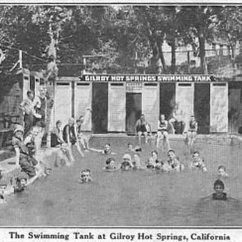
    Gilroy Hot Springs

    3.7 (3 reviews)

    Gilroy Hot Springs Photos

    You might also consider

    Recommended Reviews - Gilroy Hot Springs

    Your trust is our priority, so businesses can't pay to alter or remove their reviews. Learn more about reviews.
    Yelp app icon
    Browse more easily on the app
    Review Feed Illustration
    Photo of Audrey A.
    76
    250
    1565

    6 years ago

    Helpful 0
    Thanks 0
    Love this 0
    Oh no 0
    Photo of Jolt G.
    16
    98
    120

    19 years ago

    Helpful 5
    Thanks 0
    Love this 2
    Oh no 0
    Photo of miriam b.
    111
    1307
    1

    20 years ago

    Helpful 2
    Thanks 0
    Love this 2
    Oh no 0

    You might also consider

    Verify this business for free

    People searched for Hiking 558 times last month within 15 miles of this business.

    Verify this business

    Berry Creek Falls

    Berry Creek Falls

    4.8
    (8 reviews)
    40.7 mi

    Berry Creek Falls is absolutely stunning! If you're coming to Big Basin Redwoods State Park and…read moreyou've never hiked to the falls, you MUST do it. Don't come all the way out here and miss out on this gorgeous waterfall. We did an 8 mile out and back hike to the falls via the Skyline to Sea Trail. The hike is moderate and begins on a downhill slope into the forest. Going down is always the easiest part for me, especially when a trail starts off descending. The real challenge is going back up once you reach the falls. It's nothing too strenuous but I'd definitely bring plenty of water and bug spray because there are lots of bugs on the trail. The trail itself is mostly shaded and features an abundance of beautiful redwoods, vibrantly green foliage, and scenic viewpoints. The waterfall is definitely the highlight of the hike! The falls were still flourishing in mid-July which worked out for us because we were able to take full advantage of the scene. When you make it up to the falls, there's a small deck area with two benches where you can sit and enjoy the picturesque views of the falls. Surprisingly, it wasn't too crowded on a Saturday afternoon in mid July. You may have to wait your turn to take a picture next to the falls. People were really courteous and didn't spend too much time which allowed for others to capture the moment. Bring your lunch and take a break here before continuing on your hike back. The scenery is so amazing here. Definitely recommend a hike to Berry Creek Falls is you're visiting Big Basin Redwood State Park.
    AMAZING PLACE…read more Beautiful views and scenery. We did the Redwood Trail to the Skyline to the Sea to the Berry Creek Falls to the Sunset back to the parking lot. There are so many beautiful waterfalls along the trail. Some parts of the trail near the falls are muddy so wear good hiking shoes Note: This is a long trail (11 miles). Pack water and lunch and stay on the trail. You pay for parking with the rangers (10$ cash or card). Bathrooms at the park entrance are nice!

    Photos
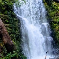
    Berry Creek Falls
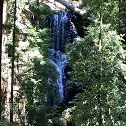
    Berry Creek Falls from the view point
    Berry Creek Falls from the view point
    Berry Creek Falls

    See all

    Uvas Canyon County Park

    Uvas Canyon County Park

    4.6
    (284 reviews)
    16.8 mi

    This review is specifically for the Waterfall Loop Nature Trail within Uvas Canyon Park, one of the…read moreBay Area's many "hidden gems." Nothing like a relaxing hike along a pristine nature trail to clear the mind and nourish the soul. I noticed that one recent review calls this hike "easy" but as we were climbing the stairs from the parking lot, we encountered two young women who looked to be in their 20s who were going in the opposite direction, returning to the parking lot. "It's beautiful," one of them volunteered to us, "but it's really HARD!" And indeed, on the trail we encountered young people who were visibly panting, even though the Waterfall Loop trail is shorter and easier than others in the park. So you might want to take that into account, FWIW, as the expression goes. It might also be helpful to mention the following: * The rules of this park call for purchasing an entry pass/parking permit online BEFORE you arrive. The reason is the limited number of spaces. Your permit is good for entry during a ONE-HOUR WINDOW for which you make your reservation. The person in the car ahead of us hadn't purchased a permit in advance and was able to use a credit card to purchase it at the entry gate but that might only be done when ample space in the lot is available. * To access the park, you must drive through a private 110-acre resort (Sveadal, meaning Swedish Valley), owned and operated by the Swedish American Patriotic League since 1926. It's a SINGLE-LANE road that is NOT LEVEL (quite rocky). You will want to make sure that your vehicle is in reasonably good shape for this drive. The only really scary part of this road for us was that at a couple of points, the incline is steep enough that you can't see ahead of you on this single-lane road. So you have to trust that no other vehicle is going faster than it should be coming toward you, in the opposite direction. * One more point ("muy importante"/very important): If you're coming for the waterfalls, use your preferred AI platform to check to make sure that the water will be flowing at the time of your visit. That's because the falls are generally seasonal and dependent on the amount of rain during preceding months. The falls are not large and thundering but they are nonetheless quite beautiful and soothing. PS: For those who don't know Spanish but may be interested: The Park is named after the Spanish word for grapes (uvas), referring to the abundance of wild grapes (Vitis californica) that early settlers found growing along the creek and throughout the canyon.

    The best hike I've ever been on! Great views with multiple waterfalls throughout the trail and a…read morehuge plus that the park is completely dog-friendly. Easy parking but you have to reserve a spot ($6) ahead of time. We only booked a day before and there were still a lot of availabilities. The reserved hour is only a time frame of when you have to arrive to the park but you can stay for as long as you would like. My printer ended up not working the day of so I called the park and they were so nice in offering that I just write my reservation number on paper and place it on my dash. The weather was so nice when we went (mid March) and almost all of the trail was beautifully shaded. We did the Waterfall Loop trail which was about 3 miles and lasted about 1 hr & 40 min. Moderately challenging and such a fun workout with absolutely amazing views. I loved everything about this park!

    Photos
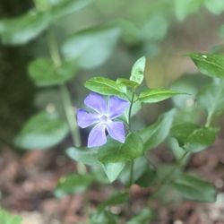
    Greater Periwinkle
    Greater Periwinkle
    Lower waterfalls with my crush
    Lower waterfalls with my crush
    Lower Falls trail

    See all

    Lower Falls trail
    Lions Creek Trail

    Lions Creek Trail

    5.0
    (1 review)
    6.0 mi

    The Santa Clara Valley Water District Board of Directors approved a joint use agreement with the…read morecity of Gilroy to construct a pedestrian bridge and a pedestrian and bike trail extending nearly one mile along the banks of Lions Creek and West Branch Llagas Creek in Gilroy. The district supported a portion of the trail with a grant of $249,550.  The project included paving of existing maintenance access roads along the creeks, and installing signage and landscaping features. The city of Gilroy also received a California Safe Routes to School grant to support this trail. Since its directly across the sreet from Antonio Del Buono school. "The water district has worked with partners to open access to many miles of creek-side trails," said water district board member Rosemary Kamei. "Creeks are an asset for everyone to enjoy. Trails help people see and learn up close how important it is to protect our creeks and watersheds."  Gilroy City Administrator Tom Haglund stated that "this joint effort is a wonderful example of two government bodies working together towards a positive common goal which will benefit the community for many decades to come."  Locals can enjoy the trail alongside their pooch, too. The trail is dog friendly, with waste bags available to keep the trail--and the bottom of shoes--clean. The trail is part of the city's effort to implement a trail system offering community members safe commuting alternatives that don't involve dangers, like trekking along the highway.  The effort resulted in collaborative between the City of Gilroy, the Santa Clara County Water District, Caltran and the Safe Routes to School Program (SRTS), which functions to encourage walking and biking to school through educational activities, like Walk and Bike to School Week in the city of gilroy. Residents are already utilizing the trail, Carrasco said, which includes new amenities like benches, garbage cans, a bridge, little plaques detailing Gilroy's history and, of course, a new paved trail running parallel to Lions Creek.  Locals can enjoy the trail alongside their pooch, too. The trail is dog friendly, with waste bags available to keep the trail--and the bottom of shoes--clean.  Here are some facts about the trail: The trail is 3,500 feet long, and runs alongside Lions Creek from Kern to Wren avenues, and from Wren to Farrell avenues110-foot pedestrian bridge across the creek. The trail is for bicycles and pedestrians.

    Photos
    Lions Creek Trail
    Lions Creek Trail
    Lions Creek Trail

    See all

    Pinnacles National Park

    Pinnacles National Park

    4.5
    (453 reviews)
    44.6 mi

    A beautiful CA national park. We did 2 short hikes in one day…read more The pinnacle rocks and the caves are SO cool! Parking was really easy for the trails we wanted to access. National Park pass is required.

    As part of our quest to visit all 63 U.S. national parks, we set off on a six-week road trip. I…read morehave a personal rule: I only count a national park as "visited" if I actually spend time there, hike or walk through it, and truly experience it. On this trip, we visited 14 national parks, and Pinnacles National Park turned out to be one of the most enjoyable surprises. Pinnacles may not be as famous as Yosemite or Sequoia, but it is well worth a visit. It offers dramatic rock formations, beautiful scenery, excellent hiking, and one especially memorable feature: its talus caves. The landscape feels rugged and distinctive, with spectacular views around nearly every bend. We especially appreciated the variety of hiking options. There are trails for every ability level, including gentle paths that are accessible for visitors with mobility limitations, so many people can enjoy the park's beauty. For me, the highlight was exploring the caves. These are not traditional limestone caves but talus caves, formed when enormous boulders fell into narrow canyons and created natural tunnels. Walking through them was a real adventure. Some sections were very dark, and while a flashlight or headlamp is definitely recommended, I managed with my phone's flashlight, and a little optimism. It made the experience even more memorable. Pinnacles is also one of the best places in California to spot the magnificent California condor. We weren't lucky enough to see one soaring overhead, but knowing these endangered birds have been successfully reintroduced here adds another layer of appreciation for the park. Spring is especially beautiful, with wildflowers covering the hillsides, and the park is full of interesting rock formations, oak woodlands, chaparral, and abundant wildlife. Pinnacles National Park offers a little bit of everything: beautiful scenery, excellent hiking, unique geology, and genuine adventure. It may be one of the smaller national parks, but it delivers an impressive amount of beauty and fun in one visit. If you go, don't miss the caves, and bring a flashlight. Or, if you're like me, your phone and a sense of adventure might just do the trick.

    Photos
    West Pinnacles National Park
    West Pinnacles National Park
    West Pinnacles National Park
    West Pinnacles National Park
    West Pinnacles National Park

    See all

    West Pinnacles National Park

    Gilroy Hot Springs - hiking - Updated August 2026

    Loading...
    Loading...
    Loading...