Mt. Whitney Photos


More like Mt. Whitney
Recommended Reviews - Mt. Whitney
Start your review...

Reviews With Photos
Few things in my life have been as difficult or challenging as this hike. We applied for the single day hike lottery and won. I believe our date was sometime in August of 2020. After a nice early turn in at the lone pine Campground. We began our journey at about 1am. Under the cover of darkness we set out by partial moonlight and headlamp. We packed fairly light. As this was just a day trip. We brought multiple layers of clothing. Beanie caps. Hats for the sun, sunscreen, sunglasses, an e-tool (folding shovel), wipes, a h2o pump/filter, 4 hydration systems, 4 field stripped MRES, and a bunch of snacks like jerkey, trail mix, cliff bars etc. We didn't really do anything all that special to prepare for this hike other than a few measly hikes. And our normal work out routines. We did hike crystal lake near Mammoth two days prior. And we hiked methuselahs trail at the ancient bristlecone pine forest in Bishop,CA the day prior. I feel both of these hikes got our lungs acclimated and our legs stretched and ready to go. I do wish we would have done more to prepare for this. As it had taken us a whopping 22 hours to complete the 22 miles of this journey. This was both my wife and I's first ever 14er. A few things I'd change for the next one. I would pack lighter! And train up for it. In all this was one of the best experiences of my life. Hands down the hardest hike I've ever done. I would highly recommend this adventure to anyone feeling brave enough!
on the JMT to the top of Mt. Whitney.")
Summiting Mt. Whitney was one of the hardest backpacking/hiking trips I've done. From getting the permits, to my ENTIRE group of six completing the summit, the stars all aligned for us this trip. Read this hiking guide to help with planning (it is much more detailed that I ever could be): https://hikingguy.com/hike/hiking-trails/hikes-around-mt-whitney/ This is the breakdown of our 48 hour trip: Day 1- Meet at Whitney Portal and backpack to Trail Camp (~6.3 miles) Day 2 - Summit Mt. Whitney (~ 4.7 miles) return to camp to eat and pack up (~4.7 miles) backpack out to Whitney Portal (~6.3 miles) TIPS: *the mosquitos here are REAL big and hungry - drench yourself in bug spray *use a water filter instead of carrying all your water - there are plenty of good water sources *eat and drink frequently *wear sunscreen Overall, a really cool trip but probably won't re-do due to the altitude and post trip pains. Still... highly recommend!

*inhales deeply as this review is going to be long* Where do I even begin. Oof. So, I've been an avid hiker for quite some time, but about two years ago started taking it seriously. Like, backpacking, 14 mile hikes, rock scrambling, etc. serious. I researched this place and my golly, I was going to do it if I had to wait years! It's open to 100 day hikers and 50 campers a day from April - Nov. so you have to be extremely lucky to get a permit through their lottery. I got even luckier, because I caught a "alternative day permit" that was open on Oct. 23rd. Doing it in the middle of the week, woo! Anyway, I got there and apparently if you sign up for an alternative day permit, there is a chance where you can't actually hike the mountain. This is a tip, because the ranger I talked to said that a lot of people come with no other goal than to hike Whitney and when they can't, they don't know what to do with themselves. Right, onto the actual hike. If you have time the day before, drive up to the portal so you can check out the area. It helps, so that way you are horribly lost in the darkness on your hiking day. Also, it's gorgeous up there and deserves much respect. I can't talk much about camping as I was one of those crazy people that did it as a day hike. Start early...and I don't mean 5 a.m. early. I mean, get your butt into that mountain by 2:30-3:00 a.m. early. Wear a head lamp, bring gloves, a warm jacket, check the weather, be prepared to get crampons if needed, and just be prepared. End of story. So ultimately, this is one of those trips that can be life changing. 22 miles alone, for 12-16 hours is a lot of time to get introspective and "get in touch with nature, bro." It was the most amazing hike I've ever been on, even though the first few hours were in complete darkness. You can see fellow hikers headlamps in the distance at night while you walk up the trail, which increases at around a steady 550ft per mile, roughly the whole way. The night sky, when you stop and look at it, is brilliant up there and seeing the sunrise over Death Valley is pleasant enough, but add the fact that you are in high altitude territory when it happens. It's something else. So essentially, you start in an alpine forest with a bunch of trees, lakes, campsites and what have you. This is the part that you unfortunately do in the dark, so all you can see is what your headlamp lets you, even though you can hear water all around you. Soon the alpine turns into a snowy, rocky wasteland that offers it's own majestic beauty. Imagine being surrounded by nothing but tall cliffs, knowing that you are now well over 11k in the air, slowly rising. Shortly after the last camp, which is where probably 95% of the campers were located when I went, the "terrible" 99 switchbacks are situated. Honestly, if you hike a lot and are used to switchbacks, these are nothing. Baby switchbacks, really, as most of them are relatively short. The only rough part about them, is the fact that you're gaining altitude, which makes it easier for you to get winded. If you've trained for this hike, or if you are an avid hiker, it's not terrible. When you get to the ridgeline, congrats! You are over 13,000ft in the air! This is also, in my opinion, the worst 2 miles of the hike. Oxygen isn't plentiful, you are still gaining altitude, everything is horrible, and you start questioning your life decisions. But the peak is right there, you can see it! So after making more stops than you care to admit, you make it to the peak. The view is amazing. On a clear day, I could see Wheeler Peak, Charleston, and Telescope all in one go. The panarama is jaw dropping, and so is the wind. Luckily there is a tiny hut to go take shelter, eat your victory meal, let yourself rest for awhile, and make the 11 mile back to civilization. It's a hard hike, even if you train for it. If the altitude doesn't get you, the 22 mile round trip will. By mile 18, i was more or less done with the whole day. I just wanted to get back to the car, retreat to the hotel, take a nice long shower, and pass out. That being said, it's life changing, breathtaking, and every avid hiker should attempt it.

Summited this bad boy on Wednesday, July 19th with a group of 4 others. We camped at the Whitney Portal Campground Monday night to try to acclimatize and then started out on the Mount Whitney Trail Tuesday morning around 6:30am bound for Trail Camp. There were an abundance of stream crossings but we researched and prepared properly and had brought sandals along for these crossings. Add in some large snow fields along the way, particularly just before Trail Camp was an added challenge. I felt the altitude at Trail Camp but with a hefty lunch and nap, my headache subsided. Early to sleep we went as we decided on an alpine start Wednesday morning to try to see sunrise from the summit. Well, I guess we'll say everything happens for a reason or something because the footprints we followed did not lead us to the relatively snow free switchbacks but rather straight to the chute. From about 3-4:30am there was a heck of a lot of struggling and uncertainty until we finally returned to safety and proceeded up the switchbacks with the good ol sunshine leading the way. The switchbacks weren't as bad as I thought they would be. There were two distinct patches of snow I recall but with micro spikes, poles, patience, and caution they weren't too too bad. The last 1.9 miles were the most difficult but the mantra of "just keep going" played in my head on repeat. When I saw the ski hut on the summit I nearly jumped for joy. I had made it! We enjoyed about 20 minutes on the summit and returned to Trail Camp for lunch & camp takedown. Hiking back out Wednesday after the summit was tiresome but the reward of seeing the cars was worth it ;) overall, an excellent adventure. I look forward to summiting Whitney in the future, perhaps as a day hike. Keep in mind these were the conditions on Wednesday July 19th, they have certainly changed since then. PS. Train, train, train!

********1000th Review ********* Wow. This review is the big 1000! Who knows when I will reach 2000 reviews! But until then I will celebrate this occasion by reviewing something that is worthy of the number 1000. Mt Whitney. The highest summit in the contiguous United States. ~22 freaking miles roundtrip with an elevation of 14,505 feet! Hiking Mt Whitney requires a permit however there is a small section of the Mt Whitney trail which you can hike without a permit. Read about that here: (http://www.yelp.com/biz/lone-pine-lake-lone-pine#hrid:-2vZ0etBCElbs704AWSp-A/src:self) This hike is a 5 mile roundtrip hike from Whitney Portal to Lone Pine Lake. Before hiking Mt Whitney, my team and I hiked several other mountains to prepare for the elevation gain/distance. Out of these hikes, the most beneficial hikes we did in my opinion were the hikes on White Mountain Peak (http://www.yelp.com/biz/white-mountain-peak-lone-pine#hrid:Ihp3GuBdVMElYb89-STf7A/src:self) and Mt Baldy. However I am not an expert in hiking but I can point you in the right direction if you are looking for someone who is an expert in training for Mt Whitney. I liked Mt Baldy because it is just brutal to go up. I liked White Mountain Peak because it is one of the easier hikes you can do, yet still reach 14,000 feet because you are already starting out at 12,000 feet. Since our goal was to hike Mt Whitney in one day, we started this hike at 2am which meant waking up at 1am! On a normal day I'm barely going to sleep at 1AM! We woke up at 1am and loaded up our camelbaks with plenty of gu gels, snacks, Gatorade, water, layers, and WAG bags (luckily I did not have to stop for the restroom the during the entire hike!). Hiking at 2am, you'll need to bring a headlamp... flashlights would work, but it's not very efficient. The hike was not as hard as I thought it would be, it was just really long. What I liked about the hike was that it was very easy to find your way on the trail. You should NOT get lost if you hiked this on your own. The views at the top were really nice and once you reached the top, it was a good feeling knowing you were almost at the top of the world! I also liked that it was easy to look up from where you were on the hike and was able to see where you're going and where the summit was. When I reached the infamous 97? 99? switchbacks all I said to myself was... "well, this is it" and continued walking. I didn't try to count how many there were but I actually liked going up it. One tip I got from one of my hiking friends, Stephanie W. was to leave your backpack when you reach this sign: (http://www.yelp.com/biz_photos/vS8W0WsT4ESXz4Utk7j0sg?select=Xm14o01v0SFrhW9iBOX3TQ) since you will not be needing it for the last two miles of the hike which is a GREAT idea because you want to be efficient! Just bring what you need to get to the summit and get your backpack on the way back! On the way back, unfortunately it started hailing on me. After about half an hour of hail, it started raining and it did not stop raining the entire hike back; almost eight miles. Lesson Learned (Bring a rain jacket in case it rains) Towards the end of the hike with two-three miles to go, I was pretty tired. I would say it was the hardest part of the hike. I am not sure if I would ever hike Mt Whitney again, but I would consider it. You never know!!! And in case you were wondering... YES!! I did complete it in one day!

The Mountain and Me by Markus N. Once upon a time, not too long ago, I was sitting at home playing dust mote with the cat. I was listless, but Newtonian, an object at rest. I needed to be acted upon by an outside force. What it was and how it came to be manifested by a trip to the mountain, I cannot say. But the next afternoon there I was, day pass in hand, Hasselblad and 25 pound tripod keeping my Chips Ahoy and other meager sundries company in a spartan but very heavy backpack. At the Portal I read Harry Potter in the oh so comfortable bed in my truck, watching campers go hither and forth, brushing their teeth, yawning. I yawned in my show of support. I yawned as I left the truck at 11PM and hoisted said 50 pound pack full of tasty bits and camera gear. Then I stopped yawning and walked. On through Low Camp, where the tents were still only recently occupied, some reading with flashlights others dead asleep. Even with the eerie luminaria tents it felt like walking through a graveyard. The moon was full and high enough after the first camp that I was able to walk without a headlamp all the way through High Camp which was still and even more cemetary-feeling. I had to illuminate the 99 switchbacks as the moon had passed the crest and it was suddenly dark and still and very cold. I made the last switchback just before Trail Crest as the sky brightened. I made tea. I set up. I shot Whitney in first light. Elation ensued. Whitney is American magic. It's relatively well-visited, though I've never had trouble getting a permit. If you like isolation and solo night treks pick your time - there are only a handful of fellow lunatics on the mountain at 3 in the morning. It isn't the most difficult thing I've done, but it's in the top 10. Grand Canyon north rim to south rim to north rim in 36 hours would be number one. I lost my toe nails on that hike as well. If you don't prepare properly or do stupid shit you can die. Ask the fellow who took the short cut down the day after my second night hike. Or don't bother. Cause he won't be answering. To all my friends: Bucket lists are cliche. No hatin' to those who have them, I just am not a fan. So don't put the mountain on some silly list. Just go to it. Thanks to Holly B. for motivating this recollection. I needed it.
My first 14er and it was a beast! Where do I even begin?! Guess we have to rewind and start from the beginning of our journey..... the lottery system for the permit in February. Getting a permit: the lottery window opens Feb 1- March 15, you submit for the dates you want (I think you can put up to as many as 10-15 dates), and then they announce if you got it end of March. We were the unlucky ones who didn't get awarded a permit. That tis ok, on to plan B! Plan B: April 1st, the permit website opens up to the public showing the dates where there are still permits available. The window opens at 7 am online, so you gotta have quick fingers and click away to get the date! In which, that's how we ended up with the overnight permit of October 12 & 13... Which kinda sucked because everyone was like "Oh the weather might be bad and you won't be able to hike it". Nope, not gonna let others discourage us! I think it's $15 per person and there's some handling fees. Alright now, to October 11, the day before we can enter the Whitney Zone. We camped at Whitney Portal. They have a hikers walk up campsite, for $12 you can camp there. Maximum stay is only 1 night, so super convenient for hikers who want to get an early start the next day on the trail. It's beautiful too, right next to a stream, and there's vault toilets nearby and the Whitney Portal Store to grab a warm meal. Plus there's running water out of a spigot you can fill your water bottles with. Monday day #1: we were the crazy ones who started at 5 am to Trail Camp. Totally unnecessary to start so early if you are only going to Trail Camp. From trail head to Trail Camp it's 6.5 miles. Even for the slowest hiker (I am very slow), you can definitely start later. We got to Trail Camp a lil before noon time. So needless to say we had plenty of time to acclimate to the altitude of 12,039 ft. Trail Camp is the last place you can filter water before reaching the summit. Tuesday day #2: THE LONGEST DAY OF MY HIKING LIFE. We hit the trail at 2:30 am. Also meaning hitting the 99 switchbacks. Did I tell you it snowed the week before so the switchbacks were covered in snow? We lost the trail within 20 min. But we saw two others coming our way, we waited for them, and the 4 of us managed to get to Trail Crest by 7 am. We summited at 10:20 am. (Again, did I tell you this was the longest day of my life?).... going on, we headed back down and reached Trail Camp at 4:30 pm. We packed up camp, and reach Whitney Portal at 9:45 pm. YES, WE HIKED FOR 19 HOURS THAT DAY. Tips: I am a slow hiker, I couldn't have done this trek in a day, so if you are slow, consider backpacking it. Especially if the trails are covered in 2-3 ft of snow. We also had brought microspikes, if we didn't have them, with the snow, I don't think we would have been able to summit. Things to bring: - sun protection, hat, sunscreen, sunglasses - windbreaker - long underwear, waterproof gear if you are backpacking - beanie - gloves - water filter or iodine tablets - extra pair of socks, your shoes might get soaked If it weren't for Ron's review (I had screenshotted it and used it for reference on the trail) I would have gone kookoo on the trail. So best of luck to you hikers!!!

I summited Mt Whitney on July 25 as a day hike. My group left at 2:30am and it was a couple of days after a full moon. I still needed my headlamp. Me and another had separated from the rest and we lost the trail a couple of times but didn't take long to backtrack and find it. One of those times was when we reached the first camp site. It was still dark but campers were up and a nice lady congratulated us in making it there, yet it was only 3.8 miles into it. She directed us in the right direction. The log crossing was a little scary especially one particular spot where there was a gap but trekking poles and going slow were the way to go. The part I didn't like about this trail were the rock steps. There were just too many of those things for my short legs. I would rather have more switchbacks than rock steps. I wasn't bothered by those switchbacks at all. Climbing over the rocks up past Trail Crest was tough too. Even though I had the right of way, I stepped aside to rest as I let others pass. Everybody I encountered was friendly. They must have seen the anguish in my face as they told me I was almost there. I knew one person that was on his way down who told me the truth. I was in disbelief when he said I had about 2 hours left before I reached the summit. Somebody had offered me some water between Trail Crest and the summit but I had declined thinking I had enough left. Little did I know that when I summited, I had finished my 3 liters but thankfully my group had waited for me at the summit, bless their hearts. I was able to get some water from one of them till we got down to Trail Camp where we filtered from the lake. When you're on those switchbacks, you can yell and it will echo. The last couple of miles down felt like the longest ever. Hopping down those rock steps to keep pace with my hiking buddies caused my knees to ache in the last few miles. I told my hiking buddies I would never do the hike again. One of them was right, that I would change my mind. For the next time I would start after midnight because of my slow pace. I would get a better night's rest. I wouldn't take anything with caffeine as it had caused me to pee too often after I hit Trail Camp. I would check my water levels. I personally didn't feel there were too many people on the trail. There were lots of stretches where I was alone and that was a good thing when it came time to pop a squat. I was shy at doing it at Trail Camp because you can see people in the distance but I got over it. Thank goodness I didn't have to use my wag bag. One small thing that kind of bothered me was that some kid had picked up the water bottle/mister I left behind where people drop off their extra weight before getting to the top. It was a coincidence that he was hanging out next to us at the summit with it in his hand. I didn't know it at the time so I said to him, "Hey, I've got one just like that." He said he had found it. My guess is that the other items next to it were already picked up so it probably stood alone. Rightfully so, he handed it back to me. In hindsight, I want to say I took a long time getting to the summit because I stopped to take in the views. I was lucky though. Had there been any thunderstorms that afternoon, I wouldn't have been able to continue to the summit in fear of lightning. Overall, it was a good experience and I was happy to cross this off my list. Shout out to the Pasadena Hiking Pacers who myself and the 3 others I shared this journey with represent.

This has been on my bucket list and would never thought I'd be able to hike it but the day has come. With the popularity of the place, permits always gets sold out but luckily a friend got a day permit on this late season. Anyways here's how it went. Saturday morning arrival of 4am into Lone Pine to TRY to get acclimated to the altitude. Got to camp and took a nap. Woke up at 1pm and went for a warmup hike (6.3 miles). Got back, ate dinner and went to bed at 8pm. Sunday morning 2am wake up. Pack away the tents and other stuff. 3am rolls around and we are off on the trail. It's dark, weather is 34 degrees and roughly 11 miles til we reach the summit. The trail is situated in between two sheer mountains and zig zags within it. You're already starting at 8600+ ft of elevation so it's already up there in altitude. After about mile six you're above the tree line and into the Rocky Mountain terrain. Stopped to refill on some fresh ice cold mountain water and started up the famous 99 Switchbacks. These was hell and torture. All 3 miles worth and not only that it was icy and snowy at some parts. After 2-3 hours we made it to the Trail crest and was greeted with such a spectacular view and now know the summit is so near with only 3 miles remaining. However it's the hardest 3 miles when you can see the end is near but yet so far. With deadly steep edges on one side and sheer walls on the other, topped with icy narrow trails, one slip and it's over. Another 2 hours and we are at summit, greeted with blue skies and some clouds in the distance. The Views here is just gorgeous and infinite with 360 degrees of the surrounding valley. After taking pics with the signs and officially signing the log book, we make our way down towards camp. However as we are leaving, I can see a huge rain cloud coming our way and little do you know we crossed path at the crest and was greeted with a hour long snow shower that blanketed the upper half of the hike. Now we have to slow down and trek carefully back to trail camp at mile 6 where we refilled on water again before making the last stretch down. Now you would think it's all downhill from the top and would be a piece of cake? NOPE!!!! The last six miles was the worse and brutal part of a hike I've ever experienced. From the lack of real food to altitude to the cold weather and pain from the feet to the whole body, every step was excruciating. Well 4 hours later we are back at camp. What a experience Mt. Whitney has to offer. Trail is well laid out and clear with beautiful wooded area. Many lakes and streams to enjoy and refill water from. Amazing views all throughout the hike. But don't let this fool you, as this is one tough hike and we sure as hell underestimated the mountain. Not that I would do it again but if I did, I'd definitely be training for it. This is a once in a lifetime experience for me and a check off my bucket list. If you're a outdoor person and love nature and hiking you just give it a shot. Sorry for the long review but I had to share.

"To reach beyond what you are you must ignore the rules and fashions of the day. Or perhaps better yet cast them way out in your peripheral vision where you can still see them but only as a vague reference point. This doesn't mean that all the rules are gone. It might mean that you adopt a far tighter code of conduct to ensure the necessary level of intensity and adventure." Peter Croft "Climbing Mt. Whitney" No, I didn't hike to the top with my 10 year old :) But, the gorgeous drive up to the trailhead combined with some light day hiking around the Mt. Whitney area has totally whetted my appetite to do this (like my friend Tina did and my friend Mara is going to do). Highly recommended for whatever type of physical activity you want to do up here.

I hiked this monstrosity mid-September and it was a great experience! The engineering of the trail is awesome because you could hardly feel the elevation gain. There are a ton of other hikers on the trail and they are super friendly. My friend wasn't able to hike the majority of the hike due to altitude sickness so I was a lone trekker on the trail. I felt so welcomed by other groups and meeting cool hikers from all over the world. Tips for all the newbies hiking here: -Bring gloves!! I didn't and my fingers were on the brink of freezing. -Start early!! I started my 2nd day at 3:30am and ended at Whitney Portal at 5pm (for reference I hiked 3 miles the first day and 19 miles the 2nd day) -Bring hiking poles! Really helps relieve stress from your knees. -Get a prescription for Diamox and bring it on the trail. Altitude sickness is very frequent on the trail. Make sure to read the instructions and take as needed. So glad I was able to summit and cross this place off my bucket list. On to the next! :)

"The clearest way into the Universe is through a forest wilderness." John Muir. 1864 California State Geologist Society named Mount Whitney after Josiah Whitney, state geologist, and surveyor benefactor. At 14,505 ft. elevation (and then some with plate shifts), Mt. Whitney is the tallest and highest summit in the lower 48 contiguous states. The highest would be in Alaska, Mount Denali at 20,310ft. Mt. Whitney offers one of the most physically challenging feats and rewarding experience any human can accomplish in their lifetime. Many may attempt to summit but not reach the top due to the toll hiking and elevation places on one's mental and physical abilities. Yes, people can die from taking on Mountaineering routes, harsh cold/hot conditions. Many sites claim it is 22 mile R/T. However, it is more of a 24/25 RT mile hike depending on where you start. If you ever hiked, or at high elevations, you would know how dangerous or difficult this could be. On my first attempt, I summited Mt. Whitney on July 29th for a day permit. Beautiful sunny weather. I wouldn't recommend going during the winter. According to the recreation gov website, only a limited number of day and overnight permits are allocated per day by lottery. After having the time to TRAIN and availability to hike on that weekend, I committed myself to the journey not understanding the intensity and challenge it takes to complete the summit in less than 1 day. I completed the RT in 16 hours with less than 20 minutes on the summit. Started around 4AM and reached the top just passed noon. I have hiked several summits/peaks in SoCal, but nothing was like the Whitney experience. I have to credit some of my running, yoga, Crossfit, HIIT training, skills in helping me complete the summit. Also, I HIGHLY RECOMMEND bringing Scopolomine or Diamox to help with ALTITUDE symptoms (naseua, vomiting, light headaches, dry mouth, drowsiness). At 12,000 to 14,000 ft. YOU WILL FEEL beyond exhausted. If it is your first time, I recommend watching several youtube videos on preparation, reading hiking guy's website, taking REI Whitney prep class, and learning about the trails on All-Trails. Onto the next challenge... Here are trail checkpoints: Whitney Portal 8,300 ft. /0 miles Lone Pine Lake 9.960 ft. /2.8 miles Outpost Camp 10,360 ft. /3.8 miles Mirror Lake 10, 650 ft. /4.3 miles Trailside Meadows 11,395 ft. /5.3 miles Trail Camp 12,039 ft. /6.3 miles **99 Switchbacks (One of the most difficult checkpoints to ascend due to elevation gain) Trail Crest Ridge13,777 ft. /8.5 miles John Muir Trail Junction 13,480 ft. /9 miles Mount Whiney Summit 14,505 ft. /11 miles

It took us 4 years to win an overnight permit via the Lotto system, but it turned out that it was worth the wait. There are day-of permits available if someone cancels so you can always try that approach as well as day trips are easier to obtain, BUT much harder to pull this 22-mile, 6,100' elevation gain GRUELING hike. BE PREPARED for this hike or do not attempt it. Mt. Whitney has a 70% failure rate (Everest is 56%); these stats clearly have deeper discussions, but reality is that 7 out of 10 quit the hike for some reason or another. The final 1.9 miles seem closer to 37 miles! It was the slowest, most difficult 1.9 miles you can can probably find to hike (at least locally) and once you add in the lighter air and colder temps at 14,508' it gets even tougher. It is a very grueling hike, but also very rewarding once you summit!

Marvelous experience! Truly deserving of its title Tallest Peak in the Contiguous US. We went the longer 45-mi route from Cottonwood Pass, which took us 3 days 2 nights. Camped 1st night in the forest by a creek, 2nd night by Guitar Lake. Lots of privacy throughout this ordeal. Each day we passed about 10 ppl each. Heard cows mooing. Saw pikas, marmots, chipmunks, and fighter jets. Mesmerizing night sky completely blanketed with stars. Tough altitude experience. Lightheadedness and windedness from AMS will kick your butt. Better train beforehand by hiking shorter mountains such as San Gorgonio (11.5k', tallest peak in SoCal). Many people camp at least one night somewhere along the trail to help acclimate/acclimatize to the lower air density overnight. Turns out the hut at the summit (14.5k') will protect you from lightning. You will definitely need a water filter. Don't wanna lug 5 L of water for 20+ miles. Refill your bottles at creeks and lakes. read more


We were very lucky to snag a couple of last minute permits. Drove 4 hours and started hiking at 1 am. Summit the mountain around 8 am and enjoyed our time at the top. The views are amazing and the 99 switchbacks seem like eternity. We got back to the parking lot at 6pm and drove home. Weather was great at about 40 degrees. An unforgettable adventure. Please come and create your own. read more


Was camping in Death Valley for a few days and we decided to go check out Mt Whitney and the Whitney portals. It was cold about 35 degrees, wind blowing, snow covering the ground and a little melt on the road. Luckily it was not raining when we were there. Pretty incredible views, they speak for themselves. We were there about an hour but the wind was really causing havoc and the temperature was dropping fast so we decided to head out and will go back another time. With the nearby Alabama Hills to also explore, this is a photographer's dream. read more


4 years ago
Few things in my life have been as difficult or challenging as this hike. We applied for the single day hike lottery and won. I believe our date was sometime in August of 2020. After a nice early turn in at the lone pine Campground. We began our journey at about 1am. Under the cover of darkness we set out by partial moonlight and headlamp. We packed fairly light. As this was just a day trip. We brought multiple layers of clothing. Beanie caps. Hats for the sun, sunscreen, sunglasses, an e-tool (folding shovel), wipes, a h2o pump/filter, 4 hydration systems, 4 field stripped MRES, and a bunch of snacks like jerkey, trail mix, cliff bars etc. We didn't really do anything all that special to prepare for this hike other than a few measly hikes. And our normal work out routines. We did hike crystal lake near Mammoth two days prior. And we hiked methuselahs trail at the ancient bristlecone pine forest in Bishop,CA the day prior. I feel both of these hikes got our lungs acclimated and our legs stretched and ready to go. I do wish we would have done more to prepare for this. As it had taken us a whopping 22 hours to complete the 22 miles of this journey. This was both my wife and I's first ever 14er. A few things I'd change for the next one. I would pack lighter! And train up for it. In all this was one of the best experiences of my life. Hands down the hardest hike I've ever done. I would highly recommend this adventure to anyone feeling brave enough! read more


6 years ago
Summiting Mt. Whitney was one of the hardest backpacking/hiking trips I've done. From getting the permits, to my ENTIRE group of six completing the summit, the stars all aligned for us this trip. Read this hiking guide to help with planning (it is much more detailed that I ever could be): https://hikingguy.com/hike/hiking-trails/hikes-around-mt-whitney/ This is the breakdown of our 48 hour trip: Day 1- Meet at Whitney Portal and backpack to Trail Camp (~6.3 miles) Day 2 - Summit Mt. Whitney (~ 4.7 miles) return to camp to eat and pack up (~4.7 miles) backpack out to Whitney Portal (~6.3 miles) TIPS: *the mosquitos here are REAL big and hungry - drench yourself in bug spray *use a water filter instead of carrying all your water - there are plenty of good water sources *eat and drink frequently *wear sunscreen Overall, a really cool trip but probably won't re-do due to the altitude and post trip pains. Still... highly recommend! read more
on the JMT to the top of Mt. Whitney. - Hiking Near Me - Lone Pine, California")


4 years ago
4 years ago
7 years ago
*inhales deeply as this review is going to be long* Where do I even begin. Oof. So, I've been an avid hiker for quite some time, but about two years ago started taking it seriously. Like, backpacking, 14 mile hikes, rock scrambling, etc. serious. I researched this place and my golly, I was going to do it if I had to wait years! It's open to 100 day hikers and 50 campers a day from April - Nov. so you have to be extremely lucky to get a permit through their lottery. I got even luckier, because I caught a "alternative day permit" that was open on Oct. 23rd. Doing it in the middle of the week, woo! Anyway, I got there and apparently if you sign up for an alternative day permit, there is a chance where you can't actually hike the mountain. This is a tip, because the ranger I talked to said that a lot of people come with no other goal than to hike Whitney and when they can't, they don't know what to do with themselves. Right, onto the actual hike. If you have time the day before, drive up to the portal so you can check out the area. It helps, so that way you are horribly lost in the darkness on your hiking day. Also, it's gorgeous up there and deserves much respect. I can't talk much about camping as I was one of those crazy people that did it as a day hike. Start early...and I don't mean 5 a.m. early. I mean, get your butt into that mountain by 2:30-3:00 a.m. early. Wear a head lamp, bring gloves, a warm jacket, check the weather, be prepared to get crampons if needed, and just be prepared. End of story. So ultimately, this is one of those trips that can be life changing. 22 miles alone, for 12-16 hours is a lot of time to get introspective and "get in touch with nature, bro." It was the most amazing hike I've ever been on, even though the first few hours were in complete darkness. You can see fellow hikers headlamps in the distance at night while you walk up the trail, which increases at around a steady 550ft per mile, roughly the whole way. The night sky, when you stop and look at it, is brilliant up there and seeing the sunrise over Death Valley is pleasant enough, but add the fact that you are in high altitude territory when it happens. It's something else. So essentially, you start in an alpine forest with a bunch of trees, lakes, campsites and what have you. This is the part that you unfortunately do in the dark, so all you can see is what your headlamp lets you, even though you can hear water all around you. Soon the alpine turns into a snowy, rocky wasteland that offers it's own majestic beauty. Imagine being surrounded by nothing but tall cliffs, knowing that you are now well over 11k in the air, slowly rising. Shortly after the last camp, which is where probably 95% of the campers were located when I went, the "terrible" 99 switchbacks are situated. Honestly, if you hike a lot and are used to switchbacks, these are nothing. Baby switchbacks, really, as most of them are relatively short. The only rough part about them, is the fact that you're gaining altitude, which makes it easier for you to get winded. If you've trained for this hike, or if you are an avid hiker, it's not terrible. When you get to the ridgeline, congrats! You are over 13,000ft in the air! This is also, in my opinion, the worst 2 miles of the hike. Oxygen isn't plentiful, you are still gaining altitude, everything is horrible, and you start questioning your life decisions. But the peak is right there, you can see it! So after making more stops than you care to admit, you make it to the peak. The view is amazing. On a clear day, I could see Wheeler Peak, Charleston, and Telescope all in one go. The panarama is jaw dropping, and so is the wind. Luckily there is a tiny hut to go take shelter, eat your victory meal, let yourself rest for awhile, and make the 11 mile back to civilization. It's a hard hike, even if you train for it. If the altitude doesn't get you, the 22 mile round trip will. By mile 18, i was more or less done with the whole day. I just wanted to get back to the car, retreat to the hotel, take a nice long shower, and pass out. That being said, it's life changing, breathtaking, and every avid hiker should attempt it. read more


3 years ago
Summited this bad boy on Wednesday, July 19th with a group of 4 others. We camped at the Whitney Portal Campground Monday night to try to acclimatize and then started out on the Mount Whitney Trail Tuesday morning around 6:30am bound for Trail Camp. There were an abundance of stream crossings but we researched and prepared properly and had brought sandals along for these crossings. Add in some large snow fields along the way, particularly just before Trail Camp was an added challenge. I felt the altitude at Trail Camp but with a hefty lunch and nap, my headache subsided. Early to sleep we went as we decided on an alpine start Wednesday morning to try to see sunrise from the summit. Well, I guess we'll say everything happens for a reason or something because the footprints we followed did not lead us to the relatively snow free switchbacks but rather straight to the chute. From about 3-4:30am there was a heck of a lot of struggling and uncertainty until we finally returned to safety and proceeded up the switchbacks with the good ol sunshine leading the way. The switchbacks weren't as bad as I thought they would be. There were two distinct patches of snow I recall but with micro spikes, poles, patience, and caution they weren't too too bad. The last 1.9 miles were the most difficult but the mantra of "just keep going" played in my head on repeat. When I saw the ski hut on the summit I nearly jumped for joy. I had made it! We enjoyed about 20 minutes on the summit and returned to Trail Camp for lunch & camp takedown. Hiking back out Wednesday after the summit was tiresome but the reward of seeing the cars was worth it ;) overall, an excellent adventure. I look forward to summiting Whitney in the future, perhaps as a day hike. Keep in mind these were the conditions on Wednesday July 19th, they have certainly changed since then. PS. Train, train, train! read more


********1000th Review ********* Wow. This review is the big 1000! Who knows when I will reach 2000 reviews! But until then I will celebrate this occasion by reviewing something that is worthy of the number 1000. Mt Whitney. The highest summit in the contiguous United States. ~22 freaking miles roundtrip with an elevation of 14,505 feet! Hiking Mt Whitney requires a permit however there is a small section of the Mt Whitney trail which you can hike without a permit. Read about that here: (http://www.yelp.com/biz/lone-pine-lake-lone-pine#hrid:-2vZ0etBCElbs704AWSp-A/src:self) This hike is a 5 mile roundtrip hike from Whitney Portal to Lone Pine Lake. Before hiking Mt Whitney, my team and I hiked several other mountains to prepare for the elevation gain/distance. Out of these hikes, the most beneficial hikes we did in my opinion were the hikes on White Mountain Peak (http://www.yelp.com/biz/white-mountain-peak-lone-pine#hrid:Ihp3GuBdVMElYb89-STf7A/src:self) and Mt Baldy. However I am not an expert in hiking but I can point you in the right direction if you are looking for someone who is an expert in training for Mt Whitney. I liked Mt Baldy because it is just brutal to go up. I liked White Mountain Peak because it is one of the easier hikes you can do, yet still reach 14,000 feet because you are already starting out at 12,000 feet. Since our goal was to hike Mt Whitney in one day, we started this hike at 2am which meant waking up at 1am! On a normal day I'm barely going to sleep at 1AM! We woke up at 1am and loaded up our camelbaks with plenty of gu gels, snacks, Gatorade, water, layers, and WAG bags (luckily I did not have to stop for the restroom the during the entire hike!). Hiking at 2am, you'll need to bring a headlamp... flashlights would work, but it's not very efficient. The hike was not as hard as I thought it would be, it was just really long. What I liked about the hike was that it was very easy to find your way on the trail. You should NOT get lost if you hiked this on your own. The views at the top were really nice and once you reached the top, it was a good feeling knowing you were almost at the top of the world! I also liked that it was easy to look up from where you were on the hike and was able to see where you're going and where the summit was. When I reached the infamous 97? 99? switchbacks all I said to myself was... "well, this is it" and continued walking. I didn't try to count how many there were but I actually liked going up it. One tip I got from one of my hiking friends, Stephanie W. was to leave your backpack when you reach this sign: (http://www.yelp.com/biz_photos/vS8W0WsT4ESXz4Utk7j0sg?select=Xm14o01v0SFrhW9iBOX3TQ) since you will not be needing it for the last two miles of the hike which is a GREAT idea because you want to be efficient! Just bring what you need to get to the summit and get your backpack on the way back! On the way back, unfortunately it started hailing on me. After about half an hour of hail, it started raining and it did not stop raining the entire hike back; almost eight miles. Lesson Learned (Bring a rain jacket in case it rains) Towards the end of the hike with two-three miles to go, I was pretty tired. I would say it was the hardest part of the hike. I am not sure if I would ever hike Mt Whitney again, but I would consider it. You never know!!! And in case you were wondering... YES!! I did complete it in one day! read more


The Mountain and Me by Markus N. Once upon a time, not too long ago, I was sitting at home playing dust mote with the cat. I was listless, but Newtonian, an object at rest. I needed to be acted upon by an outside force. What it was and how it came to be manifested by a trip to the mountain, I cannot say. But the next afternoon there I was, day pass in hand, Hasselblad and 25 pound tripod keeping my Chips Ahoy and other meager sundries company in a spartan but very heavy backpack. At the Portal I read Harry Potter in the oh so comfortable bed in my truck, watching campers go hither and forth, brushing their teeth, yawning. I yawned in my show of support. I yawned as I left the truck at 11PM and hoisted said 50 pound pack full of tasty bits and camera gear. Then I stopped yawning and walked. On through Low Camp, where the tents were still only recently occupied, some reading with flashlights others dead asleep. Even with the eerie luminaria tents it felt like walking through a graveyard. The moon was full and high enough after the first camp that I was able to walk without a headlamp all the way through High Camp which was still and even more cemetary-feeling. I had to illuminate the 99 switchbacks as the moon had passed the crest and it was suddenly dark and still and very cold. I made the last switchback just before Trail Crest as the sky brightened. I made tea. I set up. I shot Whitney in first light. Elation ensued. Whitney is American magic. It's relatively well-visited, though I've never had trouble getting a permit. If you like isolation and solo night treks pick your time - there are only a handful of fellow lunatics on the mountain at 3 in the morning. It isn't the most difficult thing I've done, but it's in the top 10. Grand Canyon north rim to south rim to north rim in 36 hours would be number one. I lost my toe nails on that hike as well. If you don't prepare properly or do stupid shit you can die. Ask the fellow who took the short cut down the day after my second night hike. Or don't bother. Cause he won't be answering. To all my friends: Bucket lists are cliche. No hatin' to those who have them, I just am not a fan. So don't put the mountain on some silly list. Just go to it. Thanks to Holly B. for motivating this recollection. I needed it. read more

My first 14er and it was a beast! Where do I even begin?! Guess we have to rewind and start from the beginning of our journey..... the lottery system for the permit in February. Getting a permit: the lottery window opens Feb 1- March 15, you submit for the dates you want (I think you can put up to as many as 10-15 dates), and then they announce if you got it end of March. We were the unlucky ones who didn't get awarded a permit. That tis ok, on to plan B! Plan B: April 1st, the permit website opens up to the public showing the dates where there are still permits available. The window opens at 7 am online, so you gotta have quick fingers and click away to get the date! In which, that's how we ended up with the overnight permit of October 12 & 13... Which kinda sucked because everyone was like "Oh the weather might be bad and you won't be able to hike it". Nope, not gonna let others discourage us! I think it's $15 per person and there's some handling fees. Alright now, to October 11, the day before we can enter the Whitney Zone. We camped at Whitney Portal. They have a hikers walk up campsite, for $12 you can camp there. Maximum stay is only 1 night, so super convenient for hikers who want to get an early start the next day on the trail. It's beautiful too, right next to a stream, and there's vault toilets nearby and the Whitney Portal Store to grab a warm meal. Plus there's running water out of a spigot you can fill your water bottles with. Monday day #1: we were the crazy ones who started at 5 am to Trail Camp. Totally unnecessary to start so early if you are only going to Trail Camp. From trail head to Trail Camp it's 6.5 miles. Even for the slowest hiker (I am very slow), you can definitely start later. We got to Trail Camp a lil before noon time. So needless to say we had plenty of time to acclimate to the altitude of 12,039 ft. Trail Camp is the last place you can filter water before reaching the summit. Tuesday day #2: THE LONGEST DAY OF MY HIKING LIFE. We hit the trail at 2:30 am. Also meaning hitting the 99 switchbacks. Did I tell you it snowed the week before so the switchbacks were covered in snow? We lost the trail within 20 min. But we saw two others coming our way, we waited for them, and the 4 of us managed to get to Trail Crest by 7 am. We summited at 10:20 am. (Again, did I tell you this was the longest day of my life?).... going on, we headed back down and reached Trail Camp at 4:30 pm. We packed up camp, and reach Whitney Portal at 9:45 pm. YES, WE HIKED FOR 19 HOURS THAT DAY. Tips: I am a slow hiker, I couldn't have done this trek in a day, so if you are slow, consider backpacking it. Especially if the trails are covered in 2-3 ft of snow. We also had brought microspikes, if we didn't have them, with the snow, I don't think we would have been able to summit. Things to bring: - sun protection, hat, sunscreen, sunglasses - windbreaker - long underwear, waterproof gear if you are backpacking - beanie - gloves - water filter or iodine tablets - extra pair of socks, your shoes might get soaked If it weren't for Ron's review (I had screenshotted it and used it for reference on the trail) I would have gone kookoo on the trail. So best of luck to you hikers!!! read more


13 years ago
I summited Mt Whitney on July 25 as a day hike. My group left at 2:30am and it was a couple of days after a full moon. I still needed my headlamp. Me and another had separated from the rest and we lost the trail a couple of times but didn't take long to backtrack and find it. One of those times was when we reached the first camp site. It was still dark but campers were up and a nice lady congratulated us in making it there, yet it was only 3.8 miles into it. She directed us in the right direction. The log crossing was a little scary especially one particular spot where there was a gap but trekking poles and going slow were the way to go. The part I didn't like about this trail were the rock steps. There were just too many of those things for my short legs. I would rather have more switchbacks than rock steps. I wasn't bothered by those switchbacks at all. Climbing over the rocks up past Trail Crest was tough too. Even though I had the right of way, I stepped aside to rest as I let others pass. Everybody I encountered was friendly. They must have seen the anguish in my face as they told me I was almost there. I knew one person that was on his way down who told me the truth. I was in disbelief when he said I had about 2 hours left before I reached the summit. Somebody had offered me some water between Trail Crest and the summit but I had declined thinking I had enough left. Little did I know that when I summited, I had finished my 3 liters but thankfully my group had waited for me at the summit, bless their hearts. I was able to get some water from one of them till we got down to Trail Camp where we filtered from the lake. When you're on those switchbacks, you can yell and it will echo. The last couple of miles down felt like the longest ever. Hopping down those rock steps to keep pace with my hiking buddies caused my knees to ache in the last few miles. I told my hiking buddies I would never do the hike again. One of them was right, that I would change my mind. For the next time I would start after midnight because of my slow pace. I would get a better night's rest. I wouldn't take anything with caffeine as it had caused me to pee too often after I hit Trail Camp. I would check my water levels. I personally didn't feel there were too many people on the trail. There were lots of stretches where I was alone and that was a good thing when it came time to pop a squat. I was shy at doing it at Trail Camp because you can see people in the distance but I got over it. Thank goodness I didn't have to use my wag bag. One small thing that kind of bothered me was that some kid had picked up the water bottle/mister I left behind where people drop off their extra weight before getting to the top. It was a coincidence that he was hanging out next to us at the summit with it in his hand. I didn't know it at the time so I said to him, "Hey, I've got one just like that." He said he had found it. My guess is that the other items next to it were already picked up so it probably stood alone. Rightfully so, he handed it back to me. In hindsight, I want to say I took a long time getting to the summit because I stopped to take in the views. I was lucky though. Had there been any thunderstorms that afternoon, I wouldn't have been able to continue to the summit in fear of lightning. Overall, it was a good experience and I was happy to cross this off my list. Shout out to the Pasadena Hiking Pacers who myself and the 3 others I shared this journey with represent. read more


This has been on my bucket list and would never thought I'd be able to hike it but the day has come. With the popularity of the place, permits always gets sold out but luckily a friend got a day permit on this late season. Anyways here's how it went. Saturday morning arrival of 4am into Lone Pine to TRY to get acclimated to the altitude. Got to camp and took a nap. Woke up at 1pm and went for a warmup hike (6.3 miles). Got back, ate dinner and went to bed at 8pm. Sunday morning 2am wake up. Pack away the tents and other stuff. 3am rolls around and we are off on the trail. It's dark, weather is 34 degrees and roughly 11 miles til we reach the summit. The trail is situated in between two sheer mountains and zig zags within it. You're already starting at 8600+ ft of elevation so it's already up there in altitude. After about mile six you're above the tree line and into the Rocky Mountain terrain. Stopped to refill on some fresh ice cold mountain water and started up the famous 99 Switchbacks. These was hell and torture. All 3 miles worth and not only that it was icy and snowy at some parts. After 2-3 hours we made it to the Trail crest and was greeted with such a spectacular view and now know the summit is so near with only 3 miles remaining. However it's the hardest 3 miles when you can see the end is near but yet so far. With deadly steep edges on one side and sheer walls on the other, topped with icy narrow trails, one slip and it's over. Another 2 hours and we are at summit, greeted with blue skies and some clouds in the distance. The Views here is just gorgeous and infinite with 360 degrees of the surrounding valley. After taking pics with the signs and officially signing the log book, we make our way down towards camp. However as we are leaving, I can see a huge rain cloud coming our way and little do you know we crossed path at the crest and was greeted with a hour long snow shower that blanketed the upper half of the hike. Now we have to slow down and trek carefully back to trail camp at mile 6 where we refilled on water again before making the last stretch down. Now you would think it's all downhill from the top and would be a piece of cake? NOPE!!!! The last six miles was the worse and brutal part of a hike I've ever experienced. From the lack of real food to altitude to the cold weather and pain from the feet to the whole body, every step was excruciating. Well 4 hours later we are back at camp. What a experience Mt. Whitney has to offer. Trail is well laid out and clear with beautiful wooded area. Many lakes and streams to enjoy and refill water from. Amazing views all throughout the hike. But don't let this fool you, as this is one tough hike and we sure as hell underestimated the mountain. Not that I would do it again but if I did, I'd definitely be training for it. This is a once in a lifetime experience for me and a check off my bucket list. If you're a outdoor person and love nature and hiking you just give it a shot. Sorry for the long review but I had to share. read more


"To reach beyond what you are you must ignore the rules and fashions of the day. Or perhaps better yet cast them way out in your peripheral vision where you can still see them but only as a vague reference point. This doesn't mean that all the rules are gone. It might mean that you adopt a far tighter code of conduct to ensure the necessary level of intensity and adventure." Peter Croft "Climbing Mt. Whitney" No, I didn't hike to the top with my 10 year old :) But, the gorgeous drive up to the trailhead combined with some light day hiking around the Mt. Whitney area has totally whetted my appetite to do this (like my friend Tina did and my friend Mara is going to do). Highly recommended for whatever type of physical activity you want to do up here. read more

I hiked this monstrosity mid-September and it was a great experience! The engineering of the trail is awesome because you could hardly feel the elevation gain. There are a ton of other hikers on the trail and they are super friendly. My friend wasn't able to hike the majority of the hike due to altitude sickness so I was a lone trekker on the trail. I felt so welcomed by other groups and meeting cool hikers from all over the world. Tips for all the newbies hiking here: -Bring gloves!! I didn't and my fingers were on the brink of freezing. -Start early!! I started my 2nd day at 3:30am and ended at Whitney Portal at 5pm (for reference I hiked 3 miles the first day and 19 miles the 2nd day) -Bring hiking poles! Really helps relieve stress from your knees. -Get a prescription for Diamox and bring it on the trail. Altitude sickness is very frequent on the trail. Make sure to read the instructions and take as needed. So glad I was able to summit and cross this place off my bucket list. On to the next! :) read more


"The clearest way into the Universe is through a forest wilderness." John Muir. 1864 California State Geologist Society named Mount Whitney after Josiah Whitney, state geologist, and surveyor benefactor. At 14,505 ft. elevation (and then some with plate shifts), Mt. Whitney is the tallest and highest summit in the lower 48 contiguous states. The highest would be in Alaska, Mount Denali at 20,310ft. Mt. Whitney offers one of the most physically challenging feats and rewarding experience any human can accomplish in their lifetime. Many may attempt to summit but not reach the top due to the toll hiking and elevation places on one's mental and physical abilities. Yes, people can die from taking on Mountaineering routes, harsh cold/hot conditions. Many sites claim it is 22 mile R/T. However, it is more of a 24/25 RT mile hike depending on where you start. If you ever hiked, or at high elevations, you would know how dangerous or difficult this could be. On my first attempt, I summited Mt. Whitney on July 29th for a day permit. Beautiful sunny weather. I wouldn't recommend going during the winter. According to the recreation gov website, only a limited number of day and overnight permits are allocated per day by lottery. After having the time to TRAIN and availability to hike on that weekend, I committed myself to the journey not understanding the intensity and challenge it takes to complete the summit in less than 1 day. I completed the RT in 16 hours with less than 20 minutes on the summit. Started around 4AM and reached the top just passed noon. I have hiked several summits/peaks in SoCal, but nothing was like the Whitney experience. I have to credit some of my running, yoga, Crossfit, HIIT training, skills in helping me complete the summit. Also, I HIGHLY RECOMMEND bringing Scopolomine or Diamox to help with ALTITUDE symptoms (naseua, vomiting, light headaches, dry mouth, drowsiness). At 12,000 to 14,000 ft. YOU WILL FEEL beyond exhausted. If it is your first time, I recommend watching several youtube videos on preparation, reading hiking guy's website, taking REI Whitney prep class, and learning about the trails on All-Trails. Onto the next challenge... Here are trail checkpoints: Whitney Portal 8,300 ft. /0 miles Lone Pine Lake 9.960 ft. /2.8 miles Outpost Camp 10,360 ft. /3.8 miles Mirror Lake 10, 650 ft. /4.3 miles Trailside Meadows 11,395 ft. /5.3 miles Trail Camp 12,039 ft. /6.3 miles **99 Switchbacks (One of the most difficult checkpoints to ascend due to elevation gain) Trail Crest Ridge13,777 ft. /8.5 miles John Muir Trail Junction 13,480 ft. /9 miles Mount Whiney Summit 14,505 ft. /11 miles read more


It took us 4 years to win an overnight permit via the Lotto system, but it turned out that it was worth the wait. There are day-of permits available if someone cancels so you can always try that approach as well as day trips are easier to obtain, BUT much harder to pull this 22-mile, 6,100' elevation gain GRUELING hike. BE PREPARED for this hike or do not attempt it. Mt. Whitney has a 70% failure rate (Everest is 56%); these stats clearly have deeper discussions, but reality is that 7 out of 10 quit the hike for some reason or another. The final 1.9 miles seem closer to 37 miles! It was the slowest, most difficult 1.9 miles you can can probably find to hike (at least locally) and once you add in the lighter air and colder temps at 14,508' it gets even tougher. It is a very grueling hike, but also very rewarding once you summit! read more


Undulating mountains from the summit. I love it. The Eastern Sierra mountains are so cool. First time I did as a day hike from Whitney Portal. 3 a.m. to 5 p.m. Last 1.9 miles? So long. The longest 1.9 miles ever. Second time, I did from JMT. It was pretty easy. read more


5 years ago
9 years ago
This hike is about 22 miles roundtrip, up and back. We did this as a day hike. I have read that this hike would not be difficult if it weren't for the elevation. I did not find this to be true for me. I would still consider this a difficult hike, especially on the upper levels of the 99 switchbacks and the last mile or so of the hike. The trail is single file with varying sizes of loose rock. As you gain elevation, the trail becomes much more rocky. Most of the trail has a steady incline. There are a few steeper areas, but it is not generally steep. Having to climb up, over and maneuver around large rocks was tricky at times. There are multiple stream crossings in the first few miles of the hike. Normally, they can be traversed without getting wet feet, but this year the streams were so full due to excessive snow melt that it was inevitable. The first 6 miles are not that difficult, but after Trail Camp the switchbacks begin, and so does the difficult climb. The elevation can impact speed. Make sure to remain well hydrated and eat often, as dehydration can present symptoms similar to that of altitude sickness. After Trail Crest, you will reach a sign that indicates it is 1.9 miles to the summit. The first mile-ish after the sign, it is pretty much all downhill or flat, which offers a nice respite, but the mile after this to the peak is uphill and tough. Also, keep in mind that the downhill portion that felt so good will be uphill going back, and this part was difficult. If you are used to hiking at elevation and trained well for this hike, then you will likely not have a problem and be able to summit. The views are spectacular. Don't forget to sign the register! parking - free lot read more


4 years ago
Do some practice hikes at altitude so you know how it affects you before tackling this hike! Nothing like getting partway and having to turn back around... August 1/2 - we woke up at midnight, left the Lone Pine Best Western at 1:00am, and met at the trailhead around 1:30am. We started hiking by 2:00am. Night hiking was great, can't dread what you can't see... the sunrise on the way up to the lake was the highlight of the hike. We slowed down a bit at the lake for photo ops and because our friend was suffering from some altitude sickness. Everything from the lake on -- the infamous 99 switchbacks and the scrambling required to get to the summit -- was brutal, and since it was above the tree line, it wasn't very picturesque. We summitted around 10:00am and finished hiking around 5:00pm. Most of the snow was melted when we came. There was one water crossing on the way up to the lake that was about ankle-deep where wet feet were unavoidable. We brought watershoes to change into and left them at a tree to get on the way back (they were stolen). On the way back we couldn't care less about slightly wet shoes. We didn't need microspikes though we came prepared with them just in case. I hiked in shorts and alternated between a tank top, long sleeved shirt, and windbreaker and was fine. It was nice to have light gloves and buff and a hat and headlamp were must-haves. Hiking poles were a life saver and make sure to bring at least 3-5 liters of water. Bring a water filter and fill up at the lake on the way up and down. I'd jump at the opportunity to hike to the lake again - camping there would be amazing - but I'd hesitate to summit again. The sights just weren't worth the highly difficult/grueling sections from the lake to the summit. Great to do once... ask me again in a year if I'd do it again! read more


12 years ago
Hiking Mount Whitney in ONE DAY! "What the HELL was I thinking...Never Again!" Those were the words I uttered over and over as I hiked up those last 3 miles to that 14,508 foot peak, the highest in the US continent. This has always been a goal of mine since 1980 when I moved to California, so quitting was not an option. But... who knew, it would take me 34 years to hike this 22 mile round trip with an elevation gain of 6,300 feet? Even though some goals are better done when you're younger... NEVER give up on your goal! Here are some of the major landmarks: 0.0 miles, 8,360' - Whitney Portal 2.8 miles, 9,960' - Lone Pine Lake 3.8 miles, 10,360' - Outpost Camp 4.3 miles, 10,670' - Mirror Lake 5.3 miles, 11,395' - Trailside Meadows 6.3 miles, 12,039' - Trail Camp & the 97 Switchbacks! 8.5 miles, 13,777' - Trail Crest Ridge 9.0 miles, 13,480' - John Muir Trail Junction 11 miles, 14,508' - Mount Whitney Summit Yes, I may have uttered those words "never again" on the day of my long hike...but by the next day I was already thinking about the next time I would challenge this Mount Whitney Peakl! Important Websites: http://www.recreation.gov * Sign up for the Lottery February 1st to March 15th http://www.modernhiker.com/2010/09/20/hiking-mount-whitney/ http://www.everytrail.com/guide/mt-whitney-from-whitney-portal http://www.rei.com/learn.html * REI offers a great free 'Hiking Mt Whitney' class. * The class explains how to get a permit. read more


10 years ago
Being able to reach the top of the highest peak of the contiguous United States (aka the lower 48 states) was quite an amazing accomplishment. Permits: My group and I originally got multi day permits. You have to enter into a lottery to get it. I would advise if you have a flexible schedule or can get the time off work/school to go for the weekday permits. It's much easier to win those from the lottery than weekend. We ended up switching to day passes instead. Training: I would strongly advise you to take your training strongly. It is not something to take lightly. If you don't have the adequate amount of training and being use to being acclimated, there's a good chance you won't finish. The hike: I would HIGHLY RECOMMEND to take a few days to do it. Switching to day passes was a risk to take and it took me 19 hours to finish. One of my friends was done in 8 hours, but he's crazy strong and hikes quite frequently. It's absolutely GORGEOUS. I couldn't believe just how beautiful it all was. The first few miles are gentle and easy. It starts hitting you once you past 11,000 elevation and the 99 switchbacks are not painful. Just monotonous. To have: LOTS AND LOTS OF WATER. Food. Water filter for water. Headlamp. Trekking poles. Sleeping bag, tent, and sleeping pad, the basis for backpacking. And pack layers. We went the last day of August assuming it wouldn't be too cold. It ended up being 30° when we got to the summit. I was fine with my puffy but two of my friends only wore shirts, shorts and windbreakers. I would definitely do it again, but would take 3-4 days to do it. read more


Done Whitney twice as a day hike on my birthday, July 25 in 2013 and 2014. MY 2013 EXPERIENCE Last year, I did it with a week and a half notice. I had been hiking with PHP ( http://www.yelp.com/biz/pasadena-hiking-pacers-pasadena ) for 1.5 months having already done longer distance high altitude hikes including Baldy from the Village and Ontario Peak. I also ran a few times a week, so I was in decent shape. I didn't have problems with the high altitude since I made sure to take deep breaths in the nose and out the mouth. In fact during the 99 Switchbacks, I was passing people when before it seemed everyone was passing me! But I struggled mightily after Trail Crest when the trail had so many friggin' big rocks to climb over and the summit took forever to reach. Yet I managed a respectable summit time of 8.5 hours. PREP & STRATEGY This time around, I was determined to beat that summit time. I was already working on my conditioning by doing the Echo Mountain Ridgeline hike 3-4 times a week ( http://www.yelp.com/biz/echo-mountain-via-the-ridgeline-trail-altadena?hrid=73fzjURTdWC6MkLYPMRxyw ). I also knew I would cut my time just by reducing or eliminating the rest breaks. So I used "training hikes" to practice hiking without rest breaks. If I did take a break, it would be for less than a minute. Otherwise if I were tired or eating, I would hike very slowly. Arriving a few days before your hike to acclimate yourself helps immensely. However, both times my group basically arrived at the trailhead at 2:40am (last year) or 12:50am (this year) and started hiking with headlamps and no acclimation. MY 2014 EXPERIENCE It took me a good 3-4 miles of struggling with higher altitude and hiking in the dark plus getting over the feeling of "why am I doing this??" before I started feeling my mojo and going at my usual hiking pace. My specialty is getting lost on the trails and last year me and another hiker lost our way on the trail several times while hiking in the dark. This time, I made sure not to rush as I tend to do and look around to make sure I was on the trail. Basically look for a clearly marked path or man-made rocky steps. I managed not to lose my way and next thing you know I'm at the 99 Switchbacks. I struggled a bit here as the switchbacks seem never-ending. A guy from Florida who started from Trail Camp (i.e. he had fresh legs) caught up to me and we talked a bit which helped pass the time. He did eventually pass me some time after Trail Crest, but I caught up to him after the 1.9 mile to Whitney sign. The winds were REALLY strong and he said he was thinking about turning back. Never saw him after that. I probably should have put on my rain jacket to cut down the impact of the wind but I was stubborn and refused to stop until I reached the top. Just like the previous year, I was struggling climbing over the big rocks. But instead of taking rest breaks like last year, I kept going. This is when the conditioning really kicked in. Eventually I reach the trail to the summit. Another never-ending endeavor since you don't see the Whitney Summit Shelter until you're actually a few feet away. I run in excitement when I do finally see it. I check my watch. 7:50am. I summitted in 7 hours, breaking the previous year's time of 8.5 hours! I was going to sign the register but it was just too windy and cold so I went inside the shelter where there was already a room full of Boy Scouts. It was still cold inside even with all those bodies! Three other hikers from my group arrive later at staggered times. Unfortunately, our group of 8 weren't able to be at the summit together. I had been at the summit for 2.5 hours and it was just too windy and cold to stay. So the four of us descended and informed the other four hikers along the way. I was glad to get rid of my extra 2 liters of water in my Platypus to a fellow hiker who ran out of water. We took our time getting back to the Portal, taking long breaks along the way since we knew it'd be some time before we'd see the other hikers. It was nice enjoying the scenery during the day (I had mostly been hiking in the dark). One of us realized it was a good thing we started in the dark because some of trails looked really steep during the daylight; but in the dark, you just climb up them without much thought. We also encountered a lot of hikers who were camping overnight and doing the hike in 2 days. A more reasonable alternative than the day hike! The last 3-4 miles to the Portal seemed never-ending (repeating a theme). You just want the darn thing to end and it doesn't! But with relief, we see the trailhead, mission accomplished! Maybe next time I'll do it on my birthday again, maybe even sooner! Already working on a strategy to improve my summit time! read more


12 years ago
Mt Whitney has been on my bucket list for years, but being a total couch potato, I never dreamed it would be possible for me to walk 22 miles in a day. Well, this summer I proved myself wrong and discovered just how far my two little feet can carry me. Here are some tips if you're looking to tackle Mt Whitney for the first time. HOW TO OBTAIN A MT WHITNEY PERMIT: 1) Enter the lottery via Recreation.gov. The application period usually runs from February to mid-March. If you lucked out and got a permit, then yay you win. If you missed the lottery, or if your application was unsuccessful, try #2. 2) All of the un-matched slots from the lottery are available online, open for public reservation on April 1, 10AM EST (date/time may change from year to year so check the site). You can go online after the lottery is run, before April 1 to see if there are open slots on the day you would like - they are not available for reservation yet, but this is a good opportunity to scout it out. Then get up early on April 1, sign in to Recreation.gov, and when the clock hits 10AM, quickly reserve the spot you want. If your fingers are too slow, or if you just plain slept in, go to #3. 3) Snag a cancellation - this works best if you have a boring desk job with internet access. Pick a date you'd like to do the hike, then about 1-2 weeks before that date, log onto the permit availability page on Recreation.gov every day, and keep neurotically refreshing the page throughout the day. Chances are, sometime during those 2 weeks prior, someone will make a cancellation on the date you desire. If you refresh the page a lot, you'll increase the chances that you will catch the cancellation first, and be able to snag it before someone else does. If you have a job where you actually have to work, or if you have a life, go to #4. 4) Walk-in permit. You can literally just walk into the ranger station the day before and ask for a permit. It's not guaranteed, but it's highly likely you will get one because so many people cancel last-minute. For reference, this site shows how many permits were unused per day for the Whitney trail in 2013: http://www.whitneyzone.com/wz/ubbthreads.php/topics/32270/Unused_Whitney_Permits_2013#Post32270 You can check out the data for other years as well. As you can see, for most days, there are plenty of unused permits available for walk-in hikers. TRAINING: 1) Hike! You don't have to be an iron-man or be in the best shape or your life, but you definitely need to do some practice hikes. I trained by hiking at least 3 times a month - starting with short easy hikes and eventually working up to hikes with 4000+ ft gain. 2) Cardio! FYI I did zero cardio, and I still made it to the top...but doing some cardio probably would have made the hike easier. Too lazy... ALTITUDE: Begin your acclimatization by spending a night or two at 10k at Cottonwood Lakes Campground before your hike. Understand that your body will not perform at 14k the same way it does at sea level, so don't expect it to - GO SLOW. WEATHER: Afternoon thunderstorms are the norm during the summer, so summit early and get to lower elevation before the storms hit. Tree cover pretty much tapers off above Mirror Lake, and the rest of the hike is all exposed. Check the forecast, and watch out for snow, ice, storms, wind. The better the weather, the easier the hike is, and the higher chance of a successful summit. Not to mention it's much safer... Snow can linger into July, so if you're just a novice hiker like me I would recommend you to wait until it all melts before attempting the summit. WATER: Bring a water filter! There are plenty of water sources up to Trail Camp, so filter as you go. Water is insanely heavy at 2.2lbs per liter - don't be the idiot carrying 15lbs of water! START EARLY! I loved the night hiking experience - it was magical! You don't actually need a permit for the first 2.5 miles to Lone Pine Lake, so you can even start before midnight, as long as you don't pass the Inyo permit-required sign before midnight. Sunrise is gorgeous, and the higher up you are, the more spectacular it is. CLOTHING: Bring lots of warm layers! It was freezing when we got to Trail Camp before sunrise, and we were there on a "warm" night with perfect weather and virtually no wind. I wore every single piece of clothing I brought in my pack. Top: Tank top, long merino top, puffy jacket, shell jacket. Bottoms: long merino underwear, hiking pants. Other: Gloves, neck warmer, beanie. Bring an extra pair of socks so that you can change out the sweaty pair at the top. DONT GIVE UP! Preparation is key. Don't be intimidated by this hike. Yeah, it's 22 miles. Yeah it's 6500ft elevation gain. And yeah, it's at high altitude. You can do it if you train and prepare. It's definitely hard, but as long as you keep walking, you'll get there. I promise. My Whitney experience - http://nalaexplorer.blogspot.com/2014/08/mt-whitney.html read more

12 years ago
Let me start by saying, I was surprised that Yelp would be so helpful for this experience, but found many of these reviews spot on, so I am not as much reviewing as I am sharing some thoughts for those getting ready. I can only speak to my experience...so here are my 2 cents, good luck! First and foremost, the payoff of making the summit and the incredible views was worth all the pain involved...both training and the actual hike. To put in context, I am an average guy, carrying a few extra pound on the back 9 side of life age wise. (golfers get this one) Training: I walked 2-3 miles, 4-5 times a day for 6 months. In the last few months, I did 5-7 mile hikes on Saturday, capped by a few 10 milers. I did not do an altitude hike. Hike strategy: 2 day, one to based camp, one to summit and back down. Day 1, we left at 8am, checked out Lone Pine Lake off the trail and hit basecamp before 4pm. Day 2, we left at 6:30am, summited at 12 noon and got back to the portal store at 7:30. I will say, we were on the slow side, so this is a good guide (We also had perfect weather in Sept, I would adjust accordingly) Food/Water: We over did this, next time, going with, coffee, bars and small snack like trail mix. (We also carb loaded the day before) My tip here was the Power Aide Zero drops in our water. It was a nice energy blast. As for water, you can get water along the way, fill up at base camp as it is last shot before summit. Pace tip: Small steps, small breaths...I will never forget this. I had a 70 year who I kept running into on day one tell me this. He had done it a few times and when I struggled, I went back to this strategy. In the same vain, control your heart rate, go slow and you will make it. Everyone that I saw struggling, seemed to be young and just going too fast. Once again, just my perspective. Hope this helps... read more


We had been trying to get permits for Whitney online for the past three years. I believe hikers are allowed to register for online permits around February and it is a lottery system. We tried again this year and were again denied permits. So we decided to chance it and drive up to the Eastern Sierra - Death Valley Ranger Station in Lone Pine for walk-in permits. The walk-in permit process is pretty straightforward. There are two lotteries held in the morning. One at 8 am and another at 11 am. On a weekend in early August (peak hiking season) there were about 18 groups trying to get up to Whitney with walk-in permits. Cross your fingers that people cancel and are no shows. We were able to get five permits and headed up to Whitney Portal at 11 am. The start of the trail head is Whitney Portal. No parking pass needed with permit. There is a cool weighing station right before you get on your way to weigh your pack. There's also a little shop and restaurant in the portal for last minute snacks. We began our trek around 12:30 pm and arrived at base camp around 6 pm. The weather is pretty gnarly up there so be sure to bring gloves, pants (not shorts), beanie or headband, windbreaker or jacket. Be sure to get solid gear - as in tent and at least a 32 degree sleeping bag. The wind picks up a good deal up at 12,000 feet so sturdy gear is a must - shell out the extra 100 bucks or so for that Marmot tent and don't risk throwing 40 bucks down the drain on that Wal-Mart special markdown. The second part of the trek was started the next day at around 7:45 am. It took us about 2 hours to clear the 99 switchbacks and another 3 hours to get from the end of the switchbacks to the top of Whitney. Even if the elevation doesn't get you, the oxygen is pretty thin up at 13,000, it will definitely slow you down while you try to walk over rocks that are higher than your knee. Enjoy the view from the top and if you get stuck in inclement weather there is a lightning shelter at the top. We cut our time in half coming down the mountain, picked up our packs at camp and made our way down to Whitney portal around 4 pm arriving at our car at around 7:30 pm. This was one of the most challenging hikes I have ever done. Come prepared and splurge a on solid gear. The trail is very well-maintained and marked - almost impossible to get lost, unless you're hiking at night. Enjoy! read more


9 years ago
What an experience of a life time. We conquered this summit with a group of 4. We car camped at the base camps by the Whitney portal the 1st night. Then we hiked up to the Whitney trail camp and spent 1 night. There were plenty of lakes and streams to filter water along the Whitney trail. Since Whitney Trail camp is the last place you can filter water, before you climb 2500 ft and 4.9 miles to the top, make sure to filter plenty of water to climb anc descend. It was easier to acclimate to the elevation, since we set up camps at 8000 ft (base camp) and 12000 ft (Whitney trail camp). I would definitely do it again, but in warmer months. It was literally freezing at nights. read more


This journey should be on everyone's bucket list. My mom and I decided on doing this around March, thinking we were ahead of the game. In reality, like-minded aspirants had submitted their names in the permit lottery in January and February. Late July and early August hiking permits were gone with the wind, and we were told that we could begin calling on April 28th to snap up any cancellations. Otherwise, we could show up at the Visitors Center at 11 a.m. to participate in the walk-in quota lottery for the very next day. My mother and I called (760) 873-2483 until each of the rangers knew us by our voices. According to them, cancellations would really start sprouting up within two weeks of the dates we desired. They were right. A few days before departing for California, my mom got two day passes for Friday, August 5th. When we were IN California, we scored two day passes on a Monday for a Thursday climb, which was even better because we'd have time to get back to SF and rest with my sister afterwards. It only cost us $10 to make the change. We already had reservations at the Whitney Portal Hostel (separate review) in the town of Lone Pine, but didn't quite have enough time to get acclimated the next day after picking up our passes and WAG bags (for carrying our waste while on the mountain) at the Visitors Center. We tried to sleep early, hoping for the best. It didn't work. Set out at midnight on Thursday the 4th. Mom felt the altitude pretty much right away at 9,000'. At first, I was in denial and tried to bark her through it, but then I saw that her face was completely pale. Walked her down a mile, then started again on my own. The moonless night somehow conveyed a beauty that took the edge off my primal fear at being alone in the woods in the jet black night. Saw the electric blue eyes of a deer in the light of my headlamp and almost took a shit, though. Once in a while, I ran into people who popped up at serendipitous moments (e.g. right before a barefoot, knee deep creek crossing). But more often, I had a lot of alone time. All in all, it took me 21 hours and 38 minutes because I was busy taking pictures, being paranoid about elevation sickness, and trying desperately to take my craps in the bag without being seen (sorry). Many times, I just felt like I didn't deserve to be there, and the sheer height and distance was psychologically daunting. I pondered turning back many times as I realized I was one of the slowest hikers around. But the mountain had a spell over me, and even on zero sleep, I felt completely alert the entire time, completely wired on survival mode. I was feeling it that day. Some websites are misleading or at least equivocal about what it takes to do the hike in a day. That's because every person is different and every day is different. The trail was not very technical (i.e. no pickaxes or crampons necessary), nor was it terribly steep, owing to the 99+ switchbacks to avoid this scenario when mule driving packers engineered the trail in 1904. But I saw some people turn back within sight of the summit because fear set in at the rubbly trails with canyons on either side. I saw others force themselves to the tops with splitting headaches, then shuffle the whole way back with purple faces contorted in pure nausea. It was without a doubt the toughest thing I ever did do, and I was aware at all moments that it was only at the mercy of the mountain that granted me the literally life changing experience of visiting it. Camping would be a pretty blissful, mellower experience, as would a weeks-long transverse of 30 and 50 mile accesses such as Cottonwood and Kearsarge Passes. But there's something to be said about the one day climb if you come out of it alive. You really do feel how high you are, and each step that got you there. I'll post a link to my blog entry (once I write it) with a lot more specific details about the actual timing and features of the path for any interested mountaineers. But for now - no more words. Just do it. read more


I hmmmm'd and haaaaa'd as to whether this is where I should post my review for the Whitney Portal area. I don't want to add a location just to add it or be first to review so this is where my review will reside. If you know me, you know full well that the chance of my hauling my (ahem) large backside up to the top of Mt. Whitney is about as likely as OJ finding the "real" killer. However, the road up to the camp ground and hiking trails is beyond gorgeous. BF suggested the drive as he knew I'd love it. We drove up as far as we could go before the road was closed due to snow and ice. I was bummed that we didn't make it further up but it ended up being a truly outstanding ride and view. Made me once again realize why I love the Sierras, why I love this area and why I really, really like the FlyBoy, alought. The pics can speak for themselves. read more


Did it again in 2014 and had a great trek. Don't think I'm in a rush to do it again... Too many other great Hills to climb. Pics updated from the 2nd trip. 2013 Review: I ended up doing this hike solo. After 2 years of trying to win a lottery permit, my brother who was supposed to go couldn't and I ended up enjoy 4 days of solitude and one of the most challenging experience of my life. I went up on a Friday. Staying at Whitney Portal is the way to go. Used as a base where I camped, cooked and relaxed, had 2 acclimation hikes up the before my big 17 hour monster the following Monday. Every afternoon I saw the thunderheads coming in and heard from several people of being caught in the storms. I originally thought I would start at 4am, but with the storms coming in around noon each day, I decided to start at 2am instead. The day before my hike I relaxed, hung out at Whitney Portal and reserved my energy. Monday morning at 1am I awoke after 2 hours of restless sleep. The anticipation was palpable. I got my gear (readied before i went to sleep) and drove up to the trailhead. I was alone and it was pitch, I mean PITCH black dark, except for some random meteors and stars. With my headlamp affixed I was on the trail at 1:45. Hiking in the dark was an experience. The first hour I was aware of every sound and rustling, only imagining what critters or large mammals were looking at me as a yummy morsel. But after a while, I was relaxed and started to enjoy the solitude. Heading over the log bridge and the several streams was a balancing act in the dark. 4 hours later the sun came up and I arrived at my first major resting spot: Trail Camp at 12,000 feet. I felt great and was able to watch the sunrise cause the much pictured Alpenglow. Absolutely stunning. After a small snack, some advil and hydration, it was time to attach THE Switchbacks. Now most trails I've ever taken, including San Jacinto and Baldy all have switchbacks. But when a section of trail is referred to as THE SWITCHBACKS (some say 99, 104, whatever, there are many) you know its a serious challenge. It was on The Switchbacks that I hit my first bout of dehydration and elevation sickness. I knew what the indications were, I have felt it before and got in trouble on San Jacinto 2 years ago. So I stopped. Sipped Gatorade, ate a can of pasta and took some advil. After 45 min. I was feeling much better. After another 30 min. I hit TRAIL CREST. Now this maybe one of the most beautiful sights I have ever seen. On one side you are looking down toward the Owens Valley past Consolation and Lone Pine Lakes and you just turn around and you are looking down toward Sequoia National Park. It was amazing. Trail Crest starts at 13,600 and heading to 14,508 feet and the hike is far from over. The trudging along Trail Crest was painful, the air was thin and I saw several people turn around due to elevation sickness. Don't assume that because you can ski at 11k that you can handle 14k. It's a whole different ball game. After another 90 min I made it the Smithsonian Hut, signed my name, took a few pics and some video and then I had to get the hell out. It was only 10:30 am and the mist and Thunderheads came in with a vengeance. youtu.be/BG6SkMEftJQ On the Trail Crest heading back the hail came down like rocks. Now loose talus is made of granite, and when wet, it's like walking on slickery ice. One of my trekking poles got wedged under a rock, and I fell... HARD. With a bloodied hand and lower oxygen, the blood didn't stop. It was very wet and all my bandages were not sticking. Finally after an hour I was able to stop the bleeding. For a moment I thought I was in trouble, but I didn't panic, I had a good first aid kit with me and I made it back to the Switchbacks. The descent was painful and I was walking like a zombie. I met some people on the way down and everyone was friendly. I made it back to the Portal at 7:30 pm and went back to the campsite where I literally passed out on my sleeping bag. Here is my suggestions to anyone thinking about doing this... DO IT! But get prepared. Not only do you need to train by doing some serious elevation hikes, hit the gym and plan it out. Know the trail before you go. Also, make sure you have all your gear. Get good trekking poles with shocks. Your knees and feet will hate you. The final quarter of the hike is just pain. Work in good hiking boots months before and make sure you have a decent first aid kit. Of course plenty of water, (I use a steripen) food and layers of clothes. You can see my hike (minus the descent) here: youtu.be/BG6SkMEftJQ Good Luck! read more


Page 1 of 3
More info about Mt. Whitney
Whitney Portal Rd
Lone Pine, CA 93545
Directions
Hours
Indoor Amenities
Outdoor Amenities
Ask the Community - Mt. Whitney
Anyone hiking up on May 17th? Few people that attempted the hike suggested to start at 1am and bring crampons and ice axes. A lot of packed/slushy snow just before lone pine lake. Slow and easy!!!
We have a permit for the 28th. Not sure if we'll be able to summit, may change plans.
Review Highlights - Mt. Whitney


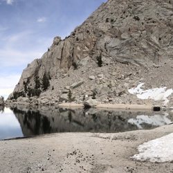


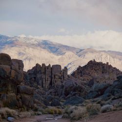


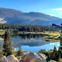


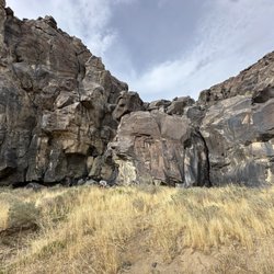
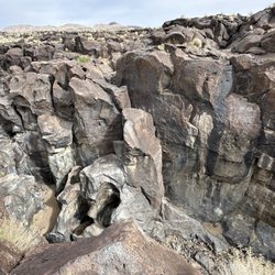
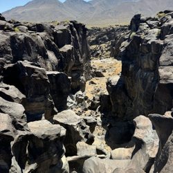
Why does Yelp recommend reviews?
Mt. Whitney - hiking - Updated June 2026
Best of Lone Pine
People found Mt. Whitney by searching for…
Beaches in Lone Pine, California
Campgrounds in Lone Pine, California
Fishing in Lone Pine, California
Parks in Lone Pine, California
Hiking Trails With Waterfalls in Lone Pine, California
Fishing Spots in Lone Pine, California
Public Shower in Lone Pine, California
Things to Do in Lone Pine, California
Watch Sunset in Lone Pine, California
Fishing Ponds in Lone Pine, California
River Swimming in Lone Pine, California
Visitor Centers in Lone Pine, California
Off Road Trails in Lone Pine, California
Star Gazing in Lone Pine, California
Waterfalls and Swimming Holes in Lone Pine, California
Swimming Lakes in Lone Pine, California
Beautiful Views in Lone Pine, California
Scenic View in Lone Pine, California
Attractions in Lone Pine, California
Flower Fields in Lone Pine, California
White Water Rafting in Lone Pine, California
Trending Searches in Lone Pine, CA
Browse Articles
Browse Nearby
Browse Brands
Related Searches in Lone Pine, CA
Best Communal Shower Facilities in Lone Pine, California
Best Fishing Locations and Guides in Lone Pine, California
Best Iyengar Yoga Classes and Studios in Lone Pine, California
Best Nature Trails for Hiking in Lone Pine, California
Best Places for Horseback Riding in Lone Pine, California
Best Sledding Spots and Fun in Lone Pine, California
Best Spots for Star Gazing in Lone Pine, California
Best Waterfalls and Swimming Holes in Lone Pine, California
Browse Yoga Classes and Schedules in Lone Pine, California
Check Out Off Road Trails in Lone Pine, California
Discover Dog Friendly Trails to Explore in Lone Pine, California
Discover Fun Kid Activities to Enjoy in Lone Pine, California
Discover Fun Recreation Activities in Lone Pine, California
Discover Gyms With Steam Room Options in Lone Pine, California
Discover Kids Play Area Spots in Lone Pine, California
Discover Popular Bike Trails in Lone Pine, California
Discover Powerlifting Gym Near Lone Pine, California
Discover Top Nature Parks to Visit in Lone Pine, California
Discover Top Yoga Options and Studios in Lone Pine, California
Discover a Hiking Trail in Lone Pine, California
Discover the Best Night Hike Trails in Lone Pine, California
Dog-Friendly Hikes With Dogs in Lone Pine, California
Enjoy Camping Adventures Around Lone Pine, California
Enjoy Hiking Adventures in Lone Pine, California
Enjoy Kayaking Adventures in Lone Pine, California
Enjoy the Best Bouldering Experiences in Lone Pine, California
Enjoy the Best Walking Trails in Lone Pine, California
Exciting Cliff Jumping Spots in Lone Pine, California
Explore Beautiful Parks and Green Spaces in Lone Pine, California
Explore Easy Hikes Perfect for All in Lone Pine, California
Explore Fun Activities to Do in Lone Pine, California
Explore Popular Campgrounds Near Lone Pine, California
Explore Popular RV Parks Around Lone Pine, California
Explore Popular Scenic Overlook Points in Lone Pine, California
Explore Popular Scenic Views Near Lone Pine, California
Explore Popular Sports Clubs in Lone Pine, California
Explore Popular View Points Around Lone Pine, California
Explore Scenic Lakes to Visit in Lone Pine, California
Explore Top Dog Parks in Lone Pine, California Near You
Explore Top Gyms in Lone Pine, California Now
Explore the Best Boating Spots in Lone Pine, California
Explore the Best Rock Climbing Areas in Lone Pine, California
Explore the Best Swimming Holes Around Lone Pine, California
Explore the Best Trail Options in Lone Pine, California
Family Friendly Hiking With Kids in Lone Pine, California
Find Beautiful Views in Lone Pine, California
Find Beginner Yoga Sessions in Lone Pine, California
Find Fun Kids Activities Outdoor in Lone Pine, California
Find Parks and Recreation Activities in Lone Pine, California