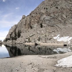
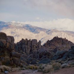
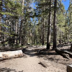
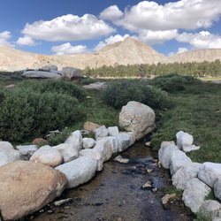
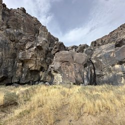
Mount Langley Photos


You might also consider

More like Mount Langley
Recommended Reviews - Mount Langley
Start your review...



4 years ago
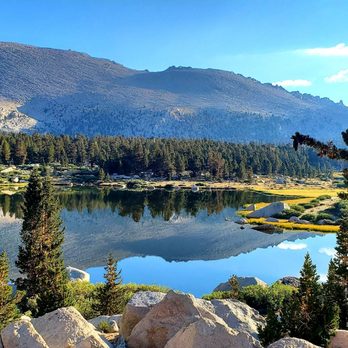
Completed on 8.20.22 We stayed the night at Cottonwood Lakes trailhead campgrounds which sits at 10034 elevation, to acclimate ourselves to the altitude. Damn! This trail is GORGEOUS and offers amazing views of lakes, medows, and of course Mount Langley! Started at 5am and was back at the trail head by 6pm, spent 45 mins at the summit and 30 mins swimming at CW lake #4. Yes, it's a long, strenuous hike. 22 miles out and back, with an elevation gain of 4000ft+...If the altitude doesn't get you exhausted, the ascent will. I started to feel symptoms of AMS around 9000ft and then again at 13000ft, take your time, hydrate, and eat. Took the new army pass up, pretty and well maintained trail, as you pass "High Lake" you'll see what's to come... New army pass is almost vertical climb up to a flase summit. You have about another 1500ft of climbing to do, to reach the summit. Desecended down the "Army Pass", this trail is a bit sketchy and nerve-wracking, if you're afraid of heights. It's totally manageable and doable, just try to focus on the trail... I carried 5l of water and lots of healthy and not so healthy snacks. Also GU gels and Tylenol will help you on this hike. There's plenty of water source in the area, so you don't necessarily have to hike with a full pack, just bring water filtering system...you'll be alright. Weather was perfect for this hike...bugs were present, but wasn't too bad. I would definitely hike this trail again! Good luck, do research, and believe what you read. It's really important to listen to your body! Happy Trails!! read more



7 years ago
This is an often overlooked mountain that is overshadowed by its sister, Mount Whitney. However, this 14er is nothing to sneeze at. The beauty of this hike is that it is good training for Whitney and it does not require a permit for day hiking, which is what we did. Depending on the trail that you choose, the total mileage can range from 20-24 miles. New Army Pass is better maintained but will add 2 miles each way. We chose to go up New Army and down Old Army for 22 miles. The first 6-7 miles are pretty easy overall, with about 1,000 feet elevation gain. However, keep in mind that the trail starts at 10,000 feet, so acclimation is always recommended. Once you start the switchbacks on New Army Pass, the ascent becomes more difficult. I personally feel that the views on this hike are more picturesque than most along the Whitney trail. What makes this hike really difficult is the last 1-1.5 miles, in which you will gain just short of 2,000 feet elevation. The climb is very steep in loose sand/scree combined with boulder climbing. It reminded me a lot of Iron Mountain in SoCal but with boulders. Follow the rock cairns closely to lead you to the summit of 14,042 feet. read more




17 years ago
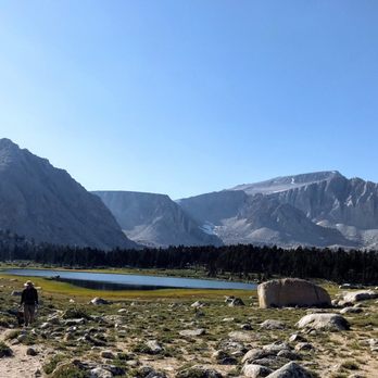
Mount Langley has an elevation of 14,042' and is a good training hike for Whitney. One of the trails that leads to the summit follows the Cottonwood Lakes Trail to Cottonwood Lake #4, and then continues on via Old Army Pass up out of the lake basin and to the summit. Alternatively, you can leave the Cottonwood Lakes Trail before reaching the lakes and take the New Army Pass to the summit. There will be a sign on the Cottonwood Lakes Trail pointing to New Army Pass, which is a maintained trail. Old Army Pass, however, is not currently maintained, but it is still in good shape and is frequently used by hikers. I brought my fishing pole and did some trout fishing at the Cottonwood Lakes before heading up Old Army Pass. There was still some snow on the trail (July 4, 2009), so be careful if you don't have an ice axe and crampons. Equipment wasn't necessary to cross some of the sections of snow, and sometimes an alternative route could be taken to go around the snow. This generally involved some class 3 rock climbing. Once you climb out of the lake basin, you'll see a bunch of trails leading to Langley's summit. Any of them will work, but depending on the snow coverage, some will be easier than others. It helps if you are comfortable with cross-country hiking and can use a map and compass or gps. If you take the most direct route, expect to do some class 3 climbing. Alternatively, you can approach the summit from the west, which is less steep, and less dangerous when there is snow. I ended up using an approach from the west, but there was still class 3 rock climbing involve, just not as steep as the direct route. It's a pretty long hike, about 20 miles with over 4000' elevation gain if you take Old Army Pass. If you take New Army Pass, add on a couple miles. I did this the day before hiking Whitney, but in retrospect, I think it's a bit too long for a warm up hike. Stopping at Cottonwood Lakes would have been ideal, but bagging another 14K peak was too irresistable. I started just before 8am and finished just after 9pm. If I cut out the trout fishing and if I didn't have to deal with the snow, I would have finished at an OK time, but 9pm was late. By the time I finished dinner, took a shower at the Whitney Portal Hostel, and drove to the Whitney Portal, it was midnight, way too late. read more


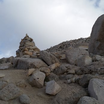
Where do you go after hiking Mt Whitney? To the next 14K footer, Mt Langley! So I did, and Oh... I like Mt Langley! It's a GREAT hike. Don't get me wrong, climbing that through that last mile of SCREE to the 14,042 foot summit was challenging and making this my second 14K mountain. I did this as a day hike, so no permit was needed. I started at the Horseshoe Meadow / Cottonwood Lake trailhead at 10,070 feet. I took the Old Army Pass up to the summit and went back down on the New Army Pass for a 23 mile round trip with an elevation gain of 4,372 feet. Taking the New Army Pass adds 400' of gain more than taking the Old Army Pass up and down. I heard some bad words about the Old Army Pass, that it is not maintained and has large boulders in the way. I feel Old Army Pass gets a bad rap! I found that the first 6.2 miles to Lake #5 was an easy trail to hike and follow, even in the dark before sunrise. There are sufficient amount of signs to keep you on the main trail that only gains 1,140 feet to Lake #5. After reaching the Lake #5 sign, you will pass in-between Lakes #4 & 5 and start the harder part of the hike up the rocky switchbacks of the Old Army Pass to the 12,024' ridge. There you will see a 'Entering Sequoia National Park' sign. Immediately after the sign, head North to the right towards the higher mountain. The trail is still easy to follow for another mile and a half where you start seeing 6 foot cairns to follow up the SCREE to the summit. There is only one very short section you have to scramble up and over some boulders. http://www.yelp.com/biz_photos/mount-langley-lone-pine?select=y_zkFdH3awf8ua8L9L3xog&utm_campaign=www_photo_share_popup&utm_medium=copy_link&utm_source=(direct) On the way down from the summit as I reached the 'Entering Sequoia' sign, I headed to the right to take the New Army Pass down. In just 0.3 mile from that sign is an easy to miss hairpin turn to the left. http://www.yelp.com/biz_photos/mount-langley-lone-pine?select=POeV04ModxbWUinUQGVSTA&utm_campaign=www_photo_share_popup&utm_medium=copy_link&utm_source=(direct) This will take you UP over the 400' hill to the ridge and down the rocky switchbacks towards High & Long Lakes. I thought this section was beautiful. Long Lake was my favorite. This New Army Pass trail will take you back to the very first 'New Army Pass / Cottonwood Lakes' sign you saw on the way up, 3.5 miles from the trailhead... what seemed like such a long time ago! http://www.summitpost.org/army-pass-normal-route/156296 This has a couple of good pictures showing the route up to the summit from the Cottonwood Lake basin. My landmarks: * Cottonwood Lakes Trailhead - 10,070' (3,972' Gain - 23 Miles) (add another 400' gain if you return New Army Pass) * 1.4 miles - Cross log on the right over creek. * 2.8 - Golden Trout Camp to the right. GO STRAIGHT * 3.0 - 'John Muir Wilderness' sign * 3.5 - 'New Army Pass Trail' junction sign (10,437') Go STRAIGHT towards Cottonwood Lakes & Old Army Pass. (Lt / West - goes to New Army Pass Trail) * 4.5 - Muir Lake junction to the right, Go LEFT (11,000') * 4.8 - 'Trail' sign. Go STRAIGHT (left goes to New Army Pass Trail) * 5.7 - Lake #3 to the left. (11,082') The lake is at the foot of the mountain. Trail goes around to the right & up the rocky switchbacks. * 6.0 - At the 'Y', go to the Left towards Lake #4 * 6.2 - 'Lake #5' sign. Go between Lakes #4 & 5 (11,210') Trail starts up the rocky SBs towards the top ridge. This is the Old Army Pass Trail. * 7.4 - 'Entering Sequoia National Park' sign at the top of the ridge. (12,024') Immediately after this sign, GO RIGHT (N). If you go straight, this will take you to the New Army Pass Trail. * 9.0 - 'Cairns' sign (12,633') Follow 6 foot Cairns. * 10.5 - Summit (14,042') * 13.5 - Back at the 'Entering Sequoia National Park' sign. To return the same way, Old Army Pass, go left. Or: I went to the Right, to go down the scenic New Army Pass. * This adds 2.0 miles & 400' of elev gain. * 13.8 - GO LEFT (SE) at the faint hairpin junction at a small cairn that takes you up the 400' hill to the top ridge. If you go straight, you would head down to the lower valley. * 14.5 - 'New Army Pass. Sequoia/Kings Canyon' sign at the top of the ridge. Head towards the large cairn & head down the rocky switchbacks to the left towards the High & Long Lakes. * 17.9 - 'Horseshoe Meadow, New Army Pass' sign. * 18.1 - 'South Fork Lakes' sign junction. GO LEFT * 19.3 - Back at the lower 'New Army Pass / Cottonwood Lake' sign. * 22.8 - read more




15 years ago

13 years ago
More info about Mount Langley
Horseshoe Meadow Rd
Lone Pine, CA 93545
Directions
Hours
Outdoor Amenities