Cancel

Open app

Search

Mt Misery Trailhead At Oregon Butte

4.0 (1 review)

Mt Misery Trailhead At Oregon Butte Photos

More like Mt Misery Trailhead At Oregon Butte

Recommended Reviews - Mt Misery Trailhead At Oregon Butte

Your trust is our priority, so businesses can't pay to alter or remove their reviews. Learn more about reviews.
Yelp app icon
Browse more easily on the app
Review Feed Illustration
Photo of Corey G.
196
1545
1676

14 years ago

Helpful 2
Thanks 0
Love this 3
Oh no 0

Verify this business for free

Get access to customer & competitor insights.

Verify this business

Blue Mountains Trails

Blue Mountains Trails

5.0(1 review)
10.8 km

These trails aren't just for winter sports. I've made it here during the summer to take my…read moremountain bike for a ride. I parked at the Sno-Park Parking lot where one would go during the winter months. Here you have a couple of dirt roads to choose from for off-road options. I decided to do some climbing and went for NFD Rd 64--to get to this road from the parking lot, ride your bike further up the valley a few hundred yards (their's a trail), and then take right. This road is fairly nice. There are lots of rock on it, but no potholes. It is a fairly uphill jaunt from the get-go. As I was approaching the top of the valley, I eyed a side road. The sign on it said (6400 500), so I don't know which is the name of the road, but I decided to take it, because it looked tiny and way less traveled (in fact it was closed to motorized vehicles). Nice. Yeah, this trail ended up being the high-point of the day. It wasn't single track, but it was close. I must admit I had the willies when I saw a half-eaten deer leg within the first minute of climbing (the rest of the ride I kept thinking of the cougar, bear, or zombie which was eyeing me from the bushes as I rode by). I love to climb. I love burning my quads like Hades. It felt good to be riding. Unfortunately, this side road only lasted a little bit before I made it up to the top of the ridge/mountain. Here this trail ties back up with one of the major dirt roads again. There are some decent views here. I then took the little road downhill. Man, I'm must be a total old fogie, because wow---I think I rode the breaks the entire way down! The road was steep, and I hit some high speeds within seconds. There were also rocks to watch out for as well. In other words, I rode it like an old person (which I am I suppose). But it was fun. It's the kind of fun, where you just have to yell with abandon (I think I did a few times--with a smile). These trails are definitely good for snow activities, and I'd say they are decent for bike riding. I don't know if I'd come here to do some straight-up hiking though. I'd save the Cascades for that. NOTE: Be careful on this road in the winter. This is the infamous scene of where my truck and my crew rolled down a mountain just over a year ago!
Photos
Blue Mountains Trails - Our Trip Along NFD Rd 64

Our Trip Along NFD Rd 64

Blue Mountains Trails - My Gloves...I like orange

My Gloves...I like orange

Blue Mountains Trails - Along NFD Rd 700

See all

Along NFD Rd 700

Steptoe Butte

Steptoe Butte

4.9(17 reviews)
106.6 km

Steptoe Butte is a must when you visit the beautiful Palouse! On a clear day you can see forever!read more

So, the Palouse (how they refer to the scenic area near Pullman) is arguably one of the most…read morebeautiful places in Washington, if not the United States. The mesmerizing green rolling hills in June attract landscape photographers around the world and there are photography workshops in various areas within the Palouse happening throughout the summer. And to see this vast beauty in one place, Steptoe Butte State Park provides a one-stop, bird-eye view of these rolling hills. My buddy and I would grab our camera gear every year in different months to capture the beautiful Palouse and we would always start with Steptoe Butte. The hours of sunrise and sunset would provide the most dramatic lighting but I really could spend the entire day clicking away in every direction. When I first saw the views on top, I immediately thought of the classic Windows wallpaper. The green colors were saturated to the fullest and I was in a surreal moment of thinking I'm inside a computer wallpaper. I was completely mesmerized by the absolute beauty everywhere I look. Every season provides its own unique colors, ambiance, and photographic opportunity. If you are into photography, you will fall in love with this place and you will come here every year to chase the light. I guarantee it.

Photos
Steptoe Butte - 2022.05.31. Sunset Palouse, view from Steptoe Butte State Park

2022.05.31. Sunset Palouse, view from Steptoe Butte State Park

Steptoe Butte
Steptoe Butte - 2022.05.31. Sunset Palouse, view from Steptoe Butte State Park

See all

2022.05.31. Sunset Palouse, view from Steptoe Butte State Park

Cahill Mountain Road

Cahill Mountain Road

5.0(1 review)
20.8 km

Why is it hard to exercise sometimes?? With the gym, the hardest thing is getting there, but once…read moreyou're there and then finish, you feel heaps better. On Sunday, I went for my first mountain bike ride of the season. I had to put the rack on the car, then I had to drive 70-miles to the trail I had in mind, I had to drive past my favorite bar, and also ignore seeing a movie at the Liberty Theater. So, many things were pulling me away from riding....I was so close to bailing, but I didn't. While going for a ride in the Blue Mountains last season, I passed a dirt road which looked totally enticing: dirt, went up, up, up, and was not very far outside of Dayton. A mental I.O.U. was made. It was time to pay up. First off: the weather was EXQUISITE!! It's amazing how much great weather can elevate the soul. The blues, the greens were so vibrant & pulling--they were orgasmic. I couldn't get my bike off the roof and on to it fast enough. I was off. From the words of Chuck D: "Here it is: BAM! And I say God d*mn! This is a dope jam!" This road hits ya from the gates. It goes vertical within feet (I was sweating within seconds). It was tough, my quads were screaming from the get-go. I was in heaven. The views hit you amazing-fast. You can look down on the Touchet River as it cuts through the valley below. You could start seeing the snow-capped Blue Mountains in the background. Now this part of the country is interesting. You're sort of in between two major environments: rolling & treeless palouse hills and a coniferous pine forest. I actually kind of liked not having many trees around--it affords one huge open views. The views WERE amazing! I didn't get to view 'em too much however, cuz my butt was busy in the saddle biking upward. I still stole views. The road is dirt, but there is also gravel (I assume for erosion protection). I tried to avoid the gravel as much as I could **envisioned biting it on these pointy little rocks**. Most of the time, it looks like the road is flanked by farmland/fields, but I couldn't see anything growing--it was mainly green green grass. I should point out, that it seemed like beer cans served as quarter-mile markers....ahhhh, ya gotta love the rednecks. It took me about an hour to climb up to the top of the valley (about a 1300ft climb and 2.5 miles). As I was thinking of turning around, I heard water streaming and an old decrepit farmhouse peaked at me from the pines in the distance (the pine trees start to appear at the top of the hill). This structure was trippy. Ok, sorry to go Star Wars nerd here, but I couldn't help think of a Sand Crawler. I kept thinking envisioning a glowing-eyed Jawa running around and trying to capture my robotic ass! I spent a good 10 minutes at this old barn/silo (great photo ops here for sure). Then it was back to business. Time for a lightning fast descent. I'm an old timer. Back in the day, I would have barreled down the hill with reckless abandon, but my old age and wisdom makes me wane on speed....a little. I made it down in 10 minutes! So amazing. I felt 17 again (sort of). This was a GREAT ride, and I can't wait to come back. It really does pay to ignore the distractions which try to keep you from exercise. Really, it does!

Photos
Cahill Mountain Road - The 5mile loop I took.

The 5mile loop I took.

Cahill Mountain Road

See all

Fields Spring State Park - One of the two sledding areas. This one is located about 30 meters from the Tamarack Cabin.

Fields Spring State Park

3.7(3 reviews)
42.3 km

We two (and our dog) stayed four nights at the Tamarack Cabin in late March, so my comments are…read morerelated to that experience. For people who enjoy isolation and snowshoeing, late March is a good time to stay. Though we won't make the 6-hour drive from the Seattle area again, staying this one time was worthwhile for us. PARK STAY LATE MARCH: 4.0. Very isolated and peaceful. We saw no other visitors during our 5 days, and rarely saw a ranger. The two park lodges and the sledding hills were closed, and it was too late in the season for cross-country skiing. No internet. No (T-mobile) cellphone coverage other than in one small area on the trails, and a very weak signal on Puffer Butte. There was still snow on the ground, and it snowed an inch or so the night of our arrival. The camp ranger said they usually get a late Feb snow, and that this year (2021) it had been unusually heavy. We snowshoed almost all the trails, going to Puffer Butte twice. We had never snowshoed before but found it easy. In winter the main entrance is closed. The winter entrance is located just a few yards north of it. Though the park does have snowshoes for rent, we had already rented two pairs (which came with poles and very handy backpacks) from Arrive Outdoors (which we learned of through our cabin confirmation letter from the state of WA). There was no outdoor light in the park at night, so on clear nights the night sky was brilliant with stars. The view from Puffer Butte was quite nice. There is a nice lodge open to all during the day and available to sleep in at night. It contained a wood-burning stove, with plenty of firewood outside. No running water, but there is a large Honeypot toilet outside. TAMARACK CABIN: 3.0. Quite different from the "standard" kit cabins we have stayed at in other WA and OR parks; those other cabins are preferable. The cabin fills most of a small building; the rear of the building has a separate padlocked door and appears to be a storage room. NOTE: if checking-in after the ranger station closure time, be sure to bring a flashlight. There is no outdoor light at the cabin, and one needs to read the check-in procedure posted next to the cabin's door. PROS: - Isolated: there is only one cabin. A lodge where multiple people can stay is located about 30 meters behind the cabin but was closed during our stay. - bathroom with shower. - Heater. - comfortable queen bed (we didn't use the bunk bed). CONS: - Oddly-shaped interior with no "dining" table. We used the provided long narrow table and the two metal folding chairs. There are only 2 chairs available, so if 4 people are staying then 2 folks would need to sit on the end of the queen bed. Or eat outside. (The picnic table was covered in snow when we stayed, so that was not an option.) - The main heater is located over the queen bed. It is rather noisy when running, but bearable. Due to its high position, there is quite a temperature differential between the upper part of the cabin and floor-level. A space heater is also provided in the bathroom, and it can be moved into the main room. (Our dog was pleased with the space heater at her lower level.) We brought a propane stovetop that we used on the porch, which was very handy to have. (There is a firepit in front of the cabin that had been cleared of snow, but we didn't use it.) The cabin has a microwave oven, but no "kitchen" sink. There is only the small sink in the bathroom. NOTE: the shower sometimes emitted only a tiny dribble of hot water. I was able to resolve this by (1) turning off the shower, (2) reaching out to the bathroom sink and turning on, then off, the hot water, (3) turning the shower water back on. NOTE: be sure to bring along enough food for your stay. The nearest grocery is over 30 minutes away over mostly unlit roads. Though it wasn't open during our stay, one of the park's two sledding slopes is located about 30 meters behind the cabin.

Came here camping this past weekend. Before coming you should know that getting here is an…read moreadventure unto itself. Twisty winding roads are the only way to get here. Even from the Tri-Cities, expect that it will take about 3 hours. That being said, once you get here, its actually a very nice park. Our main reason for coming was that you can rent a teepee for the night to sleep in. This is the only state park in Washington that offers this. It was fun, but would I drive 8 hours from Seattle just for this? No. But, if you're heading this way anyway, it makes for an interesting overnight stop. Also, be aware that there are no gas or food services in at least 40 miles so be sure to come prepared! What was neat about the park however was the AMAZING view from the top of Puffer Butte. Its about a one mile hike up to the top and from there you get this beautiful panoramic view of the Grand Ronde valley and Blue Mountains! Definetly worth the hike up.

Photos
Fields Spring State Park - Late Mar 2021. View from Puffer Butte.

Late Mar 2021. View from Puffer Butte.

Fields Spring State Park - Front entrance to lodge on Puffer Butte.

Front entrance to lodge on Puffer Butte.

Fields Spring State Park - Late Mar 2021. Lodge on Puffer Butte. Open to all during day, and available to sleep in at night.

See all

Late Mar 2021. Lodge on Puffer Butte. Open to all during day, and available to sleep in at night.

South Fork Walla Walla River Trailhead - Walla Walla River

South Fork Walla Walla River Trailhead

4.5(2 reviews)
47.6 km

This hike happened by happenstance…read more A friend and I were supposed to go up to Horseshoe Prairie (http://www.yelp.com/biz/horseshoe-prairie-nordic-ski-area-pendleton) for snowshoeing, but unfortunately, I let my friend drive and he was a little too confident about his car's snowy-road-handling ability. After spinning tires a time or two, we canned our fun-in-the-snow plans, turned around, and slid down the hill to civilization. While picking up chocolates at Petite Noirs (http://www.yelp.com/biz/petits-noirs-milton-freewater), the owner mentioned a nearby hike. To not make the day a total loss, we were all ears, and went for it. Just off of main street in Milton Freewater, you take the turn off for Harris Park (as you're driving south out of town, it'll be the left BEFORE you take the hill up and out of town). You then drive about 10 miles up a canyon carved by the South Fork of the Walla Walla River. This canyon is part of the Blue Mountains, and it's amazing to see how quickly the landscape changes from the drabby flatness of Milton-Freewater to the alpine-y beauty of the Blues & Walla Walla river. Once you're in the area of the park, keep going until you approach the trailhead for the South Fork Walla Walla River trail. Here there are quite a few parking spots, a couple of restrooms and river bubbles within earshot. You are clearly outside of civilization and within an honest to goodness country landscape. The deep valley is beautiful and the trail looks inviting. For the most part the trail parallels the river. Sometimes it sidetracks and goes up the side of the valley wall, but the river is always within view. The trail is well-kept and nice (other than a few boggy/muddy spots). We went for about 2.5 miles on the trail before calling it a day. We enjoyed sightings of elk at one spot (we later saw herds of deer, turkey, and even a scooting coyote during our dusk drive out). I'm so glad I made it here. I can definitely see myself coming back to dip myself within the magic waters (à la Field of Dreams) and fly fishing the stream (à la A River Runs Through It). I've also heard that you can ride your mountain bike here too---I'd also be down for that! South Fork of the Walla Walla Trail. I will see you again---very, very soon.

This was a great hike with my dog. Very turn their was a beautiful view of the Walla walla River…read more Trail was in decent condition. Plenty of parking at the trailhead.

Photos
South Fork Walla Walla River Trailhead - South Fork Walla Walla River

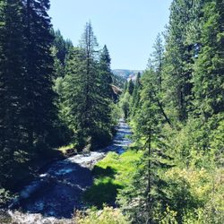
South Fork Walla Walla River

South Fork Walla Walla River Trailhead - South Fork Walla Walla River

South Fork Walla Walla River

South Fork Walla Walla River Trailhead - Trailhead

See all

Trailhead

Mt Misery Trailhead At Oregon Butte - hiking - Updated May 2026

Loading...
Loading...
Loading...